Sunday morning, I left the overcast skies of Okehampton, heading to the western side of Dartmoor, where the countryside bathed in warm sunshine. Well, that’s how it felt from the car, but when I had parked up on the edge of Roborough Down, I stepped out into a biting wind which had me layering up smartish!
Today, I was going looking for Chub Tor. Leaving the car park and crossing the road at Yelverton Roundabout, I followed the Drake’s Trail, alongside the Plymouth Leat. Eventually, the trail veers away from the busy road and, apart from cyclists creeping up on you from behind, it is a fairly pleasant walk.
Taking the footpath signposted to Hoo Meavy, I dropped down towards the disused Launceston Branch railway line. After skirting a field, I passed under the railway.
Through an old iron gate, I followed the footpath as it ascended to meet the level of the rails. I thought of leaving it to explore the disused railway, but satisfied myself with a quick look before returning to the right of way.
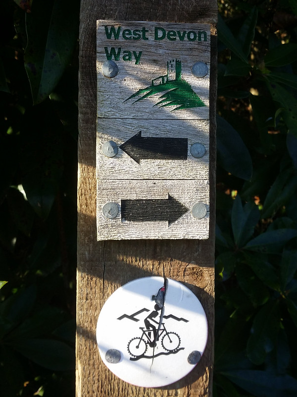
Through another gate, where I noticed a sign for the West Devon Way, I passed a row of houses, one of which is encouragingly called “Chubbtor Cottage”.
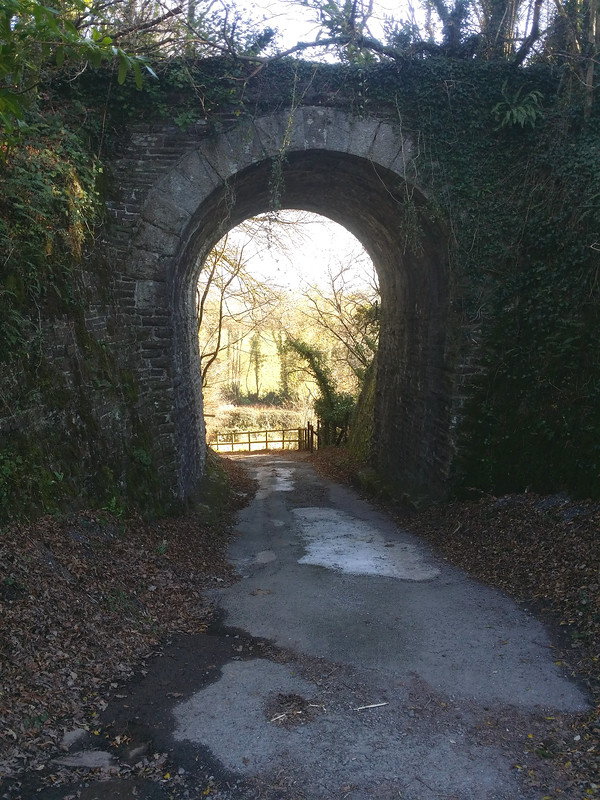
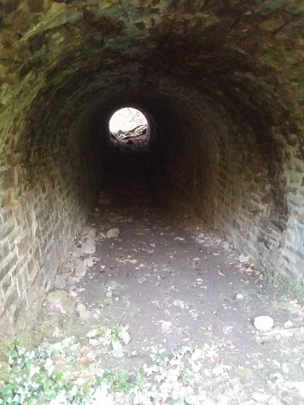
I almost missed the small tunnel hidden in the bushes. I anticipated a wet muddy floor and stepped tentatively into the darkness, but the ground was firm, if a little slippery. I should note that once you leave the footpath, you are straying onto private land, but it is only a minor transgression, affecting nobodies privacy, disturbing no crops or livestock.
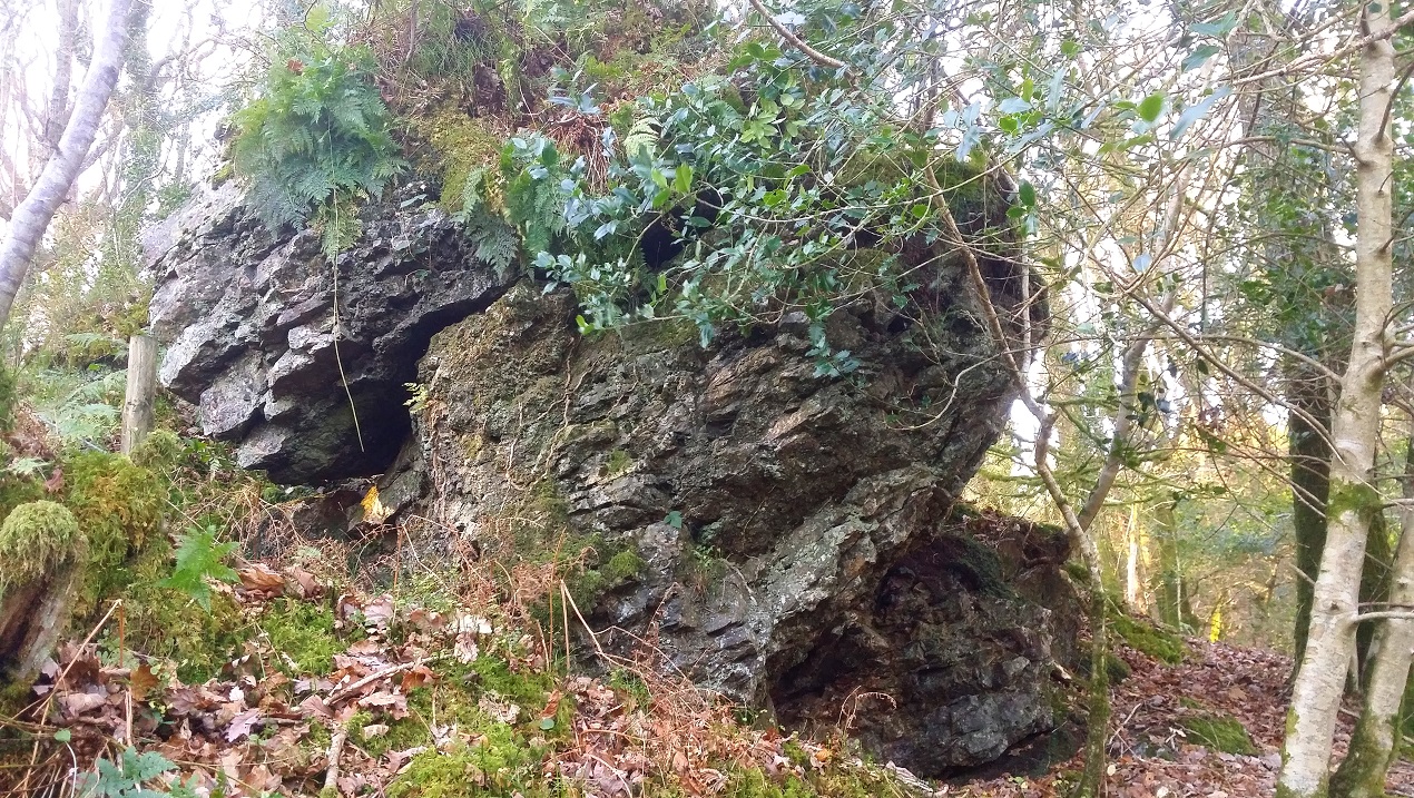
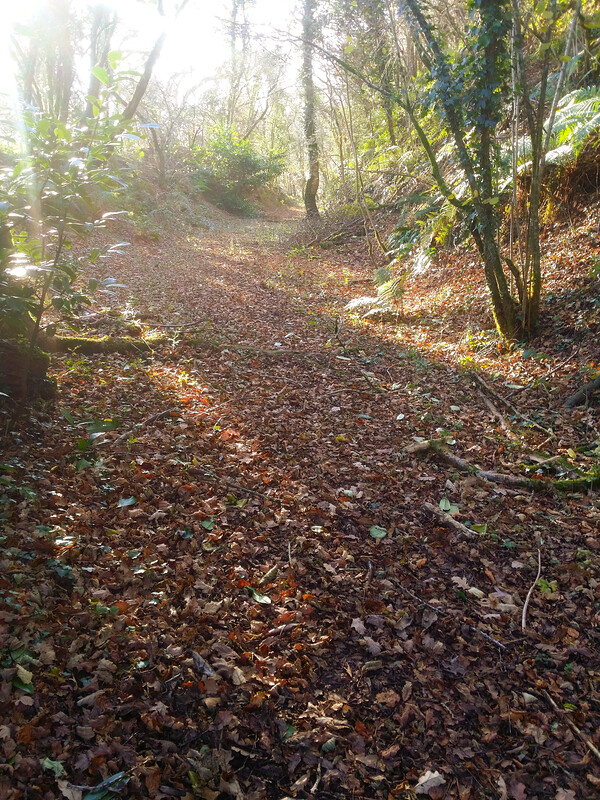
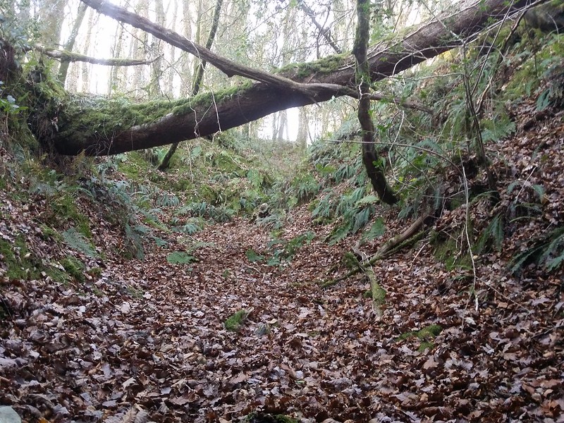
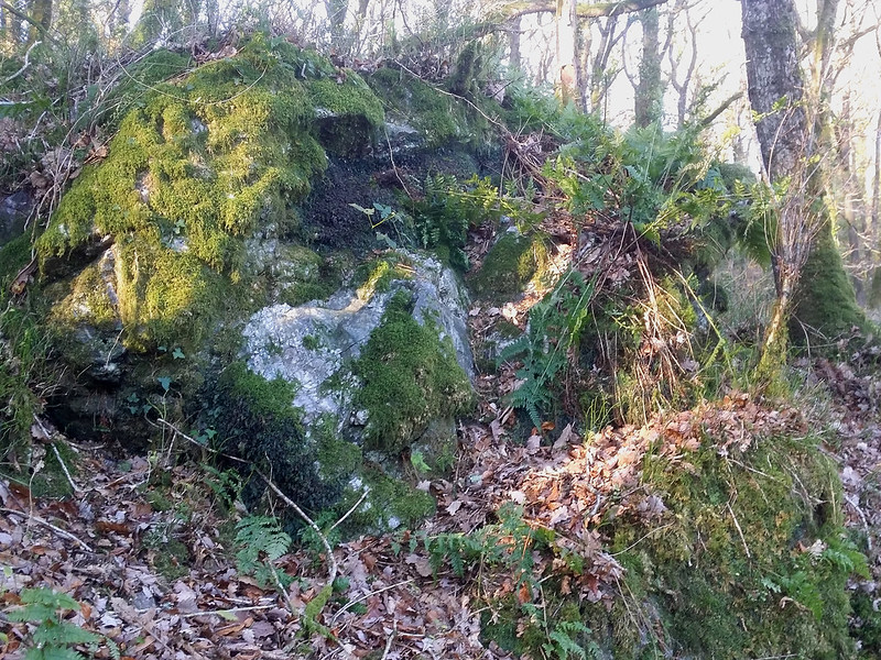
I couldn’t help but feel like I was stepping into a secret garden when I emerged into a steep banked cutting up the hill. I didn’t get far before I realised I had passed the location of the outcrop I was looking for and I was going to have to clamber up the right hand side.
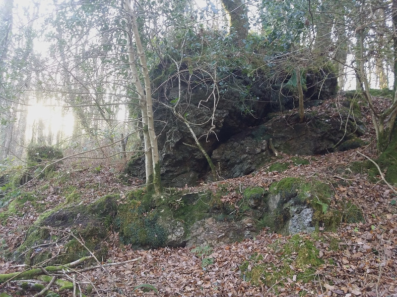
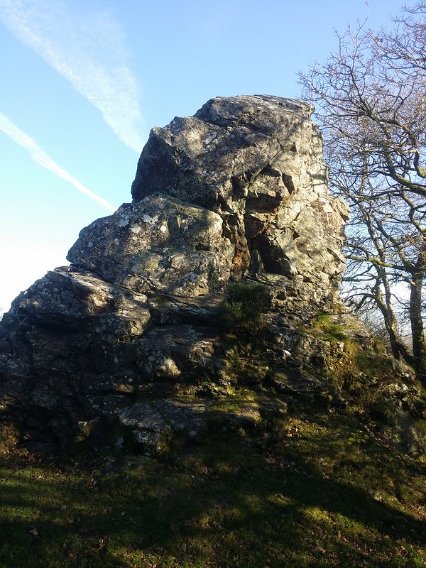
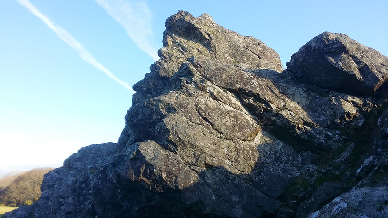
Scrambling up the mud, it was clear the return would be problematic. Once out of the cutting, the outcrop was easily found close to the railway bank. At first, the find appeared insignificant, but as I made my way around the non-granite rock, it grew in stature.
The location of Chub Tor is a bone of contention. To the west, further up the hill, the houses and farm all give reference to the name “Chubbtor” and certainly suggest an outcrop in the area but the residents are either unaware of the origins, or have sworn an oath of secrecy.
The Ordnance Survey six-inch 1888-1913 map certainly refers to the location of the farm at SX 520659, and not an actual tor, but surely there must be something on this hill? Reading the book “The A to Z of Dartmoor Tors”, Terry Bound does mention an outcrop near the top of the hill, close to the leat and the cottages, adding that it can be easily missed. As Terry’s excellent book was not a pictorial one, and Ken Ringwood didn’t even mention it, I’ve yet to see any photographic evidence supporting this. I would be taking a look myself later on my walk.

No surprise that this has piqued the interest of many keen Dartmoor explorers. A special mention must go to the usual suspects whose searches have led me to these hidden gems; Tim Jenkinson, Frank Collinson and Mike Kitchener, who have speculated that the true Chub Tor is here, at the very least a lower outcrop.
So, here is my unscientific, gut led two penneth on the subject;
This outcrop lies a couple of hundred metres north of Chubbtor Farm, but within Chubbtor Wood, and a few hundred metres north-west of Terry’s positioning. Nearby is an old shaft, part of the disused Yeoland Consol Mine and whilst it is hidden away behind the railway embankment now, I’m assuming there was a time when the outcrop would have likely been prominent, especially to the early workers of the tin mine, which was first established in the 1600’s. I think the building of the railway and the demise of the tin mine has led to its “disappearance” from the local consciousness in all but the names of the houses and the woods.
But hey, I could be way off! Time to go looking for the other site on top of the hill.
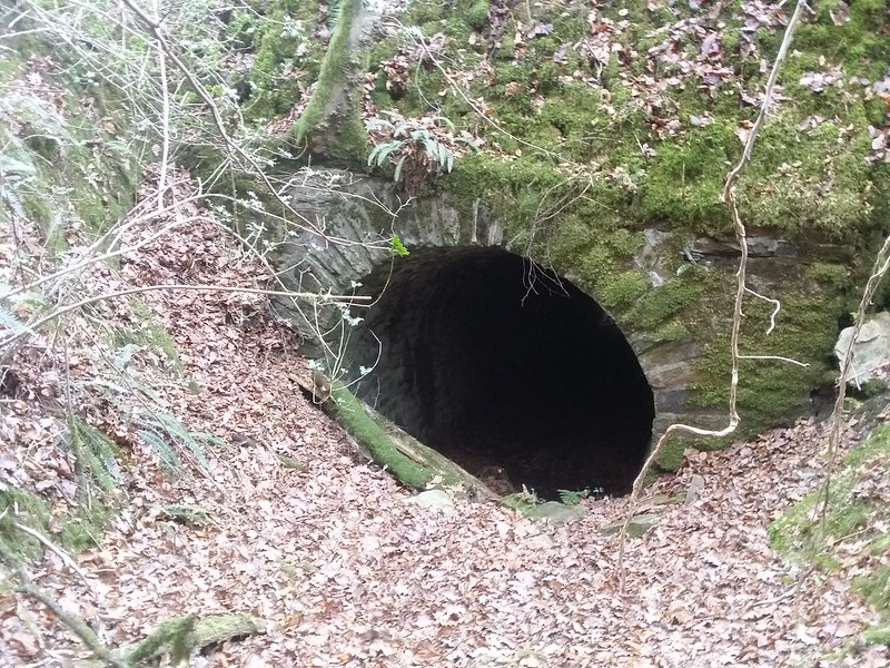
As first thought, I had to ground my backside to get back down the bank into the cutting. I made my return through the tunnel and out of the bushes, where I was met with startled and confused looks from some passing walkers.
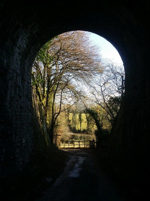
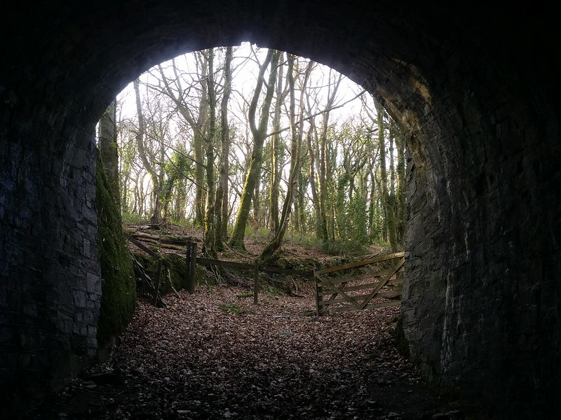
I progressed further south along the track to where another tunnel appears and a sign post indicates a footpath through it.
I was now in Mabor Wood, taking the footpath up, to an open field, beside Chubbtor Farm. On the climb, I noticed the hillside on private land to the north. The previously visited outcrop sat the other side, and the hill looked large enough to be hiding something more significant among the gorse and trees, but that would take more time than I could afford today; perhaps I should have explored further earlier.
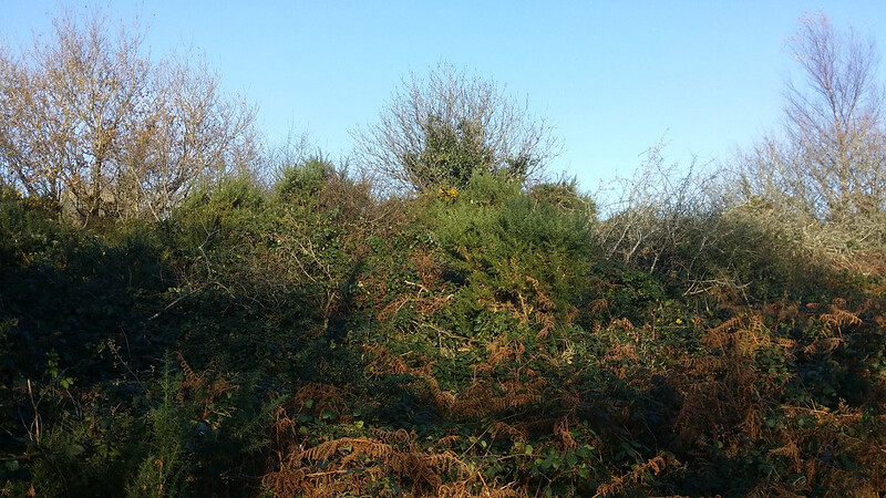
I crossed the Plymouth Leat and reached a road. Taking it north, I eventually reached the Terry Bound coordinates for the tor. I wandered around, but all I saw was overgrown brambles and bracken. Were there a tor here, and it looked unlikely, it has long been hidden.
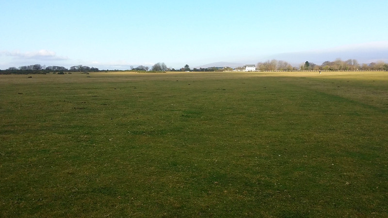
Onwards to the car, I couldn’t resist a side trip to Roborough Rock.
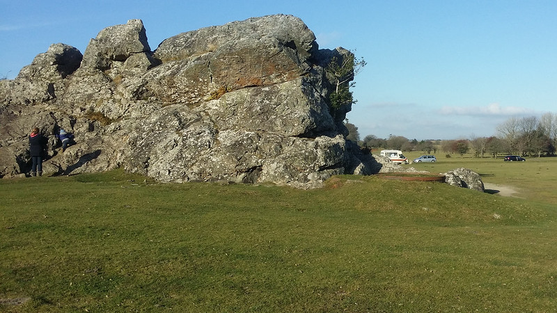
On my other visit to this impressive outcrop, last year, it resembled a kids playground, but today it was much quieter. I did a circuit of the outcrop, before heading back across Roborough Down, to my vehicle, content that another new tor had been bagged. Slowly but surely, I’m getting through my list, with 44 to go.