
Continuing our explorations in Buckland Woods, we turn to the south-eastern sections, comprising of Hardridge, Greypark and Coombe Wood.
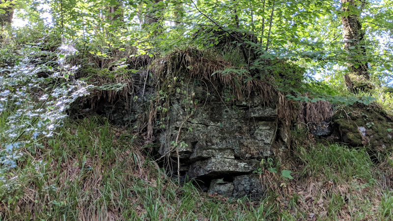
But before that there is a small tor (pictured above) beside the road between Buckland Bridge and Lodge that, to our knowledge, has not been documented before. On our adventures in Buckland Woods, we have passed it many times. at SX 7200 7194, so thought it time to give it recognition. It is a mound no higher than approximately 7 metres in height, with large trees and vegetation across its top.
Despite the growth, its metamorphic north face can be viewed and this tor can be bagged without leaving the road.
We enter Buckland Woods with a climb over the locked gate, safe in the knowledge permission has been given and take a good path along the Double Dart into Hardridge;
HARDRIDGE WOOD
There is little of note in this wood but close to the confluence of Ruddycleave Water and the Double Dart, there is a dark vegetation covered tor, at SX 7220 7221, casting a shadow over the track near Warren Bridge. We have called this Ruddycleave Water Tor.

Whilst this is on Private Land and a permit to Buckland Woods can be obtained from Fountain Forestry, it is worth noting that there is a track from the north that passes though Open Access woodland then follows the right bank of the stream down to the tor which does not possess a barrier.

GREYPARK WOOD
Crossing Warren Bridge, you now enter Greypark Wood, where you will encounter Greypark Wood Tor. Situated at SX 7234 7230 above the crag lined track between Ruddycleave Water and Landscore Tor, there is a large metamorphic wall with likely more to be discovered on the steep slopes.

There will likely be another visit to explore this section in the coming months.
COOMBE WOOD
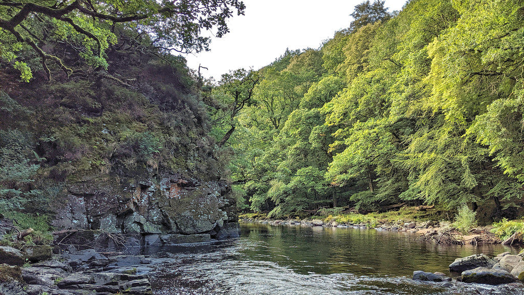
Following the path further, past Eagle Rock on the opposite bank, you come to the mighty Landscore Tor.

This is a huge towering crag of rock overlooking the path, which continues on through the private woodland of Ausewell. The name of Landscore appears on an old 1605 map of Ashburton and Crossing also assigns the name of Launceston Tor to the rocks.

Nearby there is also a boundary stone that is dated May 4th 1837 which also has a large ‘A’ and ‘B’ inscribed on its sides for Ashburton and Buckland respectively. Dave Brewer (2002) includes an account of this stone and another in the area.

We finish our tour of Buckland Woods at The Lover’s Leap. Head further along the track and you enter Ausewell Woods, which requires a different permit from Fountain Forestry. This last outcrop is a continuation and lower part of Landscore Tor but given the name of ‘The Lovers Leap’ due to its proximity to the River Dart. Said to be a place where despairing lovers threw themselves into the river. Whilst you can step onto the top, from this side, there is no view of the outcrop and it is best seen from Holne Chase on the opposite bank (picture below).
