TORS OF DARTMOOR

a database of both lesser- & well-known rocks and outcrops

Home Search Map The East Access About Team Social Blog

Pepperdon Down

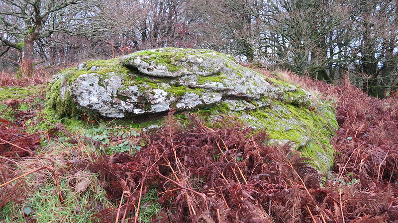
This seems to be Ken Ringwood's choice in his "Dartmoor's Tors and Rocks" book. This is definitely a lowly outcrop on the summit but there are much better outcrops sprawling across the southern edge of the down.

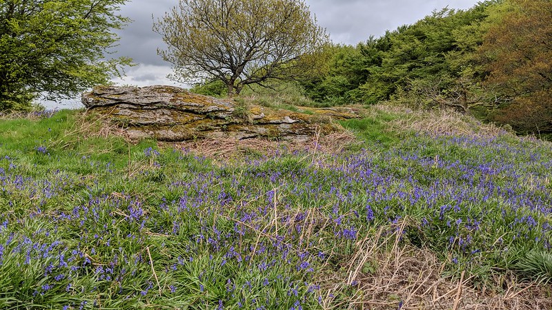
However, there is a sizeable rock basin on the summit, albeit obscured by thick moss. It is a fine formation.
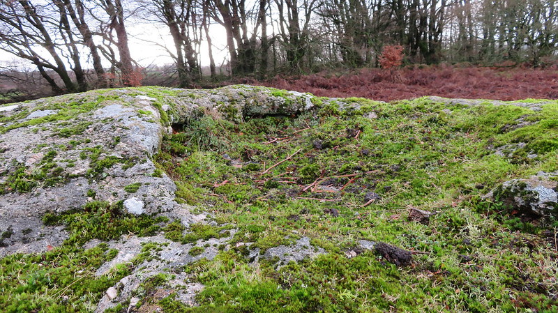
icon
icon
Pepperdon Down
The map above is not a navigation tool and we recommend that the grid reference shown below is used in conjunction with an Ordnance Survey map and that training in its use with a compass is advised.
Grid Ref:
SX 7796 8527
Height:
353m
Parish:
Moretonhampstead
Tor Classification:
Summit
Access:
Public
Rock Type:
Granite
Credit:
Steve Jenkins
Ordnance Survey
Reference / Further Reading:
Ordnance Survey Maps
Ken Ringwood: Dartmoor's Tors and Rocks
Tim Jenkinson: East Dartmoor The Hidden Landscape: Rocks and Tors (published privately)

Please Support Us

We are proud to see the names of lesser-known tors are now being used more commonly on other websites and whilst this is to be encouraged we do request that, should you wish to use the information on this page, you provide a backlink to the website as reference, by copying the relevant address:

https://www.torsofdartmoor.co.uk/tor-page.php?tor=pepperdon-down

Please also consider a small donation to the upkeep of the site; any contribution goes toward the fees to keep the database online and any costs incurred when undertaking research such as subscriptions to online archives.