TORS OF DARTMOOR
a database of both lesser- & well-known rocks and outcrops
Rough Tor (West Dart)Row Tor, Rowter 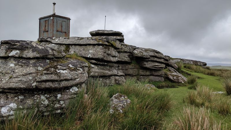 Rough Tor is a common name for tors on Dartmoor, but in all instances it is properly called 'Rowter', with Rowter Moor little more than 1km away to the east bearing this same name. When pronouncing it the 'ow' is stressed and, according to Hemery (1983), is the name used by the moormen; but modern maps continue to use 'Rough'. 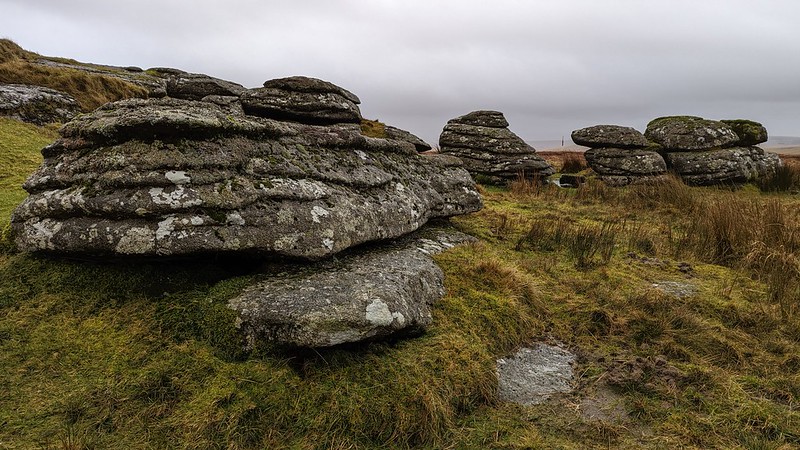 The tor sits well into the wildness of the North Moor, requiring a decent yomp to reach it. This is easiest from Holming (Omen) Beam by crossing the Cowsic on a footbridge and heading up between Lydford/Beardown Tors and across Fox Holes, following the range poles north. Being as it is within a live firing range, the tor is adorned in military paraphernalia and, as such, looks more like a submarine than a tor! This was noticed by Hemery; "The tor, although comparatively small, in shape resembles the superstructure of a submarine and gains prominence from its elevation - as well as from its military flagpole." 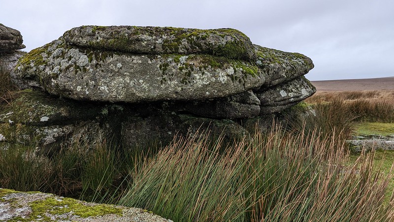 Consisting of a single, low mass of granite, it is difficult to blot out the military presence, but there are, however, a number of wonderful small shelters on the east side that block out prevailing winds coming over from the west. The outcrop is actually quite intriguing and is worth a 360-degree perambulation. On the summit you may notice a deeply cut Ordnance Survey (OS) benchmark. Recorded at 1789.4 feet above sea level, this is one of the earliest such marks that were inscribed on rocks leading to the establishment of OS Maps. 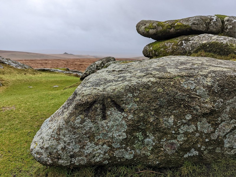 Arguably the best aspect about Rough Tor is the solitude afforded from its rocks. It is sublime. On a clear day numerous tors and hills are seen. The most notable include, in a clockwise direction: Whitehorse Hill, Sittaford Tor, Wildbanks Hill, Assycombe Hill, Braddon Tor on Rowter Moor, the Hamel Down ridge, Hay, Saddle and Rippon Tors, Longaford Tor, Beardown Tors, North Hessary Tor, Great Mis Tor and, right, the tip of Fur Tor and the noble eminence of Cut Hill.
| ||||||||||||||||||||||||||||||