Introduction
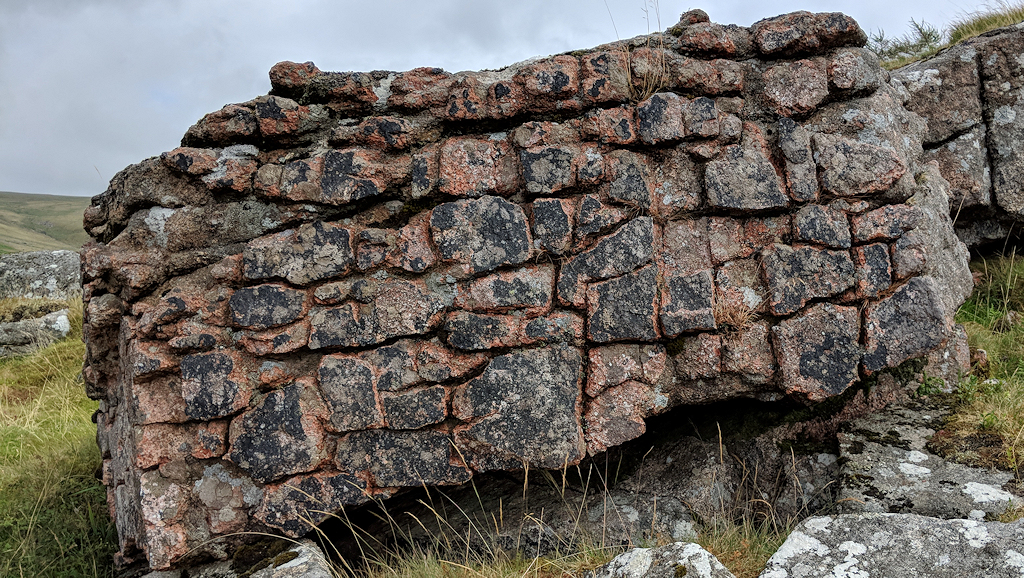
The geology of the Dartmoor tors is an interesting topic, not least because the many aspects of geology make each tor interesting and unique, whether it be several rock basins or layered horizontal jointing in the granite, or a totally different rock type, each tor is fascinating to examine. To the casual visitor, even to those living locally, the perception it seems is that most if not all of the tors are composed of granite rock, an igneous rock intruded c.272-308 million years ago in the Permian and Carboniferous Periods; and whilst this is partly true, there are two other dominant rock types comprising a fair number of outcrops – sedimentary and metamorphic – the latter of which is best seen in the western side of the moor atop Cox Tor and Sourton Tors. What these two large tors have in common differs from the granite tors, evident by the ground itself where you will notice bumps, and lots of them. These are known as ‘thufurs’ and are defined by their geology.
Thufurs
The definition of thufurs is: “A special form of cryoturbation are represented by ‘earth hummocks’ or ‘thufurs’. They are vegetated oval mounds with heights averaging 30 to 50 cm. Earth hummocks develop because of local patchy freezing of pore-water in the active layer, yet no pure ice core forms but a small proportion of the soil freezes. This core of frozen ground causes moisture migration towards it, concurrently causing a small scaled displacement of soil material in the same direction. Frost heaving leads to the development of a small mound, and as the freeze thaw processes re-occur many times, this displacement is amplified.” A fascinating exploration undertaken by enthusiast Adrian Colston (2014) on his blog looks at the many theories behind these ‘bumps’, explaining that they are of ‘periglacial origin’ which does not necessarily mean they are directly related to the North Dartmoor ice cap which was believed, at its height, to be some 100 metres deep in places, but may have been created much more recently during cold, harsh winters.
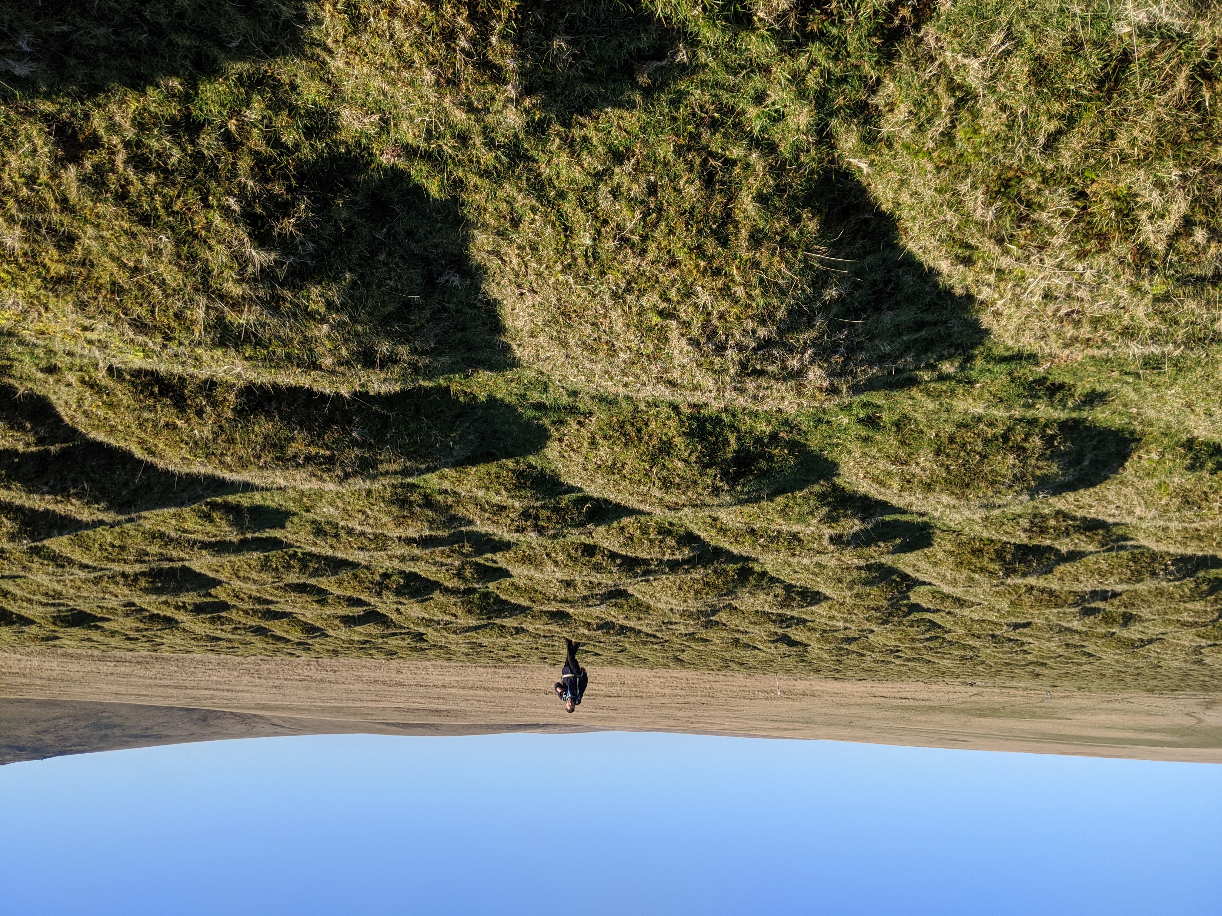
From Roos Tor and seen on aerial imagery there is a conspicuous line marking the boundary between the rock types; one example is the col (the lowest part of two hills) between Cox Tor and Great Staple Tor, in Beckamoor Dip, where the ground changes in both texture and colour. A small tarn (hill lake) has formed at the boundary where the ground has sunk likely, but not certainly, as a result of the boundary, the fault and very brink of the two rock types where one ends and another begins. The same can be seen between Sourton Tors and Corn Ridge, where the ground dramatically rises onto the granite from a rather shallow basin by the recumbent stone circle. Indeed, the topic of thufurs is still up for some debate, especially in regards to their date and place in the timeline of Dartmoor’s geology, and no doubt will more information be uncovered as further surveys take place.
Dolerite & Metamorphic Rock
A sub-category of Dartmoor’s ‘metamorphic aureole’ could perhaps be another type of rock, known as ‘dolerite’ or ‘microgabbro’. This rock is linked to and formed with the metamorphic rock but is defined by its dark colour, more slate-like with distinctive sharp edges, forming grotesque shapes. Examples include Longtimber Tor, White Tor and Boulters Tor; and whilst Cox Tor is a mix of dolerite and metamorphic rock, these tor examples are composed completely of dolerite rock. Amid this geological phenomenon lies Set Tor, a patch of Basaltic Metalava. This tor displays an amazing contrast from the clitter tors of White Tor and Little White Tor where instead the rock outcrops are flat and stained like dark slate; steps enable an easy ascent to the top and shows a tor barely emerging from the ground.
Sedimentary Rock
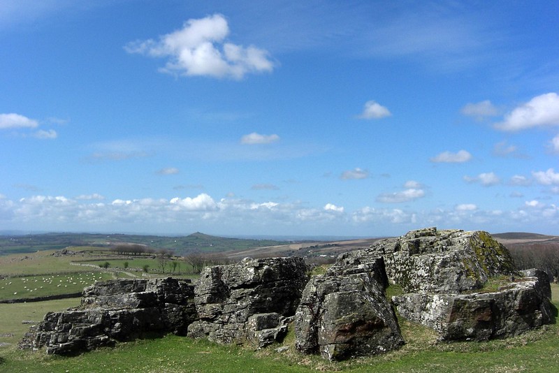
Moving onto sedimentary rocks, Loxter Tor is the best example, near Lustleigh, where the rock is surrounded by granite on all sides. The geology of this emergent pile would have formed only c.23-66 million years ago and the going underfoot here is noticeably weak and unstable. But what the rock has created is an impressive array of crags lining the hillside that are a distinct contrast from neighbouring Knowle Rocks, a nearby granite tor. The British Geological Survey tells us about the setting: “These sedimentary rocks are fluvial in origin. They are detrital, ranging from coarse to fine-grained and form beds and lenses of deposits reflecting the channels, floodplains and levees of a river or estuary (if in a coastal setting).“
Lustleigh Cleave and the Sticklepath Fault
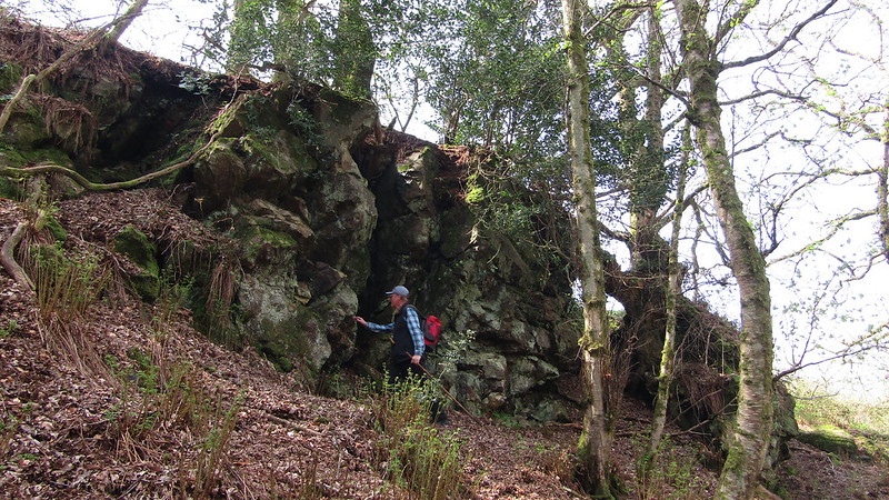
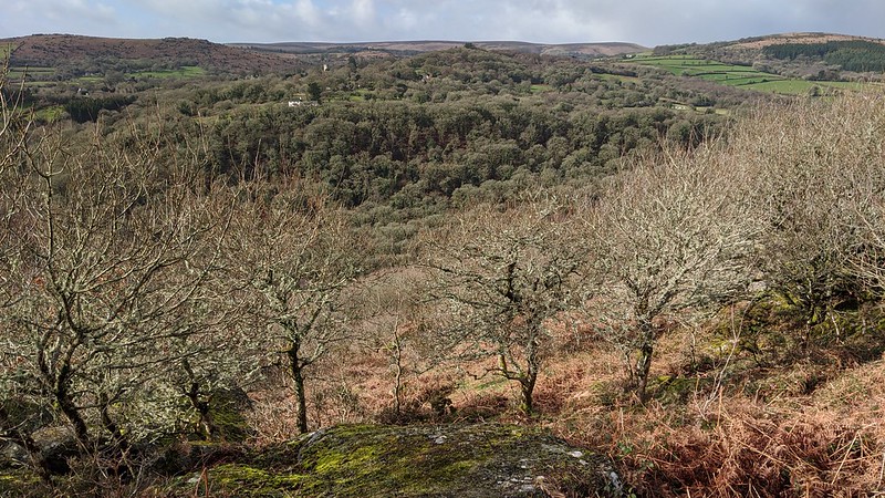
When talking about the Eastern Landscape, the most significant formation is perhaps Lustleigh Cleave, formed drastically by the Sticklepath Faultline that runs in a north-westerly direction from the impressive cliffs at Torquay, cutting through the north-eastern section of Dartmoor National Park and stretching towards Bideford Bay and Lundy Island. This has contributed a deep valley where its effects are obvious in this area and was thought to have formed in the early Tertiary Period (c.65-50 million years ago), and is a wrench or tear fault, very similar to, but in smaller scale than, the San Andreas Faultline in the USA. A fault occurs where tectonic forces acting beneath the earth’s crust cause a fracture to occur at the surface. It is possible that this faultline originated from the pressures of the formation of the Atlantic Ocean through sea-flooring spreading at the Mid Atlantic Ridge that bisects Iceland and the Azores. It was a transform movement (moving parallel to each other in a different direction or in the same direction at different speeds) and has shaped the aforementioned steep valley, with many granite tors lining the top of the Cleave spilling down to the River Bovey below. Good viewpoints to appreciate this phenomenon are from Harton Chest and Raven’s Tor.
Another fault created via the same processes occurred in the Wray Valley where a number of tors line the steep, wooded slopes of the basin that the Wray Brook has carved its way through. Running parallel to Lustleigh Cleave, although not as deep this fault is the longer of the two and most visible from the A382 road by Slade Cross. Richard Horsham has written many articles about landforms in Dartmoor Magazine but it is Issue 139 in 2020 where he considers the effects in the border-country – that is, the periphery of the granite mass and how this impacts the landscape we see today. In it, Horsham explains that the Wray Valley area (being almost entirely granite) has been influenced much more by the transform fault than it has by the rock types in the area.
Another interesting discussion is brought up in a report called ‘Devon’s San Andreas Fault’ that goes on to examine the impacts that the fault creation has had in the surrounding areas, most notably at the point where it passes through Dartmoor and the many basins created there where clay is now extracted in the Bovey Basin. The south-western side of the fault has moved westward while the opposite has occurred for the other side which has caused the granite mass to become off-set. The report continues: “Part of the movement was due to the collision of two continents and later when the continent split apart resulting in the formation of the Atlantic Ocean.“
Horizontal Jointing
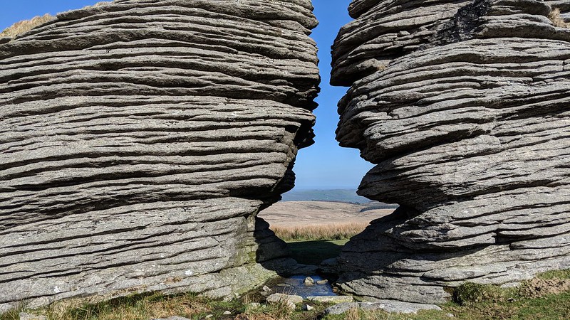
Delving deep into the many features of granite alone is a totally different story; the rock basins, jointing, logan stones and overall appearance differ incredibly from tor to tor; even on the same tor you can be rewarded with different perspectives of this fantastic rock type. It is hard to focus on one feature at a time but I think that we can all agree that, when talking about horizontal jointing specifically, Watern Tor demonstrates the most spectacular, worthy of a whole page on its own. When describing Watern Tor, Josephine Collingwood in ‘Dartmoor Tors Compendium’ best describes it: “These horizontal joints are in fact stress-release joints. When the massive weight of the overlying rock was removed over time by erosion, the release of pressure created an uplift in the granite, allowing horizontal lines of weakness to form. These have been exploited by weathering.” Chat Tor and Great Links Tor are also great examples, but the joints at these tors are further apart and a little less distinct and pronounced. What all three of these tors have in common, however, is that the joints run parallel to the slope of the hill.
Logan Stones
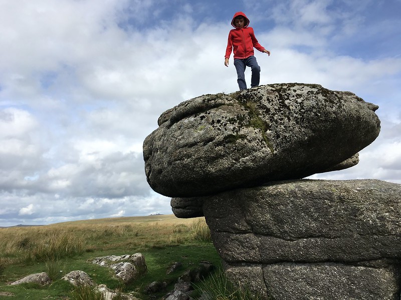
Logan stones are much rarer than they used to be to find, and having a logan stone that rocks or logs (moves) is another thing because some have even been toppled to smithereens, such as the Nutcracker near Rippon Tor (even though it is still marked on the popular OS Maps) and the Nutcracker on Sharpitor near the village of Lustleigh. Despite this, there are still some great examples on Dartmoor that deserve to be recognised here and I have picked out two to analyse, Shelstone Tor and Black Tor (Walkhampton Common) respectively. Both are well-known locally and feature at least one rock basin, leading onto the next topic (which is yet to be discussed). Logan stones are formed when a joint in the granite is eroded by the weather so much until it gets to the stage when enough weathering has taken place as to leave the stone balanced on a small pivot which enables it to rock (move). The rock has succumbed to its own weight and the boulder parted from its base.
Rock Basins
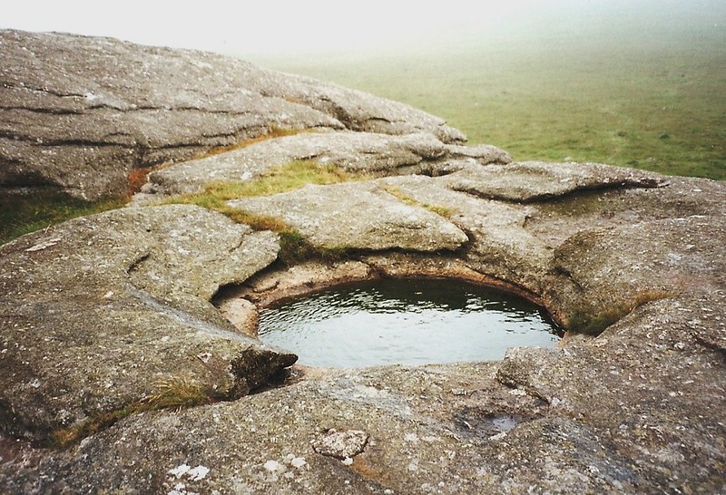
My favourite granite feature has to be rock basins, and they’re extremely common on the moor. They are usually rounded but examples such as Shaugh Beacon and Bag Tor show irregular shapes. The best examples that I can find are on Pinmoor Rocks, Arms Tor, Kestor Rock, Heltor Rock, Meldon Hill North Tor, Great Mis Tor, Tunnaford Rocks and Rundlestone Tor. The largest is the one atop Kestor Rock, which was discovered by G. Wareing Ormerod in the mid 19th Century. Again, quoting from Josephine Collingwood’s book: “They are a product of periglacial activity during the Ice Ages. Large and weak feldspar crystals split during repeated freeze-thaw action. Fragments get blown away and reveal more material to weathering. When this weathering occurs on a level surface, a small recess is created which then fills with water and freezes. This fractures the rock around it so that on thawing it too becomes fractured and blown away. Gradually the freeze-thaw action creates a dish-like hollow that gets wider and deeper over thousands of years.“
William Crossing and Eric Hemery both described a selection of rock basins in their respective works, and several more have been identified in an article written by Tim Jenkinson and myself entitled ‘Lesser-Known’ Rock Basins, found in Dartmoor Magazine Issue 140 Winter, in 2020. This article takes a closer look at some of those examples not commented upon by previous commentators and includes one of those hidden in woodlands that has only recently been uncovered.
Conclusion
So that is my first attempt at describing a confusing albeit amazing place for geology evident on Dartmoor’s tors in many different ways. There is so much more to explore and well into the future will more be revealed than we know of today. Let’s treasure and appreciate the geology of Dartmoor National Park.
More information about geology on the eastern side of Dartmoor is described in the new book ‘East Dartmoor’s Lesser-Known Tors and Rocks‘ by the author.
Resources
- Collingwood, J. (2017): Dartmoor Tors Compendium – Revised Edition
- Collingwood, J. (2022): Geology of Dartmoor – An Introduction to Dartmoor through Deep Time; its Geology, Tor Formation and Mineralology
- Colston, A. (2014): What are these bumps on the moor?
- Devon’s San Andreas Fault (accessed online)
- Horsham, R. (2020): Dartmoor Magazine Issue 139 Autumn: Understanding the Dartmoor Landscape: Dartmoor’s ‘Border Hills’
- Jenkinson, T. and Piper, M. (2020): Dartmoor Magazine Issue 140 Winter: ‘Lesser-known’ Rock Basins
- Piper, M. (2022): East Dartmoor’s Lesser-Known Tors and Rocks
- The British Geological Survey
Max Piper.

