East Dartmoor: The Hidden Landscape Rocks and Tors
by Tim Jenkinson
The various landscape features of the far eastern side of the Dartmoor National Park (DNP) have received little if any attention in the extensive literature of the moor. This might in part, be due to this area not being considered to be within the Park boundary until at least 1951 when National Park status was acquired. William Crossing writing at the start of the 20th Century reminds us that:
"Although, as De la Beche has pointed out, the region bounded on the north and east by the Teign, and embracing the parishes of Moreton, Bridford, Christow, and Hennock, is geologically and geographically one with Dartmoor, it has certainly never been looked upon as forming part of it, nor is there any mention of it in connection with the forest or commons of Devon."
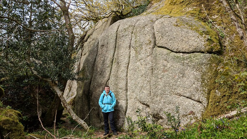
 East Wray Cleave Tor However, in his many papers and books Crossing is the first to draw attention not only to the aforementioned town and villages, but also Lustleigh and the towns of Bovey Tracey and Chagford in a series of excursions that he describes in his 'Guide to Dartmoor' (1912 edition page 267-276 and 301-311). He supplies further details in the delightful 'The Teign From Moor to Sea' booklet first published in 1986 by Quay Publications of Brixham. Here he makes several references to rock piles, but not always with much detail on their locations and as a result some have become difficult to decipher. Although most of the rocks he mentions are nowadays represented on Ordnance Survey Maps there are occasional exceptions such as John Cann's Rocks in the parish of Bovey Tracey and Druids' Altar in the parish of Bridford.
 Bowden Tor When the author first observed these fine tors and rocks, it is clear from his accounts that many of them were at that time visible to the naked eye. However, in little over a century since he roamed these parts, the hillsides have changed considerably and a proliferation of trees now conceal much of the rock-strewn terrain he described.
Subsequent authors such as Eric Hemery (1983) have largely overlooked the extreme far eastern edge preferring to concentrate on what is the more obvious 'High Dartmoor' to the north, west and south. That said I have worked with Hemery's definition of a tor as 'A prominent outcrop that can occur at any point between valley-floor and hilltop' (page 89). Mike Brown (1995) was the first to provide national grid references (NGRs) for moorland features and catalogue them in his 'Gazetteer of Dartmoor Names' which helpfully includes parts of the eastern landscape.
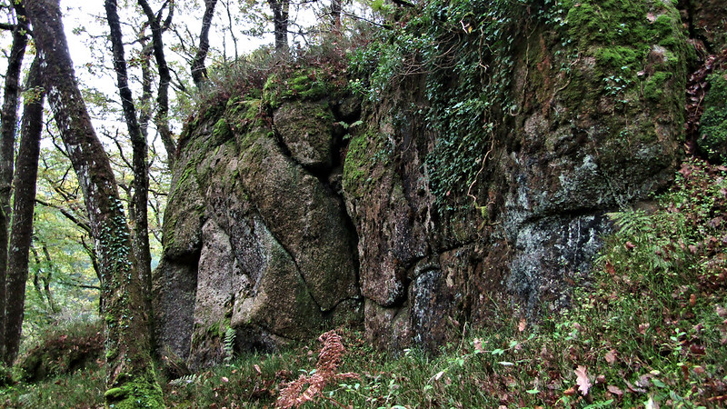
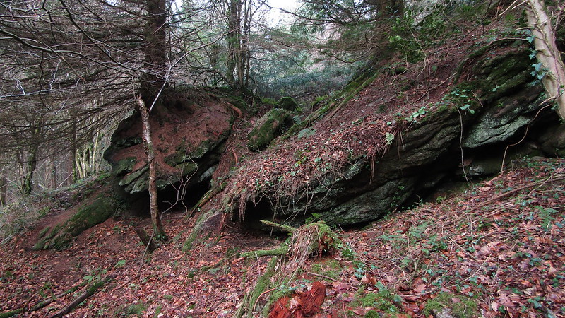
 Wray Cleave Middle Tor Another already identified and complicating factor on this side of the moor is the often densely planted woodland that sweeps across the steep slopes of places like the Wray Valley from Lustleigh to Moretonhampstead and Fingle Gorge to the south and east of Drewsteignton. This means that for much of the year the tors are hidden from view contributing greatly to their ongoing anonymity. In order, to be a 'prominent outcrop' as Hemery suggests it really needs to be seen.
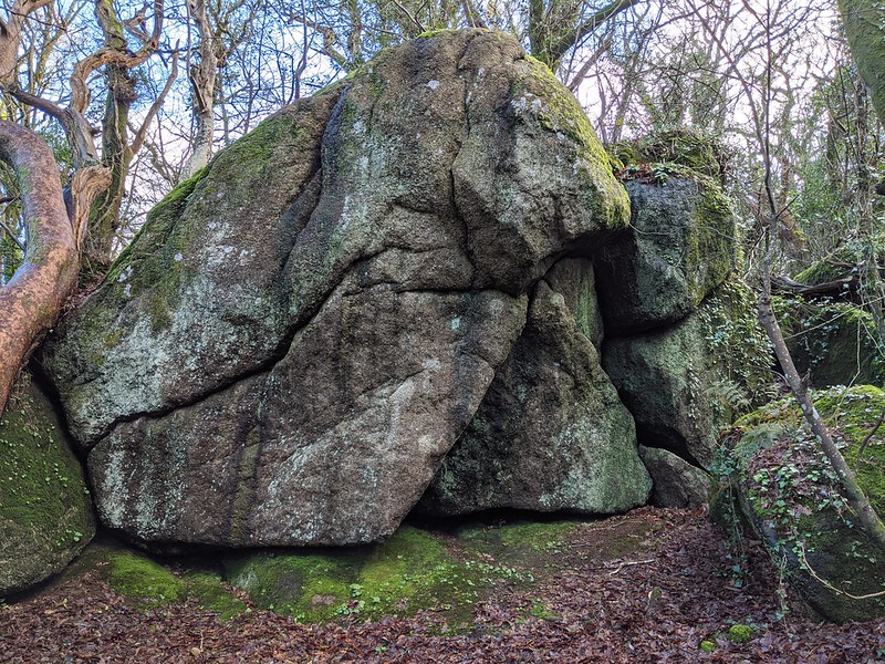
 Rooks Hole Tor In February 2011 I received an interesting letter from Dr Tim Harrod in response to a series of articles I had written for Dartmoor Magazine (DM) on the subject of Lesser Known Tors (1996/7 and 2010). These being tors that had been described in the literature and most often named but failed to appear on popular maps even though in most instances they are very distinctive rock piles. In his letter Dr Harrod gives examples of unnamed tors to the west of Slade Cross on the A382, at the top of Whiddon Wood opposite Castle Drogo and on Broadmoor Common on the north side of Teign Gorge (SX760900). Intrigued by these references I have since the beginning attempted to photograph and record location details of as many lesser known tors and outcrops, enlisting the help of Steve Jenkins who with his extensive local knowledge has identified many examples that were unknown to me. Without doubt there are others still to find. Since 2017 Paul Buck has accompanied me on several excursions into parts of Holne Chase and Ausewell Woods; permissive walks that were greatly facilitated by Paul's negotiation skills with Fountain Forestry who manage the land there. Throughout 2018 Max Piper has contributed greatly with further discoveries, his enthusiasm for exploration inspiring a number of extra excursions into the far east.
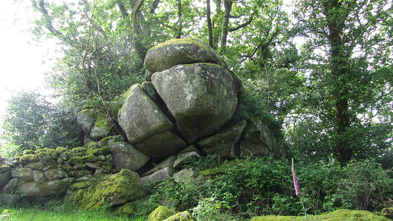
 Lizwell Rock Using recent definitions of tor types included by Richard Horsham in DM 117 (Winter 2014) as a classification tool this gazetteer of East Dartmoor will show a photograph and NGR for each rock pile, indication of the type, who first described it, or found it, whether it is on private or public access land and in which parish it resides. Parishes will be presented in alphabetical order and tors within that boundary described accordingly. The Parish boundaries are identified in accordance with the electronic map interpretation of RR Oliver and RJP Kain (2001) Historic Parishes of England and Wales Before 1850 Colchester Essex.
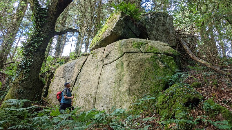
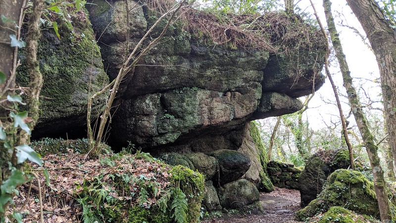
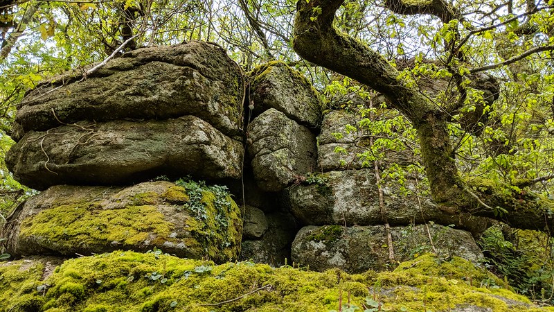
 Bearacleave North Tor The contents of this gazetteer represent at least 10 years of exploration of lesser known tors and rocks in the region of East Dartmoor, many of which have never been described before or photographed. Whilst some of these rock piles are shown on OS maps the vast majority do not appear as they are well hidden in trees and dense woods and because of this seem to have escaped the attention of early cartographers. That said recent photographic records included in the work of Tom Greeves (2015) indicate that many tors were indeed once visible on this side of the moor before the plantation of trees in the mid to late 19th Century. Clearly some of the tors now reside in what has become private land and visitors are urged to respect this if ever attempting to retrace my steps in the future.
 Fleetwood Tor The discovery of a long-lost tor continues to be a source of great inspiration and enjoyment and has been the driving force behind the completion of this project. Using old maps, William Crossing's accounts and references from people with local knowledge along with a distinct desire to explore and hunt for outcrops has led to the discovery of many previously undocumented sites that people of the parish may pass every day without knowledge or awareness. There are probably others still yet to find in the great wooded wilderness of the east but for me I feel that most have now been accounted for although updated information is always welcomed should any new sites be known and have unwittingly been omitted from this account.
 Trenchford Tor Throughout the project I have received very good support from the likes of Steve Jenkins, Dr Tim Harrod, Richard Horsham and latterly Paul Buck with whom I have shared many an interesting walk in unfamiliar territory such as Holne Chase, Buckland Woods and through Ausewell Woods. Paul's persuasive approach to landowners seeking permission to enter private land has been one hundred percent successful and has contributed greatly to extending this gazetteer.
Together the various contacts I have made as a result of researching this area have prompted me to visit more sites and record details. Collectively their input has been invaluable and has gone on to help me make further discoveries. Their contribution to each of the rock piles is acknowledged in the accounts.
 Ripin Tor Most of the far eastern side of Dartmoor is difficult terrain with its sweeping hillsides and densely wooded slopes that have gradually evolved over the past century or so to obscure many of the rocky features that were once so obvious. As a result, many people have been reluctant to seek out the tors choosing to stick to the riverbanks and footpaths where walking is easier and less strenuous. This account written in the first quarter of the 21st century has been an attempt to document what I (we) have found for future generations to seek out hoping that one day they too will marvel at the great hidden landscape of East Dartmoor.
Tim Jenkinson.
|