
An edited version of this article appeared in Dartmoor Magazine – Spring 2013.
The often-difficult terrain of Eastern Dartmoor with its steep wooded slopes above Bovey Tracey, Lustleigh and Moretonhampstead has led to considerable underrepresentation in the literature. As accessibility has and continues to be a problem, very little is known of the various tors and rocks that exist in that area. This short article begins with an exploration of those close to Little John’s Walk (LJW) near Bovey.
High above and to the north of the town a good track leads eastward from the entrance to Stonelands (SX 812800) and runs uphill for roughly half a mile to Furzeleigh Cross (SX 819796). It seems that at one time this was a public highway and is identified as such by William Crossing (WC) in the 1912 edition of his ‘Guide to Dartmoor’ but is nowadays known as LJW (Brown 1996). On page 301 Crossing describes the following excursion ‘the visitor, starting from Bovey will leave the town by the Moreton road, passing the old cross at Atway and ½ m beyond will take the R. branch at the fork and enter Lower Aller Lane. A few hundred yards further up turn R at the cross road and soon the woods, on the verge of which John Cann’s Rocks are situated R will be reached.’
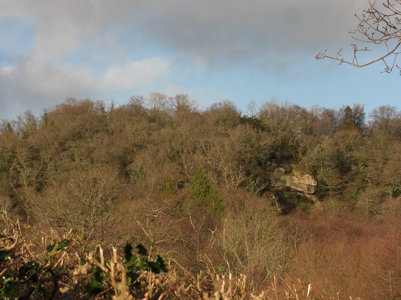
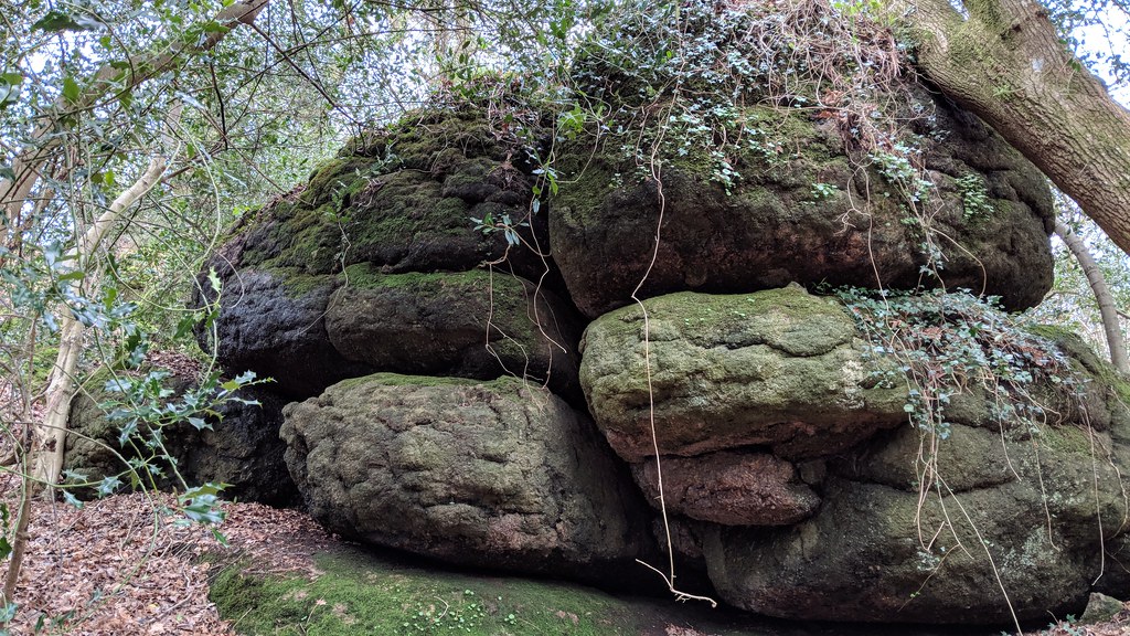
Today this route can still be walked but great care must be taken at the point where the Moretonhampstead Road from Bovey joins the A382 and then between there and Lower Aller Lane as there is no path. Whilst Crossing mentions John Cann’s Rocks (JCRs) in his account he rather strangely omits to describe the far grander cliff like face that juts from the wooded hillside above and to the north of the Stonelands estate (at approx SX 812801). Unfortunately JCRs are no longer as visible as when the author visited in the early 19th Century, as they are now hidden in woodland to the right of LJW but are nonetheless well worth a visit as they present as a fine array of brooding, dark and moss covered boulders at SX 814798 some of which are seen to extend below the track. I am indebted to Steve Jenkins for drawing my attention to these rocks and encouraging me to visit.

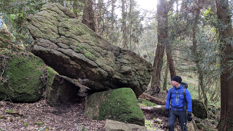
The walk uphill from here is rewarded with the sight of huge and oddly shaped boulders on the left of the track and if the visitor carries on to the second gateway on the left and follows through a permitted path for a short distance (100 metres) into an area known as Stonelands Waste, he/she will see to the right of them another fine cluster of giant rocks and outcrops rearing up from the wooded floor at approximately SX 818799, a set not previously described it seems. After exploring the rocks here, steps need to be retraced to the main track turning left and then following up to the road at Furzeleigh Cross whereupon a turn to the right will return the rambler downhill towards Bovey Tracey passing on the left the town’s hospital. Altogether this is a short walk of two hours maximum, but is nonetheless complemented by the reward of discovering some of the lesser known tors and rocks on the eastern side of Dartmoor.
References
Brown M (1996) The Gazeteer of Dartmoor Names Forest Publishing Newton Abbot
Crossing W (1912) Guide to Dartmoor Reprinted 1993 Peninsula Press Newton Abbot