
An edited version of this article appeared in Dartmoor Magazine – Autumn 2011.
This series of occasional papers is designed to build upon existing knowledge of the landscape of Dartmoor and develop where possible some new insights into those parts of the moor that have so far received somewhat scant attention in the literature. To this end the works of noted commentators such as William Crossing (WC) and Eric Hemery (EH) will be explored as well as the all-important Ordnance Survey (OS) representation of tors and rocks on their maps.
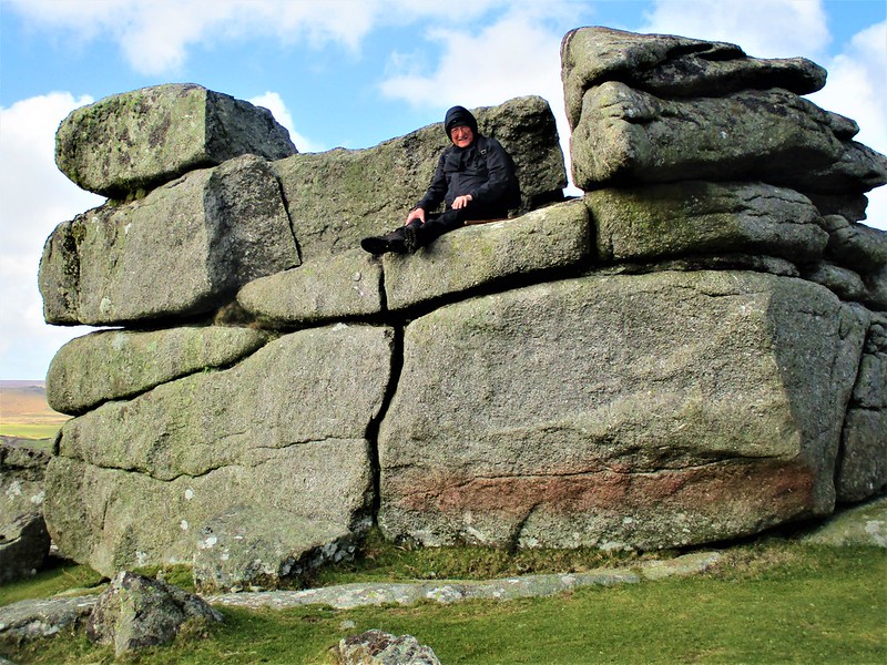
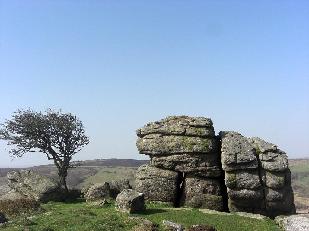
We begin with the impressive line of outcrops known as Emsworthy Rocks that occupy a proportion of the grid squares SX 7476 and 7576 between the much better-known Saddle and Holwell Tors on South Dartmoor. Visitors to this popular part of the moor and the nearby honey pot of Hay Tor will no doubt wonder why it is that such an impressive range and mass of granite is not shown on their maps. It is EH (1983 p735) who introduces the name of Emsworthy Rocks in the tome ‘High Dartmoor’ describing them collectively as a ‘markedly elongated rock ridge’ and notes that neither WC nor the OS acknowledge the area. Crossing’s omission is even more surprising when reading his account on page 299 of his Guide to Dartmoor (1993 edition) where he states ‘On the hill ¾ m S. of Holwell Tor is Saddle Tor and to this we shall now direct our steps, passing on our way another branch of the disused granite tramway’ with absolutely no mention of the sprawling rock strewn ridge in between.
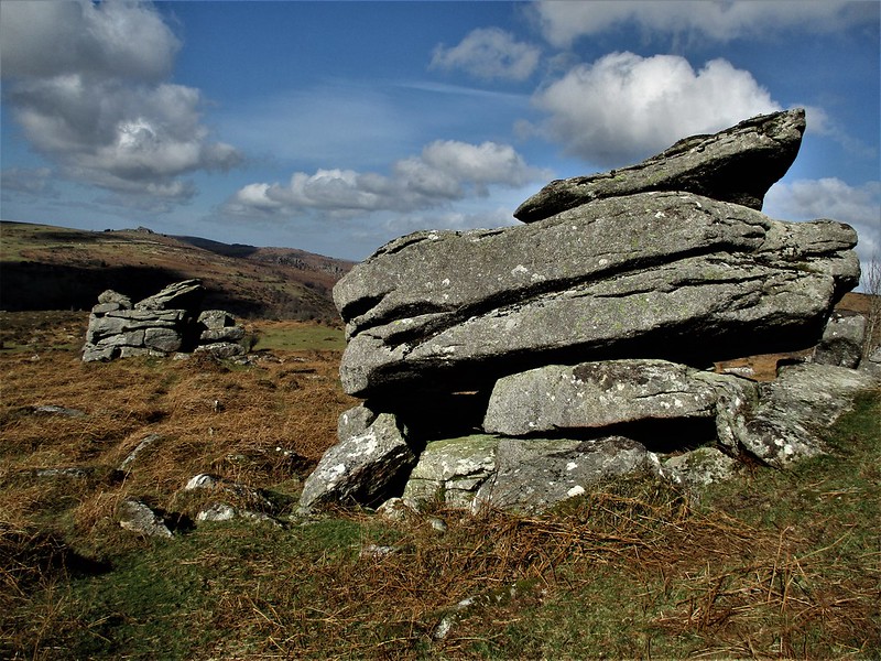
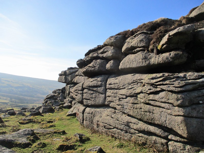
Hemery clearly links the name of Emsworthy to the nearby farmstead and of course there are many other examples of this occurring elsewhere on Dartmoor such as at Trowlesworthy, Thornworthy, Langworthy, Middleworth and Foxworthy to name but a few. The reason for the OS omission is not clear, although there is a small, shaded line shown in the vicinity well to the north of Saddle Tor at approx. SX 748770, but this representation fails to do justice to the rocks, for here we have a magnificent tor, one of the largest on the southern moor. It stretches from the east at SX 753768 to the west at SX 749769 and contains within it some impressive rock piles of considerable stature one of which near the summit is given the name of ‘Fitches Holt’ by EH and another nearby as ‘Whortleberry Rock’. At the far north-western end of the ridge is the iconic rock-fast hawthorn that is much photographed but never named always appearing under the generic name of ‘Dartmoor’ or described as ‘looking towards Hound Tor’. On the north side of the ridge there is evidence of rock splitting with distinctive tare and feather marks in the granite along with the remains of a small quarry, ruined walls and tracks running up and into. A small unrecorded logan rock sits on the lower north side at SX 750769.
Some 200 metres to the north-west of Emsworthy Rocks and still some way to the south of Holwell Tor at SX 748772 is another small tor of weathered granite tucked under the hillside. Consisting of three low piles the name of ‘Little Emsworthy’ seems appropriate as it is sufficiently detached from the larger group to warrant an identity of its own.
Over the years many people will have puzzled over the huge rocky ridge that runs some 400 metres or so to the north of Saddle Tor on South Dartmoor that is neither properly represented nor named by the OS on their maps. This short article has given some acknowledgment to Emsworthy Rocks nearly 30 years after they were first described by EH illustrating further the need for the OS to update their maps of the moor for the 21st Century.
For more information and images of various tors and rocks of Dartmoor why not go on to the internet and type the keywords ‘Lesser-Known Tors’ into a search engine and follow the link.
Update: In December 2022 Emsworthy Rocks was added to both 1,25:000K and 1,50:000K Ordnance Survey maps. Max Piper contacted the OS about the alarming omission explaining Hemery’s previous reference from 1983, and to his surprise the company obliged and the acceptance of this grand tor onto maps has finally been realised.
References
Crossing W (1912) Guide to Dartmoor Peninsula Press Newton Abbot reprinted 1993
Hemery E (1983) High Dartmoor: Land and People Hale London