
An edited version of this article appeared in Dartmoor Magazine – Summer 2014.
The far southern eastern slopes of Dartmoor National Park high above and to the north and east of Bovey Tracey and Lustleigh have to date received relatively little attention in the literature when compared to other areas of the moor. Apart from the inimitable William Crossing (1912), who describes a few excursions in his Guide (pages 301-306) and other books and the occasional article in Dartmoor Magazine such as those by Elisabeth Stanbrook (2000), Mary Tavy (2013) or myself (2013) the area has until now largely escaped scrutiny.
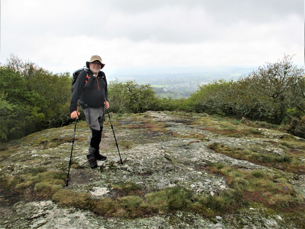
Shaptor Woods occupy a good proportion of the National Grid Squares SX 8080 and SX 8180 and can be accessed from a number of points including a gateway at the southern edge just off Little John’s Walk. A former thoroughfare in Crossing’s time, the Walk is now a public footpath that extends uphill from near the entrance to Stonelands as far as the road at Furzeleigh (Firsleigh) Cross, about a mile or so to the north of Bovey Tracey. Once inside the wood, where the lower path is clearly defined, the visitor soon encounters a series of magnificent rock piles that rise up from the shaded floor.
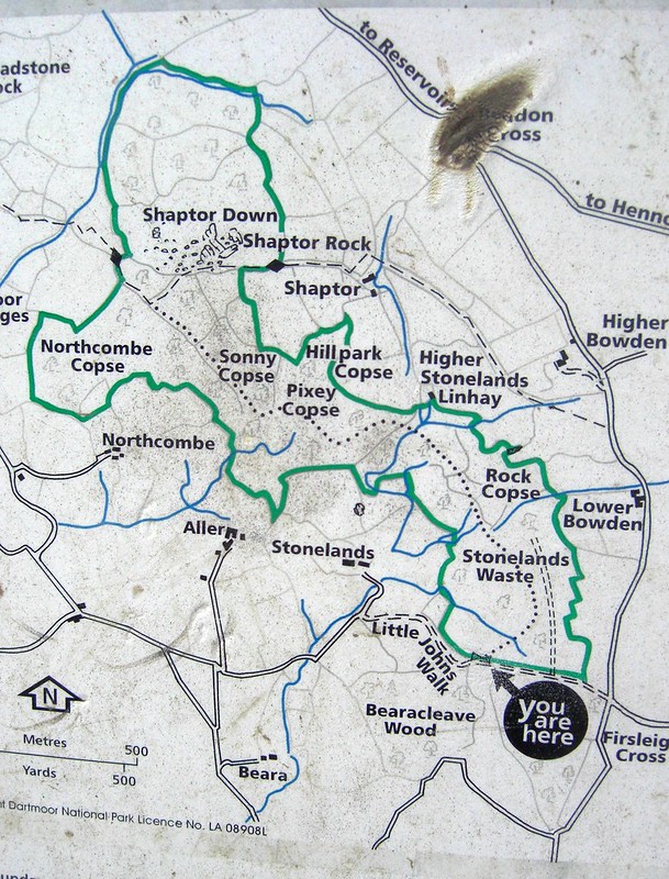
A map of the area at the gateway (there is another at the northern end) shows that the main wood is divided up into a number of distinct and helpfully named copses. Please note that some of the grid references I have included in this account are approximations as obtaining GPS accuracy under a dense canopy of trees is notoriously difficult.
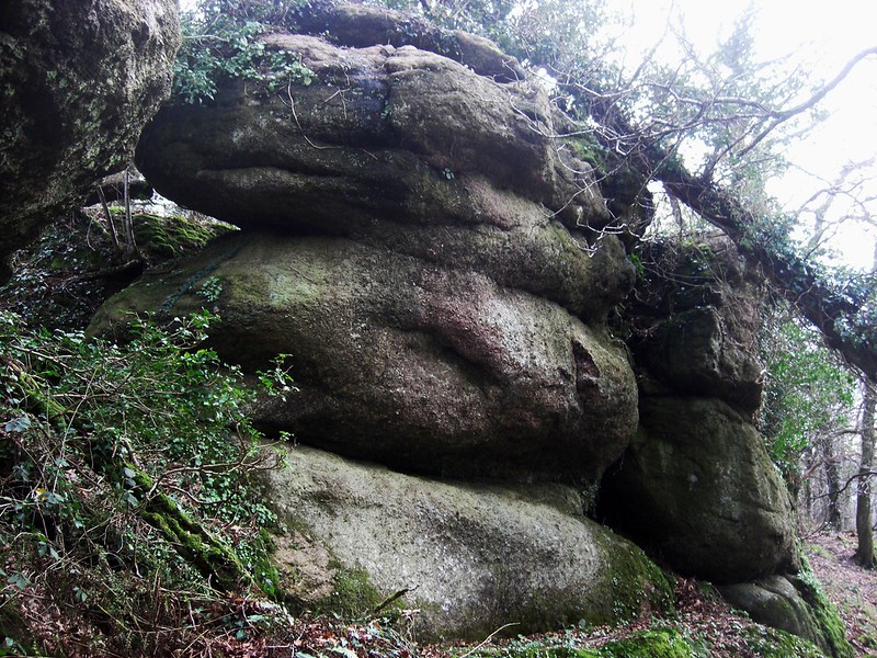
A fine tor, for that is what it is, can first be seen in that part of the woods that appears to be known as Rocky Copse at SX 815803 where two simply awe-inspiring rock piles of significant stature on the slopes above the path (there is another 30 metres to the north west) dwarf the onlooker. Rising to some 8 metres in height the southern rocks have quite distinctive round edges and shapes. Returning to the path and continuing north westward there are soon more outcrops to enjoy in that section of the woods identified as Pixey Copse (SX 810804) the largest of which is set right beside the track as it threads its way between the dark imposing rocks. Although perhaps a little less impressive than those earlier described they nonetheless command attention.
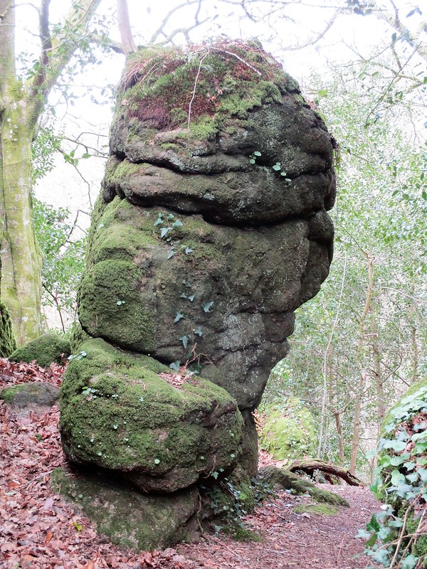
The walk from here continues along the lower slopes, through that part known as Sonny Copse at SX 810805 where more giant boulders are strewn and from here the next tor of substance lies a short way to the north set once again above the path at SX 809806 and presenting as a craggy lower outlier of the main Shaptor Rock but at some 250 metres to the south of the summit. Separate and quite distinct from the main group I have heard it referred to amongst the rock-climbing fraternity as ‘Lower Shaptor’.
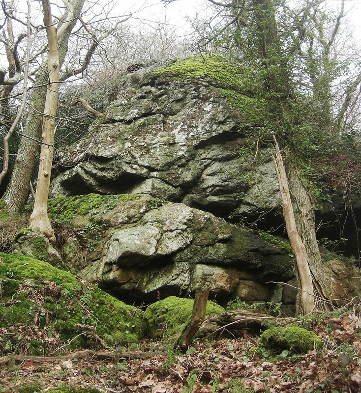
From here the path loops uphill in a north easterly direction and soon brings the visitor to the considerable rock pile that gives its name to the woods. What a spectacle this is, a giant tor enshrouded in trees, with a huge, fissured rock face that is popular with climbers and those who enjoy the sport of bouldering. The summit can be reached with a little effort and rewards the visitor with superb views over the tops of the trees in all directions. From the tor a path heading to the southeast eventually brings the walker out on to the road just below Higher Bowden and from here it is necessary to turn right and proceed downhill to the small car park at Furzeleigh Cross or continue further on down the steep and narrow lane that passes by the hospital before arriving into Bovey Tracey.
The southeastern quarter of Dartmoor has been rarely described in articles or books. Shaptor Woods and the nearby Bearacleave (SX 816797) to the south retain some considerable tors that had it not been for the dense plantation here, would be otherwise conspicuous landmarks dotted on the slopes above and to the east of the road (A382) that runs through the Wray Valley. The whole area is well worth a visit but to achieve the best impression of the tors a walk in the winter months is recommended when the vegetation has died back and even better on a clear bright day in order to facilitate a photographic record.
Update (2023):
Since this preliminary article was written further exploration of the woods has revealed more tors and currently we have recorded the following; Winterlear Tor, West Shaptor, Shaptor Rock, Lower Shaptor, Sonny Copse Tor, Pixey Copse Tor, Aller Down Copse Tor, Rooks Hole Tor, Stonelands Stack, Lower Stonelands Linhay Tor, Rock Copse Tor, Bowden Tor, Middle Stonelands Tor, Long Close Tor, Stonelands Waste Tor and Higher Stonelands Tor.
References:
Crossing W (1912) Guide to Dartmoor (reprinted 1993) Peninsula Press Newton Abbot
Jenkinson T (2013) Dartmoor Discovered: Little John’s Walk Dartmoor Magazine 110 page 22
Stanbrook E (2000) Nutcracker Puzzle Dartmoor Magazine 58 pages 8-10
Tavy M (2013) Land of Legends: The Hermit and the Cavalier Dartmoor Magazine 111 pages 50-51