
An edited version of this article appeared in Dartmoor Magazine – Summer 2012.
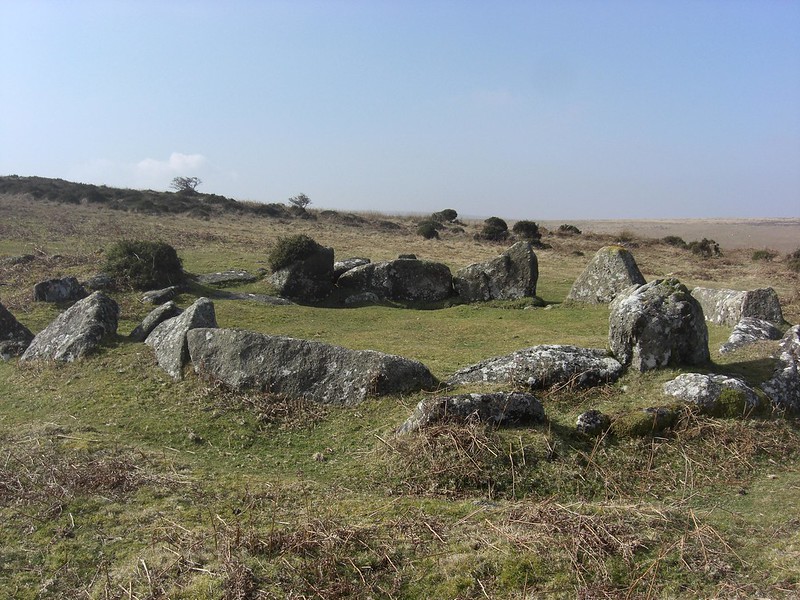
This short article charts what appears to be the discovery of a new tor, one that has been seemingly overlooked in the literature of Dartmoor and is not represented by the Ordnance Survey, which is rather surprising given its prominence atop Coombe Down at SX 7040 8229 when viewed from the north-west on Shapley Common. Ever since my earliest walks when I first became interested in what I have coined the ‘Lesser-Known Tors’ (LKTs) of Dartmoor, I was aware of a small rock pile on the crest of the Down to the northeast of the much better known but more lowly and less distinctive rocks of Shapley Tor. However, over time I had forgotten about the existence of this tor until rekindling my interest in LKTs a few years ago when I set about revisiting the various sites and making a new digital photographic record of the rock piles.

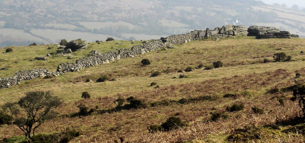
In recent months I have returned to the Coombe Down area to make an assessment and there is quite obviously a tor here, a cluster of what appears to be three main but low outcrops part involved in a field wall in private enclosures some 350-400 metres north east of the summit of Shapley Tor. Strangely, although making passing comment of this area in their books neither Eric Hemery (1983 p716) or William Crossing, seem to refer to the rocks or indeed much mention the Down. This is a peculiar oversight given the usual attention to detail by both authors. For example, in his 1912 edition of the Guide to Dartmoor (reprinted in 1993) on page 263 Crossing describes as part of Excursion 59 the following rather complicated route:
‘On reaching Moor Gate the rambler may desert the Princetown road and strike up over Shapley Common L. to Shapley Tor noticing some hut circles as he proceeds. The course is at first S.W by S with the enclosures L., but in less than ¼ m. this is changed to S., and then to E of S. By this route Shapley Tor is about 1 m. from Moor Gate’

There is no mention of the rocks on the top of Coombe Down that would have been clearly visible on high to the left of the approach to Shapley Tor, the view of which is captured in the accompanying photograph.
Only Jeremy Butler (1991) gives some representation of rocks at this point in his Atlas of Dartmoor Antiquities (Volume 1) where the ‘tor’ is shown as a small circular shaded area in the wall on a map on page 111. Disappointingly no rocks are shown on popular OS maps (1: 25000 Outdoor Leisure Map 28), where only the tiniest of shaded lines appears one that is hardly visible to the naked eye. It may well be the lack of public access to the area that has contributed in some respect to this neglect but the tor is so obviously visible from the Common it is difficult to believe that it has not been written about before. To visit the area and see the tor for yourself it is recommended that you park up at the viewpoint above Green Combe at SX 698835 and walk in a southerly direction over Shapley Common where there are also some well preserved hut circles to view on the approach.
This tor was first described albeit briefly, and the name suggested in 1996 by Peter Sanders and Alan Watson in their quest to visit 380 tors on Dartmoor
References:
Butler J (1991) Dartmoor Atlas of Antiquities: Volume One-The East Devon Books
Crossing W (1912) Guide to Dartmoor Reprinted 1993 Peninsula Press Newton Abbot
Hemery E (1983) High Dartmoor- Land and people Robert Hale London
Dr. Peter Sanders and Alan Watson (1996): Tors List 380 Tors Visitations (published privately)