

An edited version of this article appeared in Dartmoor Magazine – Autumn 2015 Issue 120, pp 40-41.
Lustleigh, a picturesque village set on the eastern edge of Dartmoor, is a gem of a setting for discovering hidden rocks and tors that are nowadays mostly shrouded under a dense canopy of trees on the steep valley sides. Perhaps best known for the Cleave on the high slopes to the west of the village where a number of grand rock piles reside most of which are marked on Ordnance Survey maps, there are nonetheless some much lesser known but equally fascinating outcrops to explore nearer to the village centre, a handful of which will be described here all of which can be seen from public footpaths and bridleways.
In the past Lustleigh has been described as ‘all hill, valley and rock’ (Reverend Richard Polwhele 1806) and as being surrounded by ‘much disintegrated granite with curious weathered granite blocks like huge loaves’ (cited in the Book of Lustleigh 2001). The visitor today if taking one of the many public footpaths that criss-cross through the woods in the village will certainly concur with the latter account.
More recently Myles Bowen (2001 page17) in the ‘Book of Lustleigh’ explains that ‘the hill fields of Lustleigh have a multitude of boulders and rocks in them’. He explains that this has occurred as a result of having been exposed by erosion but with other boulders having ‘rolled or slid downhill or been washed along by the weather conditions when the ice sheets were melting’. Whatever the cause, the result is a fascinating collection of giant rocks and tors that are concentrated in a relatively small area in and around the village.
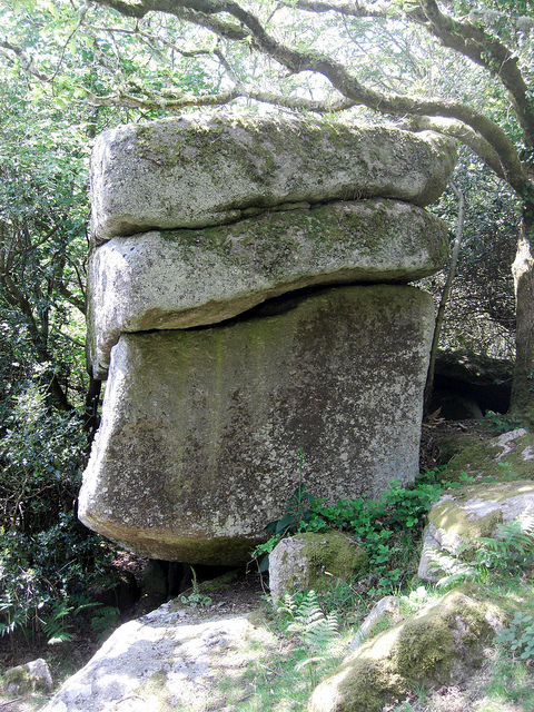
Parson’s Brown Loaf (SX 781817)
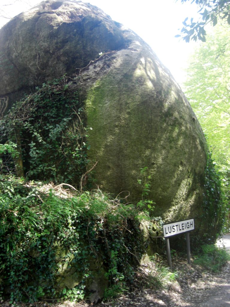
We start our tour on Mapstone Hill coming out of the village and heading up the road towards Combe at the point where the village sign can be seen. Here is a gigantic dark rounded boulder on the east side that is marked as Parson’s Brown Loaf on the 1886 edition of the OS map but is no longer shown on the modern versions. The Book of Lustleigh (page 139) gives no clue as to the reason for the name describing it as a ‘mystery’, but surely it must relate in some way to its shape as seen in the photograph. Crossing alludes to this in ‘Gems in a Granite Setting’ and with it being near the Rectory makes a tentative but possible link between the two. There is a fine rock basin etched into the top of the boulder that is just visible when viewing from below. Crossing also advises that at one time the ‘Loaf’ was known as the Map Stone, a name that is still marked on present day maps.
Ellimore/Hammerslake (SX 776815)
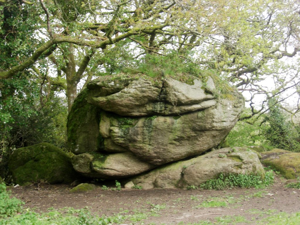
This small and quite easily overlooked tor resides in a field on a small hill just off the road to Hammerslake on its east side above Ellimore Farm and can be viewed with ease from the wayside. Steve Jenkins first gave me information on this fine rock pile the main part of which is part hidden under trees with further boulders extending downhill, its appearance is certainly in accordance with the ‘loaf’ perception already espoused.
Pathfields (SX 782814)
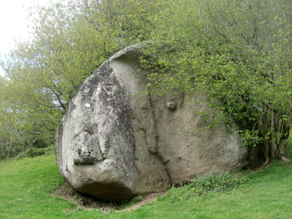
Again I am indebted to Steve Jenkins for reminding me of another huge ‘loaf like’ boulder that is set in a clearing at that part of Lustleigh known as Pathfields. First shown in an image on page 52 of William Crossing’s ‘The Teign: From Moor to Sea’ published in 1986, the rock in question is relatively easy to reach along a public footpath leading westward from the village. There is in effect a ruined tor here so much more than just the big rock that appears in the book, as there are several huge moss covered boulders gathered in the trees on the small hill above and with another massive rock below in more trees with more of the tor in the lower part of the private garden of Underwood at SX 781813 a section that is also visible from the path running below.
Mill Bottom (SX 787808)
Mill Bottom is where the Wray Brook (River Wrey) comes through the valley under the old Lustleigh Mill. It can be easily reached via a footpath leading south west from the hamlet of Wreyland. There are two rock outcrops of interest in the area the first at SX 786810 that is set in a wooded area and the second and main part a little further south presents from the side as a rugged tall elongated cliff face just above the river on its east side. Surprisingly Cecil Torr who lived in Wreyland and wrote extensively about the area in the tome ‘Small Talk’ makes no mention of the rocks here close to a path he must have walked many times back and forth from the river. This is a most tranquil spot that is well known to villagers.
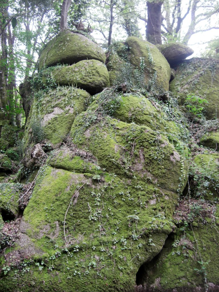
Harton Chest (SX 767817)
We finish our brief excursion to Lustleigh up on the hillside of the celebrated Cleave. The ridge is reached by following a path uphill from ‘Logan Stones’ off the road to Hammerslake and upon reaching the top we need to head in a north westerly direction along the track towards the tor. Although marked on modern day OS maps the fine rock pile at Harton Chest rarely receives the credit it deserves. It stands not far from the path and its grand summit commands breathtaking views to the south and west across the tops of the densely wooded slopes. Nobody seems sure of the origins of the name Crossing included, but its proximity to the same named farm (South Harton) and its curious vertical oblong rock atop might be suggestive of a stone chest of sorts.
Lustleigh is one of East Dartmoor’s most attractive villages and is rightly seen as a must place to visit to view the quaint thatched buildings in and around the village and on the steep hillsides above. However there are also numerous secluded rock piles and hidden tors that have received relatively little attention in Dartmoor literature even though they can be easily accessed and seen from public footpaths. This brief article has drawn attention to just a few of these fascinating piles, but visitors must also be aware that some examples do reside in private gardens and are therefore inaccessible to the public.
References
Crossing W (1986) The Teign: From Moor to Sea Quay Publications Brixham Devon
Crossing W (1986) Gems in a Granite Setting: Beauties of the Lone Land of Dartmoor Devon Books
Polwhele R (1806) The History of Devonshire’ Exeter Printed by Trewman and Son, for Cadell, Johnson, and Dilly, London.
The Book of Lustleigh (2001) Halsgrove Tiverton Devon
Torr C (1970) Small Talk at Wreyland combined edition Adams and Dart Bath Somerset