

An edited version of this article appeared in Dartmoor Magazine – Summer 2017 Issue 127.
Greatrock Copse lies approximately three quarters of a mile to the northwest of the village of Hennock on East Dartmoor, and is a fascinating place for discovering hidden rock piles as well as a series of granite stones dated 1858. The name of the copse is synonymous with extensive iron-mining operations that first took place in the area during much of the 19th century, and then most notably from 1902 onwards when the mine was renamed Great Rock by the new owners Ferrubron Manufacturing Company. The mineral that was extracted here was a high-quality micaceous haematite that when crushed and ground formed a lustrous black pigment which could be used as an ingredient for the rustproof paint on Royal Naval battleships at Plymouth Dockyard (Brooks 2004). The paint was also used on the Albert Bridge over the River Tamar at the Devon-Cornwall border and for Sydney Harbour Bridge (Fraser 2004). The mine here was eventually closed in 1969.
Yet despite both the mine and copse taking the name, comparatively little is known of the Great Rock itself. There is only scant reference to the feature in the literature, even though it has been clearly shown at SX 8216 8184 on the Ordnance Survey Landranger 191 map of Okehampton & North Dartmoor (1:50,000) for many years. Both Bound (1991) and Brown (1995) give grid references in their publications; however the former, in his first book on the subject, includes what appears to be the location of the mine rather than the rock. It is not until Ringwood’s (2013) book Dartmoor’s Tors and Rocks that we actually get to see a photograph with a short description.
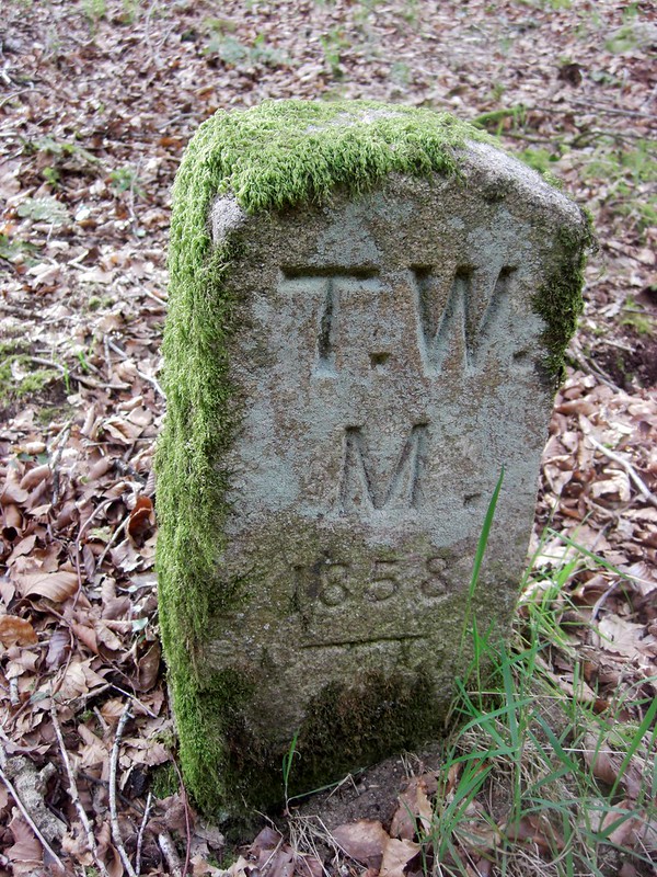
Greatrock Copse can be easily reached by walking north from the Palk Arms in Hennock and passing the old chapel on the right, where one of the aforementioned marker stones can be seen against the wall (SX 830810). It is inscribed with the letters TW/M and we learn from Bishop (2004) that they most probably stand for ‘Torquay Water Main’. Its date of 1858 signifies the laying of the original cast iron pipes from the old mill pond and streams at Tottiford (SX 810833) to supply water to the rapidly growing population of the town, covering a total distance of some 24,522 yards from the source (Chapman 1925).
However, both system and supply were soon found to be inadequate and so a reservoir was built at Tottiford in 1861 along with two service reservoirs in Newton Abbot and on Chapel Hill in Torquay (Chapman 1925). Eventually the demand for water was such that it necessitated the construction of two more reservoirs at Kennick (SX 804844) in 1884 and Trenchford (SX 804824) in 1907 (Jones 2013).
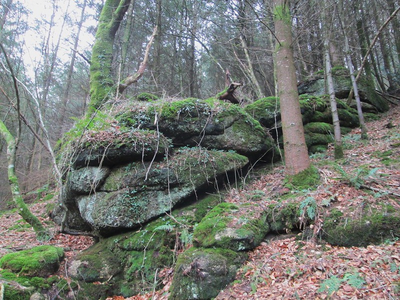
Continuing up the road from the old chapel in a northerly direction a public footpath soon branches to the left across a field and drops down through trees to a farmyard. Observing the directions the visitor will now need to cross over to the other side and enter the copse. Following the main path, which weaves its way across the hillside, several vegetation-covered outcrops are encountered both above and below the path at SX 824817, but these are merely outliers of the Great Rock itself. The path should now be followed through the wood in a north-westerly direction where soon more marker stones are seen to the left, all in remarkably good condition given their antiquity.
Other stones in this series that are not on Dartmoor have been located by the Milestone Society in Summer Lane, Teigngrace at SX 843750, on the A382 at Whitehill near Newton Abbot (SX 856722), in Old Newton Road at Edginswell (SX 893662) and opposite Barton Road in Torre on the outskirts of Torquay at SX 907646, confirming that they were once set along the entire 15-mile line of original piping. Together the survivors form a remarkable historic collection, with possibly others yet to be found (Jenkinson 2015).
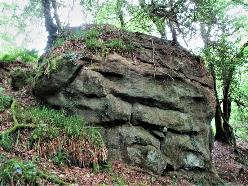
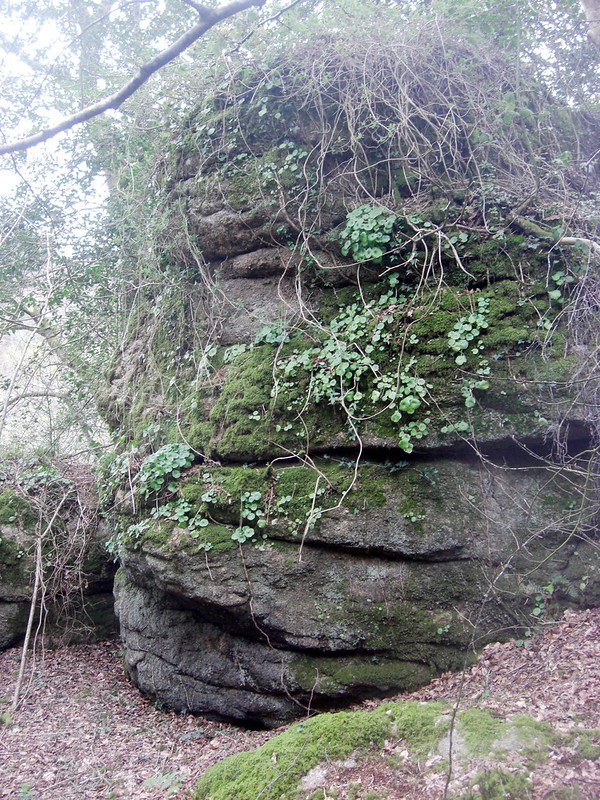
Continue along the path to almost the far north-western edge of the copse. Just before its starts to descend – and some 50 metres above it – is the magnificent rock from which the area takes its name. It is seen at its best when viewed from below, appearing as a huge dark and rounded outcrop that resembles a giant crouching toad. Before the trees overwhelmed the slopes here this rock must have formed a considerable eminence, and it is easy to see why the nearby mine took its name. In addition to the main feature, I have located other sizeable rock piles at SX 823817, in Lake’s Copse nearer the mine at SX 826817 and a smaller flattened series of rocks in Easterndown Copse at SX 819818.
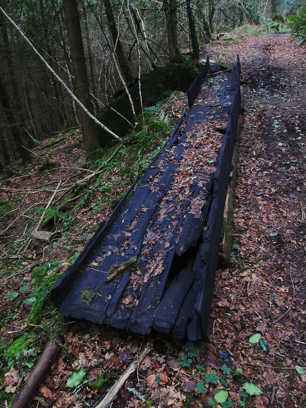
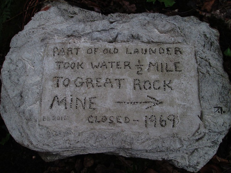
Leaving the rock the visitor will now need to descend through trees to join the main track. A short detour to the right here will allow for an examination of an old mining wooden launder, which has been left beside the track. A nearby commemorative rock that was placed in 2015 advises that the launder once carried water half a mile to the mine, presumably from the nearby Beadon Brook.
The return to Hennock can be made by either going back through the copse or walking through the gate at the end of the track and turning left to head up Beadon Lane to Chericombe Head Cross where a 19th-century four-sided granite guide post still stands at SX 822808. It is inscribed with directions to Hennock/Bridford/Moreton and Bovey on its faces. Taking the road to the left will lead back into the village via Bell Lane.
Greatrock Copse is a place of considerable industrial history with not only a once vibrant iron mine works in the vicinity but also where underground piping was first laid to bring water to the people of Torquay in 1858. In addition it has numerous hidden rock piles of considerable magnitude, including the magnificent rock itself from which the area is named.
References
Bishop, H. (2004) Personal correspondence on the subject of ‘Boundary stones in Old Newton Road’
Bound, T. (1991) The A to Z of Dartmoor Tors Obelisk Publications Exeter
Brooks, T. (2004) Great Rock: Devon’s last metal mine Cornish Hillside Publications
Brown, M. (1995) The Gazetteer of Dartmoor Names Forest Publishing Newton Abbot
Chapman, S.C. (1925) ‘The Water Supply of Torquay’ Journal of the Royal Society of the Promotion of Health 46:pp17–20
Devon Marker Stones http://www.dartmoor-crosses.org.uk
Fraser, I. (2004) Hennock: A Village History Sylverwood Publishing Newton Abbot
Jenkinson, T. (2015) ‘Torquay water main stones’ Milestones and Waymarkers The Journal of the Milestone Society Volume 8:pp41–2
Jones, L. (2013) The Great Source Dartmoor Magazine Summer pp15–18
Ringwood, K. (2013) Dartmoor’s Tors and Rocks University of Plymouth Press