
An edited version of this article appeared in Dartmoor Magazine – Winter 2015 Issue 121.
William Crossing rightly included Dartmeet, the point where West and East Dart rivers unite, as one of his ‘Gems in a Granite Setting’, for here we have ease of access to the riverbank coupled with gentle walks to enjoy that are popular throughout the year with visitors. The author advises that the name first appears in 1689 as Dartamet and is attributed to Christopher Pearce who wrote of the area in a ‘deposition respecting the eastern boundary of the Forest’. He also provides information on the remains of the clapper bridge here that was swept away in a flood of 1826 (p457 Guide to Dartmoor).
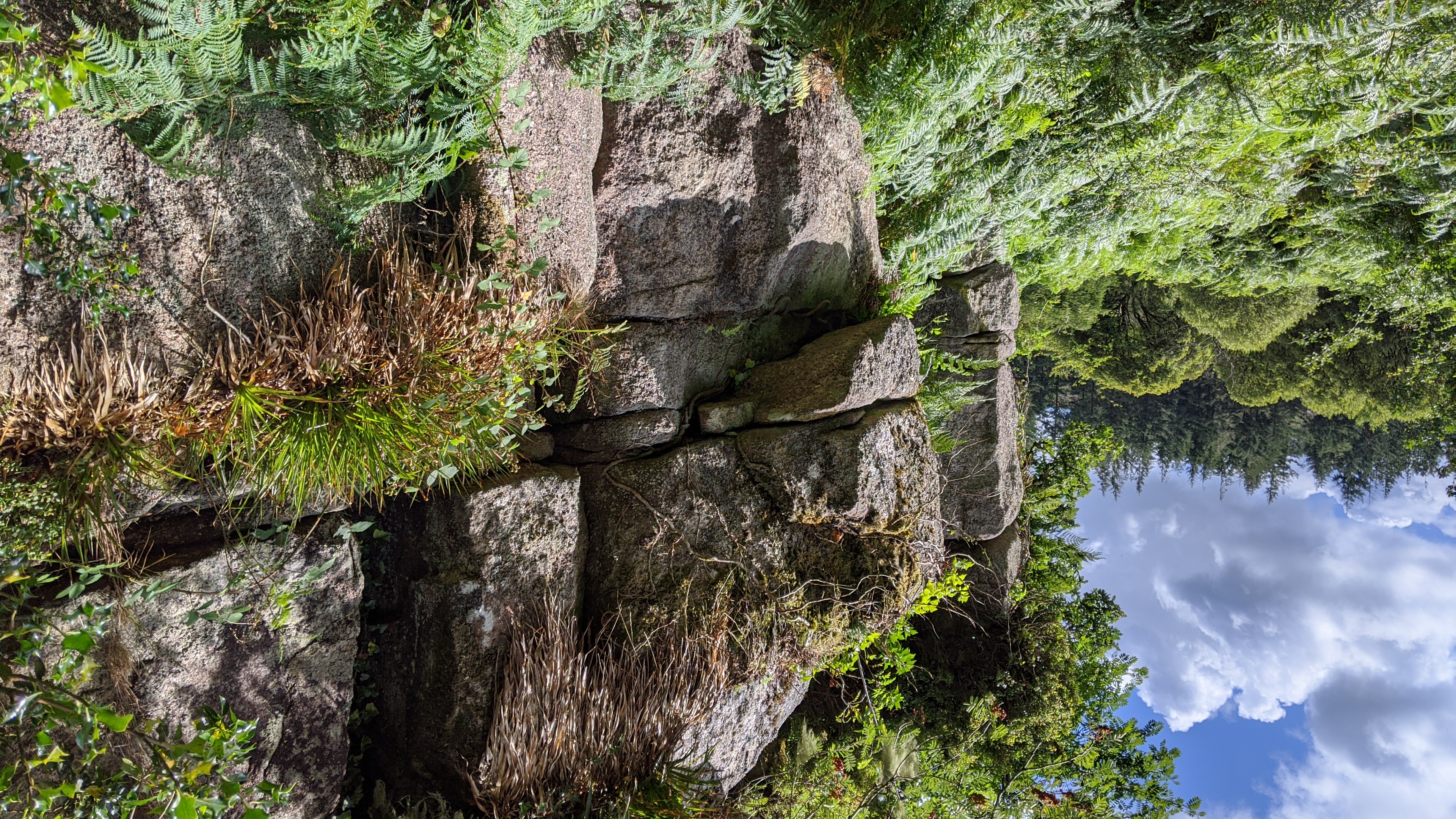
Since Crossing’s accounts, and with the advent of the motor car and improved roads, Dartmeet has understandably become one of the moor’s top honeypot tourist attractions, especially in the summer months when families take the opportunity to picnic beside the river. However, if one takes the walk leading northwards from the car park along the east bank of the river it is possible within just a few strides to leave the crowds behind at the Badger’s Holt shop and café. Not far from the complex a small yet picturesque tor is soon encountered to the right of the path at SX 673734. It consists of a lower weathered and compact overhanging outcrop and a higher vegetation-covered rock face on the hillside above.
Surprisingly the tor is not mentioned in the literature and perhaps its seclusion here hidden away as it is has led to its ongoing anonymity. At this point the path is rather rugged in places, but soon opens out into a broad spacious area tucked under the lower steep slopes of Yar Tor Hill where a number of large rocks are dotted to the east of the river.
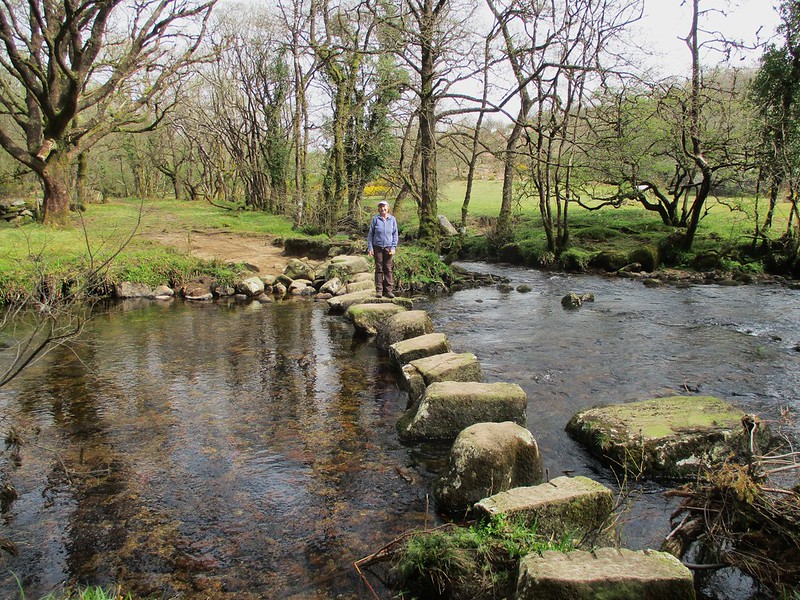
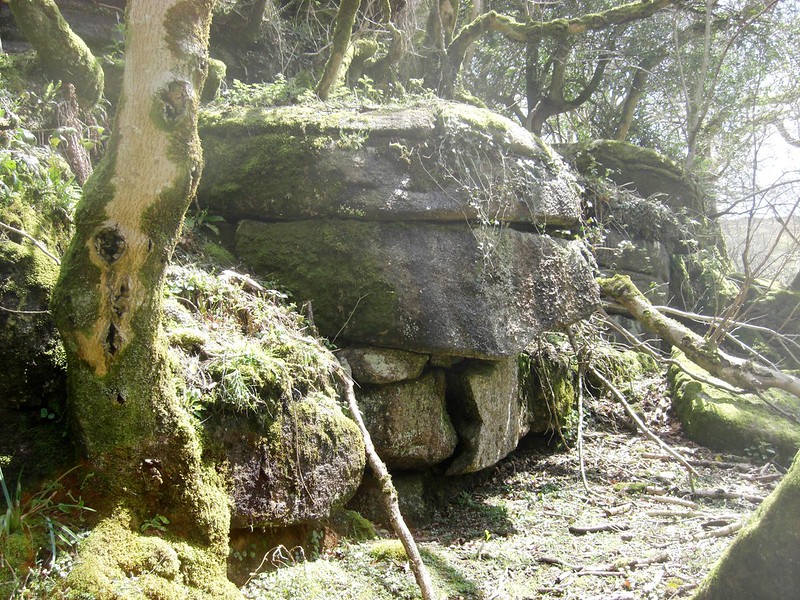
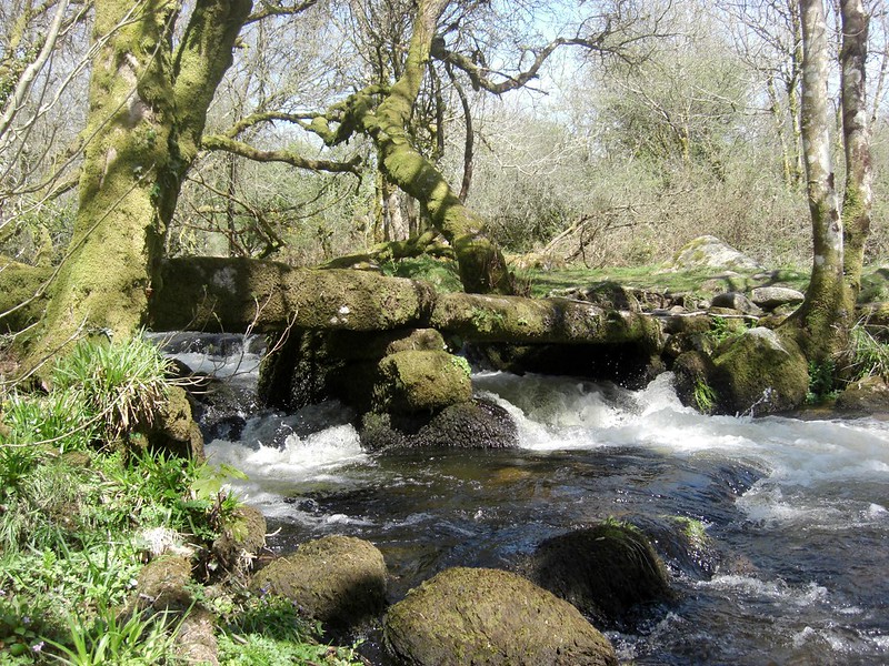
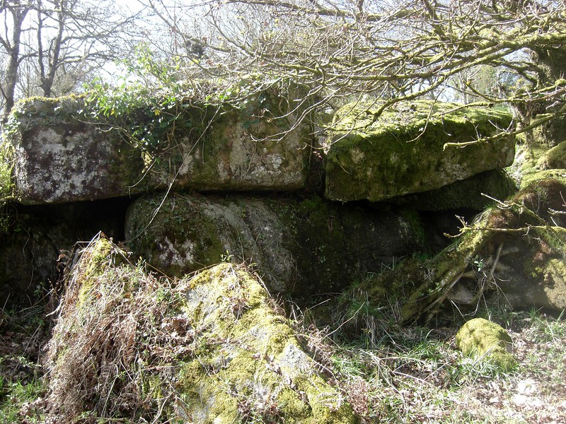
Continuing north after about three quarters of a mile or so the path leads us to the point where Walla Brook enters East Dart from the direction of Babeny to the north (SX 672747). Here was once the site of an ancient clapper bridge where there are now stepping-stones, but these can be difficult to cross when the river is high. It is now necessary to proceed up the side of the brook to reach another clapper bridge which Crossing (1912 p 459) describes as ‘very interesting’ with three openings. This is the point to cross and then walk back down towards the river, entering a small hunting gate right into an enclosure known as Stone Park where another small, ruined tor is seen (SX 671747) with its rocks extending uphill into the wood. This is most probably the ‘Great Stone’ that Eric Hemery refers to on page 533 of High Dartmoor as an ‘unbroken mass of coarse and fine grained rock, dominant though low lying and covering an area of 212 square yards’. This is a very precise assessment of what is now a rather overgrown rock pile.
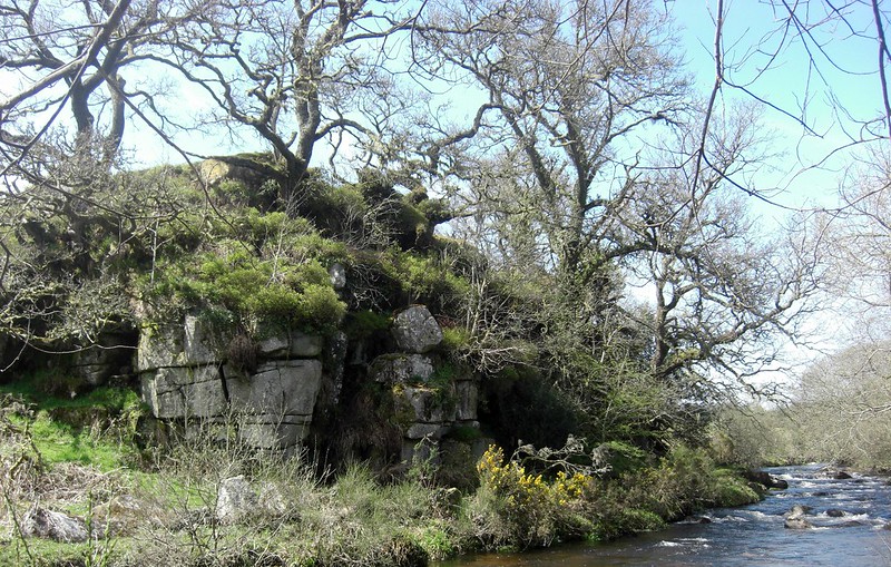
As the path is quite ill defined here there is a need to loop up and walk above the tor and then head north-westward high above the river through patches of gorse and then descend downhill to that part referred to as Babeny Rit (SX 668749), an open space where several ragged outcrops with trees growing in their midst jut from the hillside. The most impressive is on the west side of the river where a huge vegetation-topped outcrop known as Blackator Rocks is seen (SX 667750). I first wrote about this forgotten tor in Dartmoor Magazine (spring 1996 p22) and following a recent visit to the area remain impressed by its fissured cliff-like face that juts to the water’s edge: it is the appearance of a tor that is unparalleled anywhere on Dartmoor. This is an altogether tranquil place that is rarely visited and is well worth a moment or two’s contemplation. The river is at its most gentle here as it twists sublimely under the rocks. A most helpful and detailed map on page 158 of Dartmoor: A New Study in a chapter on ‘Farming’ by Havinden and Wilkinson (1970) identifies and names all of the features here, including numerous newtakes on the hillside above.
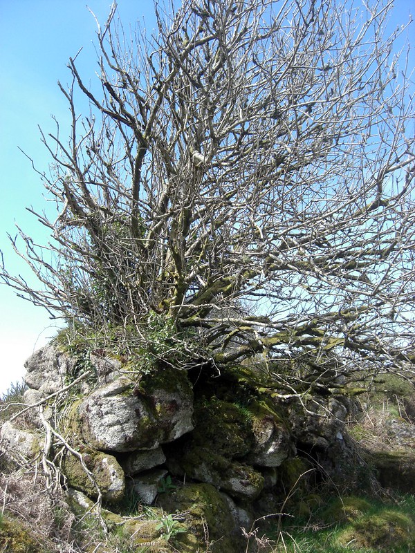
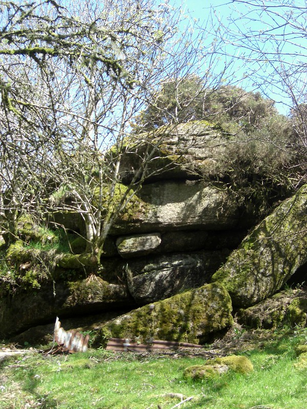
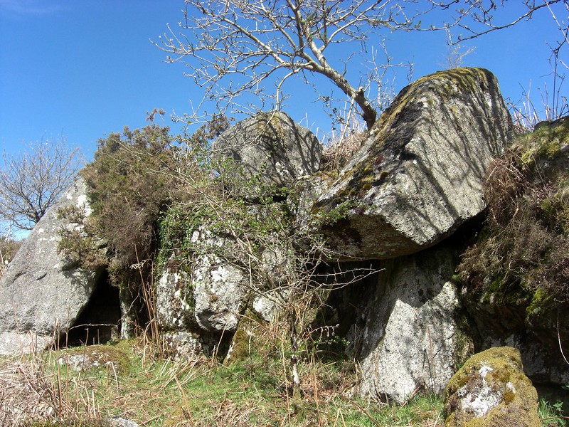
This is the northernmost point of the walk, and it is now necessary to retrace our steps through Babeny Rit and Stone Park and over the clapper bridge on to Spitchwick Common (SX 673749) where another ruined rock pile lies. Of no great significance it does, however, at close quarters present as several large boulders perched on top of one another with small caves beneath. From here the walk back to the car park at Dartmeet is via the outward route.
Together, the combined inspiring accounts of East Dart River by William Crossing, Eric Hemery and the informative chapter in Dartmoor: A New Study has on more than one occasion led me to explore the eastern side of the river under Yar Tor Hill, Babeny and Spitchwick Common as far as Blackator Rocks. This has led to the discovery of a number of hidden and lesser-known rock piles along the route, as well as stepping-stones and a clapper bridge. To this end the walk, though ill-defined in places, is well worth attempting, and possible with perseverance. Those wishing to explore the area are advised to undertake the walk in the autumn or winter, and best on a sunny dry day.
References
Crossing, W. (1986) Gems in a Granite Setting: Beauties of the Lone Land of Dartmoor Facsimile Edition Devon Books Exeter
Crossing, W. (1912) Guide to Dartmoor 1990 edition Peninsula Press Newton Abbot
Gill, C. (ed) (1970) Dartmoor: A New Study David and Charles Newton Abbot
Hemery, E. (1983) High Dartmoor: Land and People Robert Hale London
Jenkinson, T. (1996) ‘Lesser-Known Tors of Dartmoor: Part 1’ Dartmoor Magazine (Spring no 42)