
An edited version of this article appeared in Dartmoor Magazine – Winter 2021 Issue 144 pp58-59.
Bridford and Christow are two villages and civic parishes situated on the far eastern side of the Dartmoor National Park (DNP) in an area that is often referred to as the Teign Valley. The former covers approximately 4090 acres of land whilst the latter lying at about a mile to the south and once described as a ‘straggling village’ in White’s Directory of 1850 is a little smaller at around 3600 acres. Both have interesting but now mostly wooded landscapes that conceal various tors and rocks that to date have received scant if any attention in the literature of the moor. This short article identifies a few of the more notable rock piles that can be found around the villages.
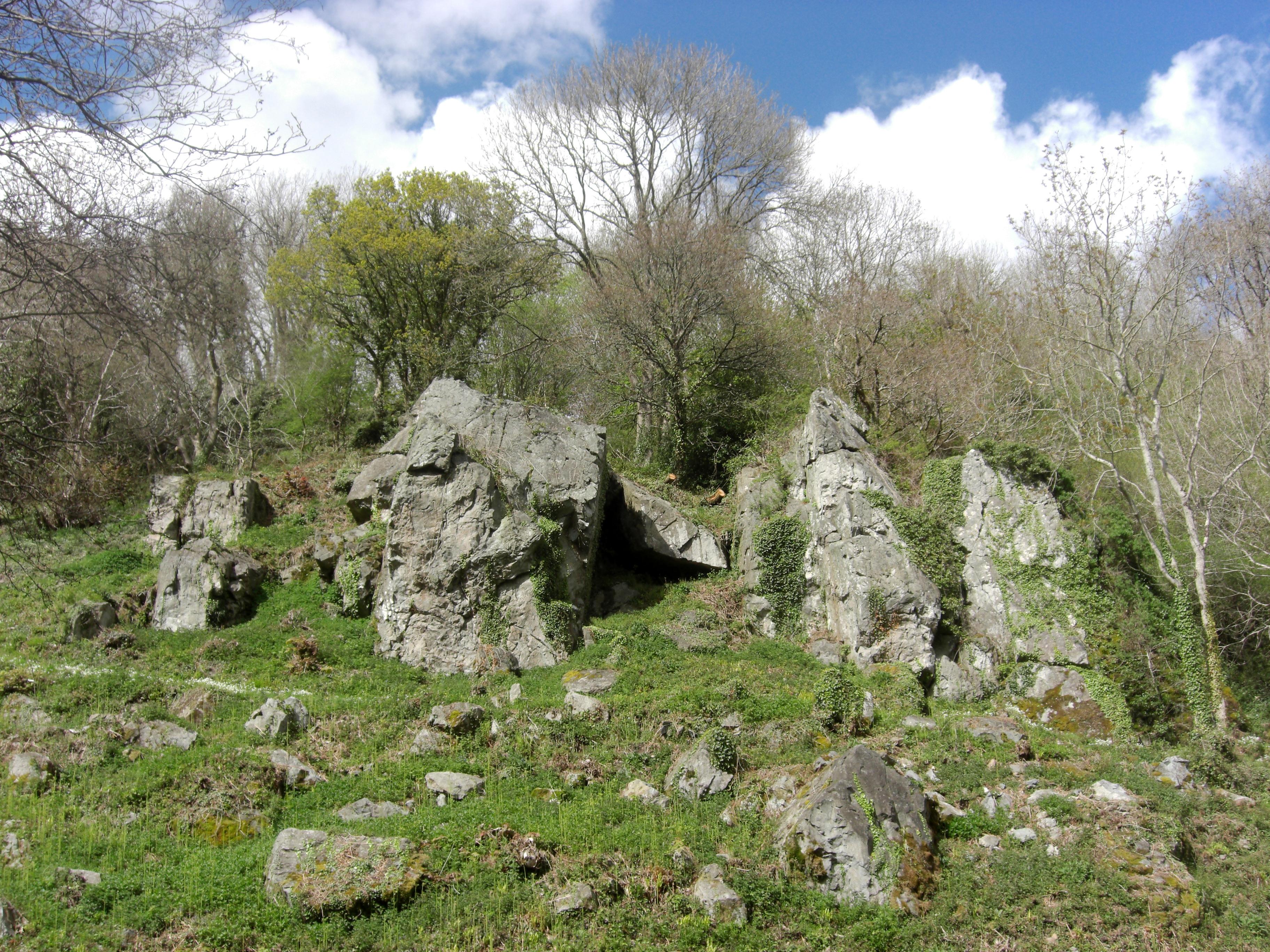
Skat Tor (Scatter Rock) SX 8205 8550
Sadly, the main part of this tor is no more but it does have an interesting history. One of the first to comment on its appearance was Samuel Rowe in 1848 where he writes ‘Proceeding southward from Bridford we shall mount the hill which rises in front of the village to visit Skat Tor remarkable for its singular conformation.’ He continues ‘The south front is graduated into a series of rude seats or steps leading to a broad platform on which is placed a mass of rock with a smaller one at the side as if it might have been the result of art.’
Later William Crossing describes Skat Tor as residing on Christow Common which marks the boundary between the parishes of Bridford and Christow. In the book ‘The Teign From Moor to Sea’ that was published in 1986 (page 39) but contains accounts from the early 20th Century the author explains that the tor is situated on the hill to the south of Bridford village and that it can be ‘very easily ascended as nature has so formed it that the rock presents as series of rude steps’.
However, the latter author was writing just a few years before the area was developed into the successful road stone Scatter Rock Quarry by John H Dickson and Joseph Tiplady in 1914. Rock from the quarry was crushed and then graded into hard wearing road stone, aggregate and ballast. We learn from Lawrence W. Pomroy (1995) that ‘the stone would be loaded into skip type buckets, each capable of carrying upwards of half a ton and hauled to Christow Station on an elaborate aerial ropeway system’.
Unfortunately, during the quarry’s heyday, the metamorphic substance of the tor was gradually destroyed by blasting before operations ceased in around 1954 (Pomroy 1995). The site today is on private land which is largely fenced off and overgrown and the upper quarry is flooded but the whole area is still marked on Ordnance Survey (OS) maps as Scatter Rock Quarry (disused). There are some sizeable boulders remaining at the site that collectively stand as silent memorials to what was once a fine tor here.
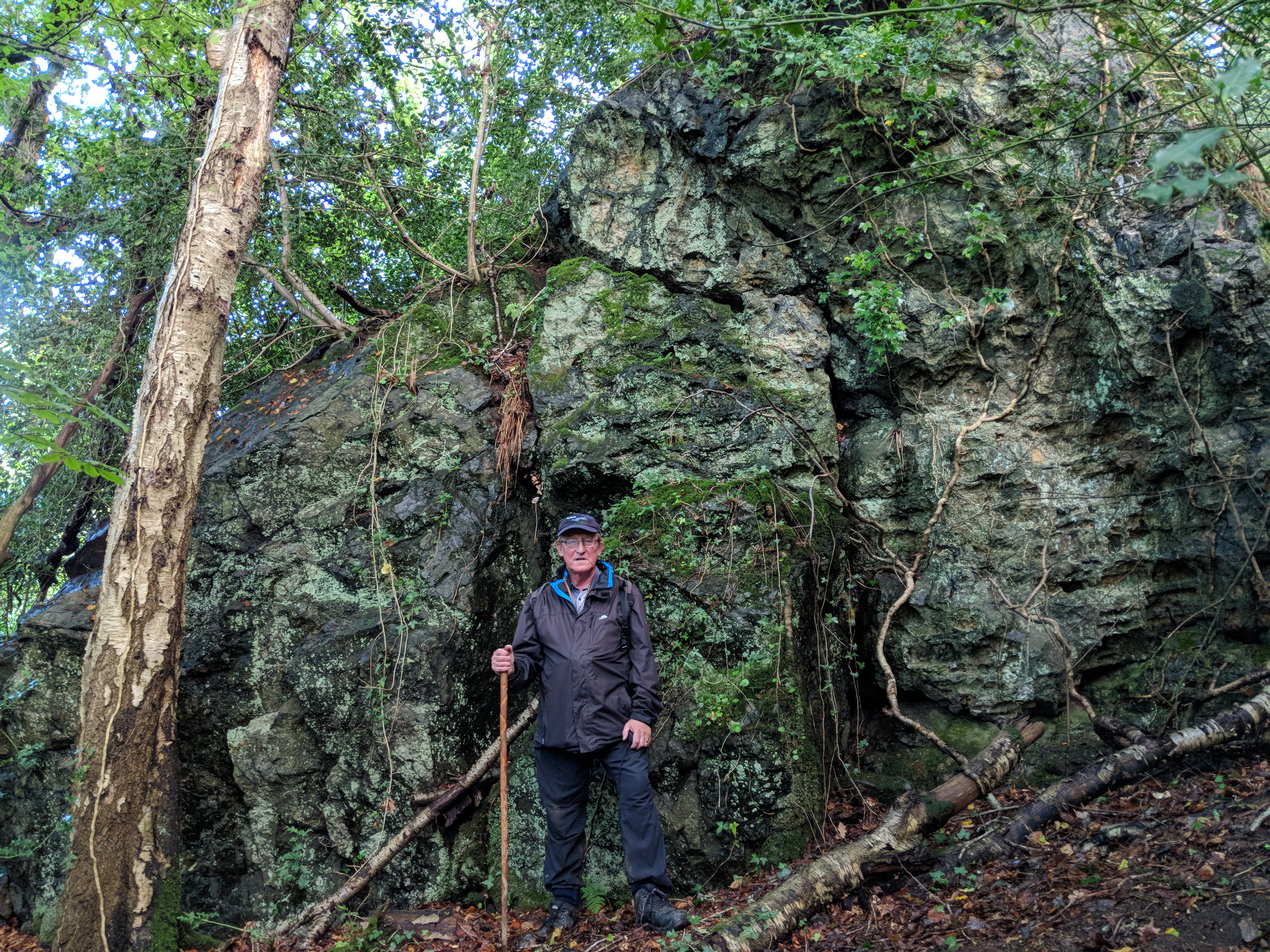
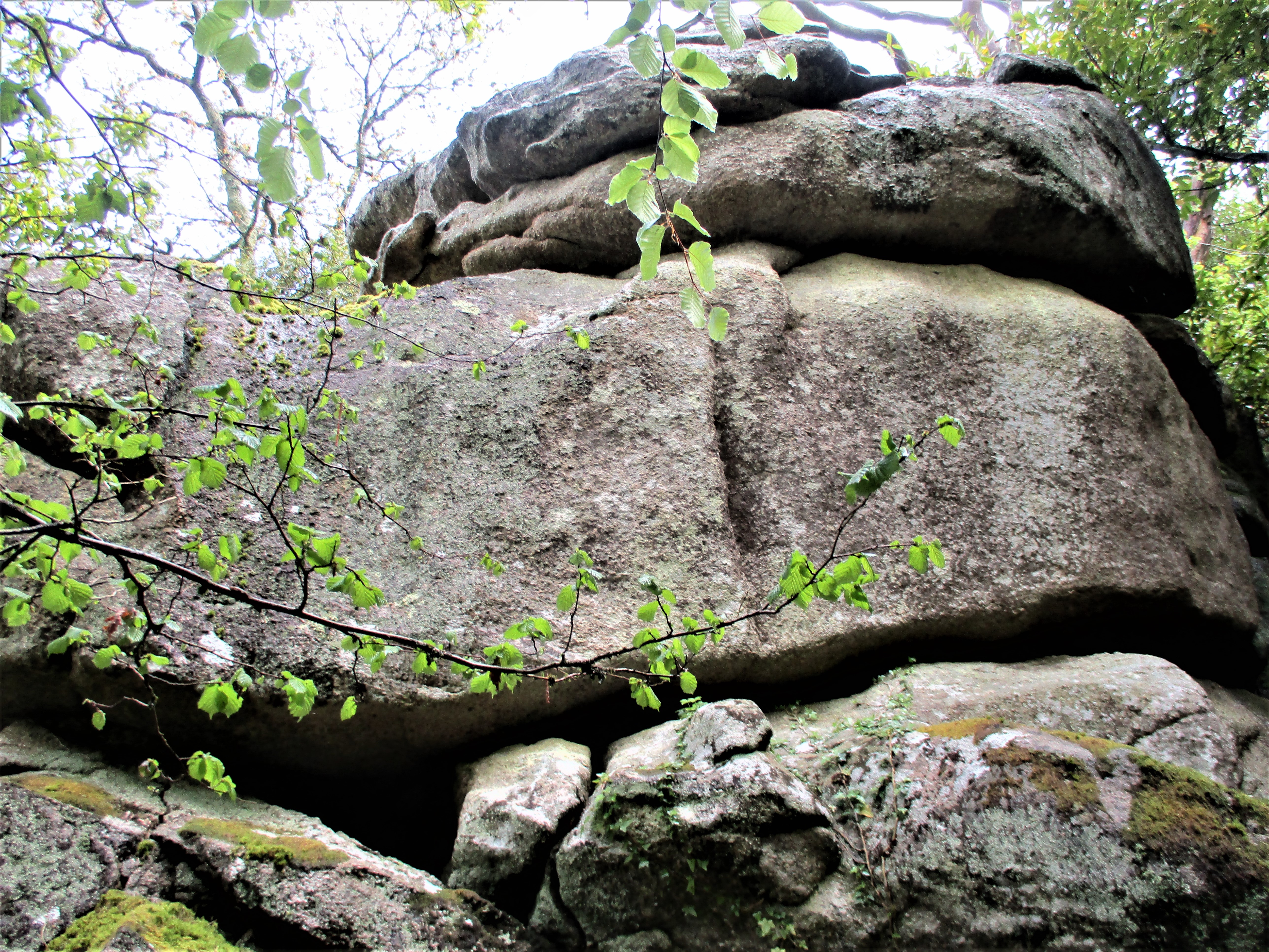
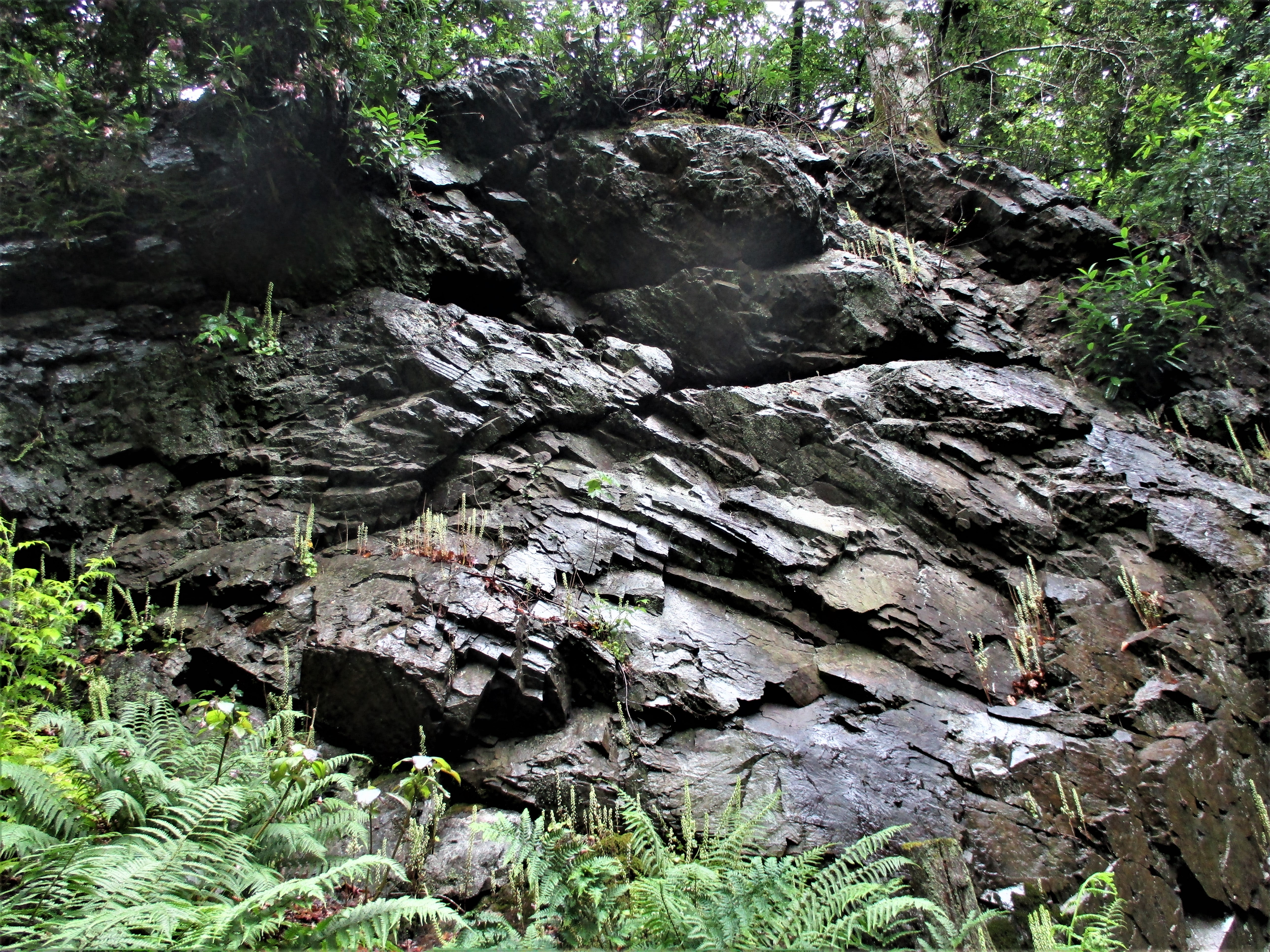
Copplestone Rock SX 8168 8765
It seems that over time the name of this Rock has disappeared from OS maps. Set on the far north-eastern edge of the National Park, it is a modest lesser-known outcrop that can easily be found on the east side of the minor road leading away from Woodlands Farm towards Bridford. The word ‘Copple’ refers to ‘something rising in a conical shape; a hill rising to a point.’ and when stood at the verge the Rock here certainly fits that description. However, the best part can be found on the north-east side where it forms a rather dark but impressive wall which is quite intimidating at close quarters. When walking around it, the Rock clearly demonstrates its metamorphic geology to good effect, with jagged sharp edges forming much of its composition. It was rediscovered in October 2019 by the Tors of Dartmoor Team (ToDT).
Rookery Brook Tor SX 8247 8618
Steve Jenkins first alerted me to this quite striking and unusual rock pile in 2012 that juts from the hillside below Rookery Brook Cottage in Bridford. It consists of a series of what appear to be tall non granite crags that are draped in vegetation. The small yet decorative tor resides on private land and is therefore inaccessible without permission but can be easily seen to the left of the minor road leading out of the village towards Northwood. Rookery Brook is the name of the lively stream that runs below the jagged rocks and very much adds to the allure of the location. Old OS Maps depict a small unnamed outcrop at this point, so it has clearly been noted in the past.
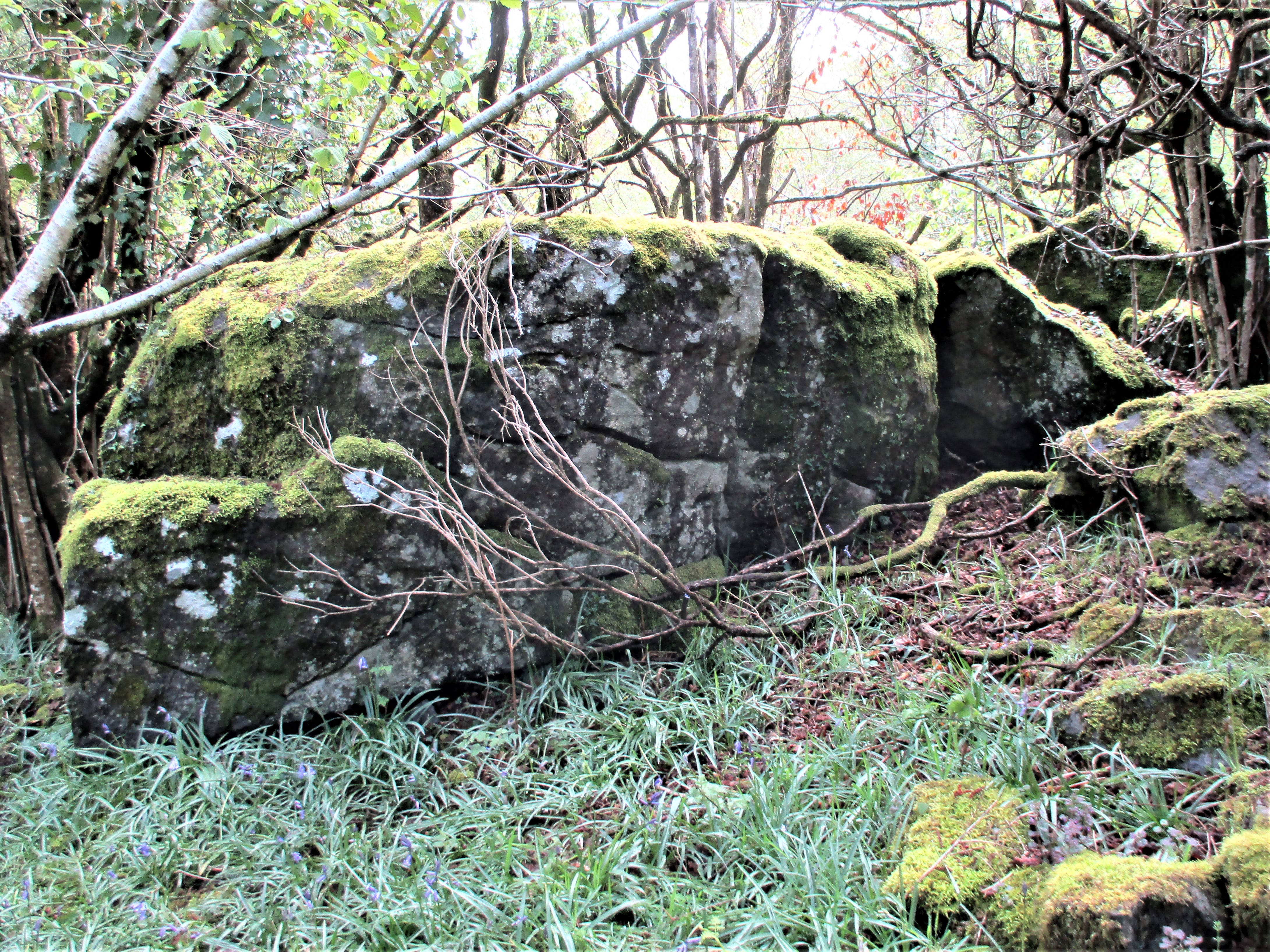
Rowdon Rock SX 8122 8603
Rowdon Rock is a hidden gem. Although clearly marked on OS maps at about half a mile south-west of Bridford it has received little if any recognition in the literature. Despite its magnitude it is completely enshrouded in trees and therefore difficult to access even though a public footpath runs close by to the south. Leaving the path where it bends to the left and heading uphill in a northerly direction after about 100 metres or so, on the right the lowest of the massive outcrops begins to appear. This is so much more than a simple Rock it is in essence a giant tor of at least three distinct sections. It has a somewhat claustrophobic feel to it as hardly anything can be seen from the piles so dense is the canopy of vegetation and overhanging branches. Despite its continuing anonymity this is still one of East Dartmoor’s finest rock piles. Thanks once again to Steve Jenkins for drawing my attention to it in April 2012.
Great Stone SX 8200 8467
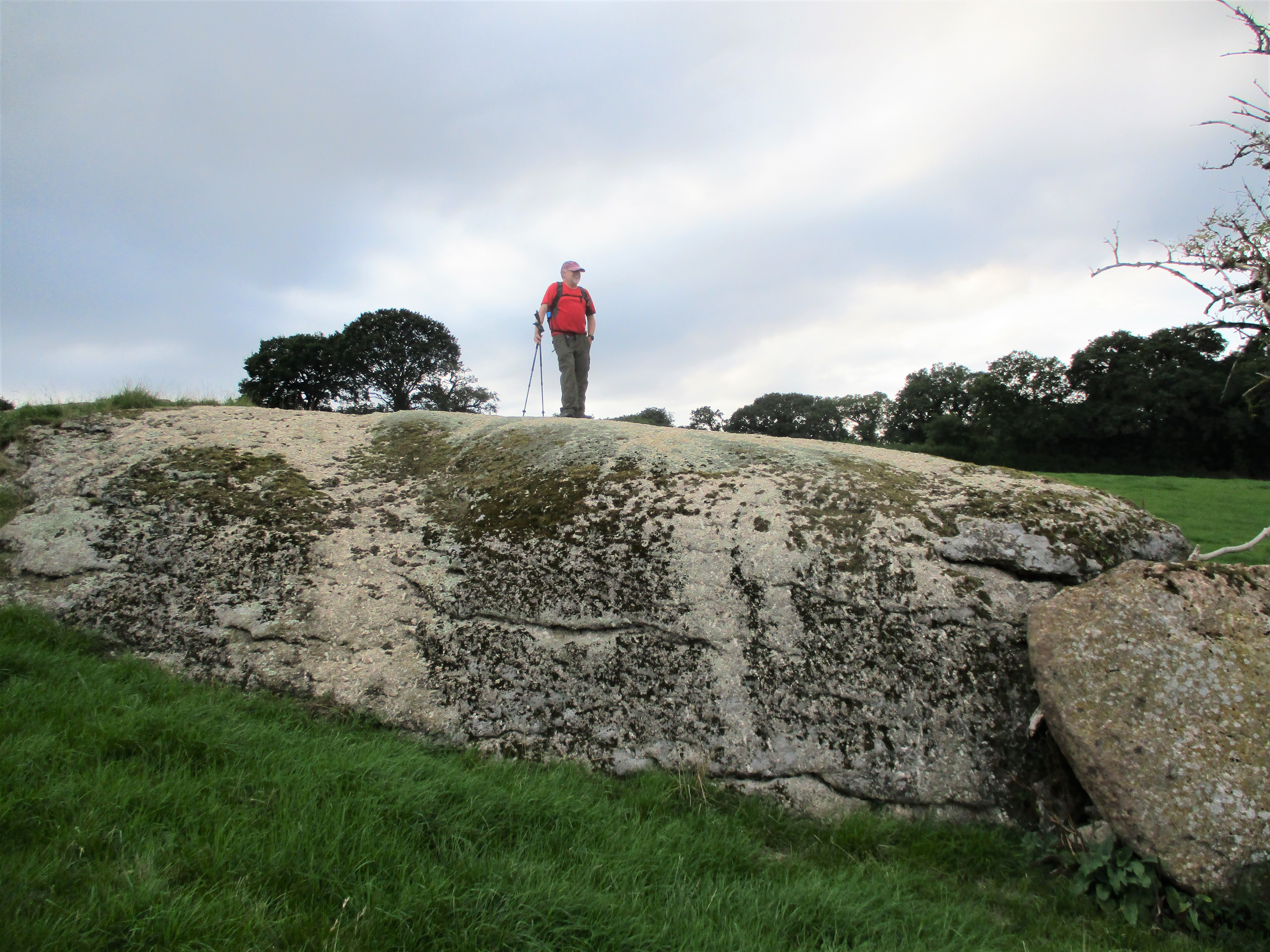
This curious lone outcrop type rock that is set in a field above a public footpath about a mile west of Christow near to Bowden Farm was brought to our attention by Peter and Karin Brooks. It has since been dubbed ‘The Tomb’ by local resident Lucy Bruckner on account of its unusual appearance.
However, following further investigation by Paul Buck it seems that the plot of land here is marked as ‘Great Stone’ in the Tithe Apportionments of 1840 and in the absence of any other rocks in the vicinity this must be the ‘Stone’ in question.
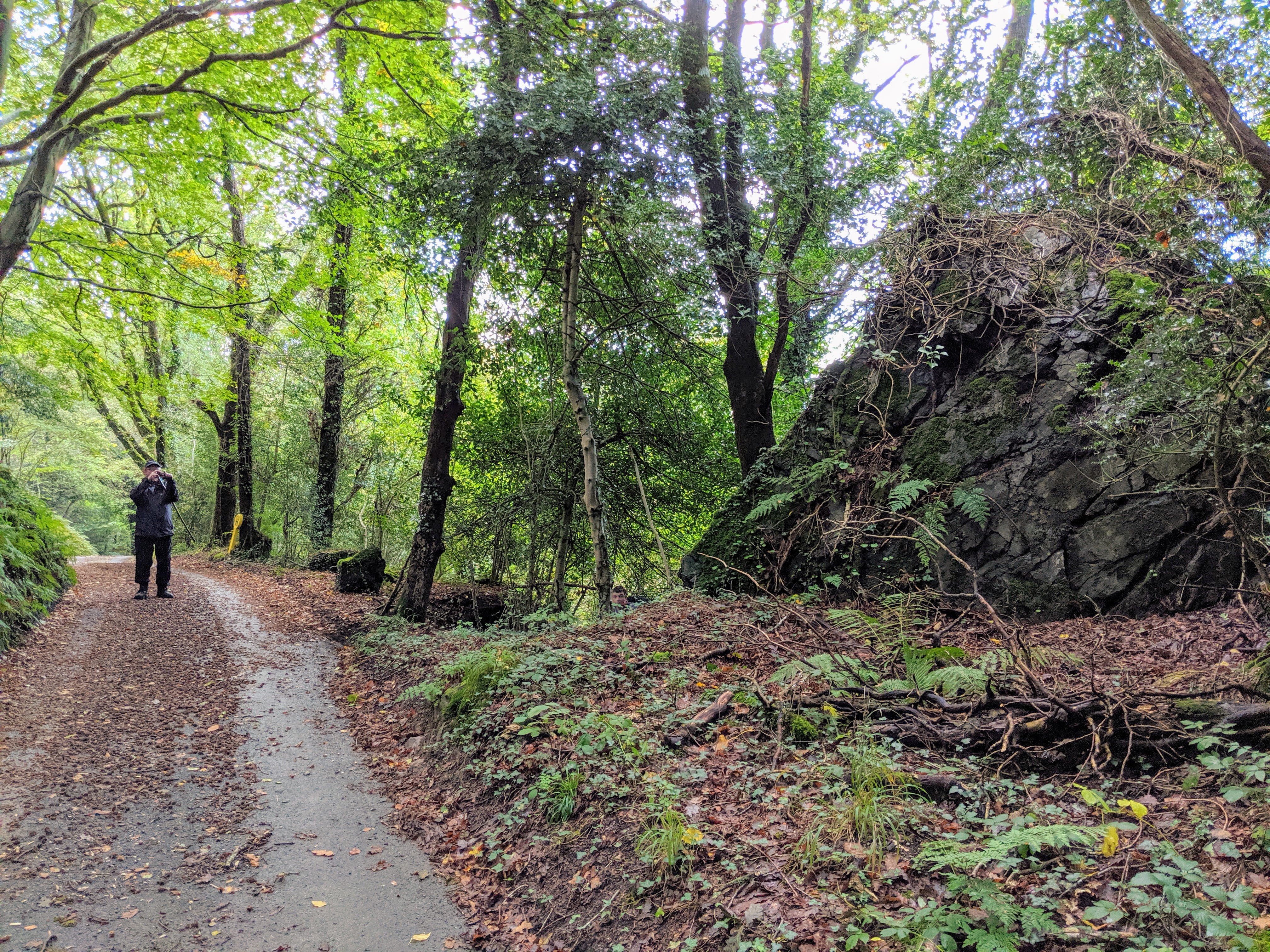
Kiln Down Tor SX 8256 8417
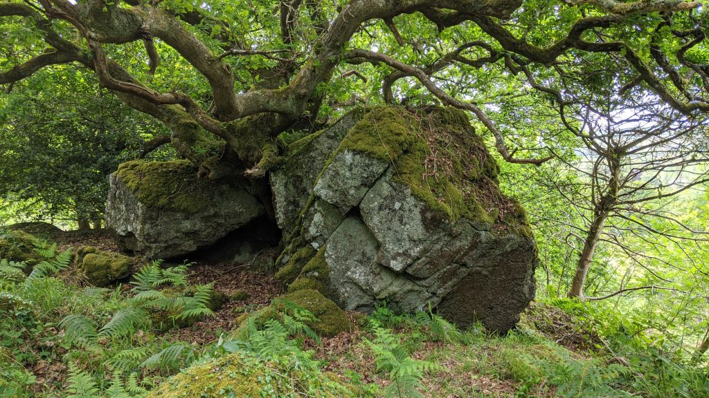
Kiln Down lies about a mile to the south-west of Christow. It is traversed by a public footpath that runs from north to south and until recently was only known for its bronze age settlements these being noted and described by Andy Crabb of DNP Authority in 2014. However, the Down is also home to an impressive tor that is hidden in the trees a little way to the east of the path. Previously unrecorded it seems, it was literally stumbled upon by the ToDT in May 2020 and was found to consist of numerous shadowy piles that are mostly entangled in oak trees, the upper outcrops having some interesting caves within.
The main part spills downhill through the copse where narrow winding tracks indicate that the rocks here are not unvisited just lesser known. Technically the tor lies on private land but is accessible because of the proximity of the main path and the ease with which it can be reached although bracken does affect the Down in the summer months, and this is obviously a deterrent to visiting at that time of year.
Secret Garden SX 8320 8240 and Fern Garden Rocks SX 8312 8247
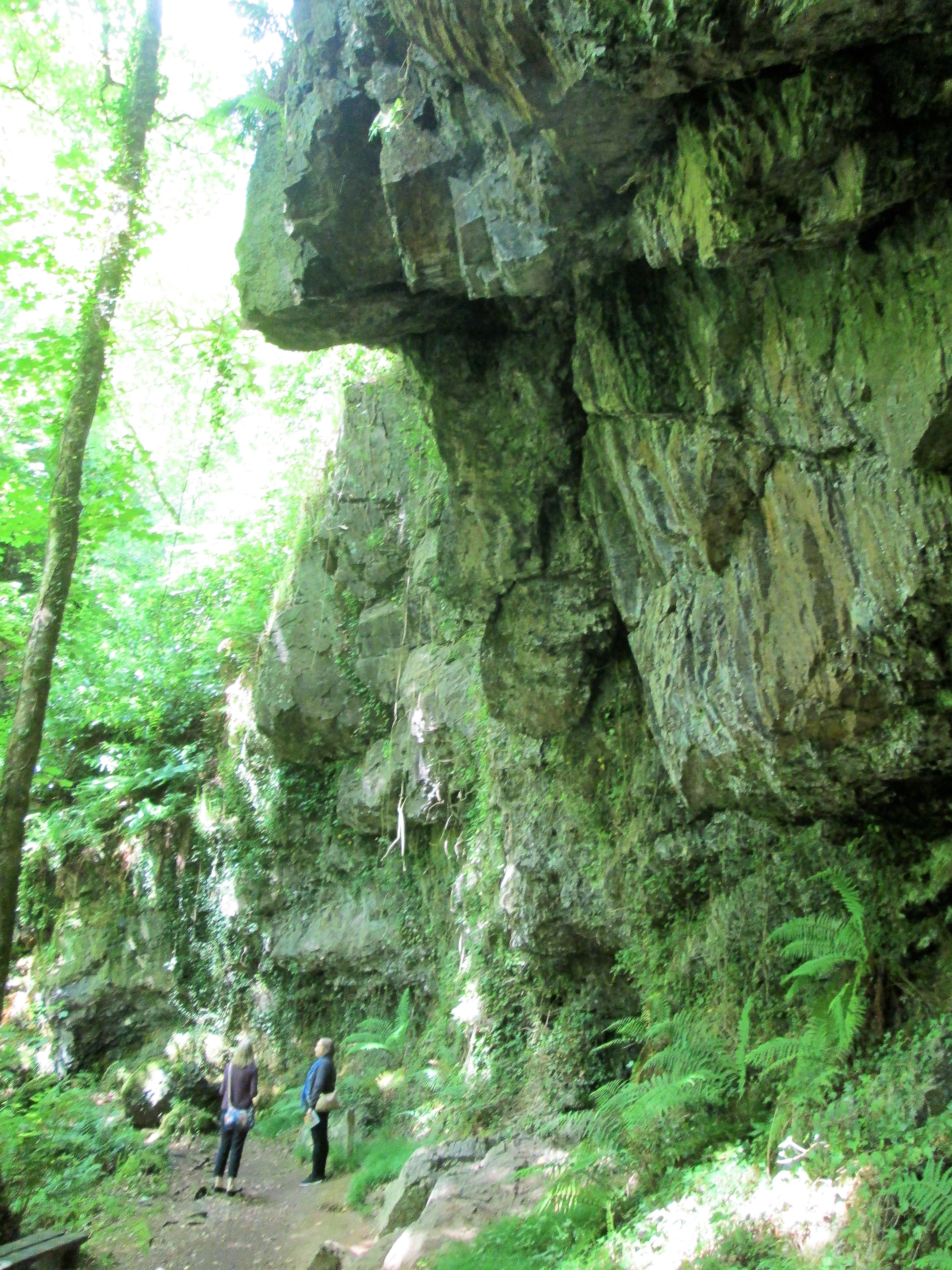
Canonteign Falls is one of East Dartmoor’s best-known attractions and for a modest entrance fee gives access to an enchanting landscape that takes the visitor along a designated footpath uphill through wondrous metamorphic rock faces and cliffs to the top of the man-made falls that were constructed in 1880 under the instruction of Lady Susan Exmouth. On the way to the summit the visitor passes first through the Secret Garden where there is a magnificent ornamental towering cliff face that dwarfs the onlooker, and then up 90 Victorian steps into the Fern Garden where more incredible jagged rocks appear either side of the gorge. The rocks are so impressive here that they take your breath away. Apart from the Garden areas more rocks can be seen above Bruce’s Pond and at the top of the waterfall where a channel has been cut through the summit rock to direct the flow downhill. Here there is also a thrilling vista to enjoy. Set just in the Parish of Christow on its southern edge and about two miles from the village a visit to Canonteign is highly recommended as you will not be disappointed.
The far eastern edges of Dartmoor continue to reveal some impressive tors and rocks that have not all been reported on or shown on maps. Indeed, over time some of the old names have disappeared. The hill sides around Bridford and Christow contain some fascinating examples a few of which have been described here. For more information on Dartmoor’s rock piles visit the Tors of Dartmoor website at www.torsofdartmoor.co.uk
References
Crossing, W (1986) The Teign From Moor To Sea Quay Publications Brixham
Crabb, A (2014) Bowden Field System site visit notes SDV356357
Pomroy, LW (1995) The Heathfield to Exeter (Teign Valley Railway) Ark Publications (Railways) Newton Abbot
Rowe, S (1848) A Perambulation of Dartmoor 1985 edition Devon Books
White, W (1850) Devonshire Directory 1968 reprint David and Charles