
An edited version of this article appeared in Dartmoor Magazine – Winter 2017 Issue 129.
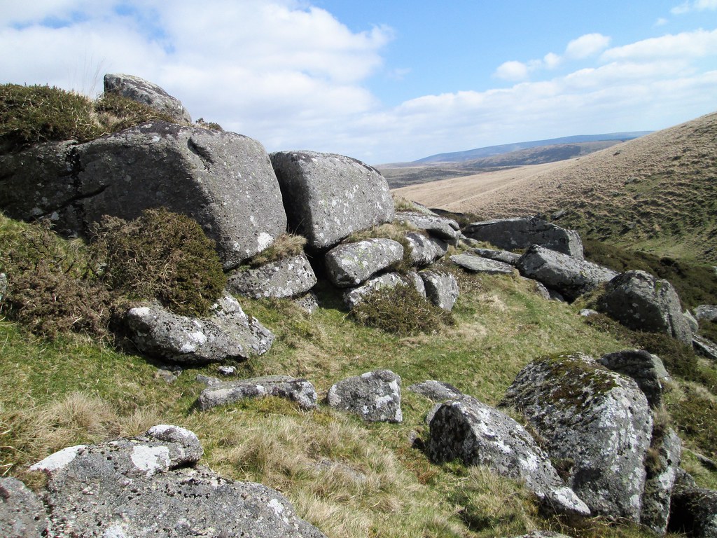
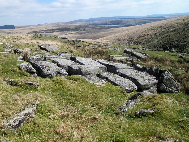
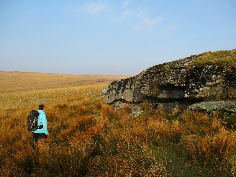
The first part of this article exploring some of the interesting features of East Dart River to the north of Postbridge concluded on the southern slopes of Lade Hill (SX 6381), a vast expanse of open moor with a scattering of mostly low-lying outcrops but with a curious rounded logan-type rock atop. From here it is necessary to return towards the river by crossing Winney’s Down Brook and continuing in a south-westerly direction along the northern bank where soon a broken tor is encountered. The rocky cleft through which the river rushes here is quite spectacular, and the slopes are covered in the ruins of this long-lost rock pile. The rock field is wide spreading and although some of the smaller outcrops survive (SX 631809), prior to its demise this must have been a most prominent tor overlooking the river. Indeed Eric Hemery (1983 p540), the first it seems to comment on the phenomenon, writes with great enthusiasm about the area identifying several things to look out for: ‘One of these is a rock field extending from the hillside above the steep to the very river bank and headed by a nameless and disintegrated tor’ and set above the ruined tor his account identifies ‘the most unusual and striking of the features-a granite pavement’. The author suggests that the curious vertical partings that can be seen in the rock are more a feature of limestone than granite. The ‘pavement’ is located at SX 629810 and presents as a most interesting weathering effect. Here it is best to stand awhile and enjoy the fine views downstream.
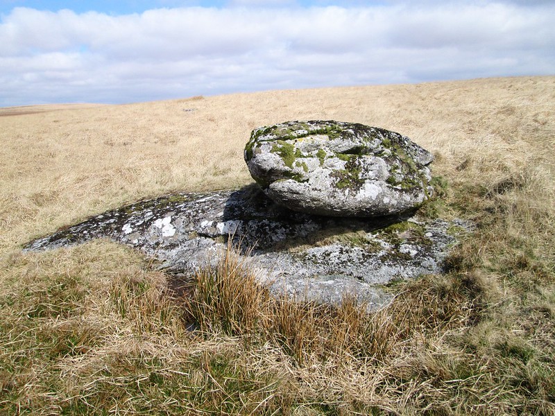
Higher on the hillside to the north and west well away from the river and the sprawl of granite is another of Hemery’s finds: a lone logan rock that is set on Winney’s Down (SX 626814). The author likens its appearance to that of the head of a fish (p494), but when viewed from certain angles it takes on a rather reptilian form. In his account of this area Hemery takes the opportunity to remind us of another Ordnance Survey (OS) error, this time the apparent misnaming of the hill to the north as Winney’s Down. He corrects the error by explaining that the east side is known as ‘Maish or Marsh Hill’, and the summit and west slope always as ‘Stats House Hill’. Given that this debate first surfaced as long ago as 1965, it is perhaps surprising to see this error still replicated on modern OS maps.
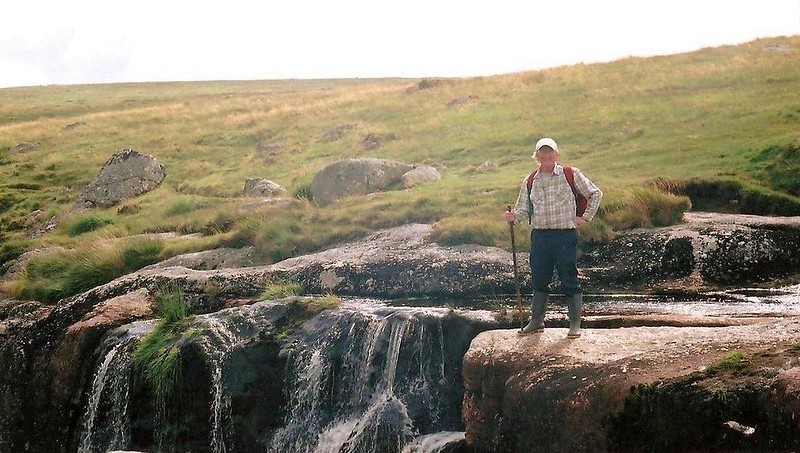
From here the descent to East Dart Falls (SX 627811) or ‘Waterfalls’ as Hemery states is little more than 300 metres away. A spectacular cascade of water, it is possible to cross the river here where the flattened boulders of the main falls form a natural crossing point, but care must be taken as they can be slippery and difficult to cross after considerable rainfall.
The climb from here over Broad Down on the return to Postbridge is semi arduous. There are several interesting rock outcrops to look out for on the ascent and further over the summit. None of any great height, they are nonetheless worthy of some attention. The largest of the group lies at SX 630805 reaching a height of at least 3m on its west side. The expanse of Broad Down is again under-represented by the OS as none of these outcrops are indicated. What the outcrops lack in height they make up for in breadth and surface area. Collectively they are given the name of ‘Broad Down Tor’ by Ken Ringwood (2013), which seems possible; however, Hemery, writing much earlier, advises that that name is never used and that ‘Broadun Rocks’ is more appropriate (p481).
However, the name of ‘Broadown Tor’ has appeared before and was of course embroiled in controversy for some time having first appeared in error as a misprint in Dartmoor A New Study (1970) in a chapter on the ‘Physical Environment of Dartmoor’ by Denys Brunsden and John Gerrard (p49). The extract reads ‘The badger (Meles meles) more usually digs its sett in the woodlands, but it regularly patrols the open moors and occasionally a sett may be found far from woodland such as those at Lur Tor, near Broadown and Bellever Tors.’ Apparently, the last line should read ‘Fur Tor, near Beardown and Bellever Tors’.
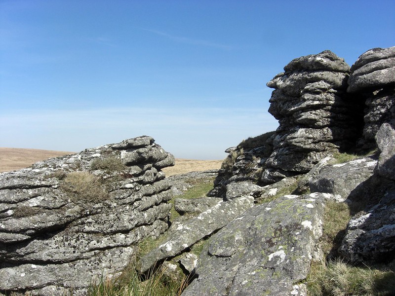
The OS marks a huge outcrop of rock at SX 622799, and this is more properly known as Rowter Moor; if you have time to visit it is well worthwhile. It is sometimes known as Braddon Tor (Brown 1995 p11), and occasionally as Hoax Tor, although the latter is a misnomer introduced by the Letterboxing fraternity in the 1980s. The tor here is quite substantial and is seen at its best from the west side where the curiously shaped rocks are seen to good effect.
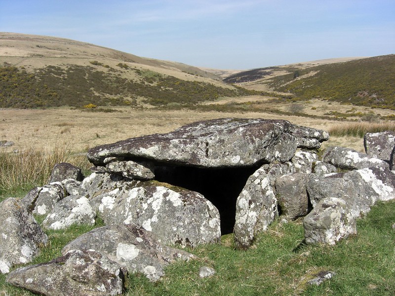
The return to Postbridge from the summit of Broad Down is all downhill but has quite spectacular views to the south. At Braddon Lake (or Archerton Brook as it sometimes known – SX 624804) the visitor picks up a section of Drift Lane to follow south-eastward. Near here on the left of the lane is a gate in the newtake wall and through here at SX 639796 is one of Dartmoor’s finest preserved kistvaens or burial chambers, set just outside the enclosure known as Roundy Park. It is an unusual feature retaining a double capstone. Hemery (p56) explains that kistvaens are usually square or rectangular Bronze Age pits that are paved and lined with granite slabs. Here would be placed the ashes of the dead inside an urn of pottery, the grave would then be covered over most often with a single slab propped on the edges of the other stones. According to the author the kist at Roundy Park was first discovered by Robert Burnard in August 1893 who later had it restored. Paul Petit (1995 p111) describes the appearance and measurements of the chamber as follows: ‘The internal measurements are 6½ ft by 4ft and when restored the depth was 3ft. The end stones are single slabs but one side is of two stones, the other of three and there are two cover stones. It therefore consists of nine stones unlike any other kist on Dartmoor and megalithic influence is clear.’
Returning to the path and continuing south towards Postbridge completes the exploration of this part of the river which is a fascinating area full of interesting artefacts and lesser-known features to complement what is a lovely walk beside one of Dartmoor’s best-known water courses.
References
Brown, M. (1995) The Gazetteer of Dartmoor Names Forest Publishing Newton Abbot
Gill, C. (ed) (1970) Dartmoor: A New Study David & Charles Newton Abbot
Hemery, E. (1983) High Dartmoor: Land and People Robert Hale London
Petit, P. (1995) Prehistoric Dartmoor Forest Publishing Newton Abbot
Ringwood, K. (2013) Dartmoor’s Tors and Rocks University of Plymouth Press