
An edited version of this article appeared in Dartmoor Magazine – Autumn 2019, Issue 136, p48-49
The literature of Dartmoor occasionally reveals some curious and rather fanciful place names for its rocks and tors that have usually been assigned by local people on account of their appearance or their proximity to nearby landscape features. However, over time many of these older names have been forgotten about, some even taken off maps and most are now gradually fading from memory. For example, we have references to a Foxes Yard and Round of Beef by William Crossing (WC) for parts of Lustleigh Cleave on the east side of the moor, a rock once known as The Feather Bed was set on Sheepstor and is first mentioned by Sabine Baring Gould and what of Charlie’s Rocks a name given up by Eric Hemery (EH) and said to lie under the equally fascinating Cathanger Rock on Corndon Down? The name of Nympenhole is introduced by Sir Walter Besant in a fictional book for an area near to the village of Manaton, Flour Rocks near to the hamlet of Sherwell get a mention from EH and according to Crossing the Cracker Stone is to be found somewhere in Red Lake on the south moor. All of these features have one thing in common they are not shown on Ordnance Survey (OS) Maps and whilst the likes of Cathanger Rock has become much better known in recent years through its inclusion on numerous Dartmoor Letterbox clues, some of the other features have not been located in recent times thereby adding to their intrigue.
One other unusual place name that occasionally pops up in the literature is that of the Flock O’Sheep on North Dartmoor that was first described it seems by WC (1912 edition page 211) and is seemingly attached to an area of scattered rocks somewhere to the north-west of what is marked as Little Hound Tor on OS maps. In the Guide to Dartmoor the author writes ‘On leaving Whit Moor Circle we shall cross the track and striking NNW to a group of ruined huts ½ mile distant’ he goes on
‘Below this group the hill which sinks down to Small Brook is covered with rocks, between which whortleberry plants grow in great profusion. One cluster of these granite masses near the stream is called the Flock O’ Sheep.’ Crossing also mentions a ‘dilapidated kist and what appears to be a menhir lying prone on the ground’ in the same area.
Taking up the name again many years later EH (1983 page 827) whilst exchanging ‘Round’ for Hound gives a slightly better impression of where the rocks might be ‘Due south of Metheral Hill and high above the elbow bend of Steeperton Brook the SZ (South Zeal) track passes under Round Tor from this point north can be seen the tip of Watern Tor, Wild Tor, the dominating Hangingstone Hill and the waterfalls at Chimney Bow, northward are Big and Little Whit Hills and Flock O’Sheep Rocks backed by Cosdon’. In order to try and make sense of these rather vague references Mike Brown (1995) provides a location for the Rocks at SX 628907. Whilst this certainly drops the visitor into an area of a few large and interesting boulders, they are now realised to be too far north of the proper site, and most importantly they cannot be seen from Hemery’s vantage spot on Round (Hound) Tor, nor do they match up with Crossing’s impressions.

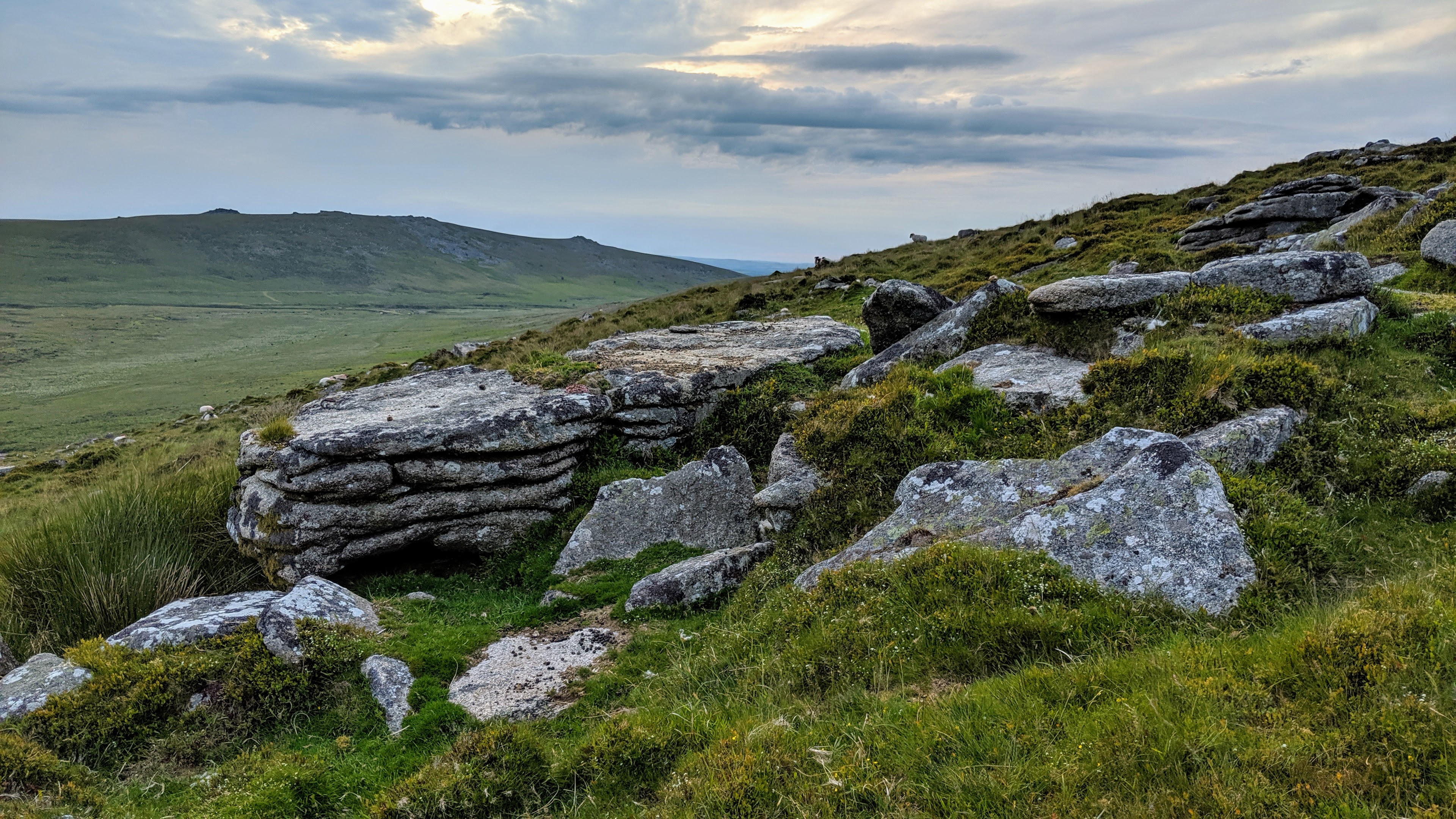
Successive visits to the area in April, May and June 2019 enabled a reassessment of the various accounts. Key to the discovery of the Rocks was Hemery’s view looking out to the north from Hound Tor. Here they can be seen just as he described and like the other features listed in the same sentence are backed by the intimidating dome of Cosdon Hill. Coupled with evidence from Crossing’s account of the hut circles and the slope below being ‘covered with rocks’ led us to a point where we discovered small outcrops with a wide and sprawling clitter at SX 6298 9037.
Jeremy Butler’s (JB 1991) description and helpful plan of the prehistoric arrangement of 20 partly enclosed hut circles on the edge of an extensive rock field on the west side of the hill above Small Brook, added extra credence.
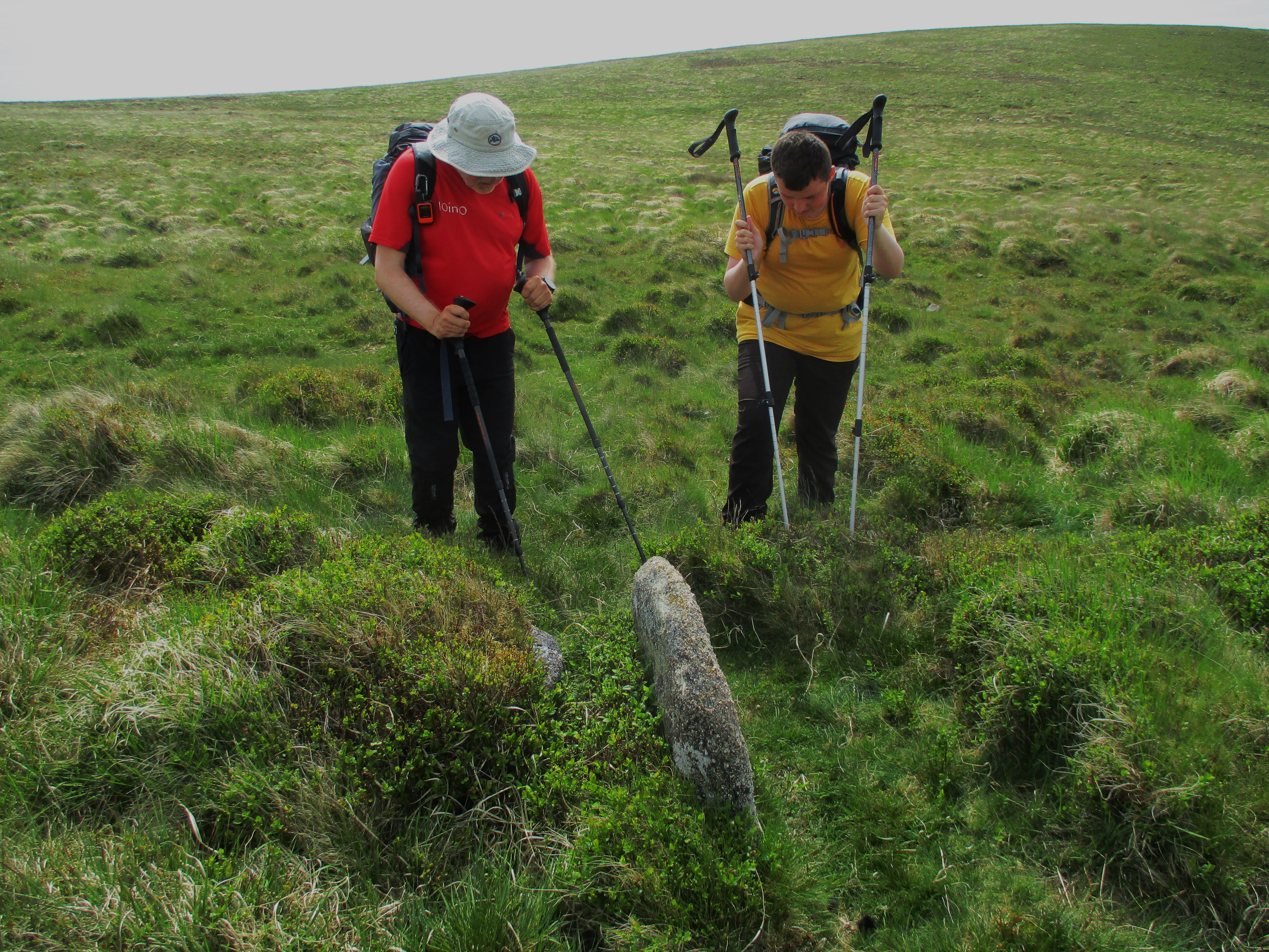
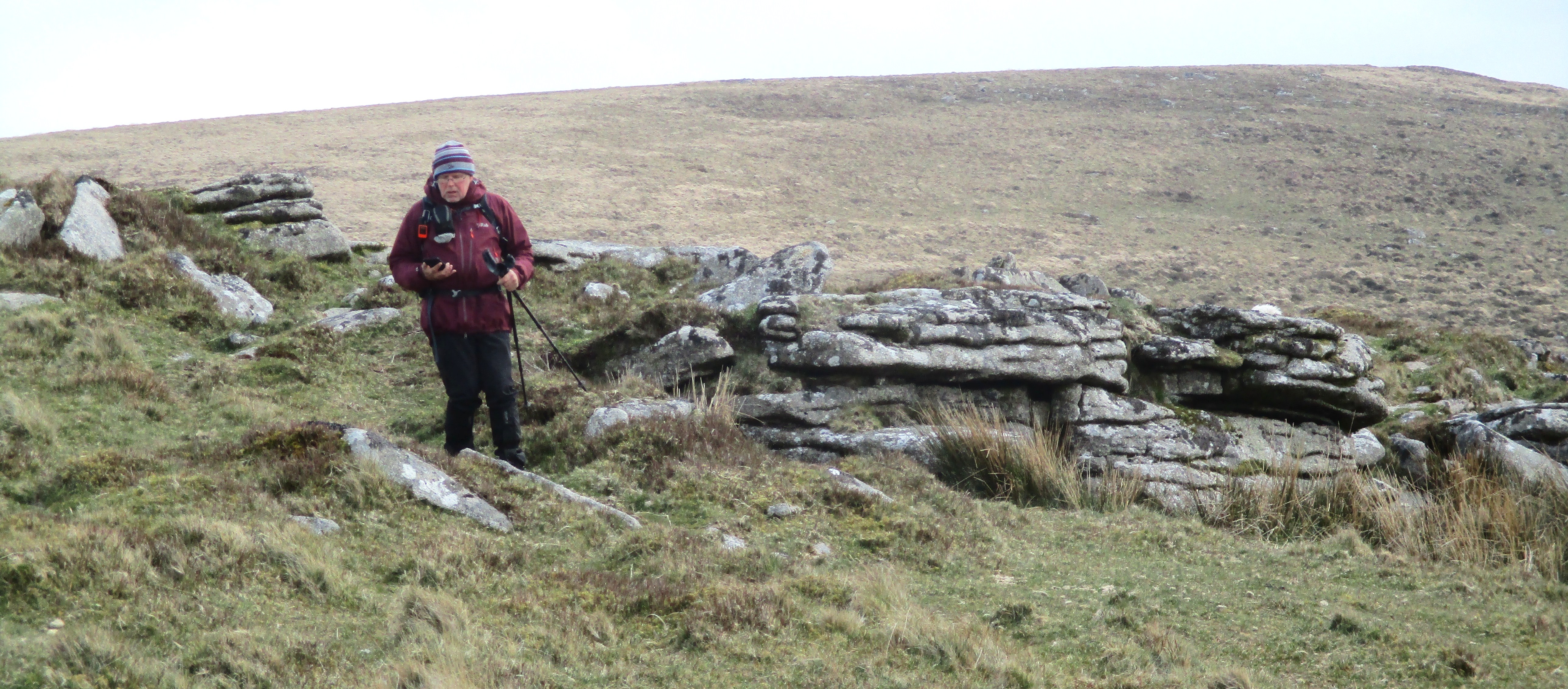
Piecing all the evidence together we now believe that the identity of the Flock O’ Sheep Rocks has been discovered. In among the main rocks here is a fine fissured outcrop below which the mainly whortleberry covered boulders extend. Above the Rocks there are the ruined antiquities that both WC and JB describe with the largest hut retaining twin granite door jambs. JB advises that the area is ‘very overgrown’ and explains that ‘further banks and huts are likely to lie below the surface.’ From the main outcrop there are some splendid views to the south but quite why the rocks are known as the ‘Flock O’Sheep’ is not fully understood. However, when viewed from above, the main group has a somewhat light faced appearance that might have warranted the nickname when seen from afar. The dilapidated kist to which Crossing refers is most probably that set at SX 6306 9042, for here we have what appears to be an upright edge stone with a seemingly slipped capstone hidden mostly under the whortleberry on the side of what appears to be a large depressed overgrown cairn.
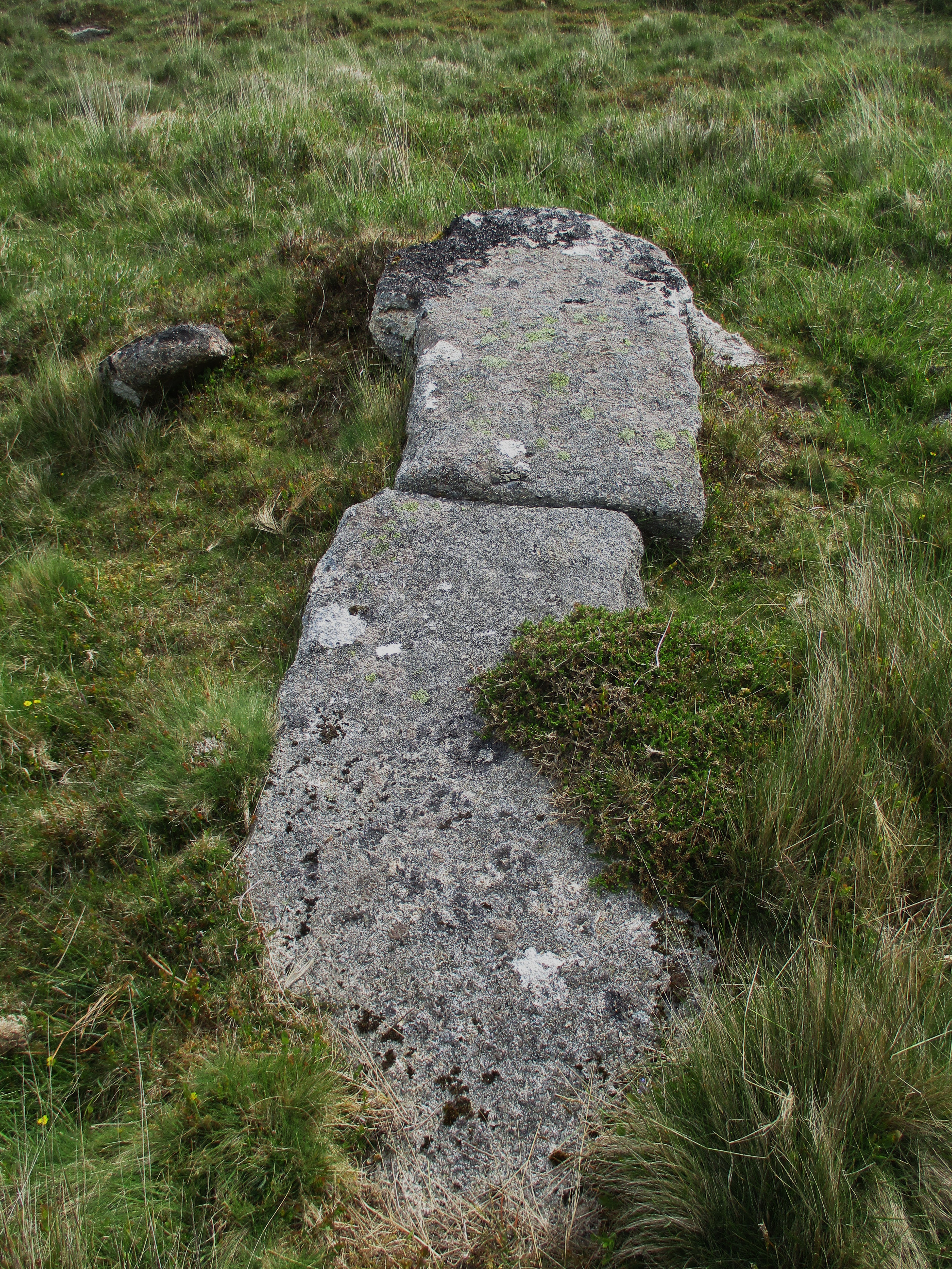
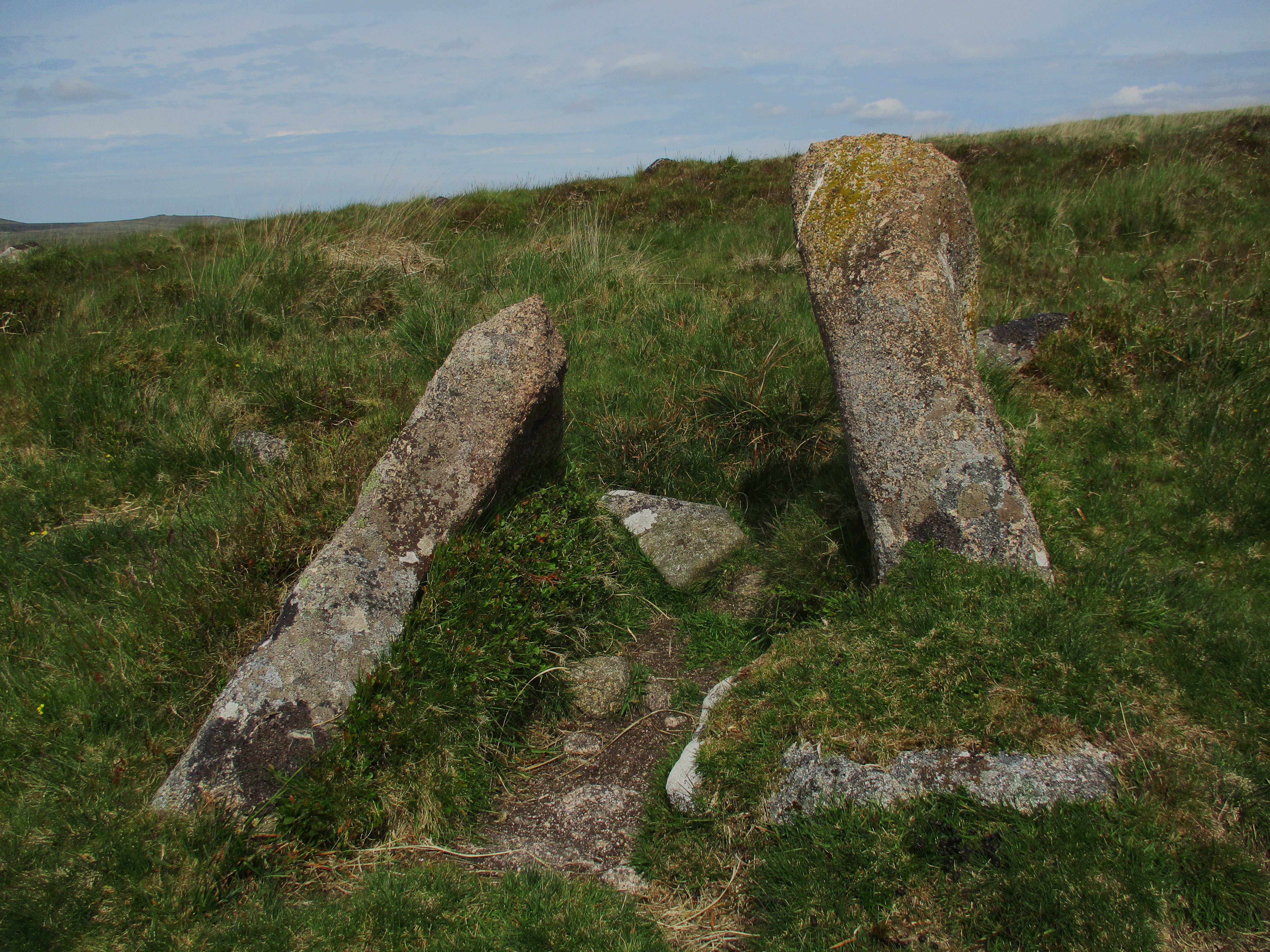
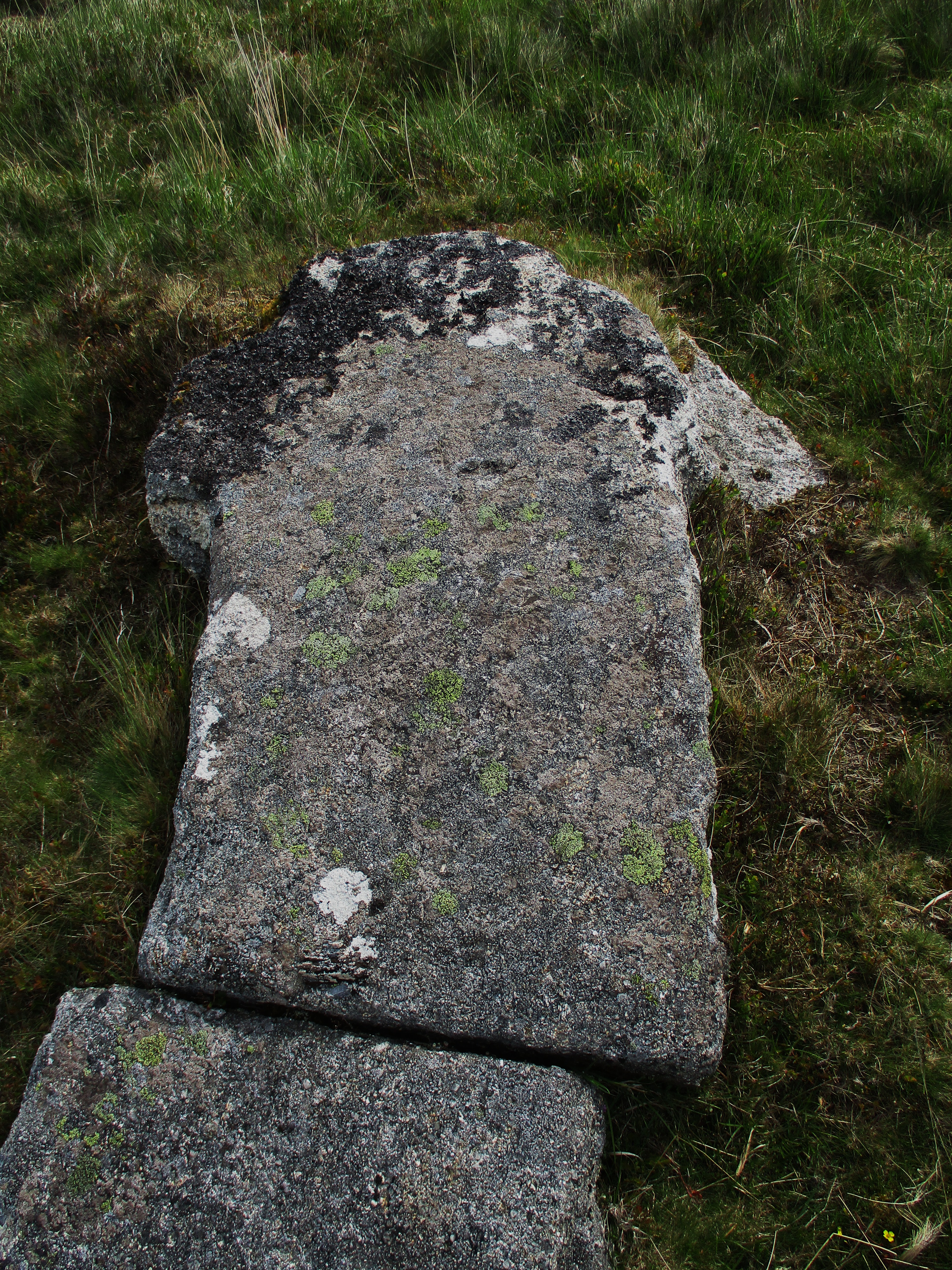
Another point of interest and set quite close to and just below the main outcrop is what has been identified as an abandoned cross lying prone on the turf. Dubbed the ‘Big Whit Hill Cross’ it certainly has that type of appearance its upper portion is suitably shaped, but it is broken across the shaft which also appears to have unusual kink in it on the right-hand side. Discovered several years ago by Dave Edgcombe the authenticity of the cross was later confirmed by Dartmoor National Park Authority and it was duly added to the Devon Stones and Monuments Register but its exact purpose remains a mystery. At its widest the crosshead measures some 79 centimetres (cms) and the full length of the artefact runs to about 267 cms which equates to around 8 feet 9 inches. Given its size it has been speculated that this might even be the fallen menhir to which Crossing alludes (Sandles 2019). It is certainly long enough to warrant that sort of impression. Further to the north-west of the cross but much lower down on the slope are more well-preserved antiquities to view, all of which are shown on modern day OS Maps.
Dartmoor has such a rich history of intriguing place names for its various tors and rocks. However as many of these names were never properly recorded on maps they have tended to fade away over time. One such location is that of the Flock O’ Sheep on the northern moor, which has been identified as a group of rocks that are set below a cluster of overgrown hut circles on the west slope of Big Whit Hill above Small Brook. The discovery of the abandoned cross lying prone amid the outcrops here a few years ago has helped greatly with solving the mystery of the Flock’s location and a more accurate grid reference for the Rocks of SX 6298 9037 is now available.
Paul Buck and Tim Jenkinson (2019)
Bibliography and References
Baring Gould S (1922) Devon: The Little Guides Series 6th edition Methuen and Co Ltd London
Besant W (1889) To Call Her Mine Chatto and Windus London
Brown M (1995) The Gazetteer of Dartmoor Names Forest Publishing
Butler J (1991) Dartmoor Atlas of Antiquities Volume 2 The North Devon Books.
Crossing W (1912) Guide to Dartmoor 1990 edition Peninsula Press
Hemery E (1983) High Dartmoor: Land and People Robert Hale London
Hemery E (1986) Walking Dartmoor’s Ancient Tracks A guide to 28 routes Robert Hale London
Sandles T (2019) Legendary Dartmoor Big Whit Hill Cross accessed at www.legendarydartmoor.co.uk/big-whit-hill-cross.htm