
An edited version of this article appeared in Dartmoor Magazine – Spring 2021, Issue 141, p44-45
In the tome High Dartmoor Eric Hemery (EH) introduces the reader to numerous and previously unrecorded place names for areas of the moor that he has visited, observations that are based on at least three decades of exploration and research prior to the book’s publication in 1983. Whilst the authenticity of some of the names he uses, has been brought into question they do nonetheless help us to identify features in the landscape that were previously overlooked.
One such name is Wildbanks Rocks (WR) that appears on pages 424 and 452 respectively in the chapter entitled ‘West Dart Country’. Although no one can doubt the author’s passion and enthusiasm for recounting his excursions to the moor, his decision not to use grid references to accompany any of his descriptions in the book, means that the reader is often required to visualise his journeys which can be problematic especially if the terrain he describes is unfamiliar. Sadly, this omission has led to occasional misinterpretations of his work further complicated by the fact that many of the names he quotes are still not shown on modern Ordnance Survey (OS) Maps.
EH’s first reference to WR relates to a reave or low wall running northward from Longaford Newtake, the extract reads ‘The reave makes a useful guide to the walker wishing to visit Browne’s House from Longaford Tor, for it leads past Wildbanks Rocks and affords an excellent view of the river approaching Dart Hole’. Fortunately, as both the House and Tor he refers to are clearly shown on OS maps (the house appears as Brown’s without the ‘e’), we get a much better idea that the Rocks lie somewhere within the grid squares of either SX 6178 or 6179. On closer examination the modern map also depicts a faint dotted line running on the west side of both Higher and Lower White Tors this being part of the reave in question.
The author’s second reference on page 452 provides a little more detail this time describing a route running south from Browne’s House ‘Plainly, Browne was by no means the first worker and seeker after solitude in these parts. Downstream the Longaford Newtake appears and the steep (right) hillside has an area of true scree. The left bank under Wildbanks Rocks is less steep and provides a fine view of the lofty Beardown Tors atop the ridge that ‘bends’ the river to the south: on it opposite the scree, lies clitter from Higher Whiten Tor’.
To try and help locate the position of the Rocks in the Gazetteer of Dartmoor Names Mike Brown (1995) offers a grid reference of SX 611802, but this is now thought to be too far to the northwest and is instead positioned somewhere on the lower slopes of the mostly featureless Wildbanks Hill, rather than at Hemery’s site which is set within what he appears to describe as Wildbanks Newtake. But in Mike Brown’s defence the commentary that Hemery provides for this area is rather convoluted, with repeated references to features appearing on different pages of the same chapter each describing approaches from what appear to be different directions. So, all in all it is a recipe for confusion.
Eager to unravel the conundrum of the whereabouts of WR in their ongoing quest to clarify and locate rock piles referred to in the literature of the moor but not always shown on maps, the Tors of Dartmoor Team (TODT) namely Paul Buck, Max Piper and myself made an on the ground assessment of the area in April 2019 and these are our conclusions.
Heading north from the car park at Two Bridges the ridge to Longaford Tor above Wistman’s Wood is soon reached, this too being laden with numerous rock piles that although are marked collectively as Littaford Tors on modern OS maps seem to have acquired different interpretations on maps from the past. A succinct account of the curious place names here dating back to the mid-18th Century can be found in an interesting article by Tom Greeves (1994) who examines the possible origins and validity of names used for the first time by early map maker Benjamin Donn in 1765. For example, along the ridge to the north of Crockern Tor, Donn introduces us to a series of now obsolete names such as Longbe Tor, Southbeetor, Waydown Tor and Beeryonder Tor but their arrangement on the map in relation to Wistman’s Wood is so confusing that it leads Greeves to conclude ‘This example indicates that Donn should be treated with some caution’.
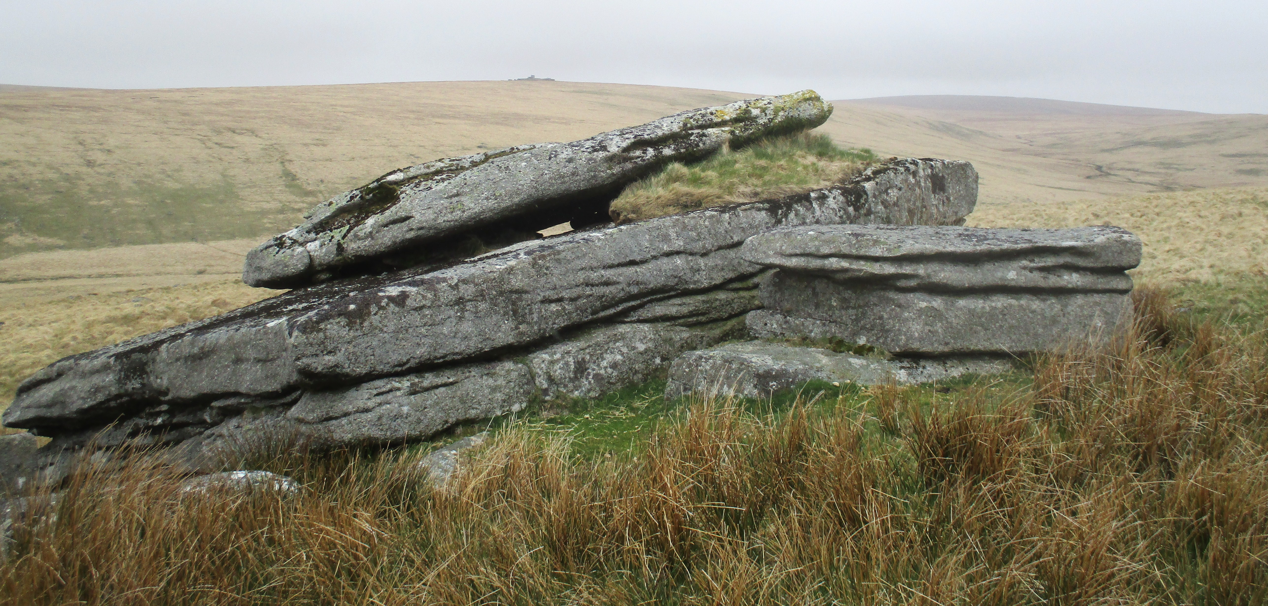
Upon reaching the main Longaford Tor at SX 6156 7795 the area to explore is now little more than half a mile away to the north and looking that way a small outcrop can be seen to be peeping above the newtake wall. Surprisingly prominent from here we have concluded that although this is in the vicinity of WR it is not part of it, indeed Hemery (p426) describes it separately ‘North of the gateway and heading a clitter is a nameless rock outcrop once a tor from which Great and Little Mis Tor appear beyond the Lydford Beardown Tors saddle’.
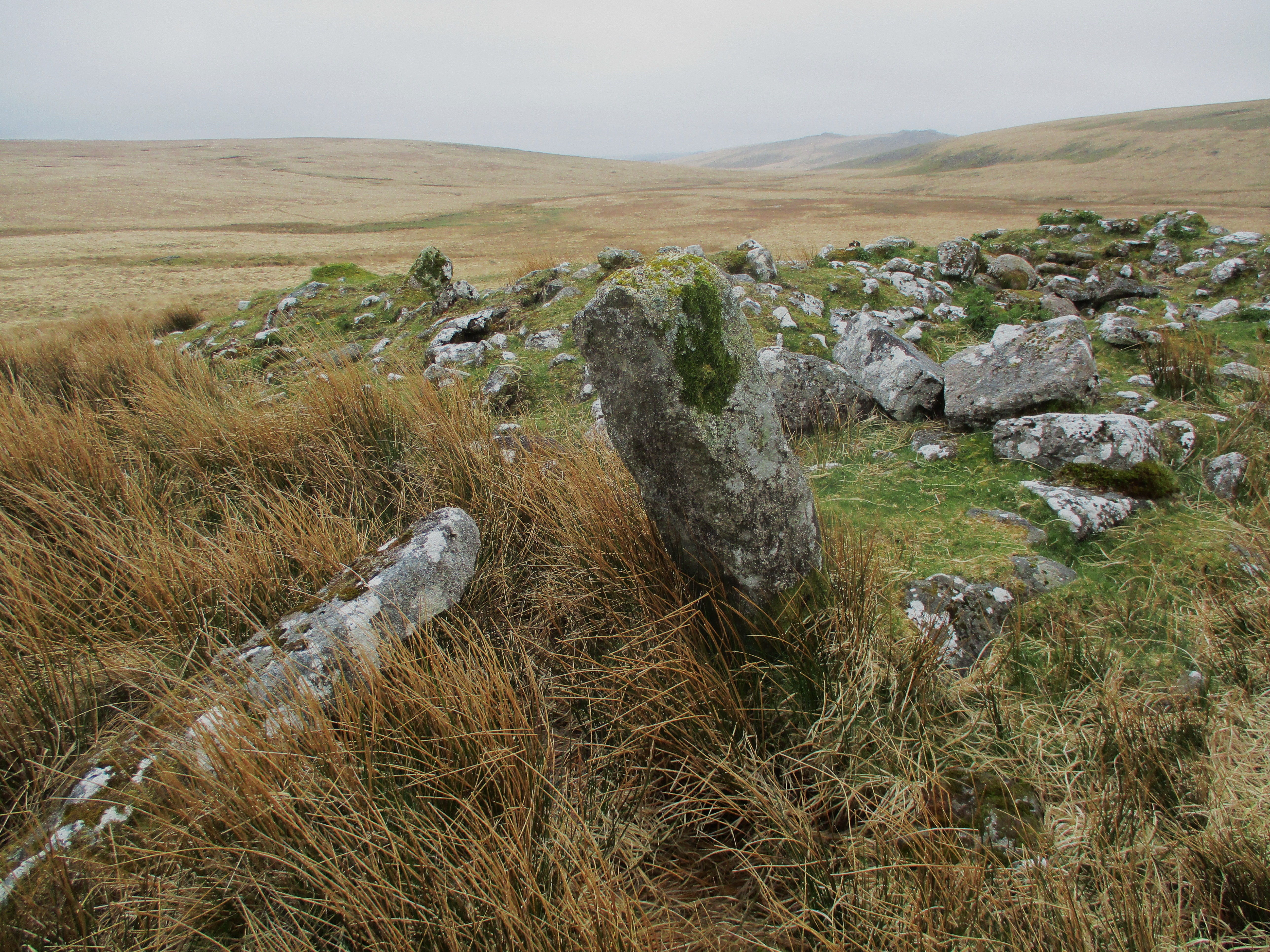
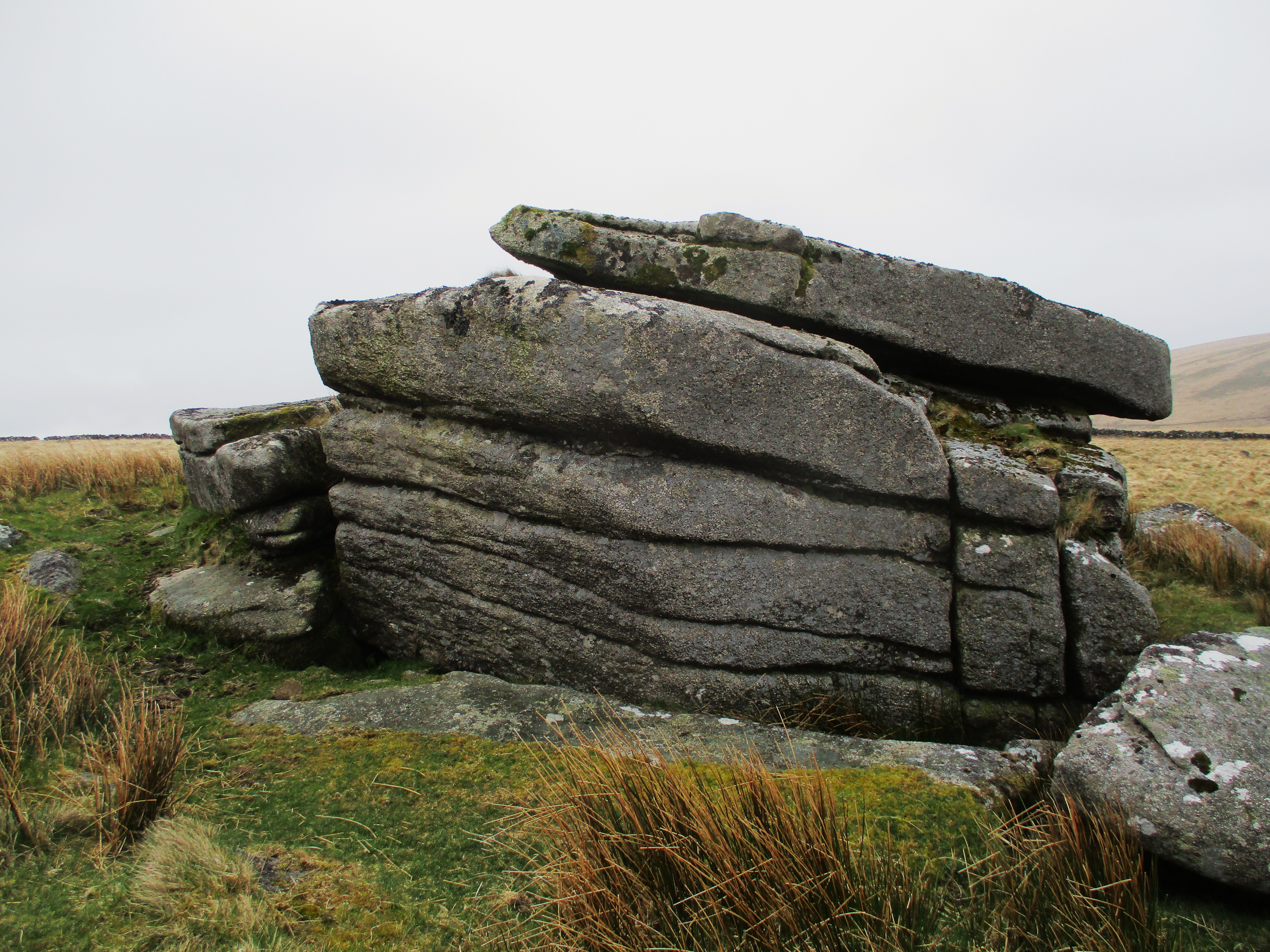
However, the lost tor at SX 6149 7870 and some 650 metres to the west of Higher White Tor, has acquired the name of Little Whiten Tor in recent times, on account of the discovery of a letterbox stamp bearing that name in the 1980s in the clitter below the main rock. Indeed, the tor remnant here is quite impressive with its north face displaying distinct horizontal fissures giving it a layered appearance and as the author observes the views are indeed very good. A short way above the tor, are the remains of the old tumbled down reave mentioned in EH’s first reference which appears as a long and low grassy mound that we now need to follow in a north easterly direction towards Cherry Brook Head to discover the whereabouts of WR.
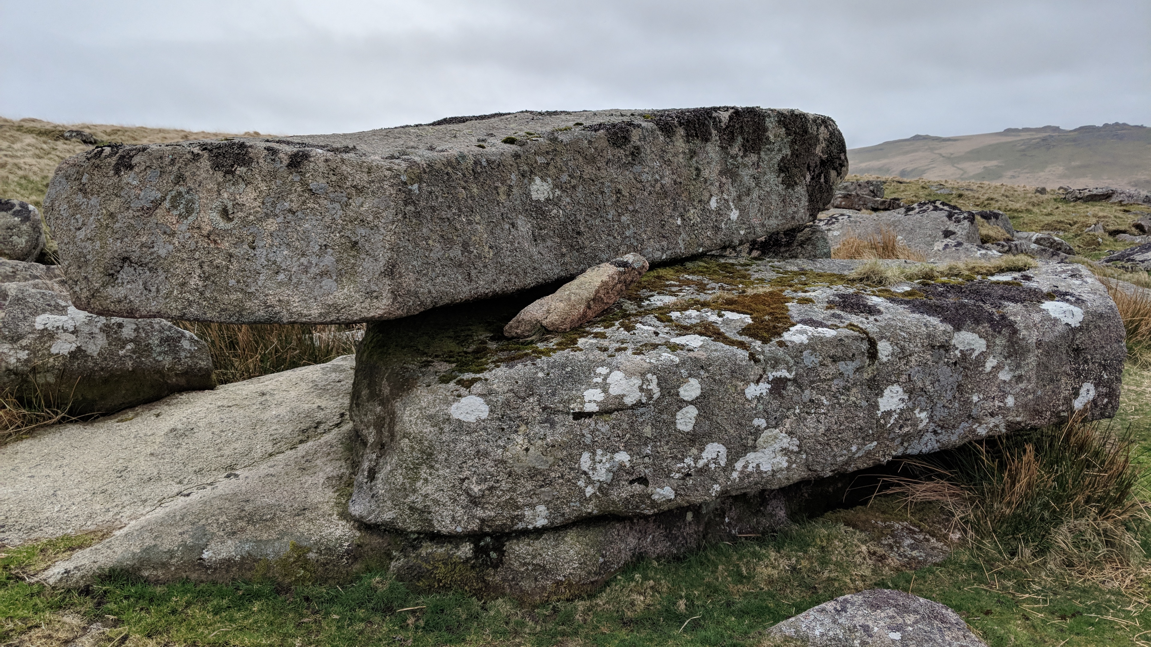
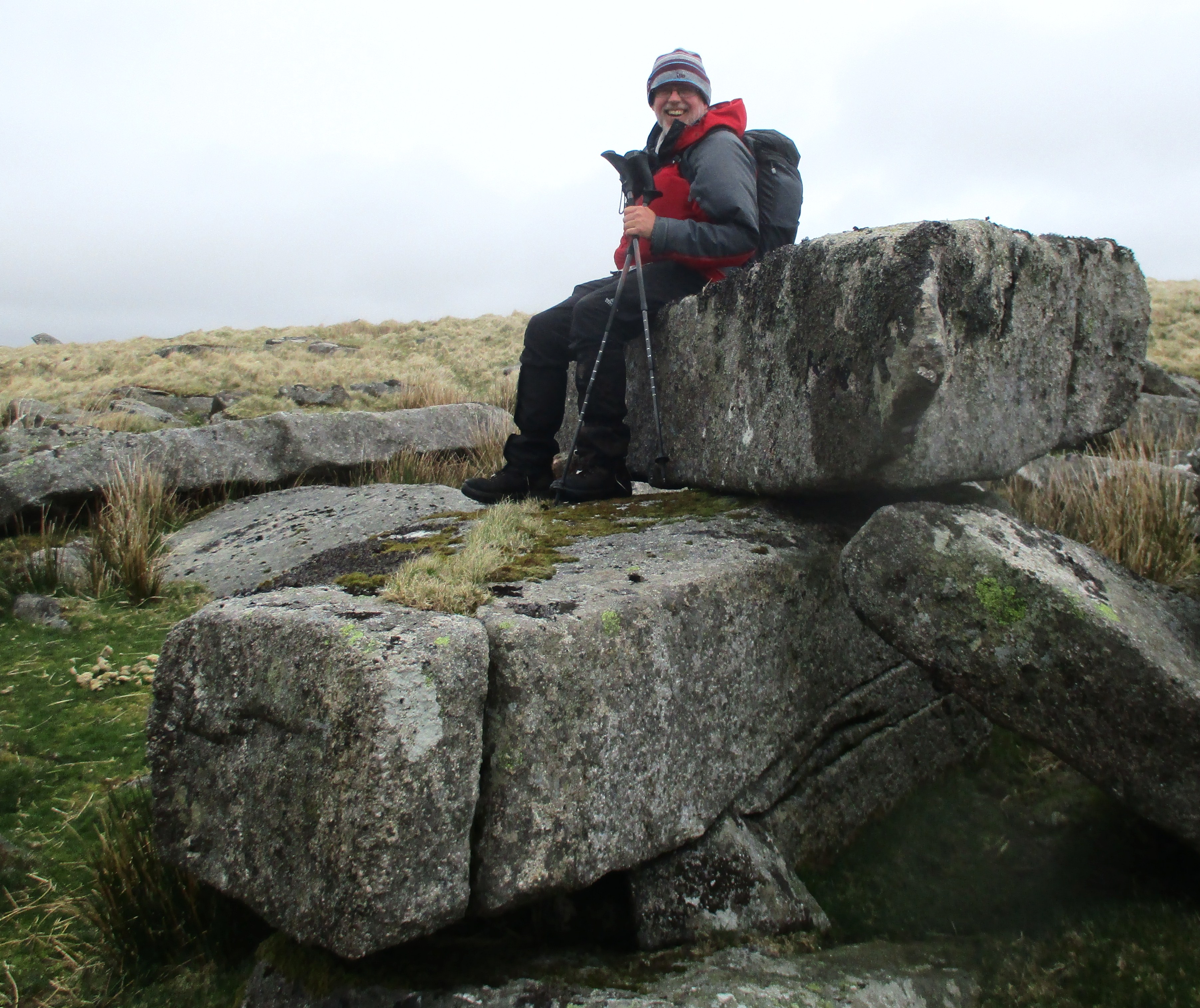
After little more than 150 metres along the reave the walker will need to leave it and head downhill to the west for a short distance before coming across a sprawling rock field with several large boulders one of which is a previously unrecorded rectangular logan stone measuring approximately 3 metres in length by 1.3 metres wide it readily rocks under pressure. Given EH’s descriptions particularly the one he gives on page 424 we feel that this is the most likely site for WR at SX 6146 7886 at about one kilometre to the south of Wildbanks Hill, but it is a little surprising that he makes no comment on the obvious logging rock feature here.
Unfortunately, Hemery’s decision not to provide even six figure grid references for the various features he describes in High Dartmoor has proven problematic over time leading to some errors in interpretations of sites. The location of WR has certainly been one of those puzzles. The TODT continue to unpick the complexities of some of the author’s accounts in an attempt to provide greater clarity into what he and others have described. Hopefully, the exact location of WR has now been identified and another mystery is resolved.
References
Brown M (1995) The Gazetteer of Dartmoor Names Forest Publishing
Greeves T (1994) Placenames of Dartmoor Lost and Found Dartmoor Magazine No 35 summer
Hemery E (1983) High Dartmoor Its Land and People Robert Hale London
Tors of Dartmoor (2021) – a database of both lesser and well-known rocks and outcrops.