
An edited version of this article appeared in Dartmoor Magazine – Autumn 2018 Issue 132.
Until relatively recently the various landscape features of the far eastern side of Dartmoor National Park (DNP) had been largely overlooked in the literature of the moor. One of the possible reasons for this could lie in the explanation offered by William Crossing well over a century ago, the extract reads: ‘the region bounded on the north and east by the Teign and embracing the parishes of Moreton, Bridford, Christow and Hennock is geologically and geographically one with Dartmoor it has certainly never been looked upon as forming part of it, nor is there any mention of it in connection with the forest or commons of Devon’.
However, the author writing later in the ‘Guide to Dartmoor’ (1912 edition) describes numerous excursions to those areas and includes routes and observations in and around the villages of Manaton and Lustleigh and out from the town of Bovey Tracey, introducing the reader to numerous names for local features such as rocks and tors. Nowadays, most of these places are considered to be well within the boundary of DNP.
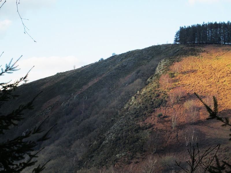
Another reason for the neglect is perhaps the terrain, which is often steep, densely wooded and with some rather ill-defined paths particularly in the Wray and Bovey Valley areas. The canopy of mostly oak and holly trees has largely obscured many of the rocks that Crossing noted during his explorations. Indeed, this latter point is well illustrated by a quote from train traveller and one of the earliest East Dartmoor explorers John Chudleigh, who when writing in 1892 (p6) describes the following scene:
‘Taking the train with a companion to Lustleigh, not long ago a quaint country village, but now fast becoming modernised by the erection of ‘desirable villa and other residences’, Bullaton Rock may be seen high on the hill to the right of the station, it is a steep climb to its summit, but the view well repays the labour’.
How things have changed since that time as the railway is long gone, the station at Lustleigh closing to passengers in February 1959 has become a private residence. Bullaton Rock (SX 796822) is no longer visible from that point and whilst the path is still in evidence leading up from the A382 near to Kelly Mine, the higher part seems to have been redirected away from the Rock as it now resides on private land.
For the purposes of this article and the one to follow, I will be using Eric Hemery’s (1983 p89) broad definition of a tor as ‘A prominent outcrop that can occur at any point between valley-floor and hilltop’. The only problem being that most of the tors I will be describing are largely hidden from view and only deemed prominent when approaching or stood alongside. All of the features highlighted, are set either beside footpaths or close by and can be accessed with comparative ease, or where this is not possible, they are readily visible from nearby roads or paths. The articles are a culmination of a series of observations and assessments of some of the finest rock piles on this side of Dartmoor mainly within the parishes of Bovey Tracey, Hennock, Lustleigh, Manaton and Moretonhampstead, where were it not for the trees, there would be a breath-taking rock-strewn landscape to enjoy.
Bearacleave (SX 816797)
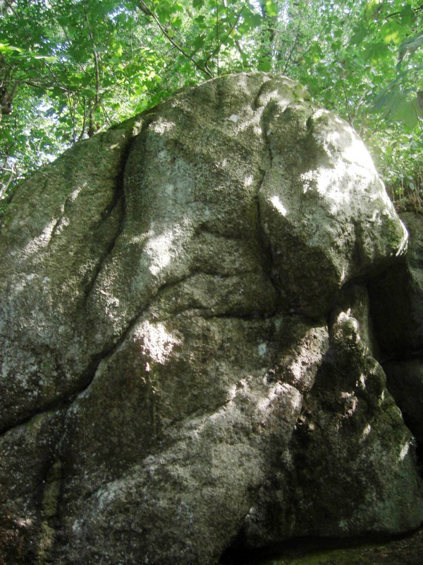
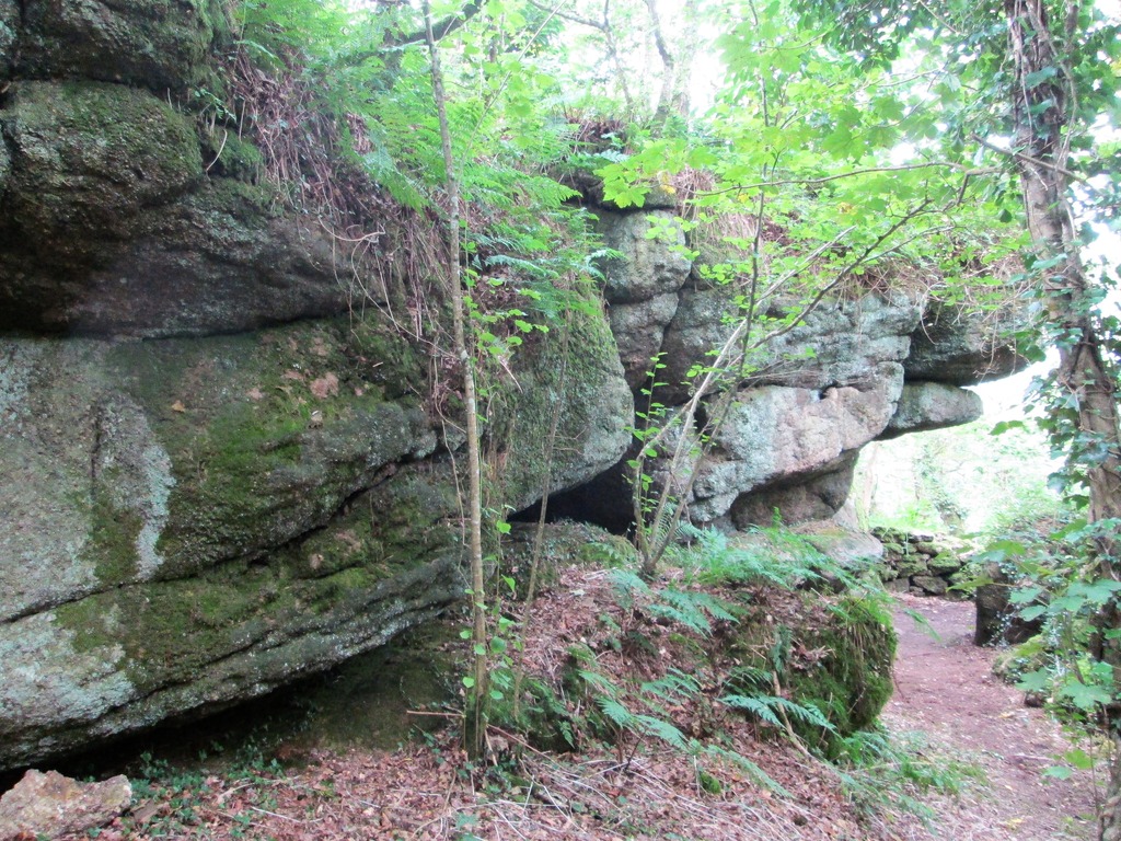
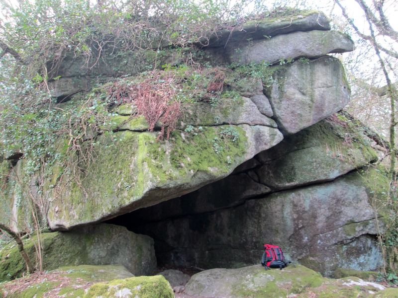
There is quite a magnificent tor that is hidden below the main path running through Bearacleave towards Little John’s Walk and Shap Tor at about a mile to the north of Bovey Tracey. A fine rock stack is piled on the slope that resembles a giant stone walrus and more of the tor exists above and below this point overlooking what appears to be huge gully in the hillside. Very close to the National Park boundary the rock pile is also right on the Parish boundary of Hennock and Bovey Tracey and is little more than 200 metres above but quite separate from John Cann’s Rocks that William Crossing describes on page 301 of the ‘Guide’. It is the southernmost of the fascinating rocks and outcrops that extend northwards from here through the trees towards Shap Tor.
Bowden (SX 817803)
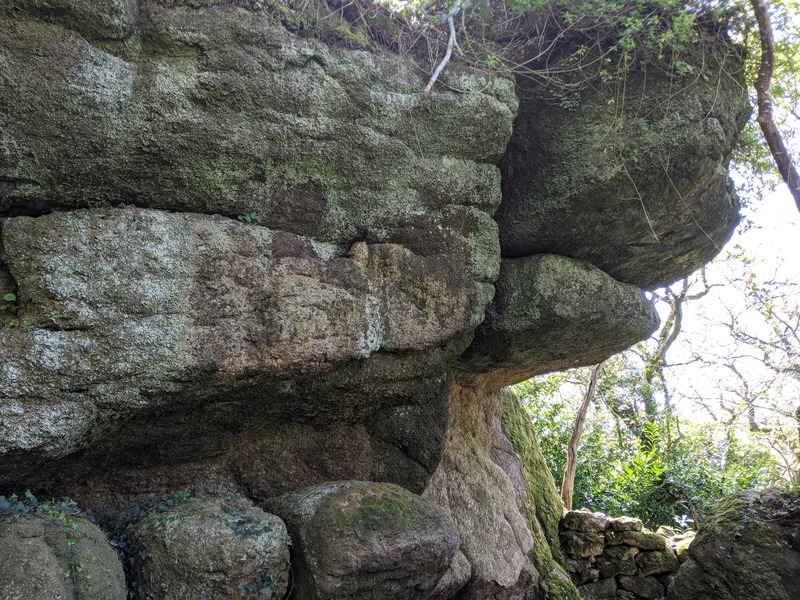
Not far from the above rock group there is another grand tor set in the upper fringe of the wood between Higher and Lower Bowden Farms that can be easily reached from the public footpath leading from the road into Shaptor Woods. It lies little more than 200 metres above the southern tor in nearby Rock Copse. It is especially impressive on the east side where a huge overhang dominates. It is hard to see how WC could have missed such a spectacle, but he may have visited Shap Tor from the Slade Cross end of the footpath and perhaps so taken was he with the splendid sprawling outcrops there, that he stopped short of coming further into the woods where he would have been rewarded by the sight of many more rock piles in the various copses.
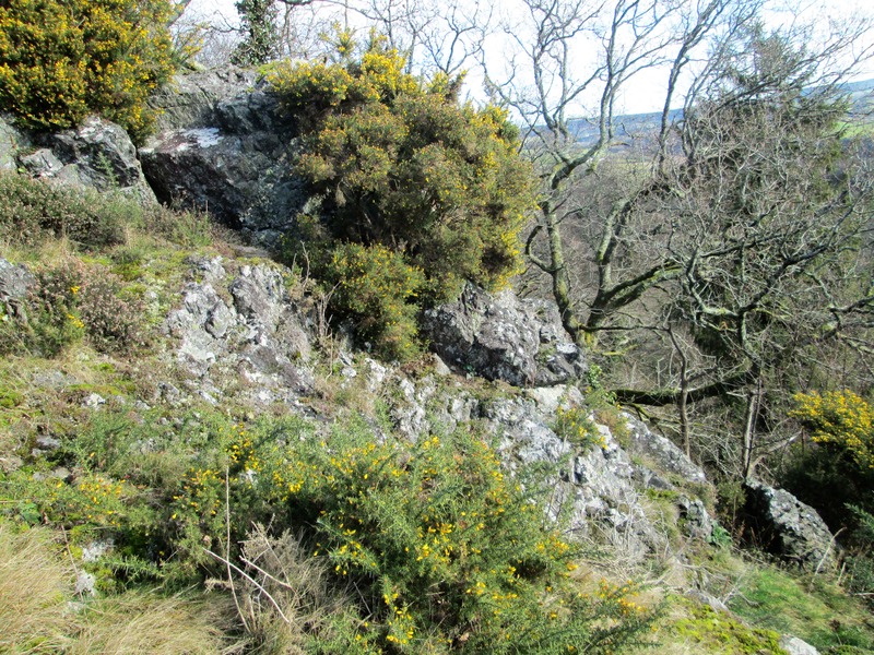
Broadmoor Common (SX 755898)
Part of this rocky ridge on the west side of Broadmoor Common is known locally as ‘Bad Rock’ and is very much like the outcrops on neighbouring Prestonbury Common not of granite. Dr Tim Harrod first identified this tor in a letter to me from February 2011. There are two main lines of craggy rock running through the hillside at this point which are best viewed in winter months from the lofty elevation of the woodland path leading to Wooston Hillfort (Castle) from Fingle Bridge. The crags on the Common are on private land and are set in the Parish of Drewsteignton.
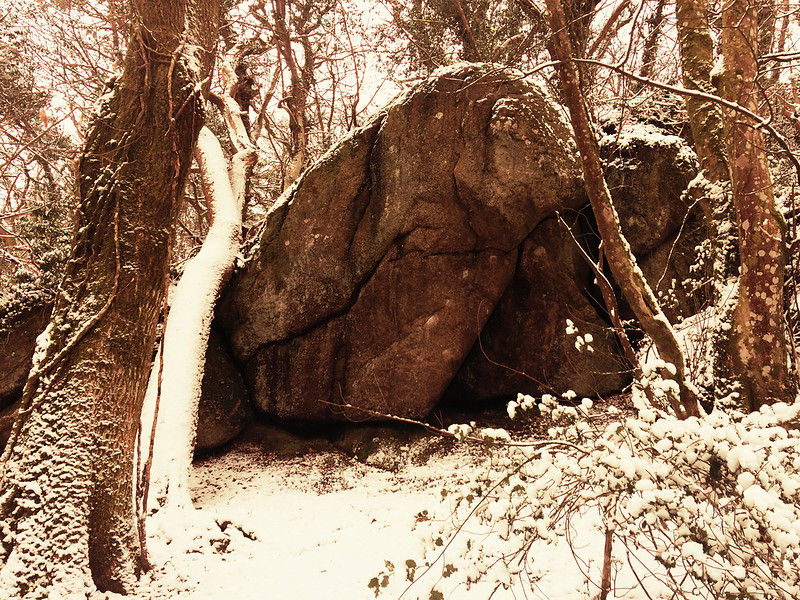
Hammerslake (SX 773814)
Having previously described some of the fine rocks in and around the village of Lustleigh, which is a haven for small tors (Jenkinson 2015), I was reminded by Paul Buck of another quite spectacular tor that resides in the woodland not far above the hamlet of Hammerslake on the steep path towards Lustleigh Cleave from Logan Stones. The lower pile is the most obvious as the path weaves beneath, but the tor also extends uphill through the trees to the south with more giant rocks and outcrops hidden there.
Hyner Rocks (SX 831818)
A huge crag of rock juts from the steep valley side above Beadon Brook on the far southern side of Canonteign Down approximately one mile to the north of Hennock right on its parish boundary with that of Christow. Known locally as Hyner Rocks (sometimes seen as ‘Highner’) it consists not of granite but is composed of a distinctive type of shale that is peculiar to the area. A geological fault referred to as Hyner Mudstone runs to this point from Beadon Lane to the west.
Information on the location of this tor was first passed to me by Ian Parsons and more of the rocks extend downhill into Hyner Bottom where a delightful mini canyon is formed either side of the brook. Now redundant mining operations are evident here along with artefacts such as an old wooden launder on the south bank. The Rocks can be viewed at leisure from the road to the southeast.
References
Chudleigh, J. (1983) An Exploration of Dartmoor’s Antiquities 1892 John Pegg Publishing Pembury Kent
Crossing, W. (1986) The Teign: From Moor to Sea Quay Publications Brixham
Crossing, W. (1912) Guide to Dartmoor reprinted 1990 Peninsula Press Newton Abbot
Jenkinson, T. (2015) Dartmoor Magazine, Issue 120, Autumn: Dartmoor Discovered: Lustleigh – Some Tors and Rocks Explored, pp 40-41
Hemery, E. (1983) High Dartmoor – Land and People Robert Hale London