
An edited version of this article appeared in Dartmoor Magazine – Autumn 2018 Issue 133.
This the second of two articles on the subject continues an exploration of some of the hidden rocks and tors of the far eastern side of Dartmoor National Park an area which until relatively recently had been largely overlooked in the literature of the moor.
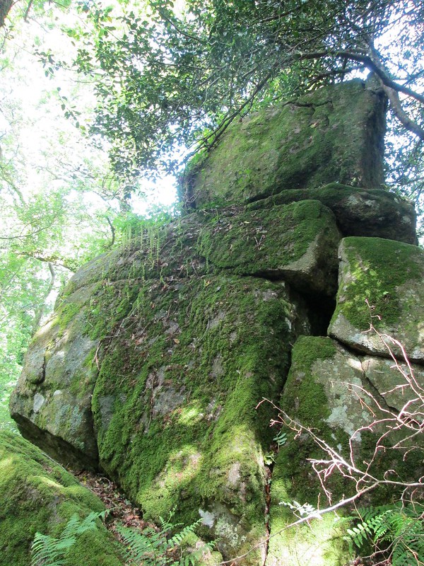
Knowle Rocks (SX 791808)
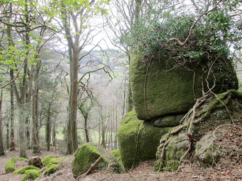
A quite magnificent valley side tor resides at the northern end of Higher Knowle Wood and extends downhill to the west for some 100 metres or so. The central and most impressive part comprises massive outcrops enveloped once more in trees and vegetation. The lowest outcrop not far above the road presents as a distinctive stack. Richard Horsham (RH) first drew my attention to these rocks in 2016 and he includes a reference to them in an article in Dartmoor Magazine from that year where he explains that the rocks here are not of granite but Woolley Grit, a hard sandstone of similar appearance.
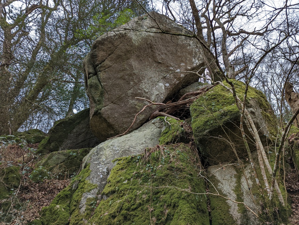
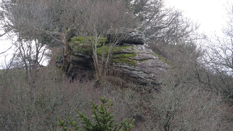
Loxter Tor (SX 792810)
Not far from Knowle Rocks a spectacular series of crags jut from the hillside at the point where Loxter Wood joins Higher Knowle Wood. Also composed of Woolley Grit conglomerate the tor sprawls across the slope here and is seen at its best from the north side. RH (2016) who first described the area explains that the tor’s ‘face is formed by a normal fault and is the footwall or fault scarp face’. Another point of interest is the nearby old May Rock (SX 791891) of Lustleigh’s May Queen event which can be seen from the footpath on the approach to Higher Knowle Wood from the village (Stevenson 2015).
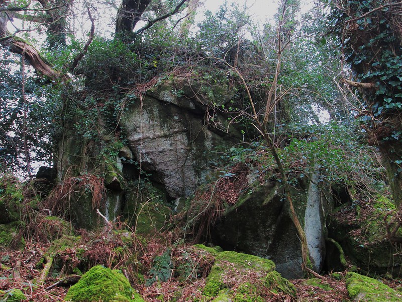
Sanduck Grove (SX 773827)
There is a small isolated tor set in the copse known as Sanduck Grove about a mile to the north west of Lustleigh. Forming a compact group of huge boulders above the main footpath leading through the wood to the County Road, the tor reaches a height of some 5 metres on its west side and is surprisingly impressive when viewed at close quarters.
Shuttamoor (SX 822827)
Although it is set on private land on a small spur to the south of Shuttamoor Farm, this surprisingly prominent outcrop of rock is clearly visible from the road near the farm. It was spotted by Paul Buck whilst walking towards nearby Fleetwood Plantation. The main pile which sits in the corner of three fields and is only just in the Parish of Hennock appears to have a large logan type boulder perched on its top. The farm less than 200 metres away is in the Parish of Christow.
A short-lived iron mine once operated at Shuttamoor (locally ‘Shootimoor’) but the poor-quality mineral in the area necessitated its abandonment in 1890. The name of Shuttamoor Rock seems appropriate given its proximity to both the farm and the nearby wood that once housed the mine.
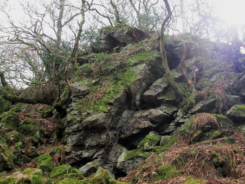
Trendlebere Down (SX 767800)
Although part of the rocks here, are shown on OS maps they are not named, and nobody seems to have written about them in the literature. An enquiry to the Dartmoor Magazine in March 2015 revealed little information. The ruined tor is set on the wooded and rapidly steepening slopes above Becka Brook and consists of numerous large and split outcrops. As about as far south as you can go in the Parish, the tor can be reached by a track leading north from the B3387 road.
Woodash/Water Rock (SX 767808)
In Gems in a Granite Setting (page 79) William Crossing describes a visit to Bovey River at Horsham Steps and explains ‘Lower down there are footbridges and by the higher one the visitor may reach Water Rock where is a magnificent view of the valley and its surroundings.’ Whilst the footbridge is no longer in evidence what appears to be the Rock in question can still be reached via a public footpath that leads through that part marked as ‘Woodash’ on OS maps.
Now almost entirely shrouded in vegetation the Rock stands about 50 metres above the path but unfortunately the view described by WC is now mostly obscured by trees. Water Rock was evidently once an important landmark in the area as the author also refers to it his ‘Guide to Dartmoor’ (p307) and it is marked by that name on the OS 1882 map of the area on the slopes of what WC calls Water Hill. The name no longer appears on modern-day versions.
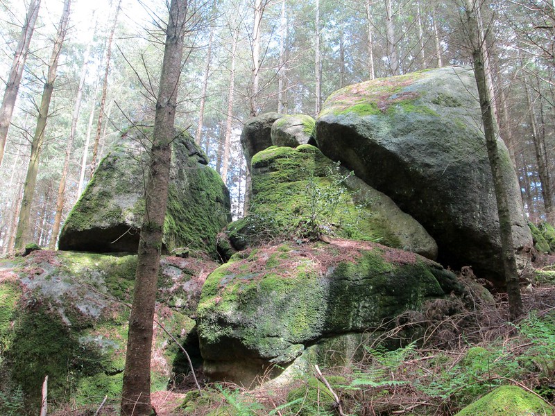
Wray Cleave Wood (SX 776842)
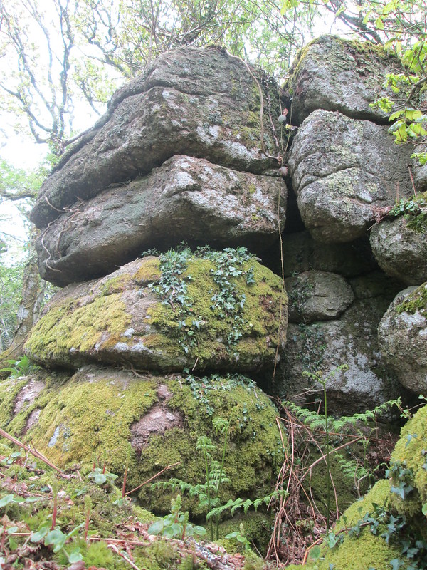
Another fantastic tor lies in Wray Cleave Wood close to the public footpath that leads downhill from the remote ruined cottages of Lewdowns (Lewdons). There is a bewildering array of giant outcrops on the hillside here none of which are visible from the A382 road below as they are all hidden under the trees. More impressive piles extend to the south. Thanks goes to Max Piper for first noticing the rock piles here on old Ordnance Survey maps. It seems that one of the last inhabitants of the nearby cottages was Mr Frederick Garnish who died aged 79 years in 1943. He had along with his wife Georgina lived there for over 40 years working as a cattleman on a nearby farm and both are buried in the churchyard at Moretonhampstead. A note on the register of her death, records that Georgina had ‘walked to and from the town until last year’, that being 1941.
Conclusion
These two short articles have described just a selection of the some of the splendid rock piles that can be found on the far eastern side of Dartmoor National Park. Now mostly obscured by a proliferation of trees these rocks were once visible and formed prominent landmarks some of which were readily commented on by late 19th Century and early 20th Century visitors to the area. Several of the better-known rocks such as Gladstone, Elsford, Gradner, Bullaton and Rowden are still marked on modern Ordnance Survey Maps but others such as Water Rock have disappeared.
I am indebted to various people for their help, encouragement, advice and company on the planning and execution of numerous excursions into the East Dartmoor landscape: In particular I would like to thank Paul Buck, Dr Tim Harrod, Richard Horsham, and Steve Jenkins for their invaluable input.
References
Crossing, W. (1986) Gems in a Granite Setting Devon Books
Crossing, W. (1912) Guide to Dartmoor reprinted 1990 Peninsula Press Newton Abbot
Horsham, R. (2016) Dartmoor Magazine, Issue 123, Summer: Understanding the Dartmoor Landscape Part 22, pp42-45
Jenkinson, T. (2015) Dartmoor Magazine, Issue 118, Spring: Letters to the Editor, p65
Stevenson, K. (2015) Dartmoor Magazine, Issue 118, Spring: Lustleigh May Day, pp22-24