TORS OF DARTMOOR EXTRA
a collection of extra material from the tors of dartmoor team
Dartmoor Discovered: Ausewell Wood: Tors, Rocks, and Boundary StonesTim Jenkinson on 13th April 2025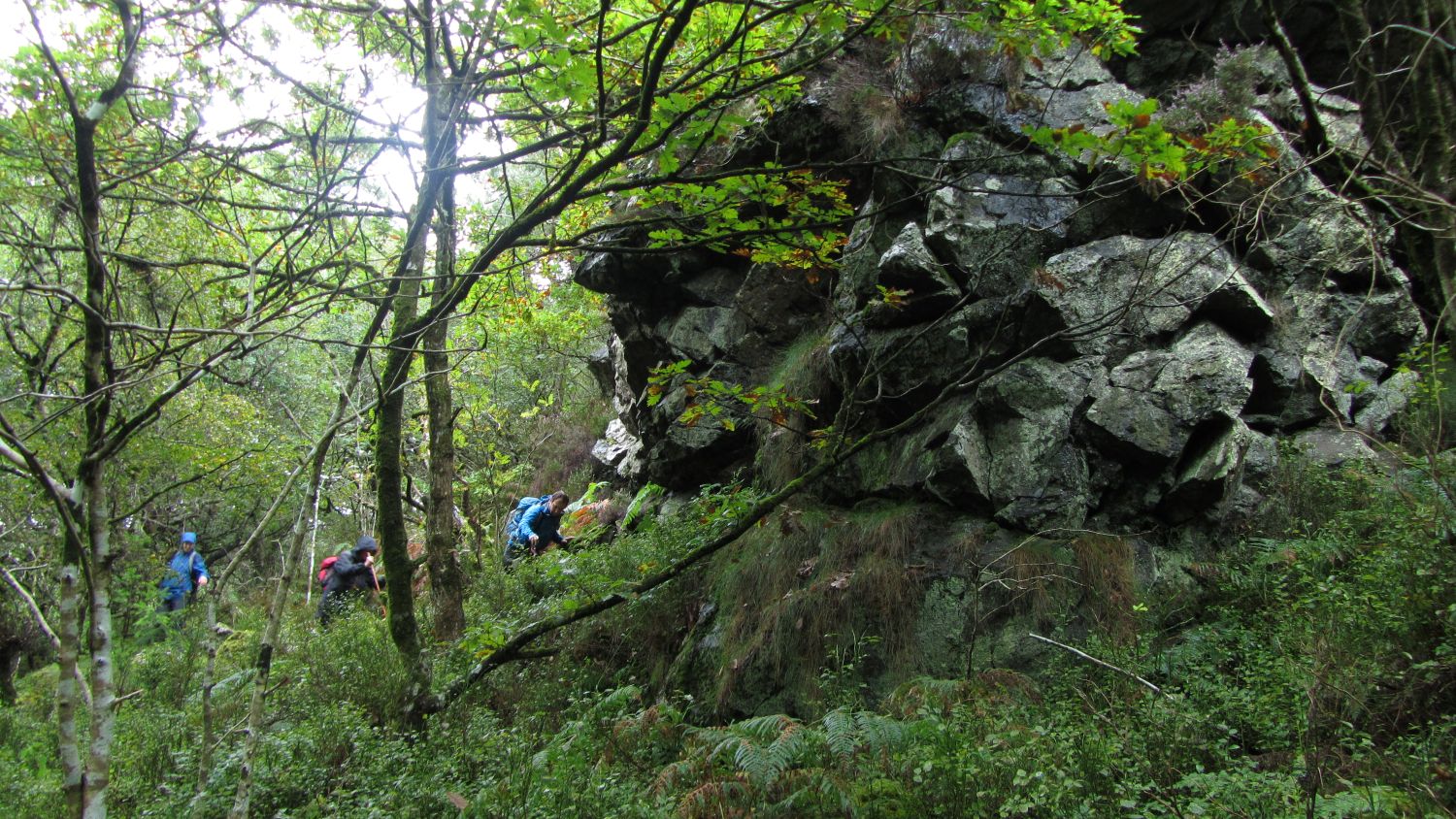 Ausewell Woods Exploration (September 2017) An edited version of this article appeared in Dartmoor Magazine - Autumn 2023, Issue 151 p19-21.For many decades a walk in Ausewell Wood (SX 7371) approximately two miles to the northwest of Ashburton on South Dartmoor was mostly prohibited. Privately owned access to the area was restricted to only certain times of the year outside of the bird nesting season and only then by acquiring a walking permit through Fountains Forestry (FF) who managed the wood on behalf of the landowner. However, in 2019 all that changed when the Wood was purchased jointly by the Woodland and National Trusts and by April 2021 there was a car park just to the north of Ausewell Cross at SX 737721 and a range of footpaths created to enable much better public access to this lesser-known part of the moor. According to the Woodland Trust (2023) website "Ausewell is like a lost world, its raw beauty a haven for rare and endangered wildlife. It is 342 acres of wild, rugged wood and heath with dramatic rocky outcrops, boulders and screes, dense woodland, and damp temperate rainforest along the famous River Dart". The National Trust (2023) explains further "When Ausewell Wood came onto the market, The National Trust and Woodland Trust as at nearby Fingle Woods, joined forces to buy, protect and enhance this precious habitat, together with the wildlife found there". I first visited this Wood in 1992 to examine the impressive Ausewell Rocks that had been so eloquently described by Eric Hemery in 1983 but it was not until a quarter of a century later in September 2017 that I returned to the area with the help of Paul Buck (PB), Richard Flint and Kerry Pearn courtesy of a walking permit from FF that had been facilitated by Paul. This article celebrates the numerous and magnificent rockpiles that are hidden within the vicinity of the wood and describes two boundary stones that were first brought to our attention in the modern era by Dave Brewer (DB) in 1986. Please be aware that restrictions continue to apply at certain times of the year under the Wildlife and Countryside Act of 1981, so it is necessary to always observe and comply with any signage or closure notices. Ausewell Rocks SX 736717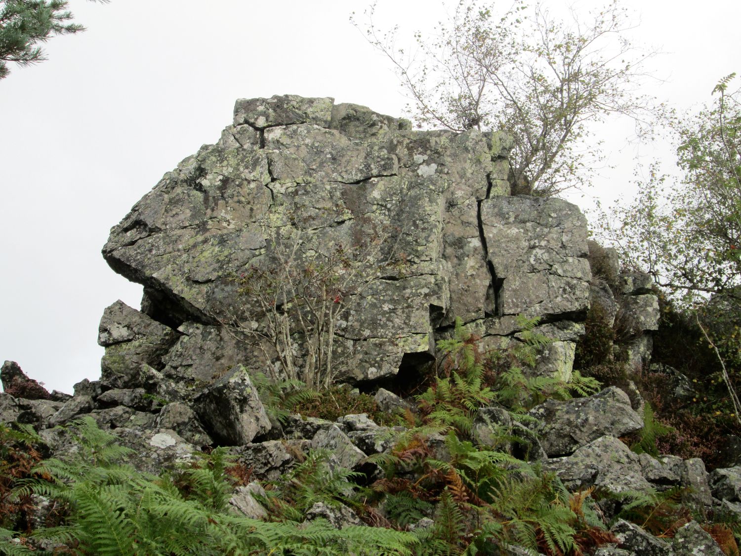 Lion Rock Samuel Rowe (1848) is one of the first to record Ausewell Rocks introducing three other names 'Answell', 'Hazel Rock' and 'Tor'. Lloyd Warden Page (1895) adds a fourth that of 'Lion Rock' on account of one of the outcrops bearing a resemblance to the profile of king of the jungle. William Crossing (1905) explains that Hazel Tor is a name that "it bears in the locality" and Hemery (1983 p666) adds that the name is a corruption of 'Ausewell- 'As'ell- (H)azel'. Writing in 2002 I remarked that "the tor lies in woodland and consists of three main piles. The eastern crag is the most impressive this being the one that is visible from the south slopes of Buckland Beacon above the tree line". Hemery writing at a time when the tor was perhaps a little more accessible states that it breaks upon the view like a 'ruined fortress' when seen from below. 60 metres or so to the west of here resides a smaller outcrop of grey slate type rock near to two huge cairns that the author describes with gusto. We learn that the eastern cairn was highlighted in the 1922 Report of the Barrow Committee as having a "crater like centre, a not unusual feature when a cairn has been ransacked in search of treasure". The larger cairn to the west is at least 20 metres in diameter with the remains of a dry-stone wall around its summit. 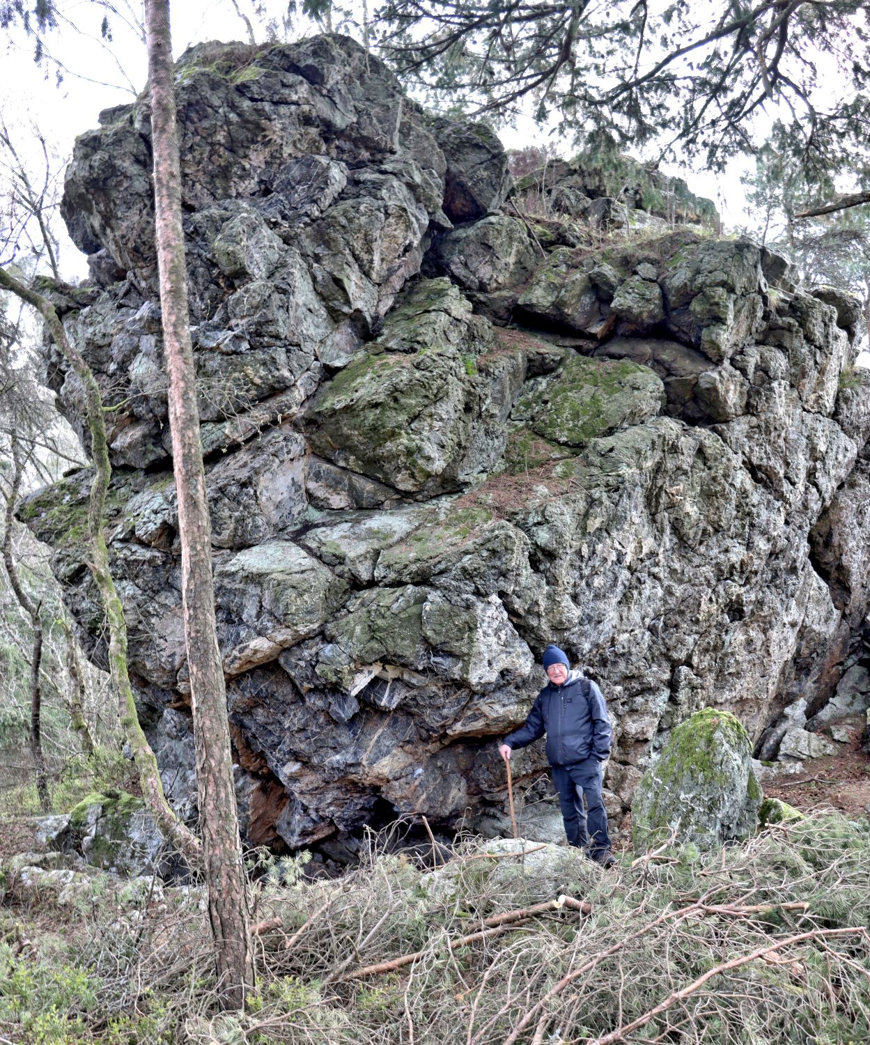 Author beside Ausewell Tor - photo by Paul Buck Collectively Ausewell Rocks are a tremendous introduction to the non-granite rocky landscape of the Wood and in Crossing's time the views that are now largely obscured by trees were described by the author as "exceedingly fine" taking in, to the east the dipping hills and valley sides of Boro Wood and Whiddon Scrubs whereas to the south and west Brent Hill and the open moor to Hickley Plain and Three Barrows distant could once be seen. Hepstock Rock SX 732715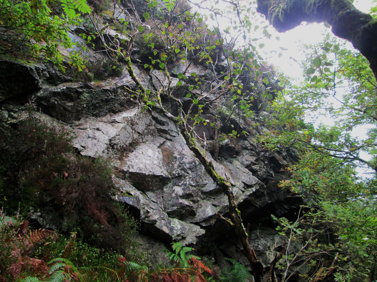 Hepstock Rock Set at about 400 metres to the southwest of Ausewell Rocks is another daunting sedimentary rockpile. Its name with an added 'e' for 'Rocke', first appears on a carefully redrawn 1605 map of Ashburton by JS Amery for his presidential address to the Transactions of Devonshire Association in 1924 (see Newman 2021). It resurfaces in an article on 'The Dartmoor Blowing House' by RH Worth from 1940 where the extract reads "A similar furnace is to be seen at the old 'Iron Mill' on the bank of the Dart under Hepstock and Awsewell Rocks". First visited in 2017 the rocks here are immense and covered in vegetation that gives it a distinctly claustrophobic and almost Amazonian atmosphere as you approach as remarked upon by the Woodland Trust. Clearly not of granite the surface of the rock here is jagged and shiny in appearance as if sweating under the canopy of the forest. As with other parts of the wood between March and the end of July this area is strictly out of bounds to the public so, please be aware of these restrictions. Landscore Tor SX 726722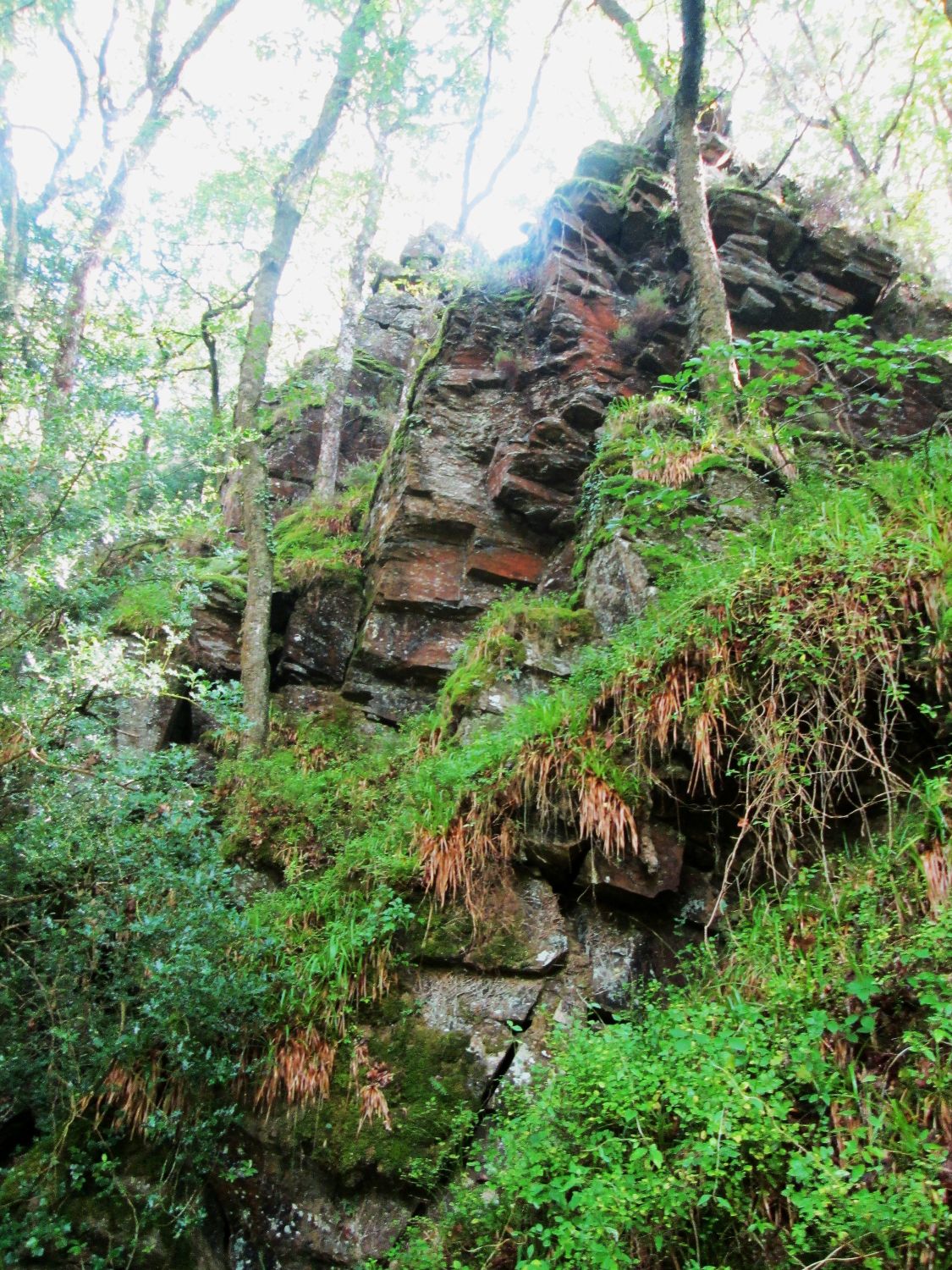 Landscore Tor The name of this tor also appears on Amery's map of 1924 but cannot be visited without first obtaining a walking permit from FF as it lies on the boundary of Buckland Wood just outside of the Woodland Trust's land. DB (2002) advises that it has had several names such as 'Lownstone or Long Score Tor' in 1593, 'Launceston Torr' in 1709 and 'Launson Torr Rock' in 1837. It is essentially a massive metamorphic cliff face that is adorned with vegetation, below which a track once known as the lower Buckland Drive has been cut. Nearby are two interesting boundary stones inscribed with the letters 'A' and 'B' for Ashburton and Buckland in the Moor on their sides and on the faces, there are dates with the name of 'King's/Head/' etched on one. 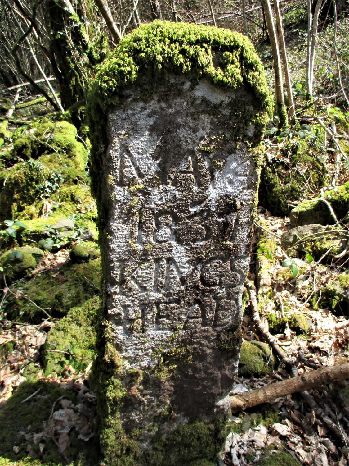 Muswell Boundary Stone Both stones here are mentioned in 1895 in an article in the Totnes Times and Devon News, that remarks on the Ashburton Beating of the Bounds of that year; "Some hearty cheers were given for the Squire and the company having inspected the bondstone which bore the date March 4th, 1837, then broke away from the drive and up through the wood by a stream towards Ausewell first coming to a well called Muswell. Here there was another stone dated May 4th, 1837. Attention was called to a large holly bush growing over the well and to the granite cross nearby all will be found in King's Head Wood". The stones are located at SX 726722 and SX 728723 respectively and according to DB were erected by the then landowner Edmund Pollexfen Bastard along with a series over Buckland Common that survive to this day. However, the granite cross referred to in the article has not been found in recent years. That said the dates on both stones are accurately recorded in the newspaper extract. Lovers Leap SX 726722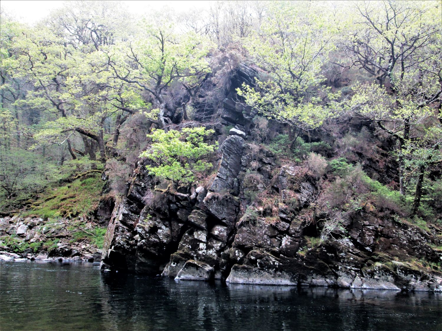 Lover's Leap Loosely remembered in legend as a former spot where despairing lovers threw themselves off into the river below, strangely in his 2002 account of the area DB (p107) implies that Lover's Leap is at the summit of Landscore Tor. This seems unlikely as previously WC in Gems wrote "It has been considered by many that the Dart at the Lovers' Leap is seen at its finest. Those who love it best, where it forces its way through rock-strewn vale, its murmuring heard only by the curlew, may not be prepared to endorse this view, but they will, at all events, be ready to acknowledge that nowhere throughout its course is the picture, of which it forms the principal feature, more enchanting than that presented at the spot where it kisses the foot of the rock with the forgotten story in the valley below Buckland." Recent impressions are that the Leap is actually at the foot of the tor on the north side of the river, the rocks having been effectively cut in two by the construction of the aforementioned lower Buckland Drive to which WC refers to in the Guide to Dartmoor (1912) commenting on a visit by Queen Victoria's husband Prince Albert "The drive here deserts the river for a short distance and is carried above the rock. In passing this an upright iron bar will be seen, which was placed here to mark the spot on which the Prince Consort stood when he visited the woods, by George Sparks, a former well-known whip of Ashburton, who drove his Royal Highness on that occasion." The Leap is further described by the author as a "fine rock" that "projects itself from the steep hillside and the Dart makes a bold sweep round it" implying that it is near the water's edge. Always best seen from the other side of the river permission should be sought from the owners of Holne Chase to visit and the nearby Eagle Rock. Raven Rock SX 729715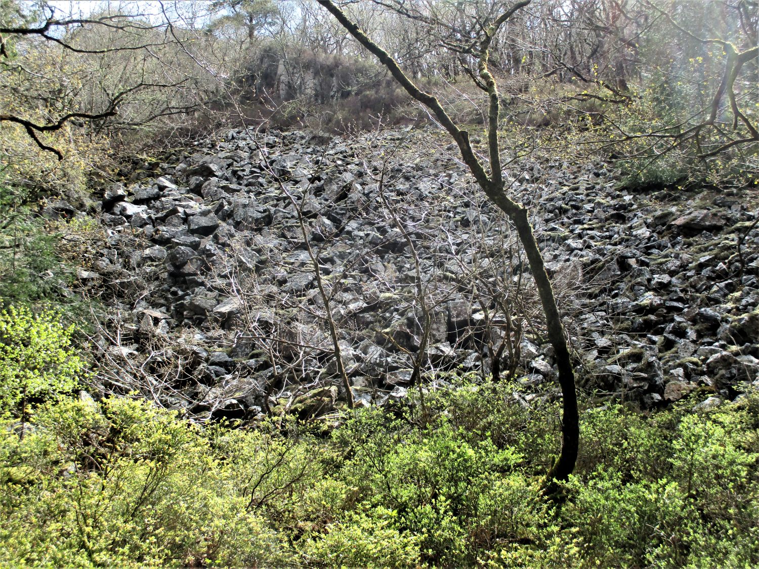 Raven Rock Scree This is probably the most difficult of all the rockpiles in the wood to see as it is mostly enveloped in trees and dense vegetation. Really only the summit of the main Rock is visible as it lies immediately beside one of the tracks that run through Ausewell Wood. From here there are some spectacular glimpses of the surrounding landscape described on the Tors of Dartmoor website as panning 'westward to Chase Wood and higher tors to the west, including Sharp Tor, Bel Tor and Corndon Tor. It is a view worth taking the time to enjoy'. However, it seems, the Rock has not always been as much obscured as it is today as we learn from WC who commenting on a visit to Holne Chase in the early 19th Century states that it "presents a fine appearance" and indeed in the winter months it can be seen from afar. There is an enormous amount of scree and loose clitter at the foot of the main Rock. Once again this is an extremely sensitive area for wildlife particularly birds of prey so it cannot be visited during the nesting season. Cleft Rock SX 726709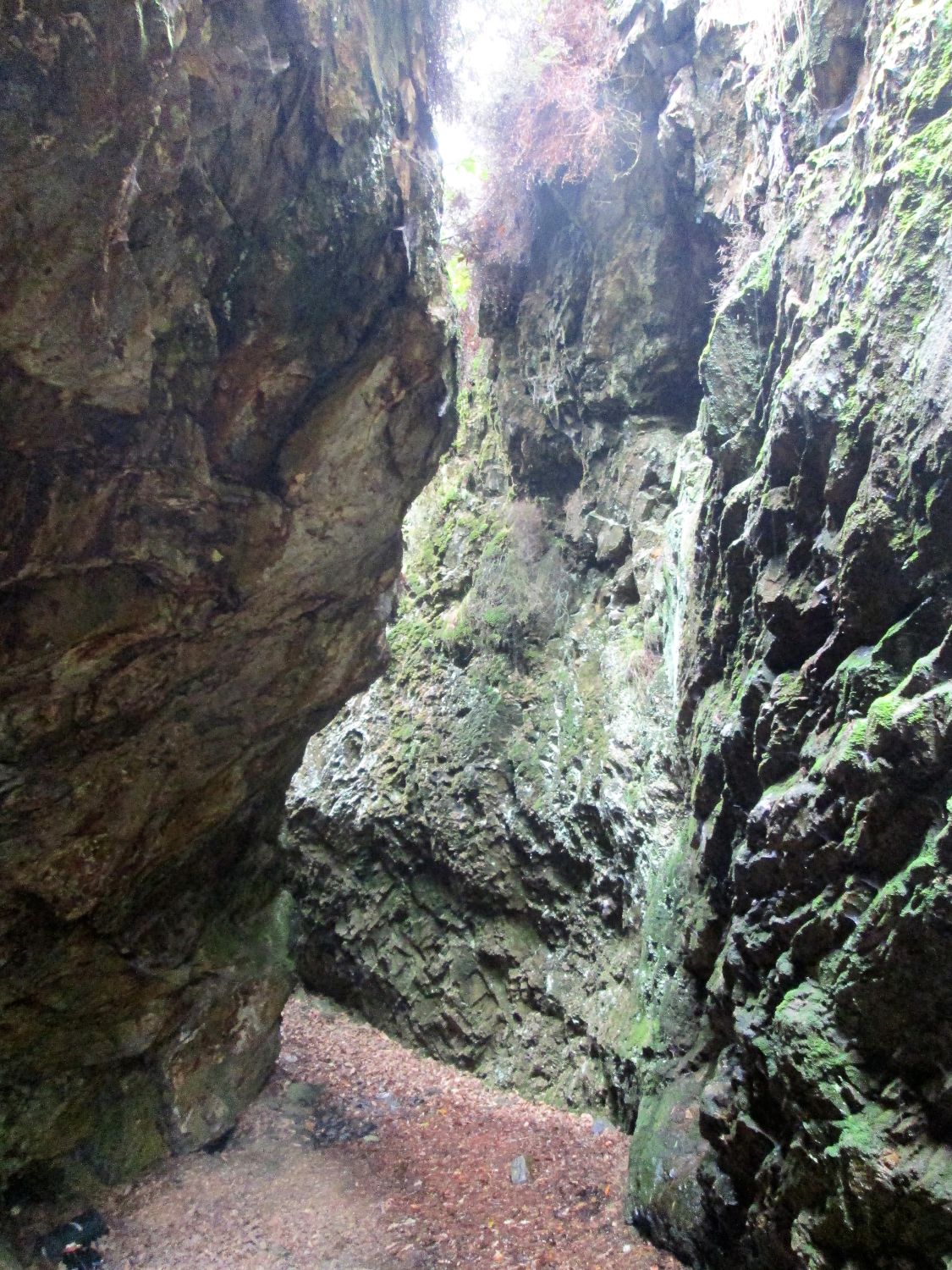 Cleft Rock The most southerly of the magnificent rockpiles within the wood is Cleft Rock but following recent concerns over safety with sheer drops and old mine shafts it is currently out of bounds to the public and is now cordoned off by a protective perimeter fence. According to the mindat.org website excavations took place here to exploit the area for its minerals "Two parallel lodes of iron and copper extend through and alongside the rock and were developed here by open cast working and underground mining. The Cleft Rock itself (which appears on current Ordnance Survey maps by this name) is a deep gunnis splitting the rock in two. Locally pronounced as "Azel", the mine, then idle, was advertised for sale as Haswell Mine in 1763 and two years later, in 1765, appears on a map as the Hazel Mine. Workings at this time were from adit and shaft." Indeed, the gunnis is the Rock's most dramatic feature a deep gouge that easily accommodates an upright person it has unforgettably damp and claustrophobic walls that are still stained with the orange and green veins of the copper ore seeping through. Given its intimidating and mysterious caverns it is thought that Arthur Conan Doyle (1902) was famously inspired to write this extract from The Hound of the Baskervilles: When they were gone, we looked out of the window again. Sir Henry had flung it open, and the cold night wind beat in upon our faces. Far away in the black distance there still glowed that one tiny point of yellow light. 'I wonder he dares' said Sir Henry 'It may be so placed as to be only visible from here' The opening up of parts of Ausewell Wood by the National Trust and Woodland Trust in 2021 has provided much greater access to what had become a lost part of Dartmoor. Within the trees some simply tremendous and special tors and rocks exist and are well worth visiting but as previously mentioned there are still restrictions in place and all signage and closure notices must be respected. References:
|