TORS OF DARTMOOR EXTRA
a collection of extra material from the tors of dartmoor team
Dartmoor Discovered: The Tale of Holwell RocksTim Jenkinson on 30th August 2025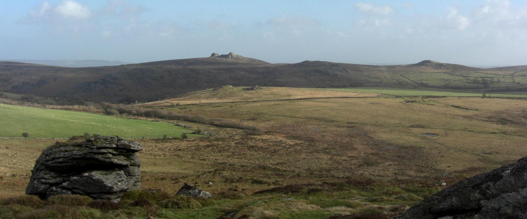 Holwell Rocks centre shot from Chinkwell Tor An edited version of this article appeared in Dartmoor Magazine - Winter 2023, Issue 152 p18-20.Coming down the road from the direction of Great Hound Tor (Swallerton Gate) towards Haresfoot Cross on Dartmoor (SX 7379 to 7376) the visitor cannot fail to be impressed by what appears to be a small tor on rising ground to the left shortly before reaching the dip and crossing the cattle grid in Snodders Bottom. This is Holwell Rocks (HRs) not to be confused with the much grander Holwell Tor that is set at about a mile to the east on the far side of the beautiful Hound Tor Combe. Reasonably well documented in the 20th Century literature of the moor, the Rocks here have surprisingly succumbed in recent years certainly post 2000 to considerable confusion over their location. It is only with the publication of Max Piper's (MP) book on 'East Dartmoor's Lesser-Known Tors and Rocks' in 2022 that we at last get a definitive descriptive record of not only the rockpile and its correct position on the moor but also a confirmed grid reference (GR) of SX 7391 7769 along with a superb photograph. This short article will identify from an historical perspective the probable reasons why there has been so much difficulty in finding these so obvious outcrops since the start of the 21st Century. 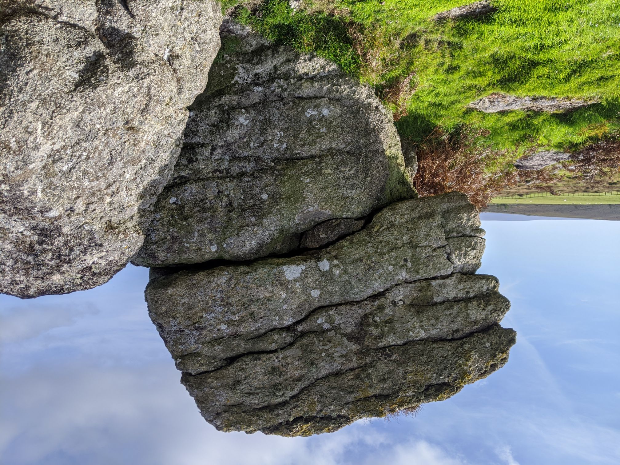 Holwell Rocks stack. Photo by Max Piper Unsurprisingly William Crossing is the first to mention Holwell Rocks in his book 'Gems in a Granite Setting' from as long ago as 1905 (1986 edition p83) where in the chapter on Hound Tor Combe he describes them as 'a tor above Holwell Farm'. Writing later in his Guide to Dartmoor from 1912 (1990 edition p312) we get a little more detail. During excursion 83 that explores the Combe on a journey from 'Widecombe in the Moor via Hemsworthy Gate' he explains 'On the L., or W., side of the Combe is Holwell with Haresfoot Mires below it, and beyond it on Holwell Down, the little pile sometimes known as Holwell Rocks.' For anyone who takes the time to absorb that description it is relatively straightforward especially as Holwell Down is not only clearly shown on modern day Ordnance Survey (OS) Maps but has been depicted at that site since at least 1888. Regrettably though, and still to this day there is no detailed representation of any granite at this point. Eric Hemery (1983) is the next to mention the Rocks in the tome High Dartmoor where on page 731 he provides the following coherent account 'The route of the path from Beltor Bog to a point west of Grea Tor, from where it drops north-eastward into the border country, is visible from Holwell Rocks (approx. 1,275 feet), a small though interesting tor of two piles on Holwell Down.' He goes on to explain that the east pile is also known locally as 'Big Rock' and that it 'is a huge cohesive mass; on its north side is a very large, isolated boulder.' In 1986 the well-known author Brian Carter (BC) writing for the Herald Express in August of that year not only names the Rocks but also shows their location on a hand drawn map of the area. A few years later he comments on the continuing lack of representation on OS maps. So, given such clarity by the two best-known commentators on the Dartmoor landscape in the shape of messieurs Crossing and Hemery and another extremely respected writer and authority in the form of BC why is it that in such a short period of time that people have been unable to correctly identify the location? There could be several reasons for this. Despite Hemery's account and the fact that he too shows a photograph of the Rocks on page 727 that is set in context to other piles in the area, the OS continue to this day to neither name nor represent the small tor on their maps. As the name of Holwell is also associated with many other features in the area namely Down, Lawn, Tor and Farm and this may have contributed to the confusion given that as previously mentioned the sprawling and much better-known tor by the same name is set way across Hound Tor Combe to the east. However, the more recent problems with interpretation seem to have stemmed in part from Terry Bound's (1991) entry in the A to Z of Dartmoor Tors. Although he gives an accurate description from Crossing who he says 'refers to the stack of rock on the east of the Hemsworthy Gate-Swallerton Gate road as Holwell Rocks' and this is then followed by a reference to a point where walls meet where the author remarks 'there is in fact two separate piles the higher one being at this junction' his ensuing GR of SX 742783 is considerably awry. In 1995 Mike Brown becomes the first to give an accurate GR of SX 739776 for the Rocks in his 'Gazetteer of Dartmoor Names' a fix that concurs with MP's eight figure GR. Writing much later in 2013 and by now far more contemporary and influential Ken Ringwood in his book on Dartmoor's Tors, who may have been swayed by Bound's error on the GR, places the Rocks somewhere on Hound Tor Down at a point well to the north and east of the correct location at a small outcrop close to the wall on rising ground overlooking the magnificent Greator Rocks. He supplies a mystifying GR of SX 744784 and the outcrop here is nothing to do with Holwell Rocks neither matching the original description nor anywhere near the true location. 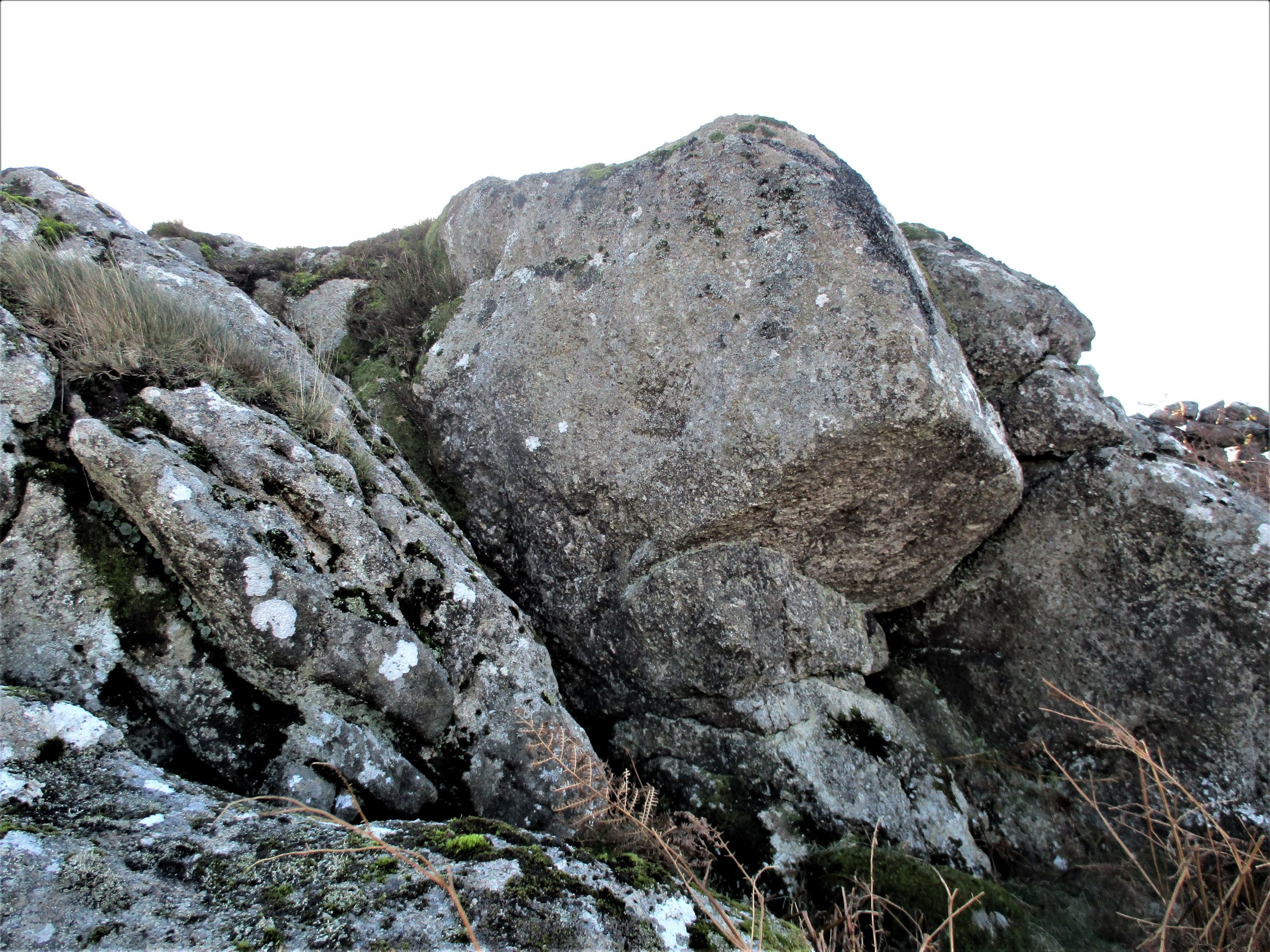 Outcrop on Houndtor Down But as errors in the literature tend to be repeated MP had cause to correct yet another mistake on the location of the Rocks in the Dartmoor Magazine as recently as 2021. To make things even more complicated in that very same year the Devon Wildlife Trust who now own the land on Holwell Down and thinking that the Rocks were unnamed after checking with local people and a succession of maps, decided to informally christen the pile 'Phoebe Tor' in honour of Phoebe Wortley-Talbot (1926-2009) who left a legacy to the Trust. Unfortunately, that name that was clearly offered in good faith, now appears on at least one notice board approaching the Down and will without doubt influence the perception of visitors to the area in the future. An article on the reason for the naming the pile 'Phoebe' later appeared in Dartmoor News (Nov/Dec 2021) number 181 (p 46-47) crucially remarking that 'there is considerable scope for confusion between the names Holwell Rocks and Holwell Tor which if used to plan routes could take people about a mile in the wrong direction across a very deep mire'. At the time of writing MP is negotiating with the OS to get the name of Holwell Rocks correctly added to their maps to deter any future confusion over their location. If we need reminding this now being nearly 120 years after the Rocks were first identified by William Crossing. Other things to see in the areaPutting the Holwell Rocks conundrum aside there are a few other interesting things of note in the vicinity. If you fancy a visit to the two sites one of which on Holwell Down is correct, the other on Houndtor Down that is wrong, these artefacts are still well worth seeing although the horseshoe jump, and giant haystack have long since gone. 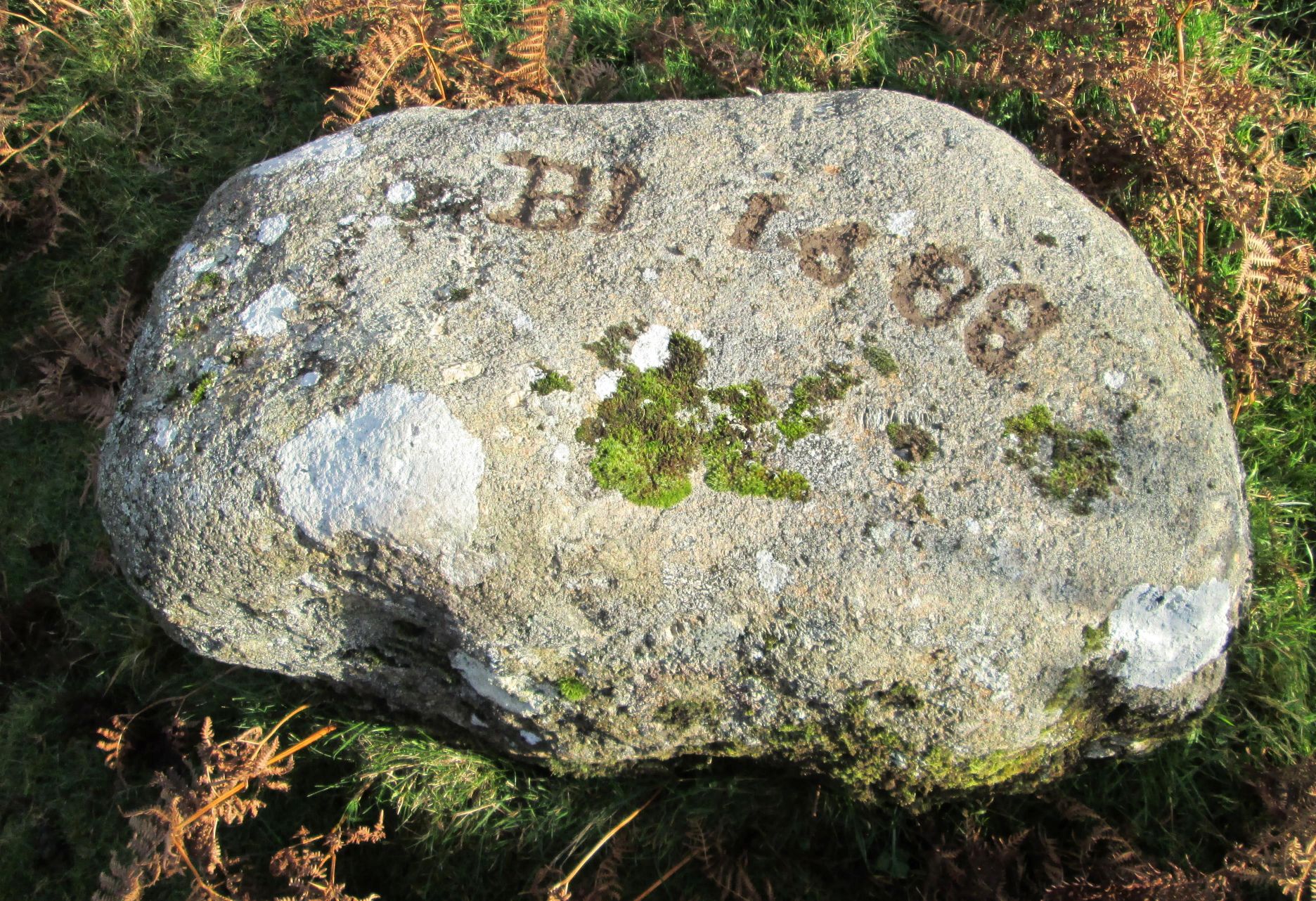 Inscribed Stone BI 1688 Snodders Bottom There is a flat inscribed stone near to the cattle grid where the road crosses Holwell Brook in Snodders Bottom at SX 7388 7793. Set on the bank on the west side of the road to the south of the grid it bears on its upper surface the letters 'BI' and the date '1688'. Dave Brewer (2002 p 90) suggests that both the stone and stream might be on and old Manorial boundary possibly of the sub manor of Holwell. Could the letters be representative of Bagtor and Ilsington as with other stones in the area? 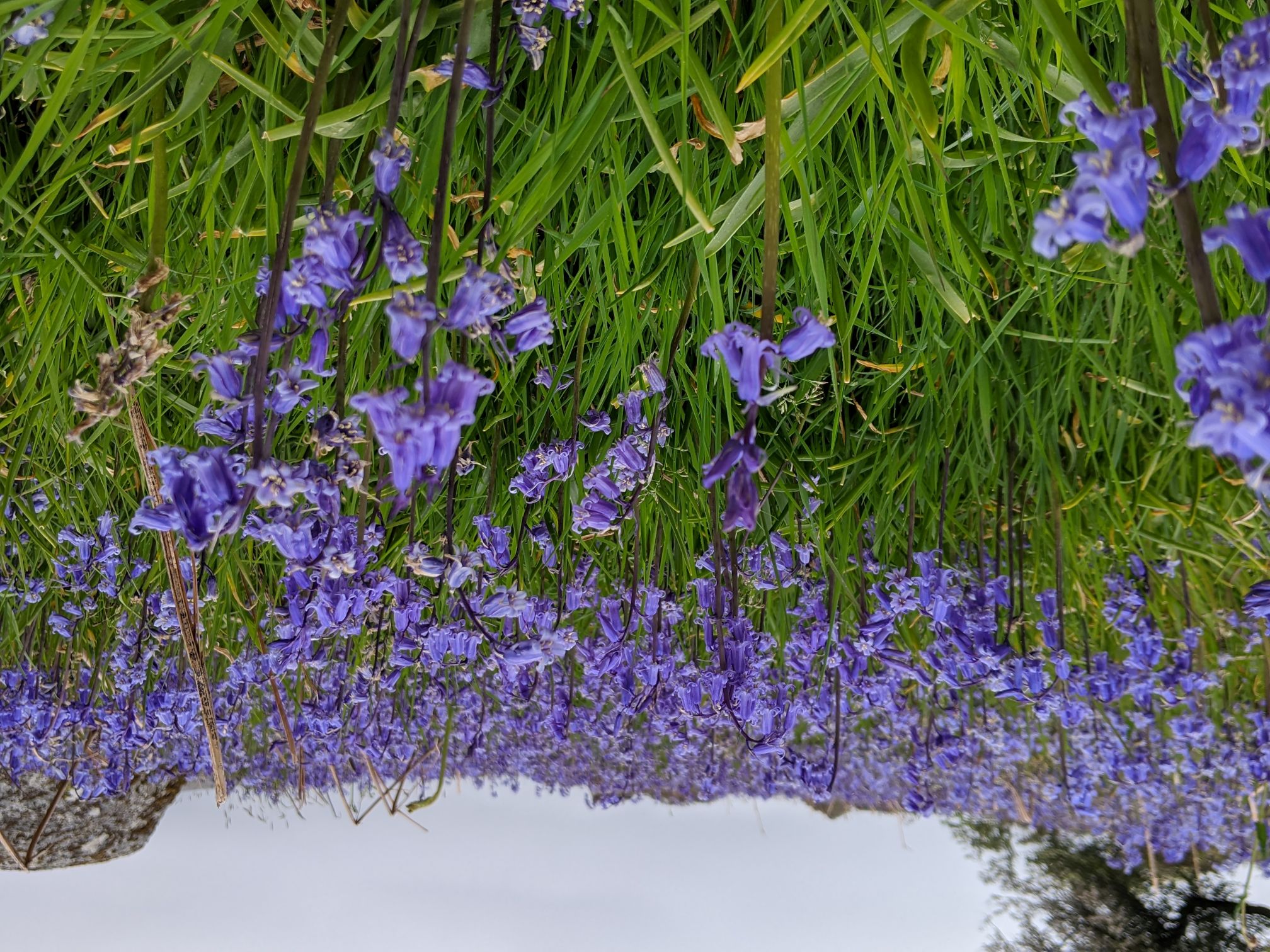 Holwell Lawn bluebells. Photo taken by Max Piper Holwell Lawn lies to the north of Holwell Down and is renowned for its dazzling display of bluebells that attracts visitors from far and wide to enjoy the annual spectacle mainly during the month of May but sometimes extending into early June. However, since May 2022 there is now something else to look out for. Expertly carved onto the southeast side of a large boulder at SX 7433 7806 is an official commemorative plaque to Queen Elizabeth II during her Platinum Jubilee year. It reads 'The Queen's/Platinum Jubilee 2022/' with a '70' and a crown interwoven within a circle. From here a point of note is that Holwell Rocks are visible on rising ground to the southwest. 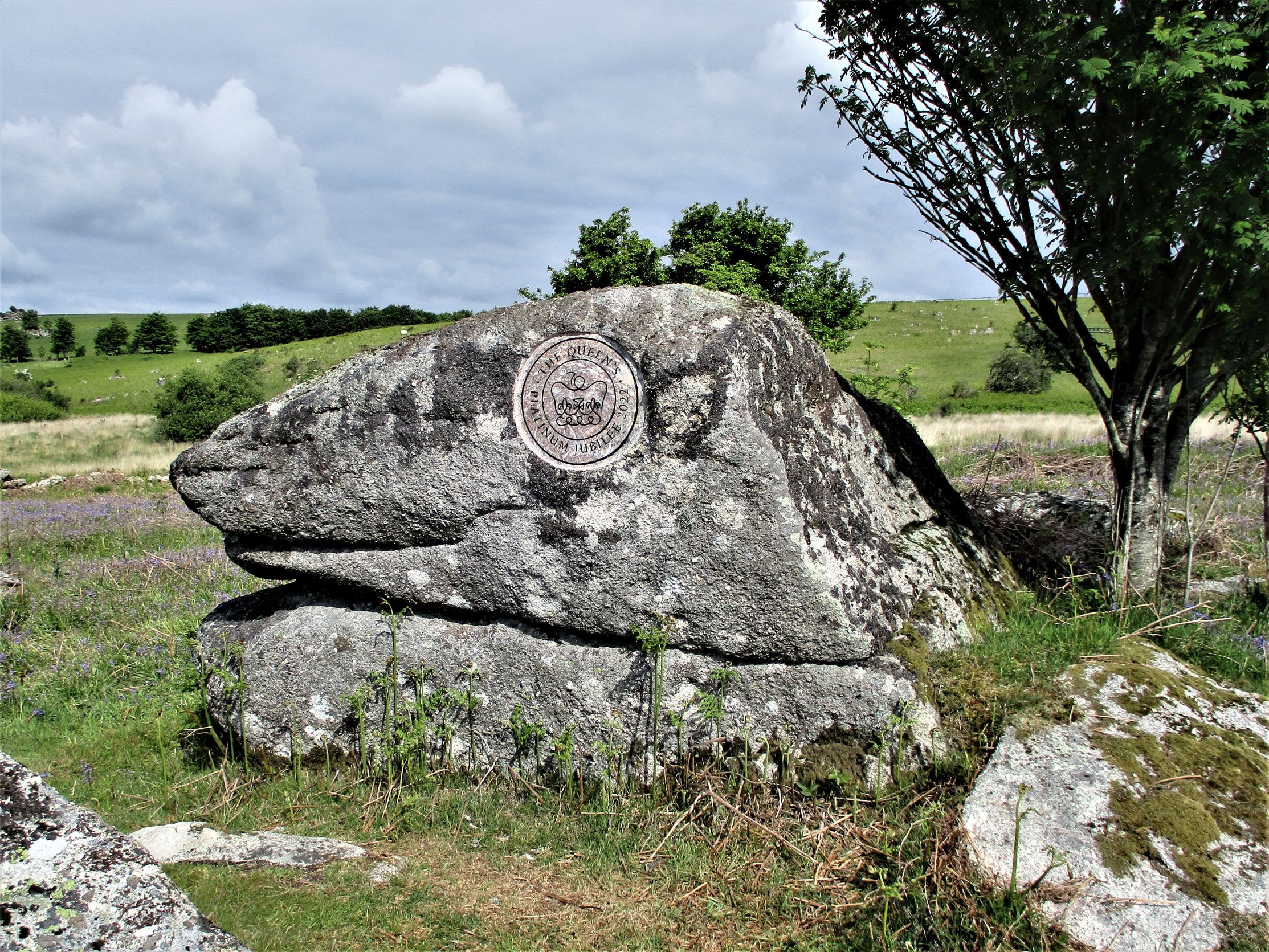 Holwell Lawn Jubilee Rock 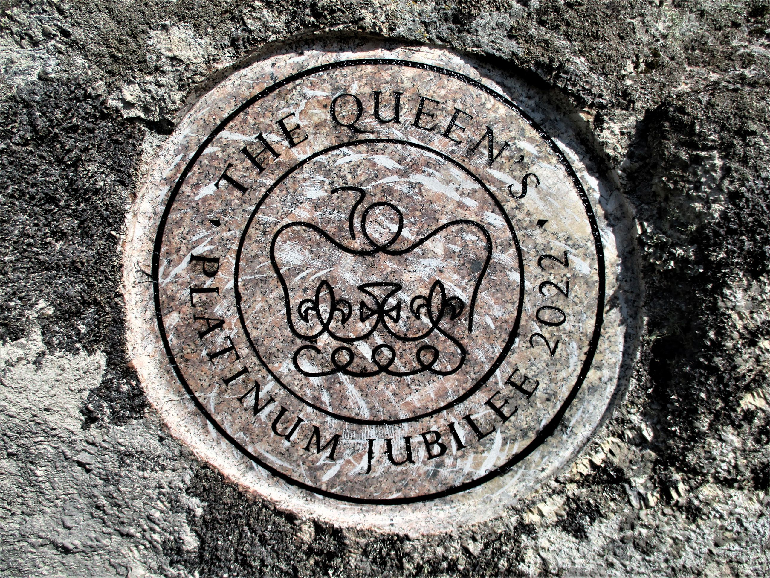 Jubilee Rock Insignia close up Please be advised that Holwell Lawn is owned by the South Devon Moorland Pony Club and that whilst public access is granted at most times of the year it is important to observe local signage and any restrictions that might be in place during competitions.  Holwell Horseshoe Jump 2014 Set at an angle in the northern wall of Holwell Lawn, Dave Brewer (2002 p102) refers to an out of context boundary stone about 100 metres above the rogue outcrop on Houndtor Down at SX 7438 7842. The author describes it as a 'spare stone' said to have been cut in 1835 and it bears on the north side a cross barred 'I' for Ilsington. 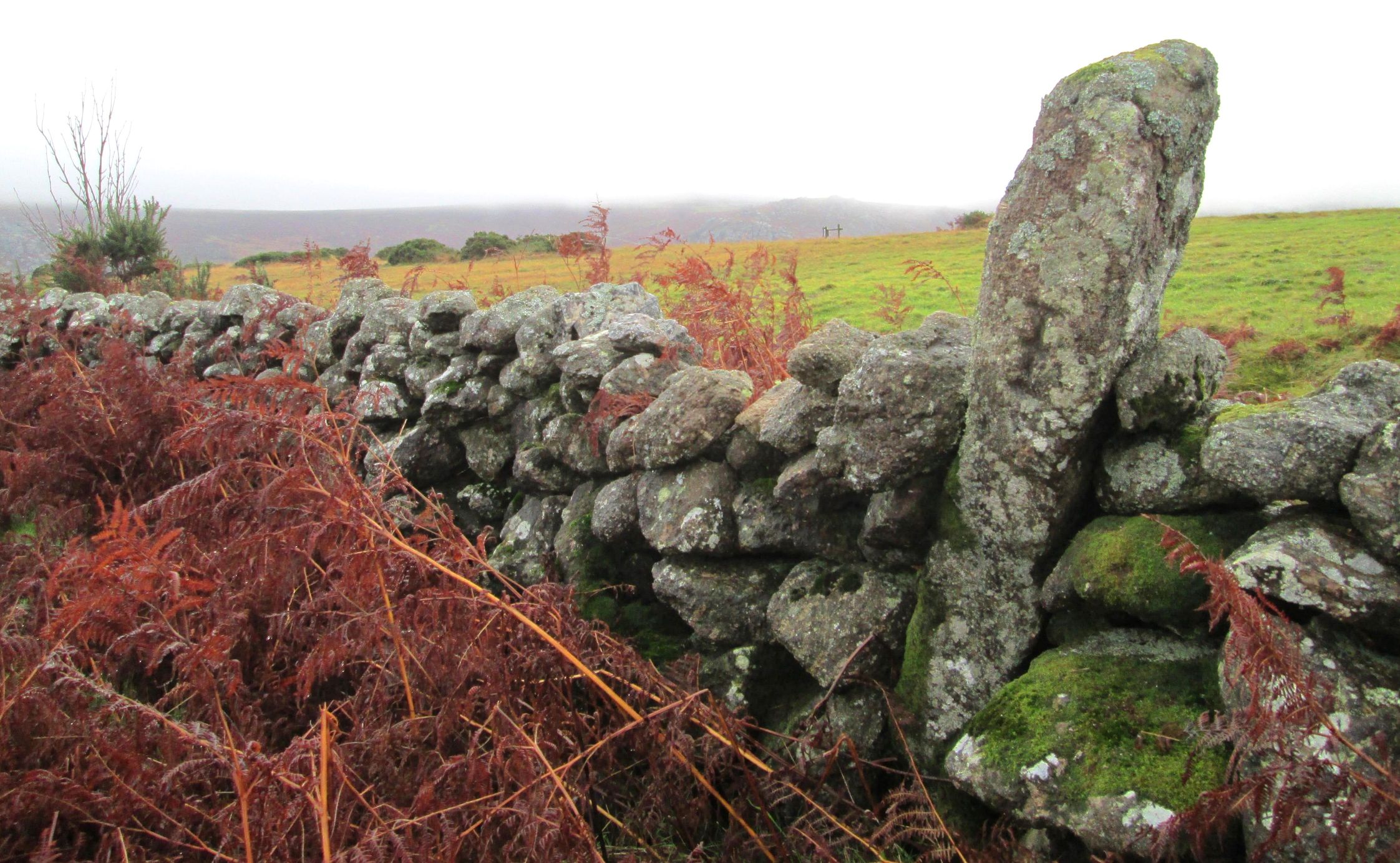 Ilsington Boundary Stone, Houndtor Down For an historical note in October 2009 a quirky giant stack of haybales was erected on Holwell Down close to the outcrops and at the time it was a curious feature that was often mistaken for a tall rockpile from afar. It later acquired a plastic pterodactyl atop. The stack was removed soon thereafter but not before the author managed to get a photo taken. 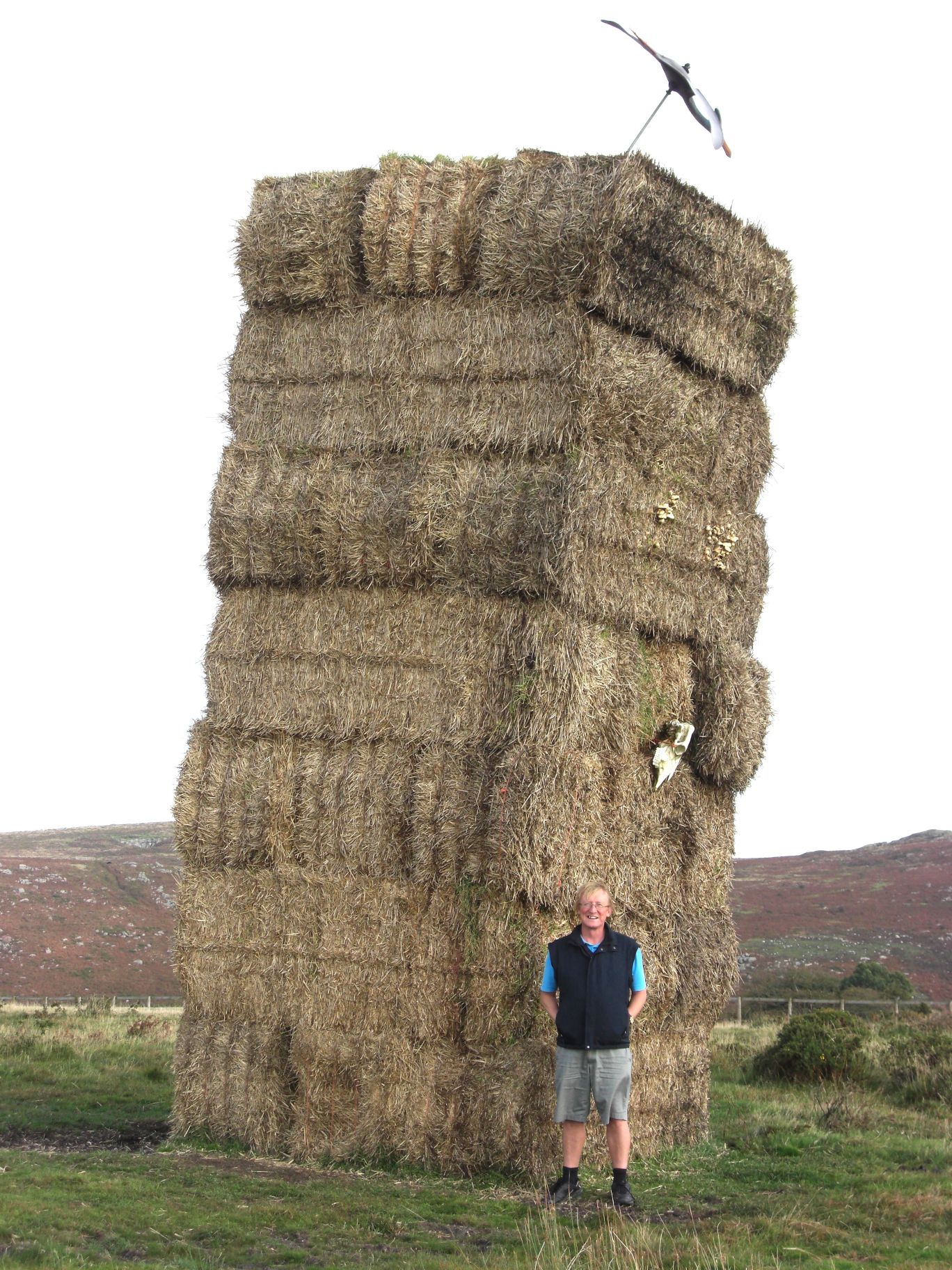 Holwell Down Haystack and TJ 2009. Photo taken by Ann Jenkinson Conclusion:Unfortunately, the location of HRs has in recent years become strangely problematic and has led to numerous misinterpretations with inaccurate descriptions and grid references and even the application of a new name to the small tor in 2021. This once again illustrates how easily errors in the literature can be repeated from person to person and how the lack of OS representation for an area can encourage unnecessary speculation. In this instance there was never any reason for mistakes given both Crossing and Hemery's accuracy in reporting. Thankfully Max Piper has set the record straight for 2022, and this article will hopefully reinforce that message. Once the name of Holwell Rocks properly appears on OS maps then that should be the end of the matter. References:
|