TORS OF DARTMOOR EXTRA
a collection of extra material from the tors of dartmoor team
The River Dart East and South of Luckey TorTim Jenkinson on 22nd November 2025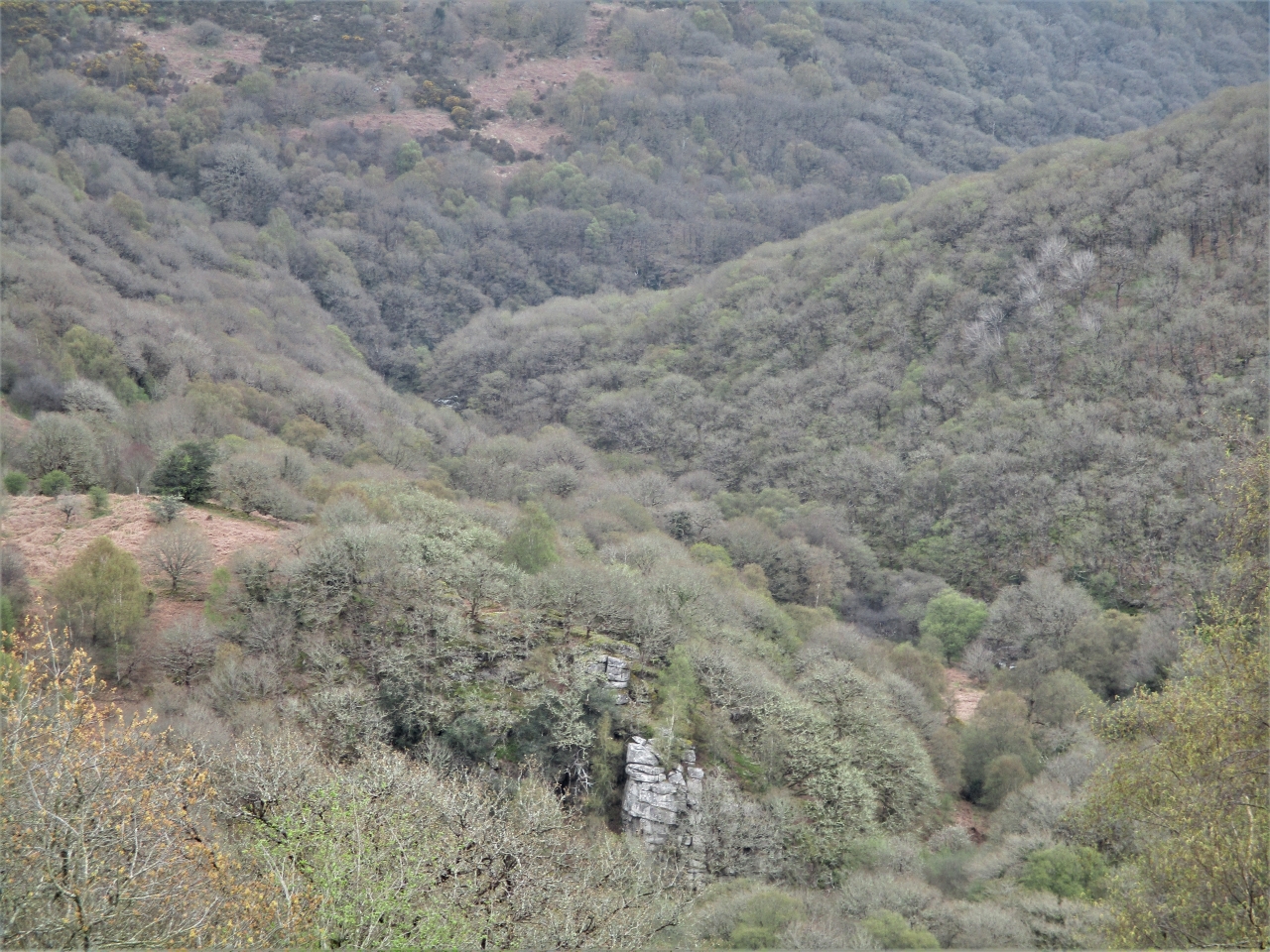 Luckey Tor. Photo by Tim Jenkinson This article is a companion piece to an account that appeared In Dartmoor Magazine number 153 (Spring 2024) under the heading 'The River Dart South of Dartmeet'. It provides details on the various rockpiles that can be located beside and high above the riverbank between Luckey Tor and New Bridge. Whilst it is a dramatic landscape that can be visited in sections, care must be taken in the often rocky and uneven terrain. Broadstone SX 6888 7235Leaving the magnificent rock face of Luckey Tor the next point of interest lies close to the foot of Simon's Lake a short water course that empties into the main river from the north. Here there are a series of curious flat boulders smoothed over by centuries of the downstream torrent that extend into the very heart of the river.  Broadstone. Photo by Tim Jenkinson Marked as Broadstone on Ordnance Survey (OS) maps this spectacular vantage spot is also referred to as Brad, Broad and Broada Stones in the literature. Understandably given its location with spectacular steep hillsides and almost impossible gradients to the east the area has been romanticised and has become associated with various myths and legends linked to a phenomenon known as the 'Cry of The Dart'. Information gleaned from the Tors of Dartmoor (ToD) website (2025) indicates that William Crossing (1912) was one of the first to describe the effect in Guide to Dartmoor where on page 458 he states: 'Opposite to the extremity of the promontory [Bench Tor] Simon's Lake falls into the river, and here are the boulders known as the Broad Stones. To "heer the cry o' the Brad Stones" is a sign of coming foul weather.' Later in 1951 Ruth Manning Sanders (1886-1988) repeats that assertion describing Broadstone as 'those boulders that are said to 'cry' when foul weather is coming'. The stones have also played a part in the legend of Jan Coo of Rowbrook who disappeared after following what he thought was the call of his name to the river below. 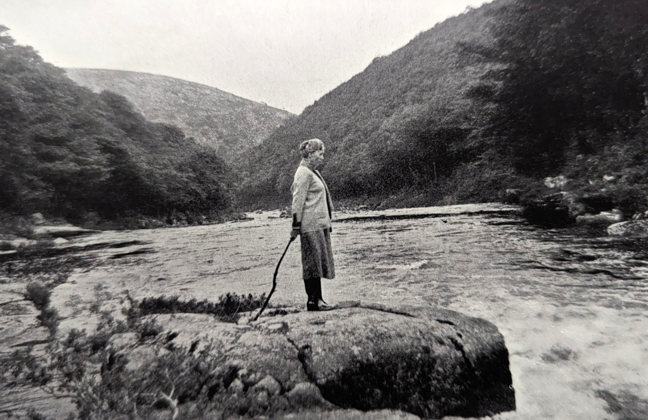 Beatrice Chase at Broadstone 1931 Eric Hemery (1983 p594) seems to explain the cause of the sound: 'As the river by-passes Broada Stones, it is confined in a small canyon, and when a wind blows through the gorge, it produces a strange, high-pitched sound amplified by the great natural sound-chamber.' Other authors such as Lady Rosalind Northcote in 1908, Beatrice Chase in 1928 and Nancy Van Der Kiste (NVDK) in 1990 have linked the 'cry' to various legends associated with the well-known Devonian rhyming couplet of 'River of Dart! O River of Dart! Every year thou claimest a heart' that is used at the start of a poem by Edward James Mortimer Collins from 1865. Since then that verse has been used to explain away a sequence of fatalities along the river. Indeed, the Dart is certainly a dangerous and twisting watercourse but strangely over time the simple two lined verse has become misrepresented. Most notably and perhaps the most puzzling is by Beatrice Chase herself in the book 'Through a Dartmoor Window' a reprint from 1928 where on page 12 she quotes 'River of Dart, River of Dart, Every Year Thou Demandest a Heart'. The same author is pictured at the spot in 1931 in her booklet entitled 'Dartmoor Snapshots', standing on one of the furthest stones set into the very middle of the river. Simon's Lake Tor SX 6900 7231About 150 metres or so to the east of Broadstone and on the same side (north) of the river is a fine tor first noted it seems in recent times by Steve Grigg. It is surprising to find no mention of this towering cliff like pile anywhere in the literature and most oddly it is the failure of William Crossing to mention it even though he describes a route along the riverbank that would have taken him beneath the rocks. 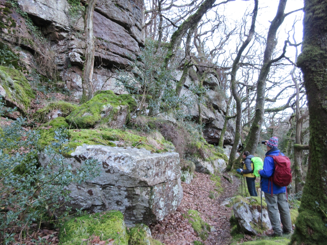 Simon's Lake Tor. Photo by Tim Jenkinson This account of the site appears on the ToD website for 2025: 'The tor here presents as a grand rugged rock face that rears up from just above the riverbank and is quite humbling to stand beneath. It gives the impression of a rarely visited place set as it is under the far southwestern edge of the precipitous slope of Mel Tor (Mil Tor) Wood'. It certainly is a secluded spot beside the Dart and the upward sweep and declivity of the steep wooded hillsides on both sides of the river are well appreciated here. Mel Tor SX 6934 7260Next in sequence is the best-known tor on this circuit. Mel Tor is a tremendous rockpile but is much better accessed with ease from Bel Tor Corner to the north rather than trying to climb the precipitous slope from the river up through the trees. This route can be done but it is torturous. The sprawling outcrops of the tor extend for a great distance under and to the west of the trackway known as Doctor Blackall's Drive tumbling down the slope towards the river. 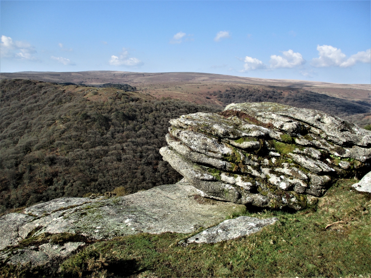 Mel Tor view. Photo by Tim Jenkinson The ToD entry is as follows; 'This is an excellent and romantic granite tor with great views of the Dart Valley and Venford Reservoir, with the Bench Tors beyond. As well as boasting good geology, it is very easy to access. This is from the north at Bel Tor car park with only a 5-minute walk to the tor. The summit of Mel Tor is adorned with small, irregular rock basins that occasionally trap rainwater. A fine millstone can also be found on the south side of the tor at SX 69346 72531, its abandonment indicative of stone cutting on the tor in times gone by. The tor spills far into the woodland of the same name below, spreading on the slopes beneath the summit rocks with many sizeable outcrops to the south and west, and there is an outlying stack to be located at SX 69466 72480'. Earlier Eric Hemery (1983) questions the modern version of the name as used on OS maps; "East of Simon's Lake is the greatly weathered pile of Mil Tor (1,125 feet) which, like its westerly companion Sharp Tor, stands in a commanding position six hundred feet above the valley floor. The common map version of the name, 'Mel' Tor, is a mistranscription of the accepted vernacular corruption of 'middle', which is 'mil'; just as Mil Tor (E. Ockment) is the middle tor of the three, so is this pile intermediate between Sharp and Bel Tors." Hockinston Tor SX 6952 7194This is a fine wooded tor with extensive clitter that is marked by the OS but is not that well defined in terms of its outcrops and so therefore requires some exploration and effort to locate. This has led to it gaining a somewhat unfair reputation as an elusive and obscured rockpile, but it can be reached with perseverance. 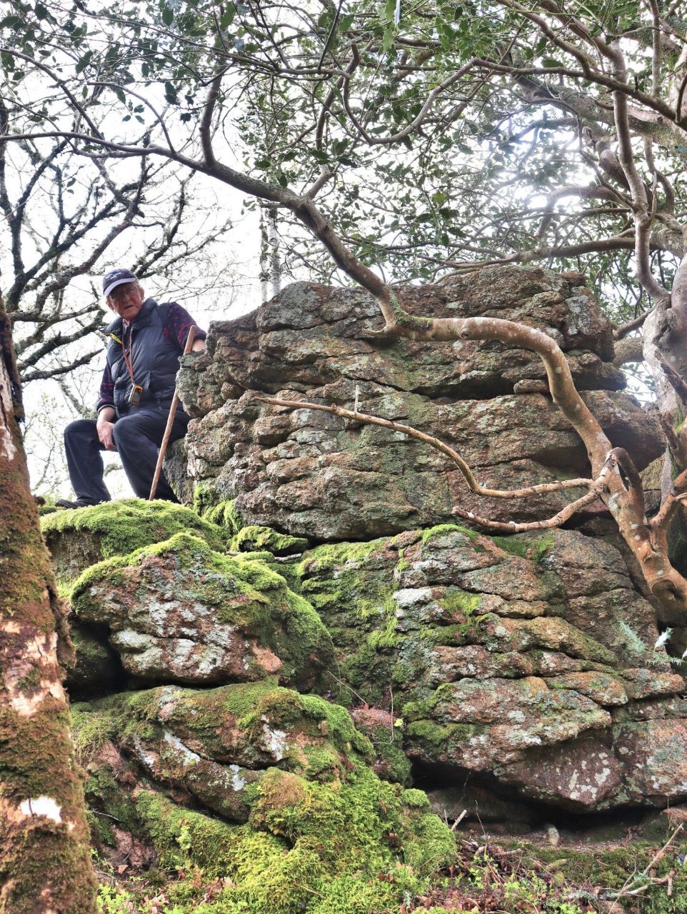 Hockinston Tor. Photo by Paul Buck It is described by Collingwood (2023) as being 'close to the edge of the granite and so is altered and affected by veins of tourmaline and pink feldspars. The metamorphic alteration has rendered it vulnerable to weathering, with gravity aiding its denudation to a mere rocky outcrop' then adding insult to injury it disappointingly receives an Arbiter's score of 2/10. This is a rather typical attribution for this tor that offers so much more where its position high above the Dart alone merits more consideration. 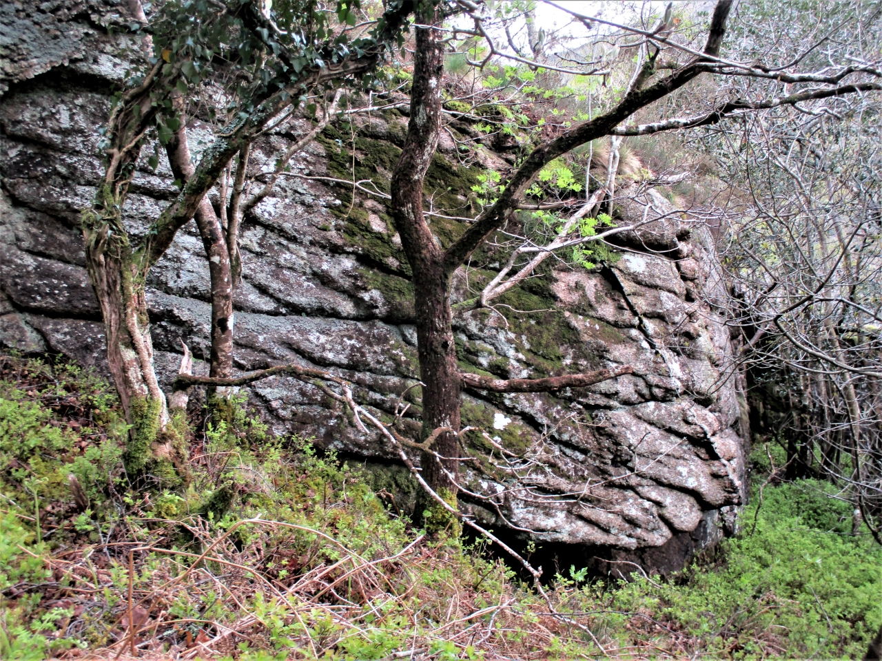 Hockinston Tor. Photo by Tim Jenkinson Thankfully there is more positivity from the ToD entry for 2025 where the following description appears; 'There is one main linear outcrop that extends downhill to the river, and atop this, the visitor is rewarded for their efforts; a most splendid view, encapsulating the valley below Bench and Sharp Tors, captures the attention, with the distant roar of the river a stark reminder of the erosion it caused to carve this deep chasm. It is recommended to take the time to enjoy this perspective of the valley and notice the tumbling rocks of North Bench Tor in White Wood. The rich texture of the trees will leave you spellbound'. Double Dart Rocks SX 7011 7077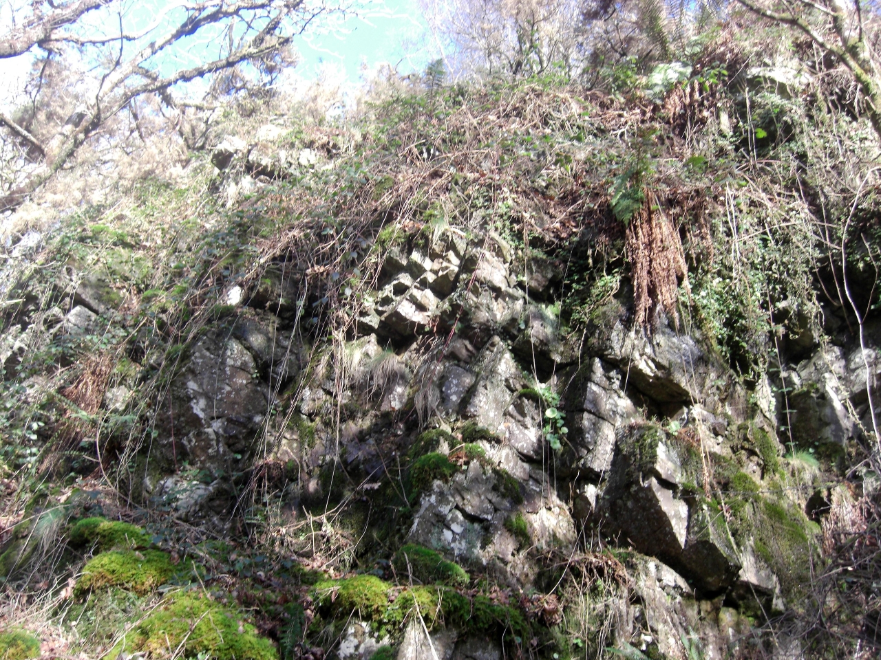 Double Dart Rocks. Photo by Tim Jenkinson The final rocks of note on this excursion reside on the east bank of the river at a place referred to by Eric Hemery as 'Double Dart'. He offers this description on page 589 of High Dartmoor; "a characteristic though nameless compensation for the humble Aish Tor. Protruding from the final steep of the hill like a huge buttress, its top weathered to smoothness, the crag looks best from beneath the trees on the valley floor beneath the precipitous slope, opposite, of Holne Wood; between them, Double Dart approaches Deadman's Corner and Wellsfoot Island, and the crag is a fitting place from which to behold, as well as hear, the departure of this swift river...". 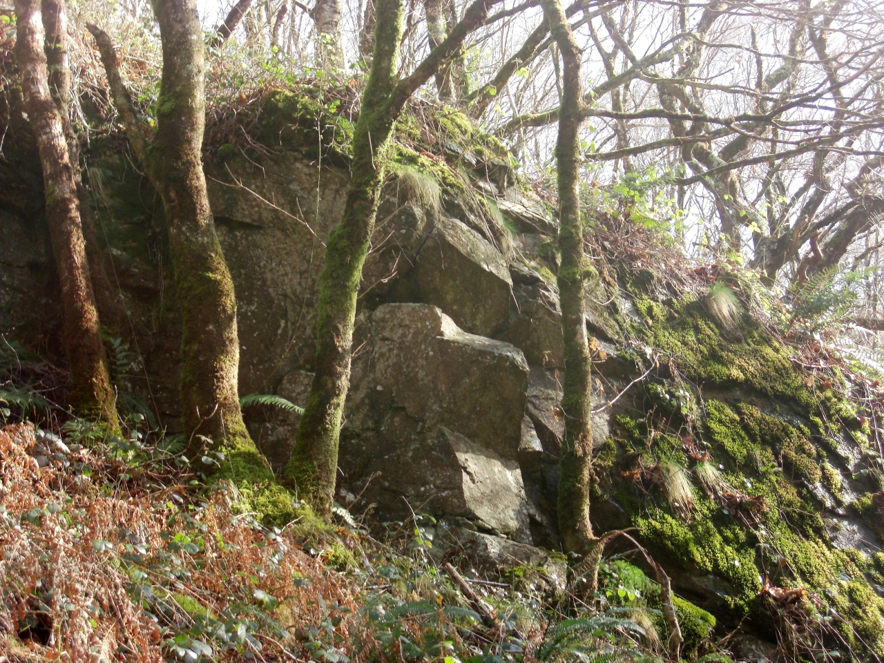 Double Dart Rocks in trees. Photo by Tim Jenkinson Whilst presenting as a rather scruffy cliff of metamorphic rock there are nonetheless some lowly outcrops jutting from the slope that are mostly draped in vegetation and are certainly more prominent in the winter months when the scrub has died away. Given its location the name of Double Dart Rocks seems appropriate. The section of river Dart that runs downstream from the foot of Luckey Tor towards New Bridge is spectacular and within its densely wooded slopes are concealed some very interesting rockpiles. Mingled with the much better-known Mel Tor are several lesser appreciated features that have received rather scant attention in the literature of the moor. It is hoped that this short article has helped in part to redress the balance. References:
|