TORS OF DARTMOOR EXTRA
a collection of extra material from the tors of dartmoor team
Dartmoor Discovered: Smeardon Down and Twyste Lane: Some Tors and Rocks ExploredTim Jenkinson on 17th Feb 2026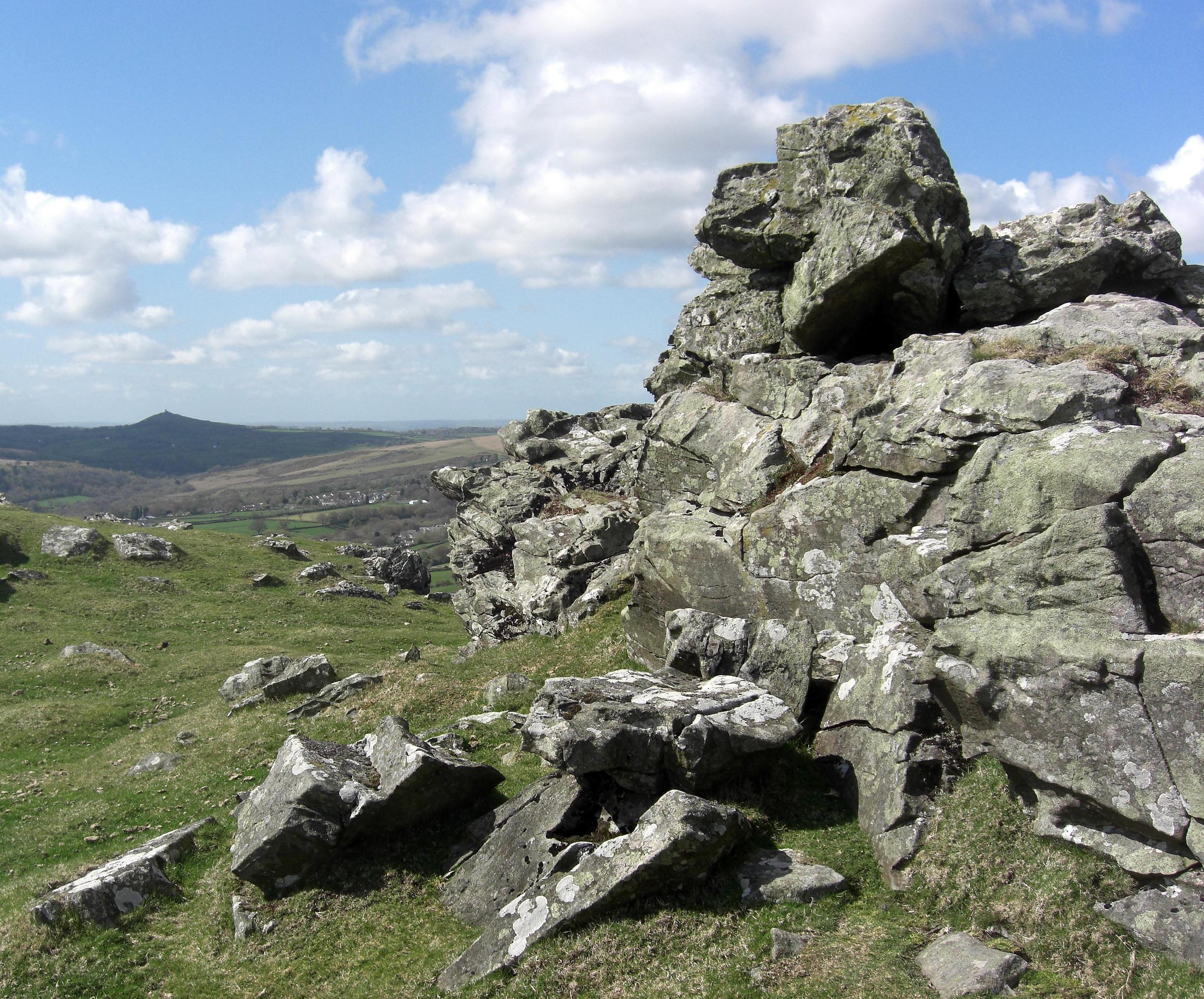 Smeardon Down Tor. Photo by Tim Jenkinson An edited version of this article appeared in Dartmoor Magazine - Summer 2023 Issue 150, p24-26.Situated at about half a mile to the east of the village of Peter Tavy on the western side of Dartmoor, it seems that the present day Smeardon Down (SX 522780) was once known as 'Smear Ridge' and is shown by this name on 19th Century Ordnance Survey (OS) maps of the area. In 'One Hundred Years on Dartmoor' William Crossing (1902) makes the earliest literary reference introducing another name when he writes 'Smearn Down (Peter Tavy) east of the village its crest is sometimes called Smear Ridge and on it are several small tors, Boulter's Tor at its eastern end being the principal'. The starting point for exploration of this area is the small quarry car park at SX 5218 7788 and across the slopes of Smeardon Down there are numerous non granite outcrops that Ken Ringwood (2013) puts at seven, however this seems a rather conservative estimate as surely there are more. In Gems in a Granite Setting Crossing (1905) provides an evocative account of the scene from the summit of the ridge where he describes a 'truly magnificent view' where 'the beholder looks down upon a vast sweep of cultivated country with the Cornish hills rising beyond, while in the foreground is the valley of the Tavy which can be distinctly traced from Tavistock to the Commons above Wapsworthy'. Writing about the very same vista nearly a 100 years later in 2002 I observed 'Although of lowly stature, the tors do provide long views to the northeast which are especially fine and take in the distant Great Links Tor and the impressive pile of Hare Tor above Tavy Cleave'. The first two outcrops on Smeardon Down are located way down on the north-western slopes just above enclosure walls at SX 5179 7828 and on a clear day overlook the church towers of both Peter and Mary Tavy villages. From here there is a progression of rock piles eastward all hugging the ridge, a line which terminates in the only ones with documented names the duo of Boulters Tors above Twyste Lane. One of the flat-topped outcrops on the ridge was used as the base for lighting the Peter Tavy beacon to commemorate Queen Elizabeth II's Platinum Jubilee on the evening of Thursday June 2nd 2022. The site was chosen here as it was high on the ridge and could be seen from Blackdown and Mary Tavy to the north. 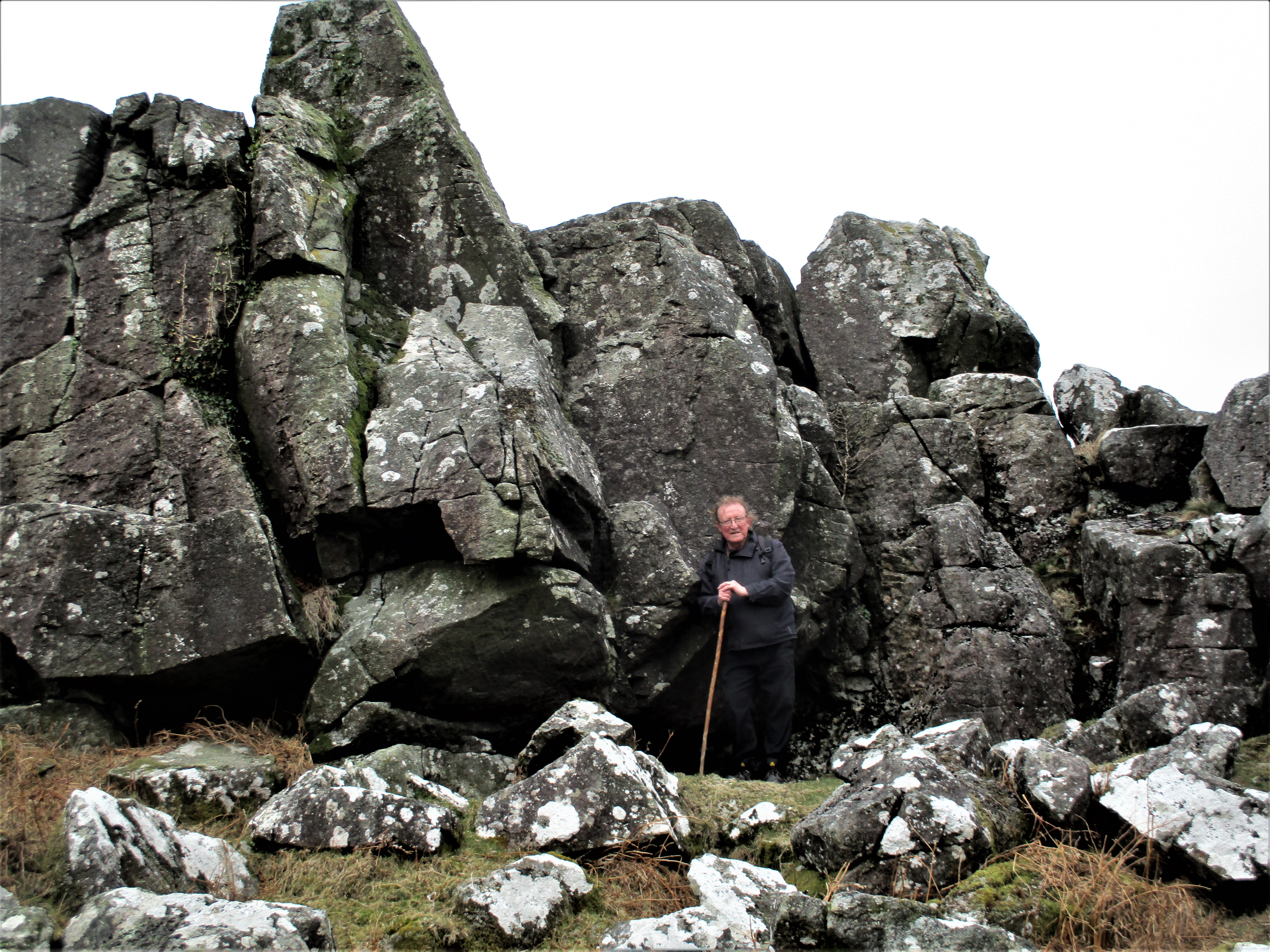 Boulters Tor and Author. Crossing (1905) describes Twyste Lane as 'an opening between some newtakes' and that 'the track runs out to the commons and may be followed to Walkham Head' As the main rock pile on the ridge Boulters Tor (SX 5247 7807) is impressive if a little disorganised and dark and in his commentary Eric Hemery (1983 p957) explains the location of another tor 'A small pile above Twyste Lane near which a path runs to Twyste is called 'Little Boulters', and that the higher main pile 'is involved in the well preserved outer wall of the Twyste enclosures'. Writing again in 2002 I commented on the lower tor at SX 5232 7801 as follows 'Little Boulters is crowned by a huge split and weathered rock and on the east side a substantial rock face has been flattened through weathering to such an extent, that a series of low steps have appeared in the rock. This natural 'staircase' has facilitated the short climb to the top of the tor from where a splendid scene unfolds. Peter Tavy village and church are visible west, whilst to the south the giant dome of Cocks (Cox) Tor Hill towers over the nearer piles of Sharp and Great Combe Tors across the valley.' From here another lowly pile rather scruffy in appearance can be seen just below the lane at SX 5255 7793, this in recent years having acquired a local name of Furze Tor on account of the number of gorse bushes running up and over its main rock face on the south side. Views from the summit wholly compensate for the rather ragged rocks and are especially good to the east and south where from viewing left to right the piles of White, Set, Great Mis, Roos and Great Staple Tors can be seen. 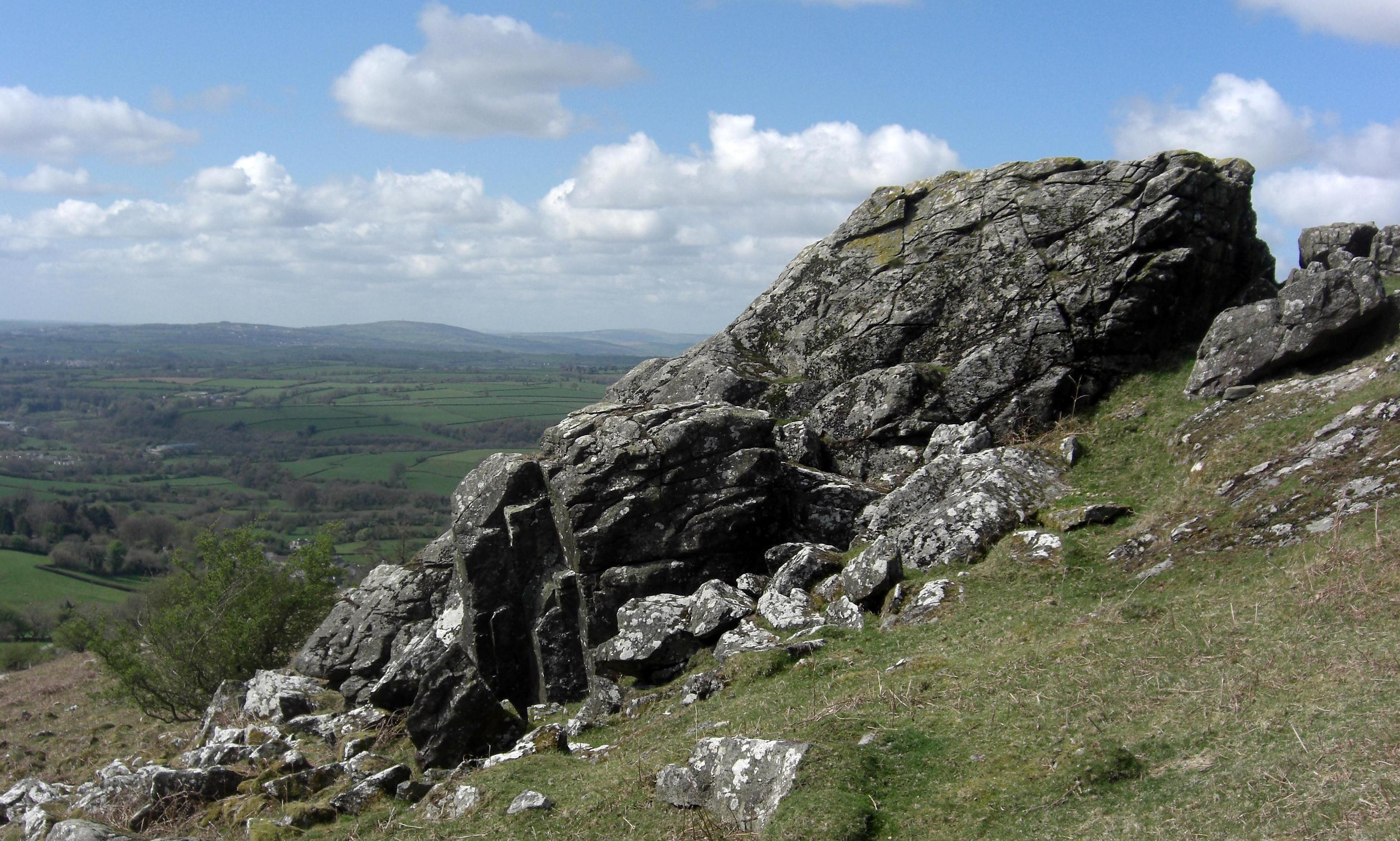 Little Boulters Tor Returning to Boulters Tor Hemery advises that 'On its brow is another more broken crag and under the south-west side of this a circular enclosure forty-two feet in diameter, presumably a very small pound'. This crag is now taken to be the small pile known as Twist Rocks at SX 5263 7813 that is set just inside the gate off the path leading to the hamlet of Cudlipptown at one mile distant. This outcrop is also involved in the wall and has a similar weathering effect to that of Little Boulters on the east side. 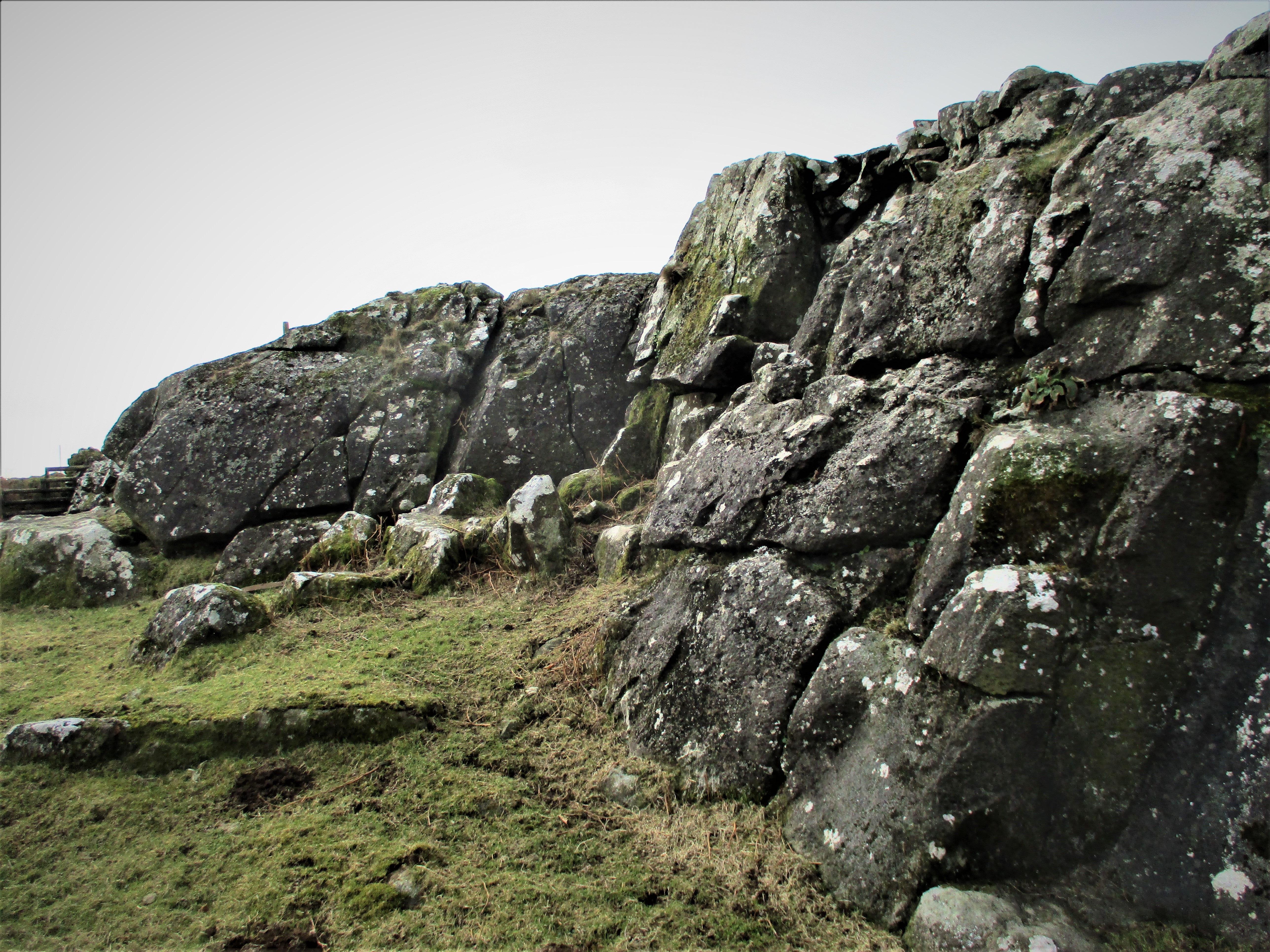 Twist Rocks The rocks here lie little more than 100 metres above the ruin of Twist Farm that is still marked on modern OS maps. According to the Devon and Dartmoor Historic Environment Record (MDV108041) Twist is a 'small early medieval farm on the edge of the moor part of the Cudlipptown Manor. Mentioned in the Domesday Book' and is recorded as 'deserted in the 20th Century and now derelict'. 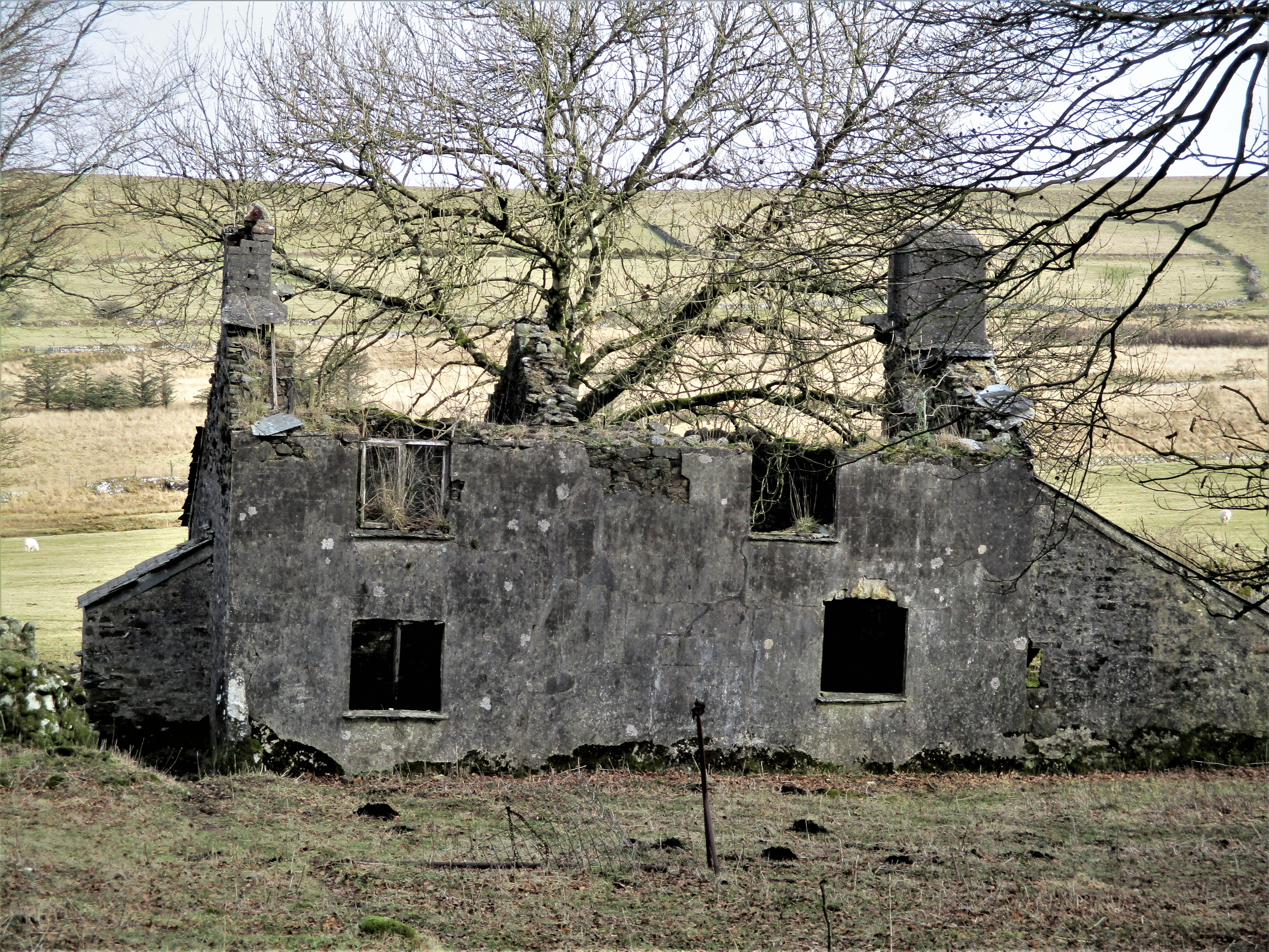 Twist Farm The farm features in a story from The Western Morning News and Mercury on May 8th, 1924, that is entitled 'Loss of Memory: Unknown Woman at Peter Tavy' the extract reads: 'A young woman of prepossessing appearance, well-dressed and well-spoken was found wandering at Petertavy near Tavistock a few days ago. She went on April 30th to a Mrs Harvie of Twist Farm and asked to be taken in. Mrs Harvie consented and although she has questioned the woman, she has not been able to elicit any information from her as to her identity. The woman is evidently suffering from loss of memory.' We learn four days later that the woman is known as Gwendoline Bradfield and is a costumier of Bath 'whose husband has recently been visiting Plymouth on business' and that the lady has been in 'indifferent health for some time' and that she 'left her home mysteriously on April 29th and up to the present she has been unable to account for her movements since then.' The news piece concludes that although she has been identified by her husband and her health has improved 'it has been decided that she shall remain in her present surroundings in the hope that her recovery will continue.' Although the Harvie family were long time occupants of the farm it seems that one of the last inhabitants was ex-army man Gilbert Pomeroy in 1952 (Herald Express) shortly before the building was abandoned and later fell gradually into the disrepair we see today. 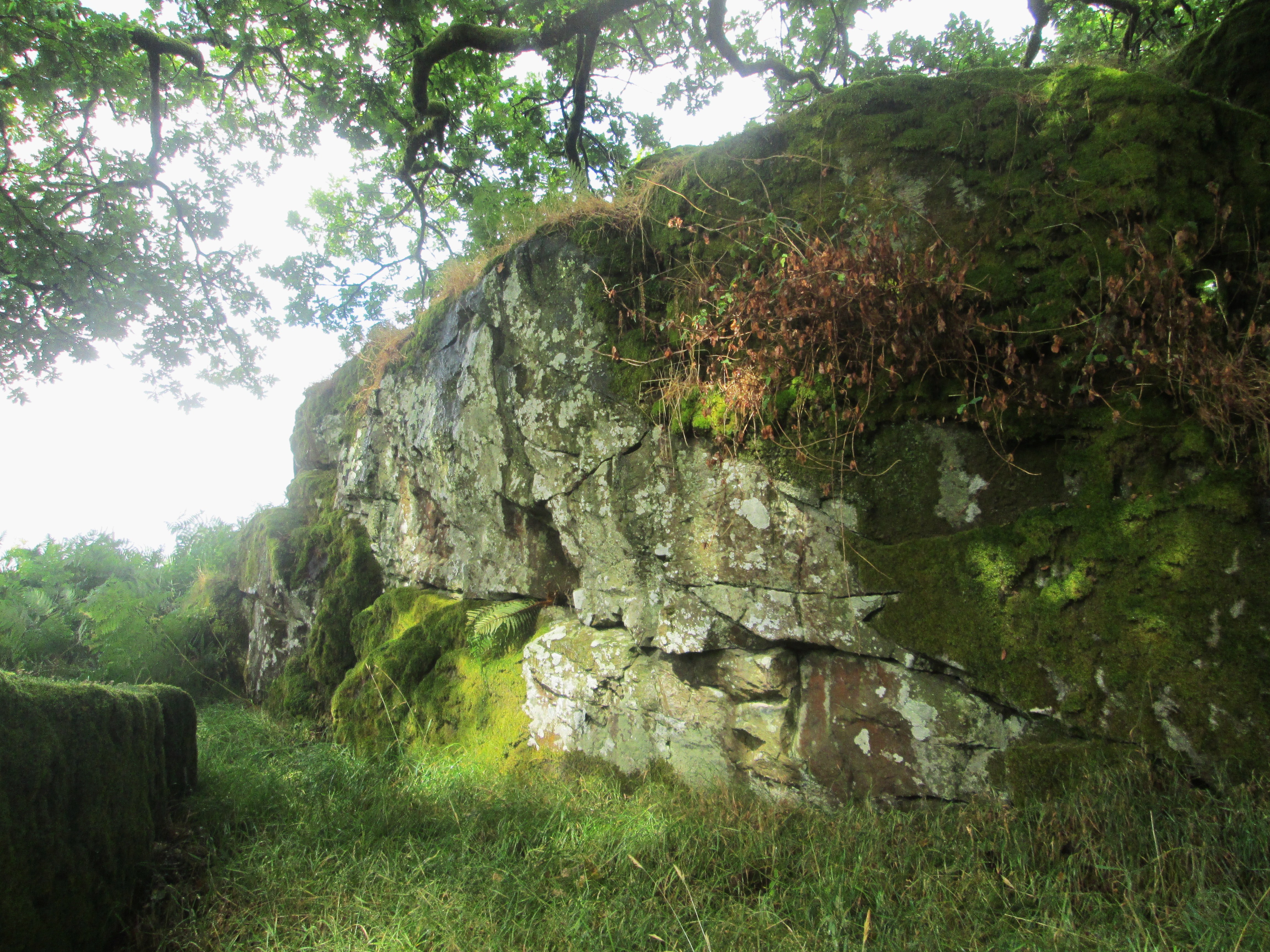 Smith Hill Tor For those willing to take a detour another small tor of interest lies some distance to the northwest of here at SX 5234 7879. Noted several years ago by Paul Buck of the Tors of Dartmoor team, it consists of large but generally low blocks of metamorphic rock that are set on a tree lined hillock in an area that Hemery (p956) refers to as 'Smith Hill Common' and in accordance with that association the low rockpile has in recent times acquired the name of Smith Hill Tor. From this point it is necessary to retrace the track back up the slope to Twyste Lane and passing through the gate to turn eastward towards the newtake walls. 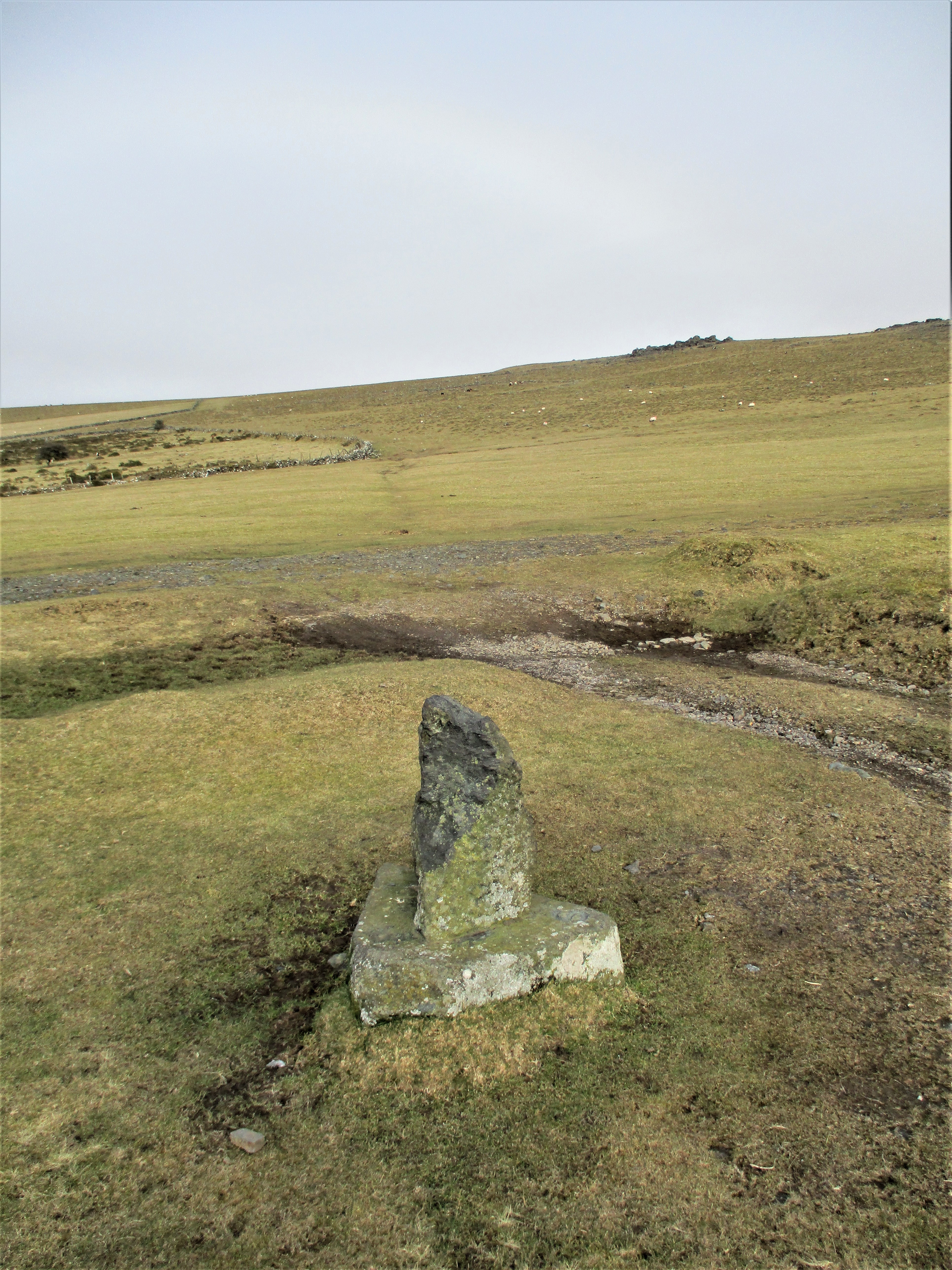 Stephen's Grave context After some 400 metres or so there is a small upright stone set on a triangular plinth on the right at the cross of ancient tracks at SX 5359 7812.This is a memorial known as Stephen's Grave and is marked as such on OS maps. Hemery (1983) advises that the current stone was erected in 1937 by the Dartmoor Preservation Association but strangely states that it is unmarked. However, writing around the same time Gant and Copley (p 40) record that it has 'a simple S inscribed', this being on the eastern edge of the base. 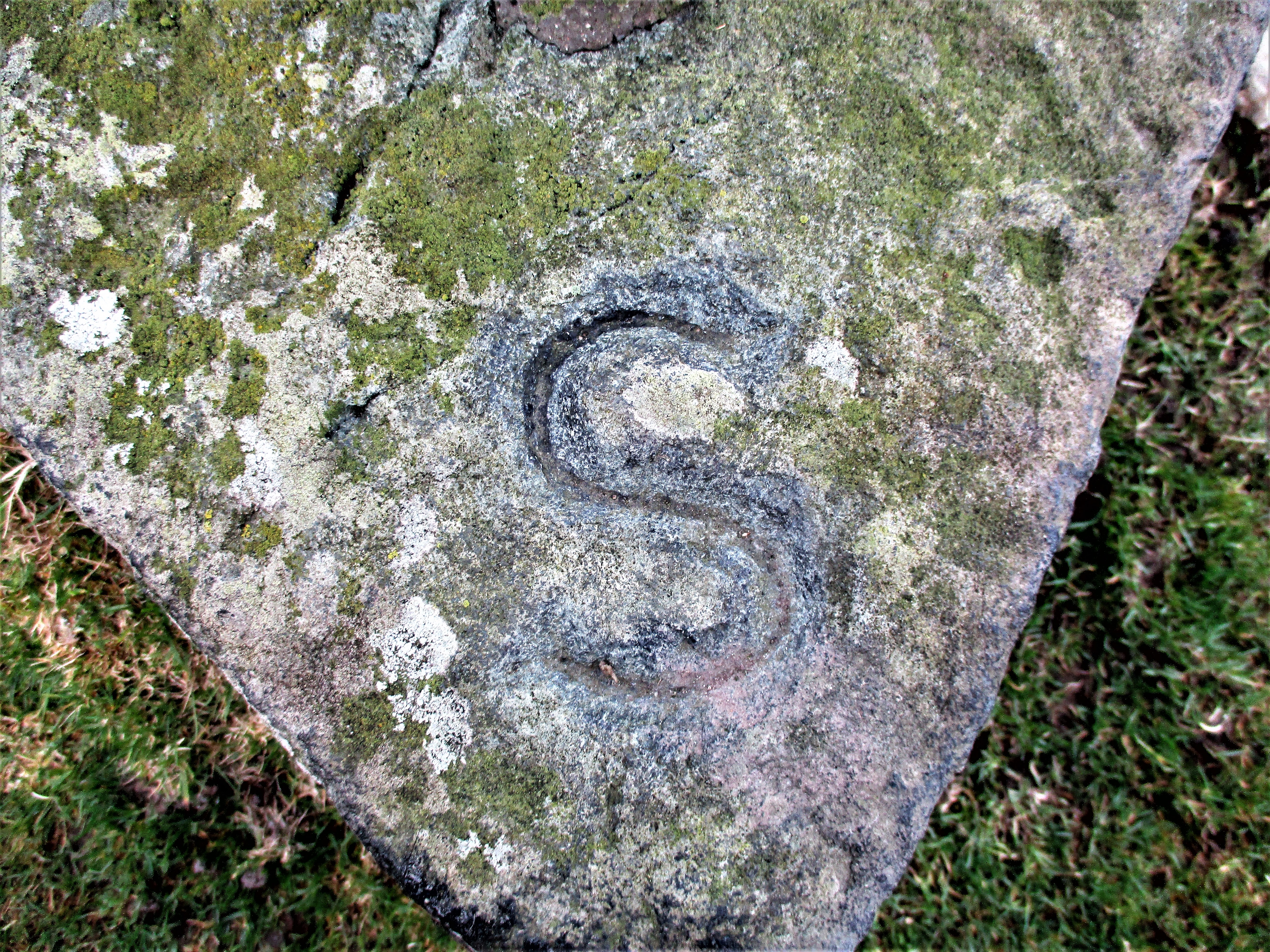 Stephen's Grave 'S' As with some other Dartmoor tales there is confusion over specific names and dates. Numerous commentators have made their assessment of the site and I will not attempt to be the latest, but we learn from Crossing (1912) that it marks the grave of a George Stephens who committed suicide. However, over time other Christian names have appeared in the literature, with both Hemery and Thurlow (1993) giving 'John', and to be honest it has become a bit of a conundrum. For a better overview of the story readers are directed to Tim Sandles' account on his Legendary Dartmoor website where he attempts to unravel the various interpretations on offer. 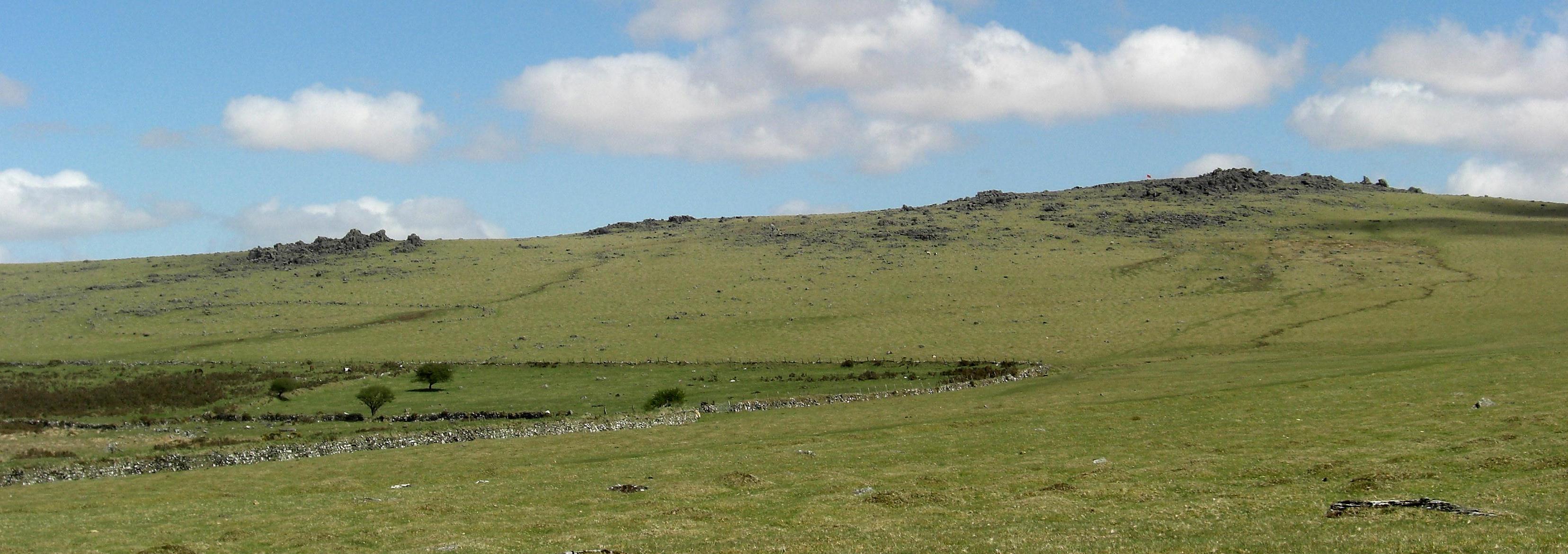 White Tors From here the craggy outline of the two White Tors is seen to the north with Hemery introducing us to the name of Little Whit Tor (Whittor) for the lower western pile that is quite stark in its ruin. Crossing advises of alternative names for the main rocks on high such as Peterstone and Peter Tor. This range is another fine example of the dark and coarse non granite rocks that pepper the slope above the huge circular Bronze Age pound of Cudlipptown Down. Worth (1953) describes the geology here as fragments of hornblendic rock, a non-aluminous anhydrous silicate of crystallized rock that is striated and with frequently rough faces. Well worth a visit the hillside is most unusual with its plethora of jagged rocks in total disarray. The final and perhaps the lowliest of the rockpiles to see on the Common are those of the diminutive Setters or Set Tor. Looking much better from afar especially to the west on closer examination the rocks here are disappointing. Crossing is the first to describe the area and perhaps the best and largest rock in the group is at the west end, much weathered and cracked it is composed of the characteristic hornblende and has been moulded once again by the elements into a series of 'step' like layers. Other low outcrops are strewn to the south and east one of which forms a short flat rock face. Whilst the rocks here are somewhat lamentable the views are memorable and there is a very good view of the Boulters Tors and their outliers with the start of Smeardon Down above and Brentor church beyond. Elsewhere the farmstead of Higher Godsworthy is visible in the valley to the south under the scree covered northern slopes of Cox Tor. From the Setters returning to the main path between the walls and following it back to the quarry could not be easier. 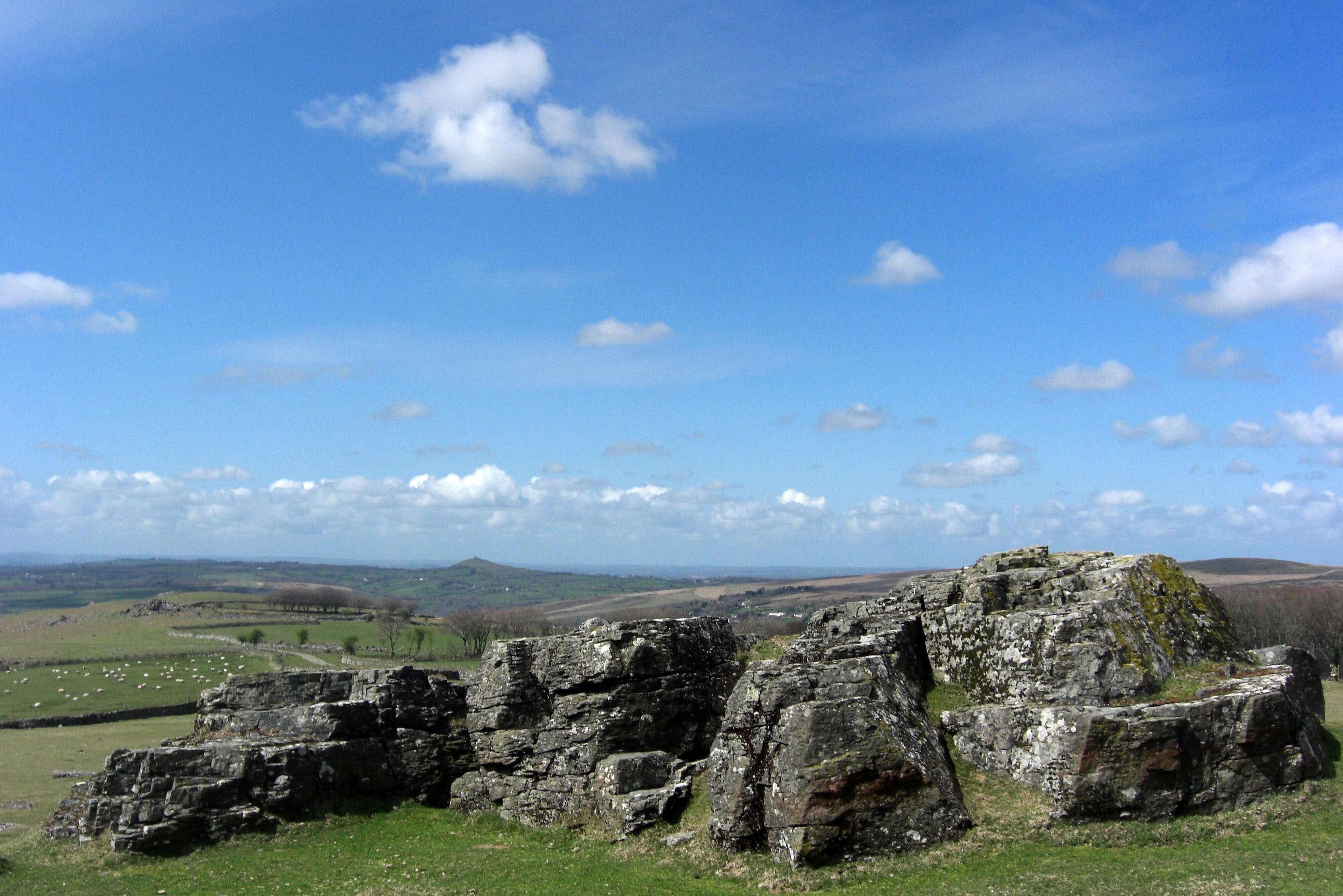 Setters Tor Easily reached from the village of Peter Tavy, both Smeardon Down and Twyste Lane to the north of the Combe have examples of long-lost tors on the slopes. Whilst several have been named in the literature and remain lesser known it is only the principal piles of Boulters and White Tor that appear on modern OS maps. The Tors of Dartmoor website documents all known tors and rocks in this area including those to the south of the Combe and can be viewed at www.torsofdartmoor.co.uk. References:
|