TORS OF DARTMOOR EXTRA
a collection of extra material from the tors of dartmoor team
Dartmoor Discovered: The River Dart to the South of DartmeetTim Jenkinson on 10th May 2026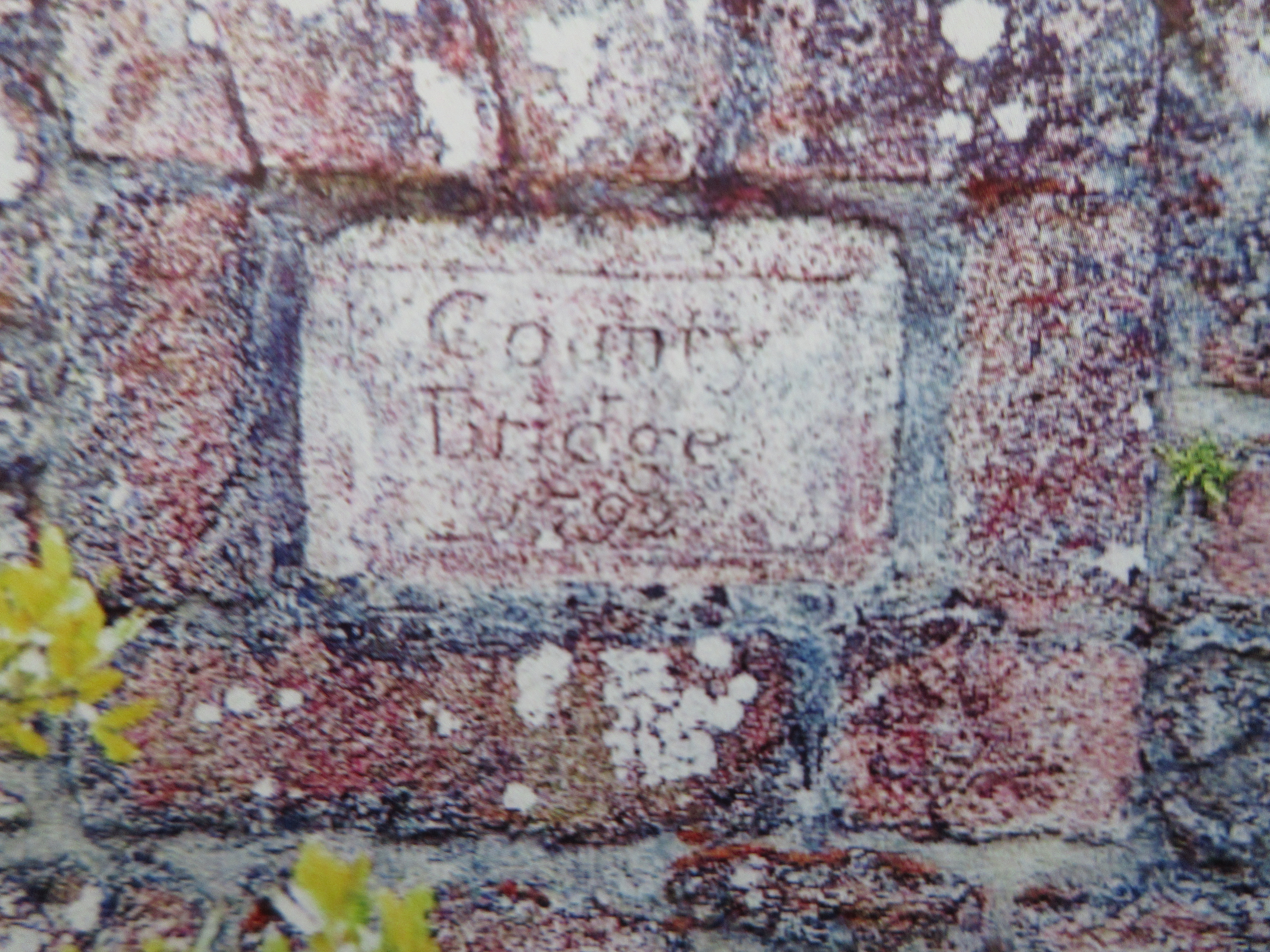 Dartmeet County Bridge 1792. Photo by Tim Jenkinson An edited version of this article appeared in Dartmoor Magazine - Spring 2024 Issue 153, p17-19This is a somewhat belated follow up to the 'North of Dartmeet' article that appeared in the Winter edition of the Dartmoor Magazine (number 121) in 2015. It includes an assessment of the various rockpiles that can be found to the south of the well-known tourist attraction this being the point where the West and East Dart rivers merge. Many of these tors have received little if any attention in the literature of the moor except for the dramatic location of Luckey Tor. William Crossing (1905) rightly included Dartmeet as one of his 'Gems in a Granite Setting', for here we have ease of access to the riverbank coupled with gentle walks to enjoy that are popular throughout the year with visitors. The author advises that the name Dartamet first appears in 1689 and is attributed to Christopher Pearce who wrote of the area in a "deposition respecting the eastern boundary of the Forest". He also provides information on the remains of the clapper bridge here that was swept away in a flood of 1826 (p457 Guide to Dartmoor). The start of the exploration is of course at the main car park where a charge is nowadays required. The path is then across the road to the south but not before observing the ruined clapper bridge to the right and the sturdy road bridge ahead. High on the north upstream parapet of that bridge is a small tablet inscribed 'County Bridge/1792/' (Jenkinson 2007) this date synonymous with the completion of the road out of Tavistock (present day B3357) to Two Bridges and beyond to Dunnabridge Pound (Groves 1970), whereupon responsibility passed to the Ashburton Turnpike Trust. We learn from Thomas (1992) that the bridge at Dartmeet was built by a William Taylor of Bickington at a cost of £195. The path now weaves beside the river. It is muddy and in places ill-defined even in these early stages but sticking to the water's edge helps. Eventually some grand rocks on the left are reached at SX 6727 7276 these being a lower section of what has become known in recent years as Little Vag Tor, with one formation resembling a miniature rock stack. On Ordnance Survey (OS) maps the path from here is depicted as a single track all the way to Luckey Tor giving the visitor confidence it is well maintained but please be advised that this is not the case and difficulties will soon be encountered. 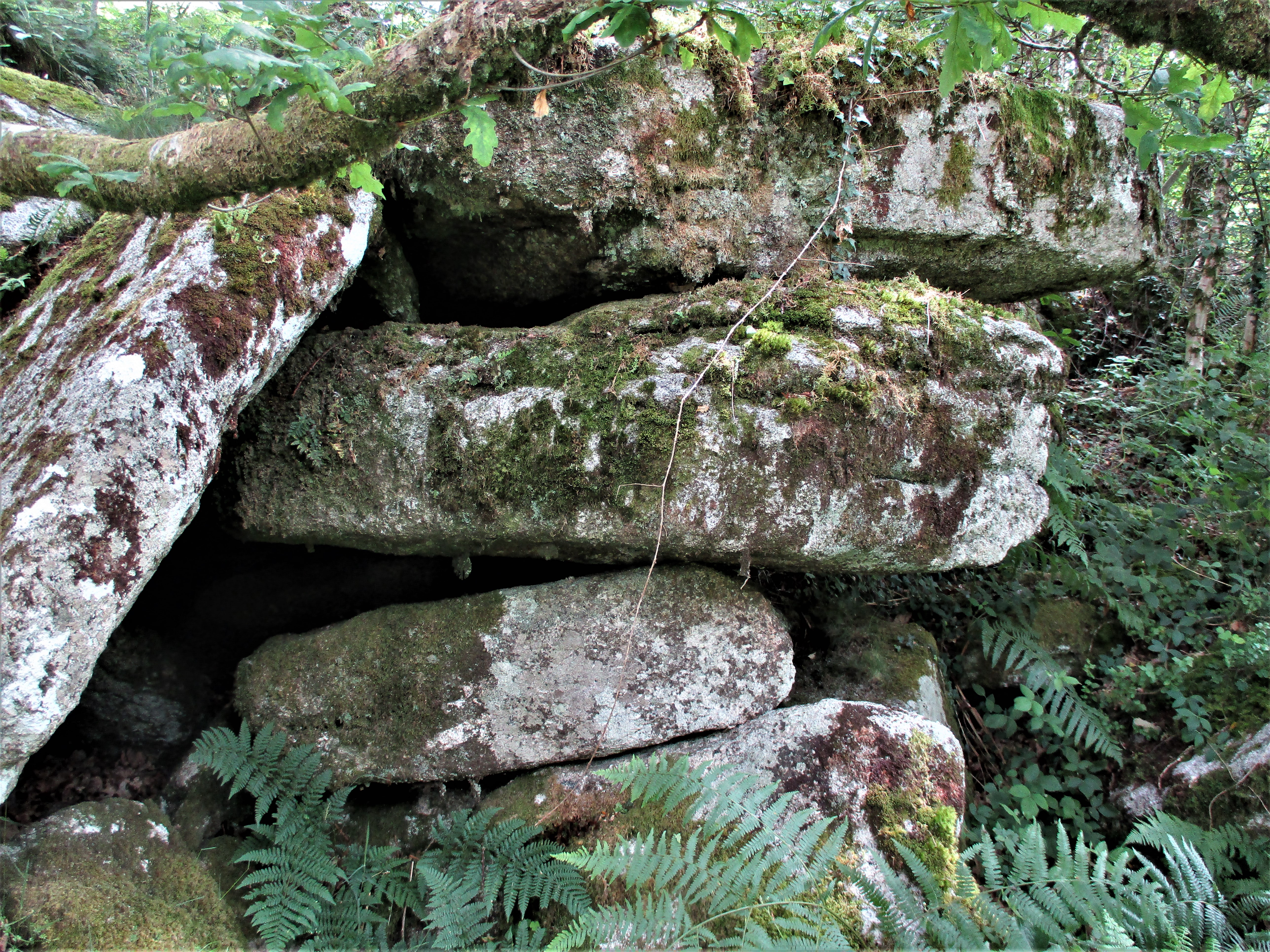 Little Vag Lower Rocks. Photo by Tim Jenkinson Breaking out of the wooded section the upper part of Little Vag's ruin is evident on the southwest edge of the hillside to the left at SX 6734 7259 at about 50 metres above the river. It is a just a little jumble of granite boulders really but with twin overhangs that from below are quite impressive. The view from the top of the rocks is most unusual and is concentrated to the south where high on the hill the outline of Combestone Tor is just discernible. 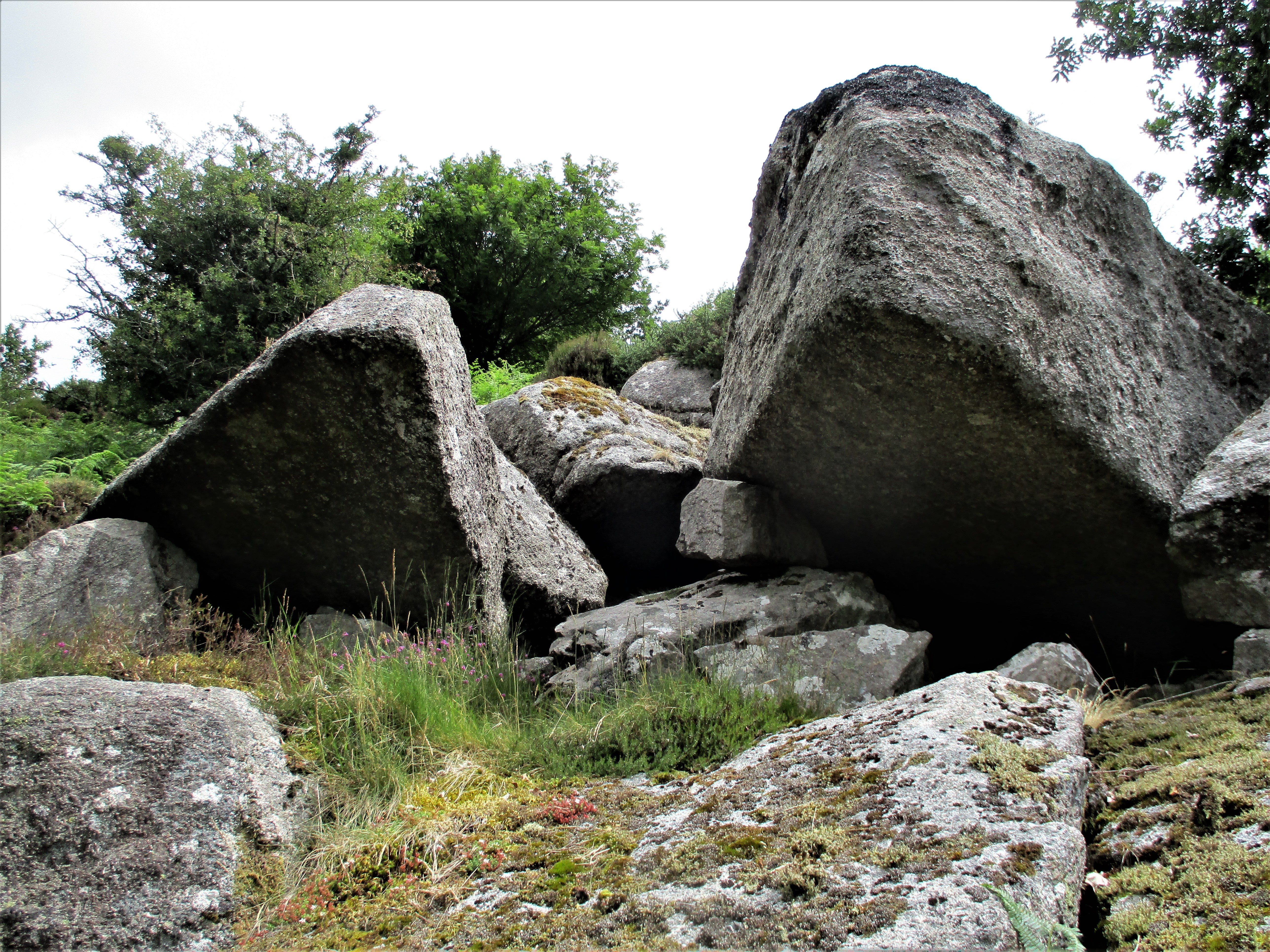 Little Vag Tor. Photo by Tim Jenkinson This tiny but charming tor remnant is surprisingly prominent when viewed from the valley side to the south and is therefore worthy of some consideration. Best visited in winter months the rocks here are encircled at other times of the year by unchecked gorse, briars, and a virtually impenetrable mini forest of ferns. Further along the river heading south and then towards the east another small rockpile emerges on the slope above at SX 6741 7237 this is sometimes referred to as Middle Vag on account of it sitting roughly in a central position between Little Vag and the giant Vag Hill Tor that is much higher up the hill of that name (but not shown on OS maps). Indeed, it is possible that Eric Hemery (1983) may have described Middle Vag in the tome High Dartmoor where on page 589 he comments "As Cumston Island comes into view, a rock outcrop, beetling and rugged, is seen to project from the underside of Vag Hill left, its clitter reaching the very riverbank, has fanned out to strew rocks over a long stretch of riverside". 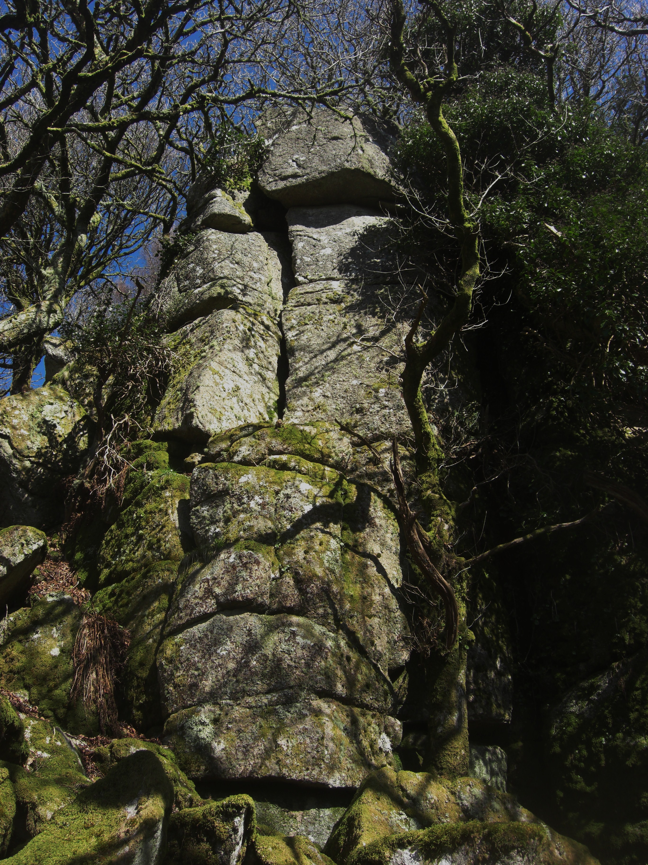 Vag Hill Tor Stack. Photo by Tim Jenkinson Vag Hill Tor at SX 6774 7235 requires a diversion from the riverbank and is a tremendous rock pile of several outcrops that are hidden in the trees. I have written about this area before but never when approaching from the river below (Jenkinson 2013). Huge, cracked crags rear up from the slope are all essential viewing and will not disappoint. Returning to the river please be warned that the following section of the footpath requires perseverance as this is where it begins to deteriorate with some parts lost to the water necessitating a short clamber uphill to continue your journey. When Hemery was exploring and writing about his excursions along the Dart it seems that the path here was still intact and passable but has since succumbed to considerable erosion. The next tor of note at SX 6825 7214, again not mentioned in the literature, is perhaps one of the most notorious to reach as the climb up to it is complicated by unstable ground and jagged rocks underfoot. I came across it in April 2013 whilst exploring the slopes to the west of Luckey Tor and was impressed by its ruin and secretive location. It sits some 200 metres above the river and is expertly described on the Tors of Dartmoor (ToD) website under the name of Rowbrook Tor: "The main part is a striking jumble of huge broken blocks forming two outcrops that have cracked into curious shapes and caverns, but much of the ragged tor seems to have shattered into a mass of clitter that is hard to walk over in the rather claustrophobic wood". It is indeed a fine rockpile but is not for the faint hearted so please take extra care when visiting. 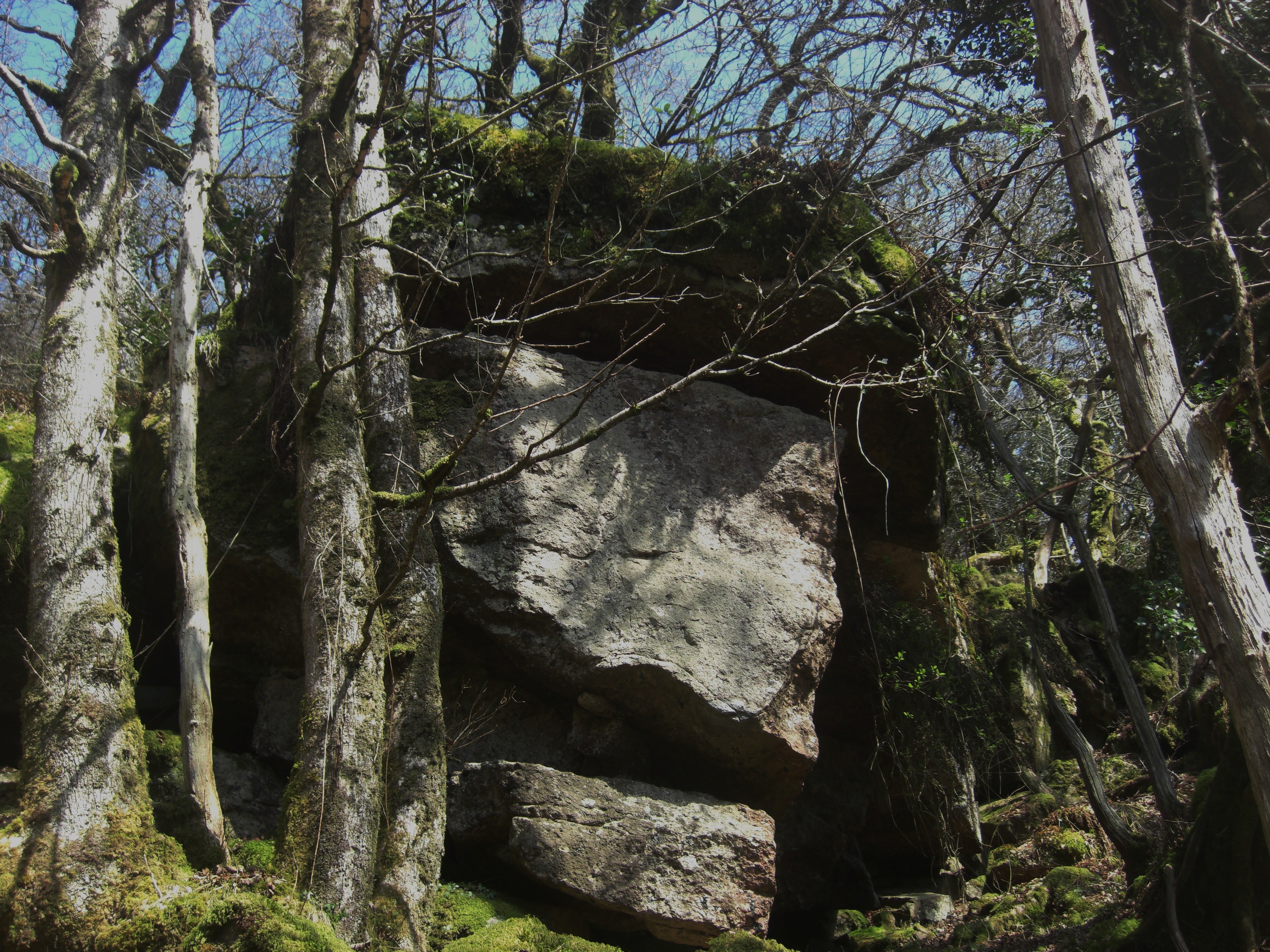 Rowbrook Tor. Photo by Tim Jenkinson We are now not far from the jewel in the crown that is the magnificent Luckey Tor at SX 6848 7204 set quite close to the river it simply towers above the onlooker. Crossing (1912) likens it to "a ruined castle" and gives it the extra names of Lug Tor, Raven Rock and Eagle Rock whilst Hemery (1983) introduces us to Looka Tor. It is described on the ToD website as "simply one of the grandest tors to be found on Dartmoor and its prominent craggy mass is enhanced by its position deep within the sheltered Dart Valley". As a result of its appearance and height it is popular with rock climbers and is without doubt one of Dartmoor's most picturesque spots. Standing beneath its enormity is both a humbling and memorable experience. It is probably best now to carefully retrace your steps along the riverbank back to Dartmeet. 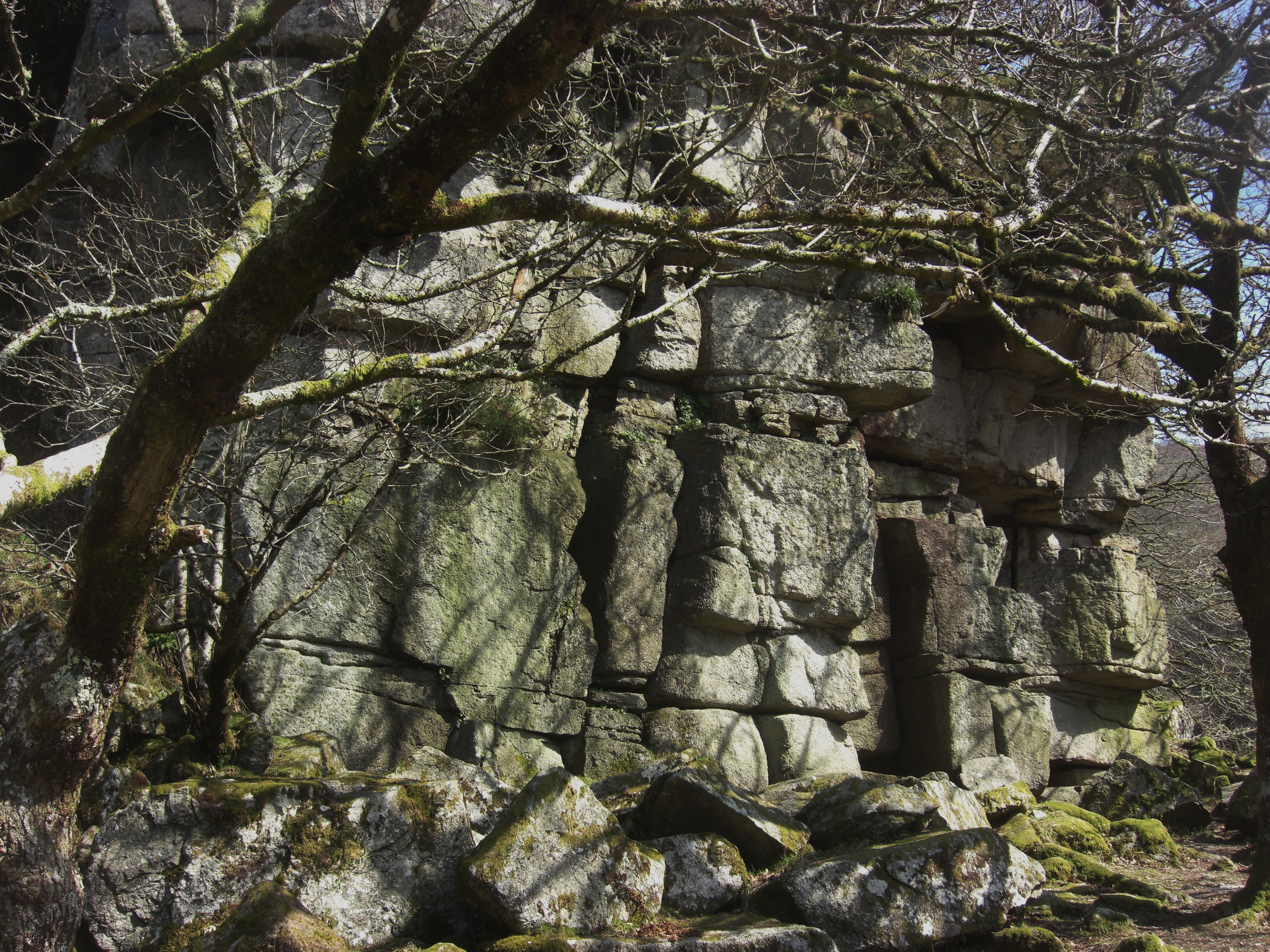 Luckey Tor. Photo by Tim Jenkinson There are two other rockpiles of interest in the area but not in the vicinity of those so far described. The first known locally as Blackpool Rocks only came to prominence following a huge landslip in April 2023. It was noted by Dan Anderson and an on-site visit soon thereafter by Max Piper, Paul Rendell and myself, confirmed the devastation with a mass of soil and trees having shifted downhill, high on the south side of the River Dart at SX 6819 7197. A now huge and quite grotesque looking outcrop has been exposed, with other scattered outcrops and rocks revealed. The terrain here is especially difficult to negotiate because of the steepness of the gradient but the sight of the main rock is quite dramatic and there are some excellent views across the river through the trees towards the majestic Luckey Tor. 'Blackpool' is taken from the OS who depict a part of the Dart here by that name. 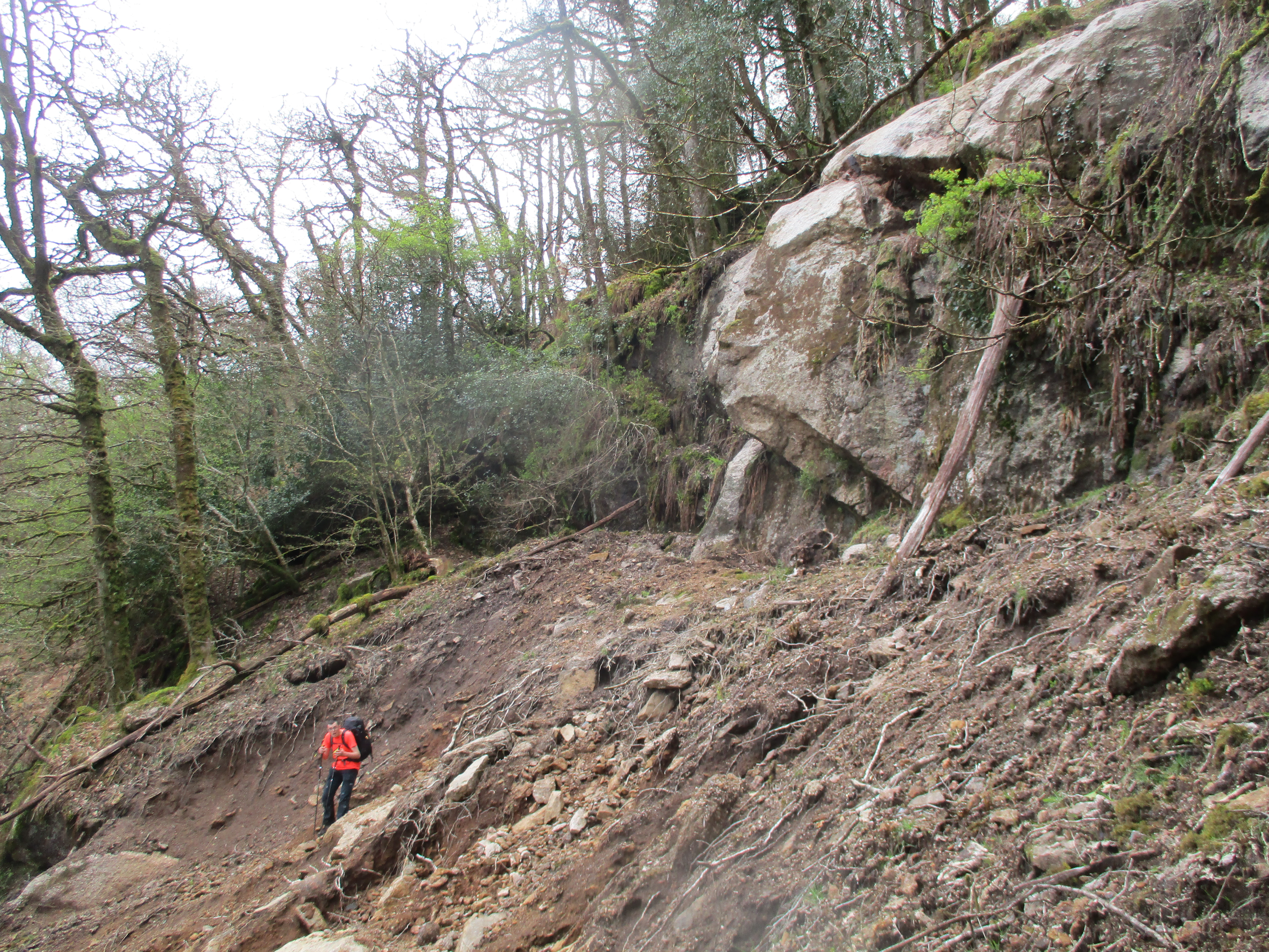 Blackpool Rocks and Max Piper. Photo by Tim Jenkinson This area is probably best reached from above, walking in from the direction of Combestone Tor a route that will also allow for an inspection of the compact outcrop and upper elongated rock face of Aller Brook Tor at SX 6783 7191, this lowly but interesting little pile was first mentioned by yours truly in Dartmoor Magazine in 2000. The final set of granite sprawl worthy of inspection is the scattered group known as Lower Weckford Rocks at SX 6646 7250 to the east of the stepping stones on West Dart at Week Ford. Here there is a ruined tor of no great height but with some interesting outcrops within, that are spread for some distance across the open access land. The Rocks can be reached by taking the footpath from Huccaby Farm southward to Week Ford and then turning left through a small gate before reaching the river. 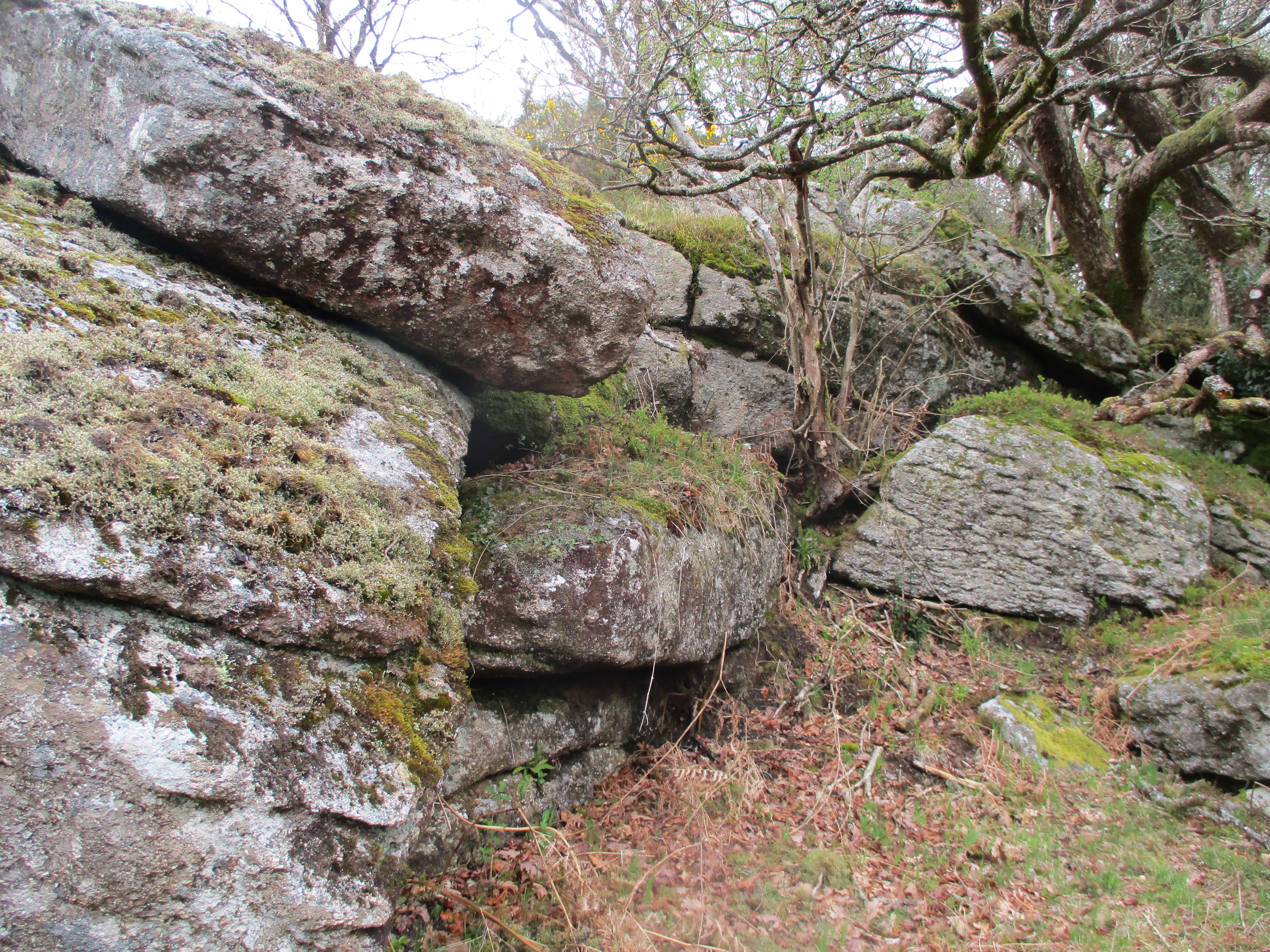 Lower Weckford Rocks. Photo by Tim Jenkinson The name of Lower Weckford (Hemery gives Wickford) appears on old Tithe Maps of 1840 and is therefore appropriate but at some point, it was corrupted to what we know today as Week Ford. Please be advised that this area has restricted access at certain times of the year by order of the landowner and any closure notices should be respectfully observed. The Stepping Stones one of the best surviving examples on the moor, are worth a look but they are quite difficult to cross, as some are irregularly spaced and nearing the south bank are slightly dislodged. In addition, they are treacherous when wet, indeed a nearby sign warns "AFTER RAINFALL STEPPING STONES ARE IMPASSABLE". Hemery (1983 p470) who counted nineteen steps across the ford noted that both they and the ford were dangerous when the river was up. He was not wrong. 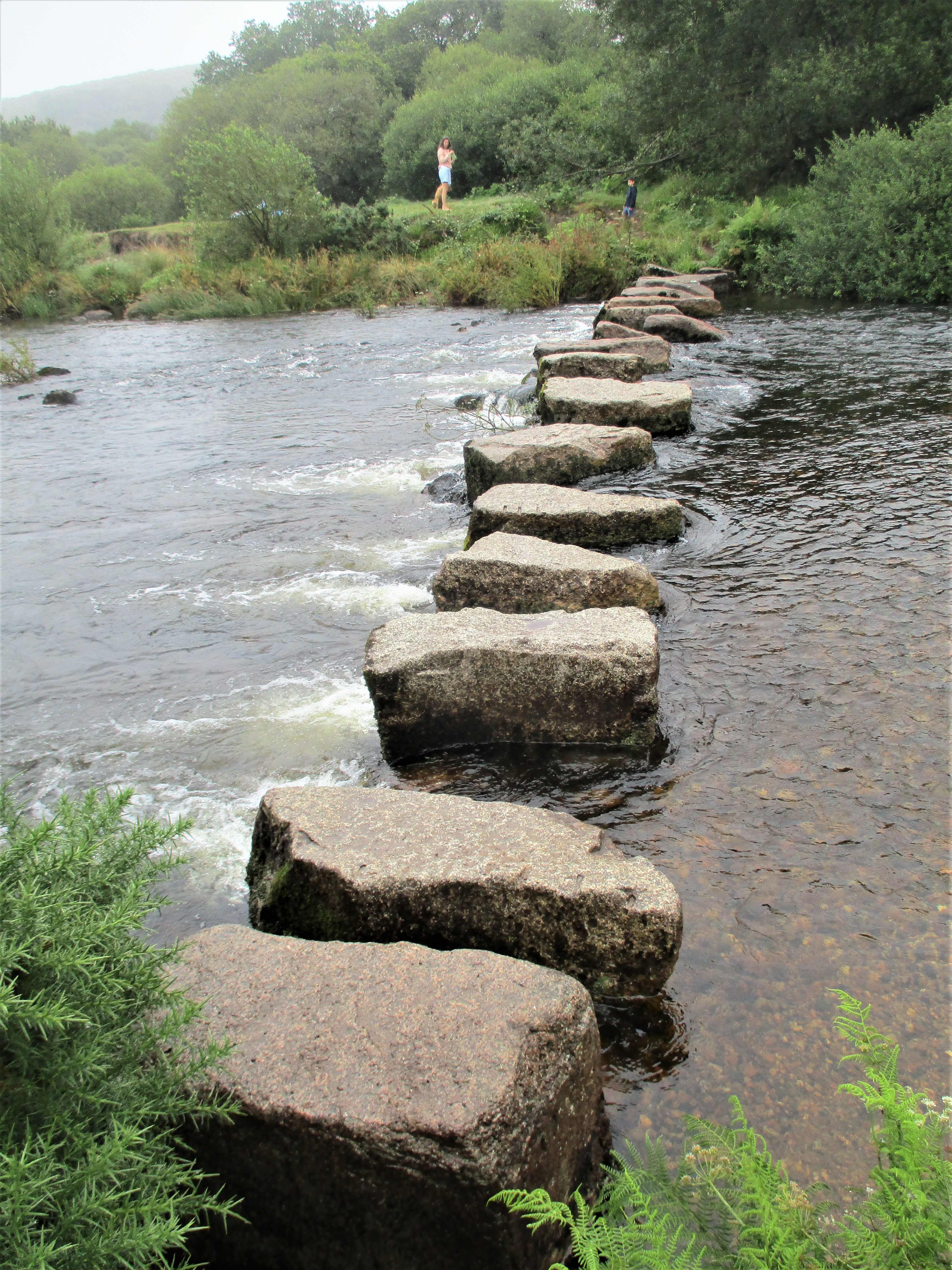 Week Ford Stepping Stones. Photo by Tim Jenkinson In conclusion, the area to the south of Dartmeet has been rather neglected in the literature of the moor with relatively few references. Yet hidden in the trees and therefore not obvious to the naked eye from afar are a series of interesting and long lost rockpiles that in recent years have been revisited by the Tors of Dartmoor Team and described on their website. All the rocks mentioned here can be reached with perseverance but will require some effort to track down as the terrain is often rugged and difficult to negotiate. That said discovering each of the forgotten tors is a rewarding experience and there is guaranteed solitude for most locations as they are rarely visited. References
|