TORS OF DARTMOOR
a database of both lesser- & well-known rocks and outcrops
Arch TorArcherton Tor  When travelling along the B3212 road between Higher Cherrybrook Bridge (site of the 'Hairy Hands') and Postbridge, you will notice a string of tors laid out in front of you above the ruins of the Powder Mills. Longaford and Higher White Tors are the most prominent, but much closer to the road there is an often overlooked and dismissed outcrop called Arch Tor that has been described in the literature by William Crossing as both "merely a small lump of rock" and a "small mass", and more recently by Terry Bound who refers to Arch as being "hardly worth the name 'tor'." Don't let these dismissive remarks deter you from visiting as there is more to this tor than meets the eye. 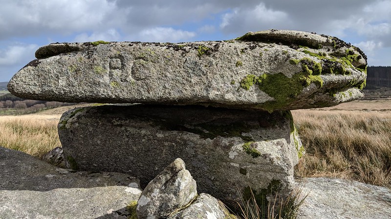 The area is best accessed by using the recently diverted track of the Lych Way that avoids the Gawler Brook and its headmire. Passing up the hill to the right you are presented with Arch Tor, at first a disappointment, but take a closer look at the main outcrop to discover some interesting features. The first is a fine collection of rock basins on the summit, these not particularly deep but very wide and seen trapping rainwater. The top slab resembles a logan stone precariously balancing on the bedrock. 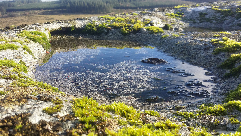 Arch Tor boasts an inscription, that of 'PC' carved onto its western face, incorrectly noted as 'AC' by Josephine Collingwood in 'Dartmoor Tors Compendium'. What, or who, these initials refer to is unclear to us, but it may denote the nearby Powdermills Cottages. 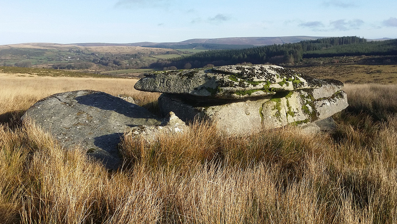 The views from this lonely and seldom visited spot are wonderful: the long range of tors to the left of the two humps of Braddon Tor and Broad Down (Broadun) are seen to great advantage, and in the opposite direction Hamel Down, Bellever Tor above its forest and the central basin are seen and beyond the latter, the ridges of the South Moor are noticed stretching off infinitely. The name of 'Archerton' for the area is given by Rowe.
| ||||||||||||||||||||||||||||||