TORS OF DARTMOOR
a database of both lesser- & well-known rocks and outcrops
Beardown East TorBeardown Tors, Bear Down Tors, Beara Down Tors, Beardon Tors, Beardown Hill, Bairdown Tor, Bare Down Tor
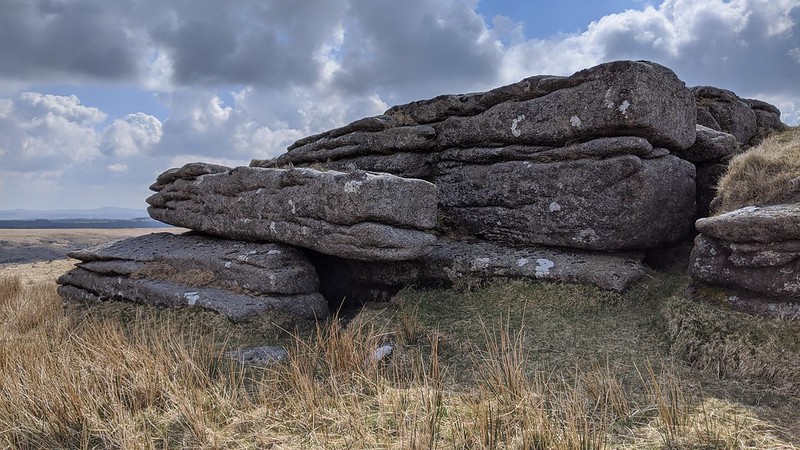 The Beardown Tors are a striking collection of tors in the centre of Dartmoor that represent what were once giant mountains in the heart of the moor above the Cowsic and West Dart valleys. There are several outcrops that stud the hill here culminating in distinctive clusters. Indeed Crossing (1912) speaks of "a group of four". Of these, the East Tor is noticeably less impressive with grass topping its summit which is adorned by a military firing range flagpole. From some angles the tor resembles a giant cairn. 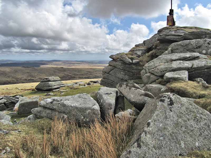 At 511m above sea level, it is the second-highest of the group and boasts perhaps the grandest view of the West Dart valley not only upstream where the immense clitter from the Crow Tors is plainly seen, but also southward where the valley sides narrow and the river enters a glen below Crockern Farm. To the east, Wistman's Wood is the most striking feature that is overlooked by the beautiful rockpile of Longaford Tor as well as its 'Little' neighbour and the Littaford Tors, these tors' clitters strewn all across the hillside in majestic fashion. The scenery on show is breathtaking and will no doubt leave the visitor in awe. 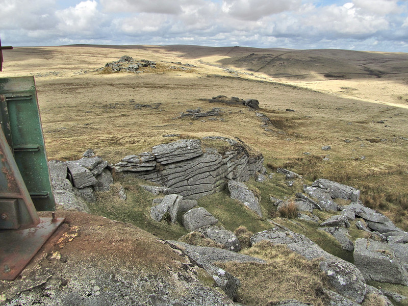 Although prominent, when compared to its neighbours the East Tor's outcrops are a little underwhelming and a bit widespread; indeed even Hemery (1983) remarks that it "is the least rugged of the Beardowns, being roughly conical in shape". It is only when standing on the east side that you get a sense of height and the crumbling walls of granite are deserving of some recognition. On the west side of the tor a military telephone point can be found at SX 60480 77406. 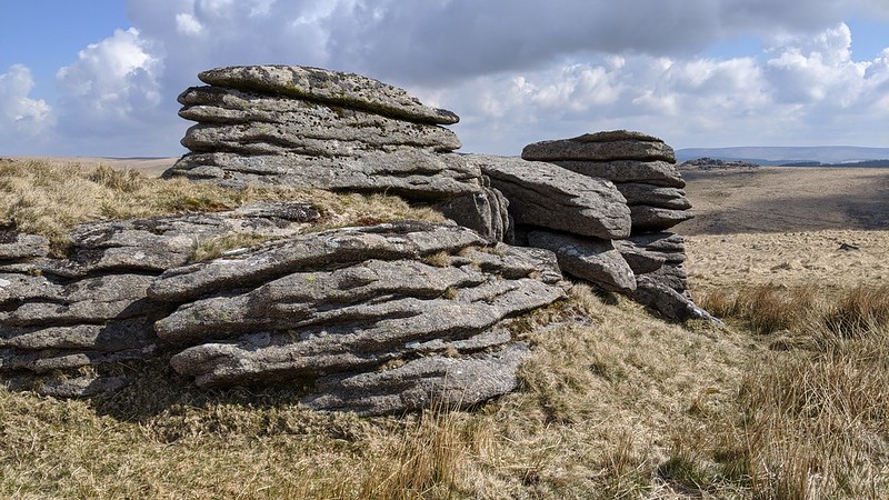 Despite this lukewarm impression, the magnificent views afforded from the East Tor make it well worth a visit, and although all of the Beardown Tors reside outside of the Merrivale Firing Range, they are close to the boundary (denoted by red and white range markers). In order to reach them from the closest car park at Holming Beam, you will need to pass through part of the Range so please consult the firing times website before setting off. The rugged tors of Beardown are the epitome of high Dartmoor and the tor bagger is urged to visit all four tors as they all offer differing perspectives of how weathering has shaped and moulded the granite that we see today.
| ||||||||||||||||||||||||||||