TORS OF DARTMOOR
a database of both lesser- & well-known rocks and outcrops
Bel TorBell Tor, Bellettor
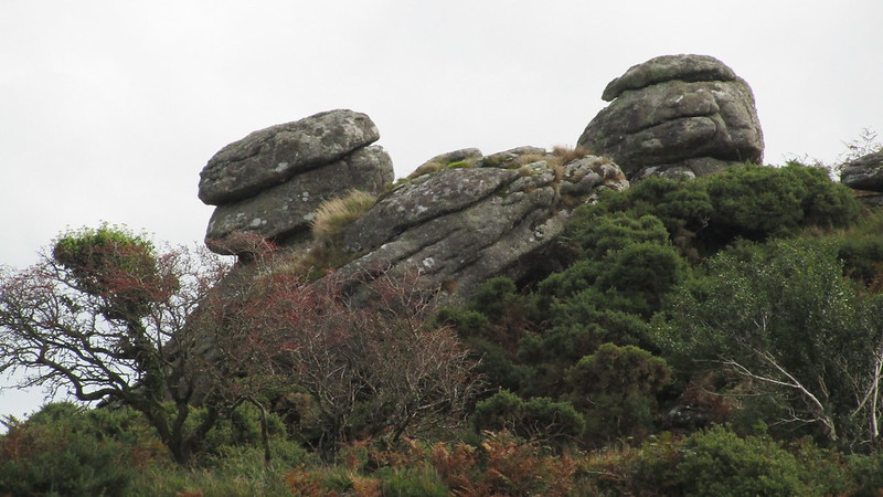 After Vixen, Bel Tor, sat so close to a car park bearing its name, is probably the most well known forbidden outcrop on Dartmoor. It has been closed to the public for over 25 years now. William Crossing, in his 'Guide to Dartmoor' tells us that; "On the left within a farm enclosure is Bel Tor, which although only a small pile, is sufficiently interesting to call for notice. A gate in the wall will enable the rambler to visit it." Sadly, that gate now has the obligatory 'private' sign, and, if landowner permission cannot be sought, the public must be content with gazing from the perimeter walls well over one hundred metres away. 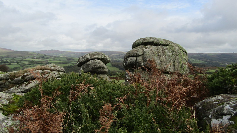 Walking the perimeter, enticing glimpses of the extent of the granite can be had, especially if you stand at Mel Tor, looking north. You will see two main outcrops on a hill being consumed by gorse. For a description of the outcrops, both William Crossing and Eric Hemery give an insight from those days when access was not an issue. Hemery, in 'High Dartmoor', says that from a distance, the tor "offers little of interest" but then goes on to describe a logan stone and three rock basins. Crossing tells of the largest rock basin; "On the surface of a logan, curiously poised and appearing as though it would topple over at any moment, is a rock basin measuring 38 inches by 32, with shelving sides, and to this a tradition attaches. It used to be said that good fortune would await anyone seeing the reflection of the rising sun collected in it." 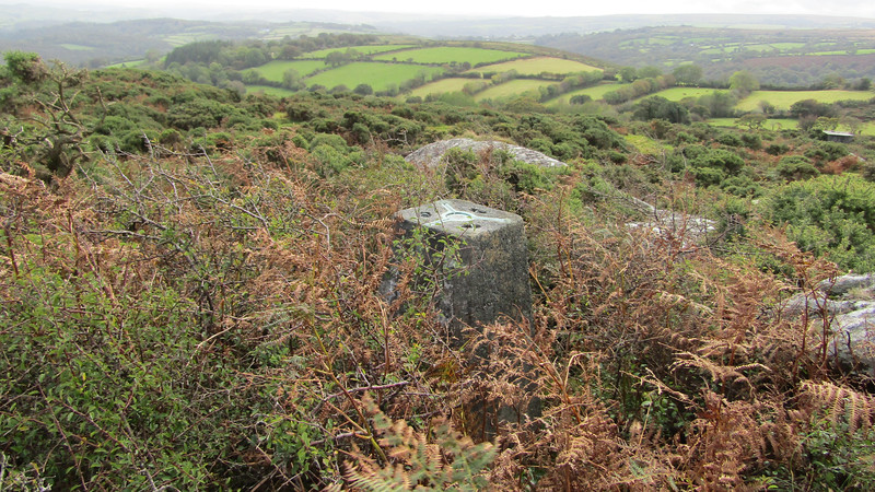 Ordnance Survey maps show us that there is also a triangulation pillar on its top, but this cannot be seen from a distance thanks to the encroaching gorse and bracken. Looking at the trigpointing.uk website, the forbidden location of pillar number 3469 makes it one sought by enthusiasts, who likely visit more often than tor baggers. It is disappointing that this tor is incarcerated with no visitor privileges. Whilst the fields surrounding the tor are farmed, often inhabited by cattle, a permissive footpath would be welcomed for this one. 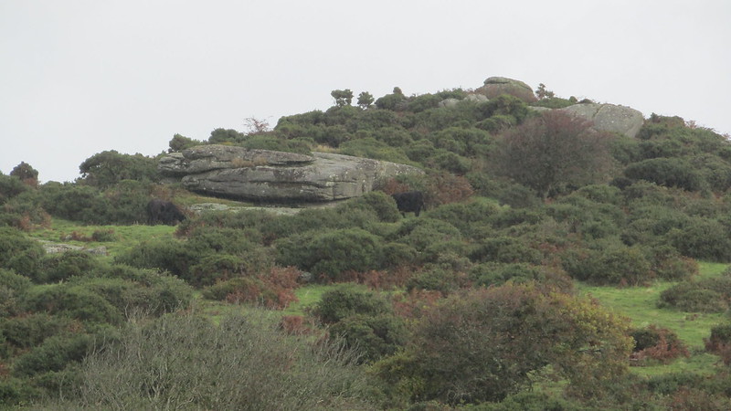
| ||||||||||||||||||||||||||||