TORS OF DARTMOOR
a database of both lesser- & well-known rocks and outcrops
Belstone Common TorHemery's Tors End 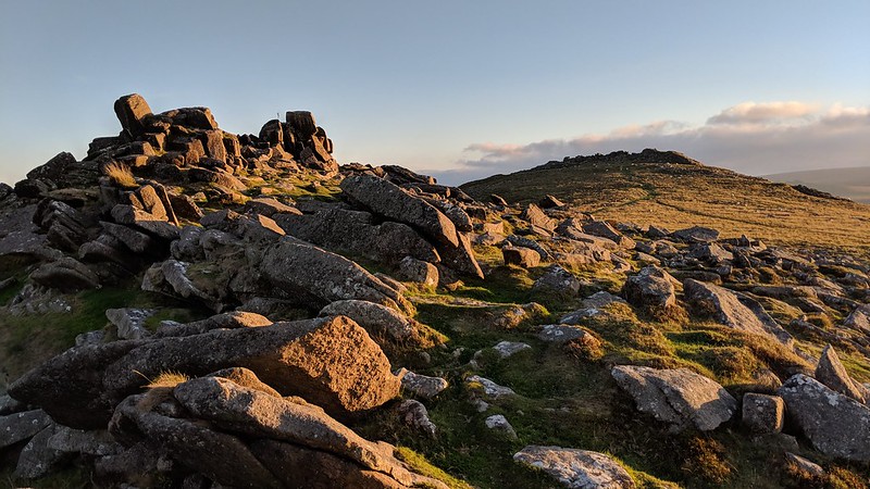 Unfortunately, the Ordnance Survey representation of the Belstone Ridge is rather disappointing, naming only Belstone Tor and Higher Tor; and while indeed these are prominent tors, it leaves out equally impressive and fascinating outcrops, particularly at the north end. As a result of this, there has been confusion as to the names for some of these rockpiles, leaving some to call the entire collection 'Belstone Tors'. One tor in particular between Belstone Tor and Tors End despite its prominence appears to have never been named, so we have simply labelled this 'Belstone Common Tor'. In the past it has been incorrectly labelled 'Tors End' and even 'Ladybrook Tor', the latter a robust outcrop sitting on the opposite hillside above the River Taw. 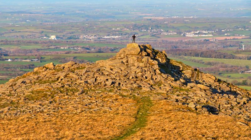 Eric Hemery (1983) mentions the outcrop at the northern end of the high ground but identifies it, in our opinion, incorrectly; "...the land falls sharply to a fine satellite pile; smaller, but fiercely characteristic, its bold cone dominates the declining northward crest and is aptly known as Tors End (approx. 1,500 feet)." Whilst this is certainly the end of the high ground, which may have swayed Hemery, it ignores the outcrops below to the north-west, which are the true end of the Belstone Ridge and the accepted location of Tors End known to locals. 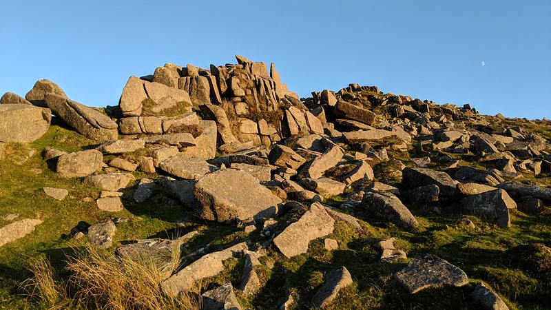 Belstone Common Tor is a fabulous tor in its own right, sufficiently detached from its neighbours to warrant an identity. Its composition is surprisingly dissimilar when compared to the rest of the common: its main pile is a massive heap of broken stones, presenting almost alpine-like from the south. The tor's appearance - that of a jumbled mound of granite rocks - is reminiscent of Sharpitor near Burrator Reservoir. The concentration of clitter all around, but particularly on the east flank of the hill, is mesmerising and indicative of these tors' former magnitude before they were brutally broken up by weathering. The area, strewn as it is by magnificent granite blocks, has also been a target for stonecutters who utilised the abundance of rock and easy accessibility from Belstone village to cut up stone for monetary gain. The north side of Belstone Common Tor has suffered by the scar of a small quarry where you can find an abandoned granite roller at SX 61589 92494, buried in the turf. Where granite cracked under pressure or transportation was deemed to be too laborious, these artefacts were simply abandoned in situ. A number of millstones, troughs, and apple crushers can be found amidst the clitter. 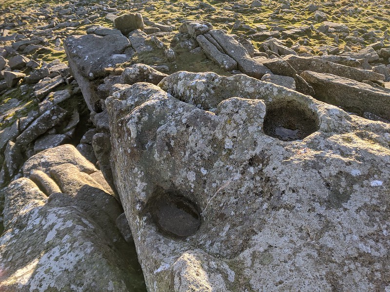 On top of the tor you will notice the remains of a concrete flagpole base; presumably this was placed here because of the more extensive views afforded of Belstone from where it could be viewed. Bob Fitzpatrick (2017) also noted no less than three rock basins near to this which are thought to be undocumented. At least two of the basins can retain water and are unusual in that none of the other Dartmoor tors this far north possess any basins. Mr. Ormerod (1859) himself states that: "From near the same point in the northerly part of the moor the Tavy flows westerly and the Teign easterly: to the north of these rivers very few rock-basins exist, and those too are in the immediate vicinity of these rivers. The Belstone examples are therefore unique.
| ||||||||||||||||||||||||||||||