TORS OF DARTMOOR
a database of both lesser- & well-known rocks and outcrops
Belstone TorMudge's Higher Tor 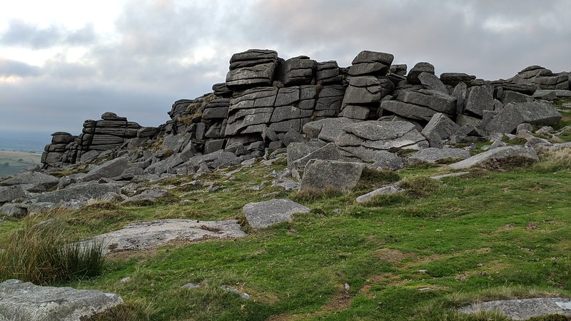 This magnificent tor stands in the north of Dartmoor above the village of Belstone. It is famed for its spectacular rock formations and views. Belstone Common is adorned by massive granite boulders (clitter) that are flung down the slopes, and the several individually named tors that snake along the ridge are sometimes collectively referred to as the 'Belstone Tors', though this would be doing each of them an injustice. Belstone Tor itself is the highest of the collection and typically the one that visitors aim for. It is split into two main piles, both at similar elevations; the more well-known part is north of the Irishman's Wall and casts a tremendous view northward where high Dartmoor meets the pathwork of fields in North and Mid Devon. This part of Belstone Tor is craggy but with distinctive horizontal joints, and is noted for having on its summit four granite stumps called footings. Chris Walpole (2021) writes: "Four man-made bases, one almost completely disintegrated, at each corner of a 2.5m square. In the bases were small pieces of corroded metal, clearly angled upwards and inwards as bracing for whatever structure had been there." He concludes: "This must have been another military signal structure of some sort." Below the summit to the west is the faint incision of an OS benchmark at SX 61416 92089, once used for surveying heights above mean sea level. 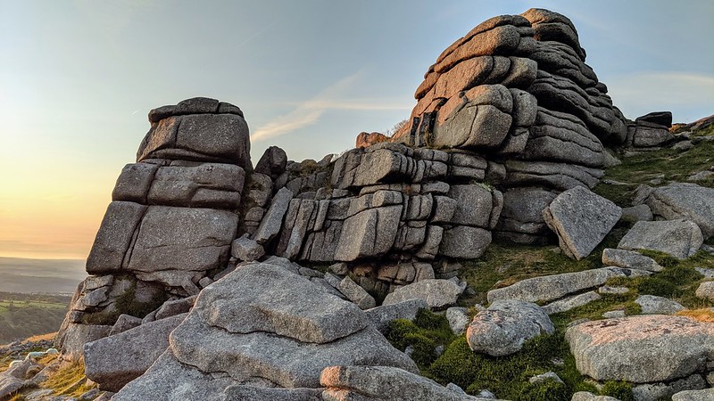 The southern section of the tor is equally as interesting, however is overlooked by the often meticulous author William Crossing, but it is mentioned later by Eric Hemery. This outcrop is a large rock face that presents its best aspect from the southern approach, thrusting out from the boulderly plateau above. It projects stupendous views to the south beyond the giant granite block that is Higher Tor, with Steeperton Tor seen standing sentinel above Taw Plain and Marsh in the distance. Nearer to the Irishman's Wall are two logan stones. This 'wall' which bisects the tor was an ambitious project to enclose part of the moor here and as far south as Steeperton Gorge, but as one would expect, it was not met positively by local residents who came together to dismantle parts of it to essentially render it worthless and the irishman subsequently departed. 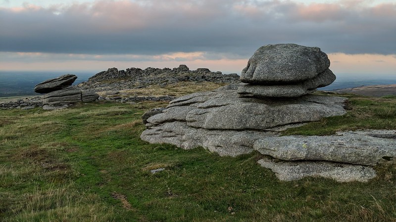 The unparalleled beauty of Belstone Tor is captured in the Exeter and Plymouth Gazette Daily Telegrams from 1880: "Belstone Tor is situate between Cawsand and Yes Tors, and is strikingly rugged and grand. The "Clatters" in Taw Marsh are more extensive and extraordinary in their confused masses than those at Lustleigh Cleave..." The abundance of strewn granite has resulted in Belstone Common being host to some of Dartmoor's finest stone artefacts, including granite rollers, millstones, apple crushers and troughs. At Belstone Tor, millstones can be found close to the Irishman's Wall, including those in their early stages of formation before being abandoned for reasons unknown. Despite the thrill to the modern walker in seeking out these artefacts, back when the industry was thriving there was concern among local residents about the destruction to the Belstone Tors. One of the most concerned was Dora James (1911) who writes: "There are now at least two large granite working yards in the village" and that the "digging out and cutting up of the glorious piles are infinitely to be regretted." Fortunately, unlike at other sites on Dartmoor, the tors here survive, albeit with some scars on their slopes. 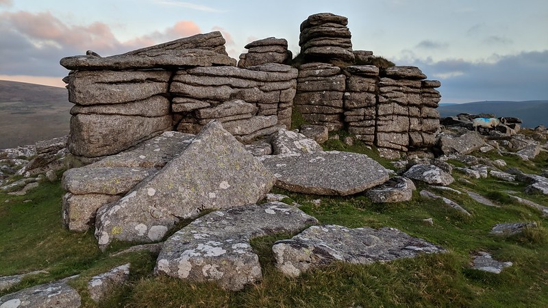 Interestingly, while modern Ordnance Survey Maps and prominent Dartmoor writers cite Belstone Tor as the highest pile of the Belstone Ridge, the survey of Devon, by Colonel William Mudge, in 1809, named this point as 'Higher Tor' and placed Belstone where Higher is now. Whilst it makes sense that the highest point on the ridge would be named 'Higher Tor', later surveys were amended and this is now the accepted location for Belstone Tor. It is a wonderful tor to visit where the visitor can walk in the footsteps of stonecutters and marvel at the fabulous rockpiles and vistas. It is an unforgettable place.
| ||||||||||||||||||||||||||||||