TORS OF DARTMOOR
a database of both lesser- & well-known rocks and outcrops
Black Tor (Brent Down)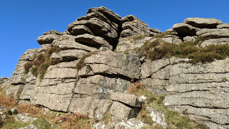 Black Tor is a large, pleasing granite tor high above Shipley Bridge that spills down to the River Avon from its multiple rock stacks, and there is easy access from the Bridge itself where there is a car park. The extensive clitter north of the outcrops suggests the previous size of the tor was much grander than it is today. 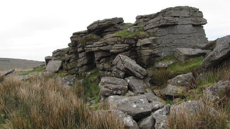 Eric Hemery tells us of Black Tor in 'High Dartmoor'; "The rocky hillside, where the plenitude of moorstone - much of it very large - facilitated the labours of the Bronze-Age village-builders, thrusts a great spur into the valley to force the river out of its southward passage through Long-a-Traw; the spur is picturesquely crowned by Black Tor (1,050 feet). Below the tor are the trees of Whisky-and-Soda Wood and the enclosure of the former Brent Moor House; across the river, as it enters Shipley Gorge, Shipley Tor provides symmetry to the picture, while northward the view from the tor of Long-a-Traw is unsurpassed. Black Tor, occupying a high shelf, or plain, on Zeal Hill, is of surprising size on approach; coarse and fine-grained granite are seen in juxtaposition among the several rock-piles here, of which one of the largest contains an immense frost-parting so poised as to suggest imminent collapse; but it is unlikely to have moved since the children of the Zeal Hill Celtic villages swarmed all over it." 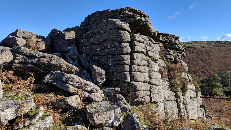 The Zeal Tor Tramway passes close to the tor, close to the Avon waterworks. Now dismantled, this tramway was built in 1847 to carry peat from the Redlake beds and had wooden rails bolted to granite blocks. However, it soon closed in 1872 and its remains can be traced along the footpath that follows its old course towards the spoil heap. 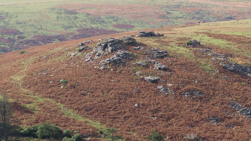
| ||||||||||||||||||||||||||||