TORS OF DARTMOOR
a database of both lesser- & well-known rocks and outcrops
Bottor RockBot Tor, Bot Tor Rock, Botter Rock, Bodetorre, Bottore, Westbottore, Bottor's Nose, Potters Rock 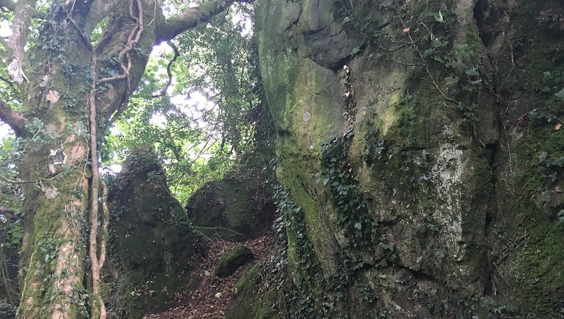 Bottor Rock stands on an elevated spot in woods on private land, about half a mile to the south west of the village of Hennock. It is a fine tor but is now mostly hidden high above the same named farm, but parts of it are still visible to the left of the public footpath (Beacon Lane) that leads from Five Ways out to Chericombe Head where a 19th century granite guidepost still stands. Like other rocks and tors on Dartmoor, Bottor is associated with numerous myths and legends. 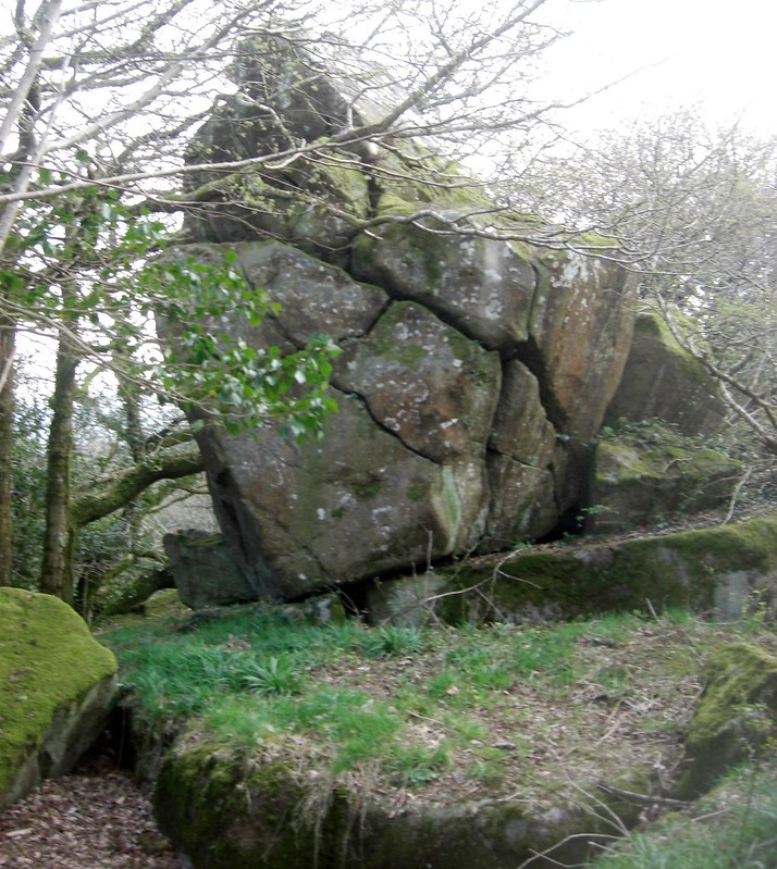 Writing in 1834 Henry Edmund Carrington is one of the first to describe the tor here he writes "Bot-tor, near Hennock, has oak trees growing in its clefts, and at its foot are hollows, like caverns, lined with byssus aurea, which, according to De Luc, at particular spots and in certain lights, displays a very glittering appearance, of a greenish blue." These hollows according to William Crossing (1909) were formerly the haunt of pixies "who have often been heard singing by the good folks of Hennock when making their way homeward late at night". The author advises (page 301) that the upper mass is known locally as 'Bottor's Nose' and then refers to a vista that sadly is no longer visible today because of the trees. The 'nose' appears to be a huge spilt pyramidal rock which is the most striking feature of the group. 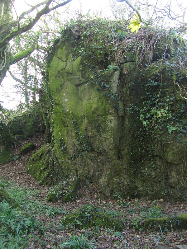 Tim Sandles (TS) explains on his Legendary Dartmoor website that "The first documentary record of the tor comes from the assize rolls of 1238 where it is written as Bodetorre, the place-name is thought to have meant, Botta's or Boda's torr. There is a suggestion that the origin of the name means inhabited hill and whilst the name does indicate that the hill/tor was owned by Botta or Boda it is hard to establish whether he actually lived on it. Further documentary records show the name mutates thus: Bottetorre - 1306 (assize rolls) Bottorre - 1330 (lay subsidy rolls) Westbottorre - 1414 (feet of fines)." It seems that one of the earliest examples of Bottor appearing on a map is from Donn's and is dated to 1765. TS also draws attention to what he calls a "supposed Idol or Stone Altar" that was first described in 1841 and later by J.G. Croker in 1852 "On the west side of Bottor Rock is a singularly placed stone, described by W C Radley in 1841, as a huge rock idol or stone altar, with its fore foot supported by a wedge-like mass of the same older syenitic rock of which the whole is composed." However, TS concludes that the consensus of opinion since, is that this is actually a natural rock formation is not man made and therefore is of no particular religious significance. 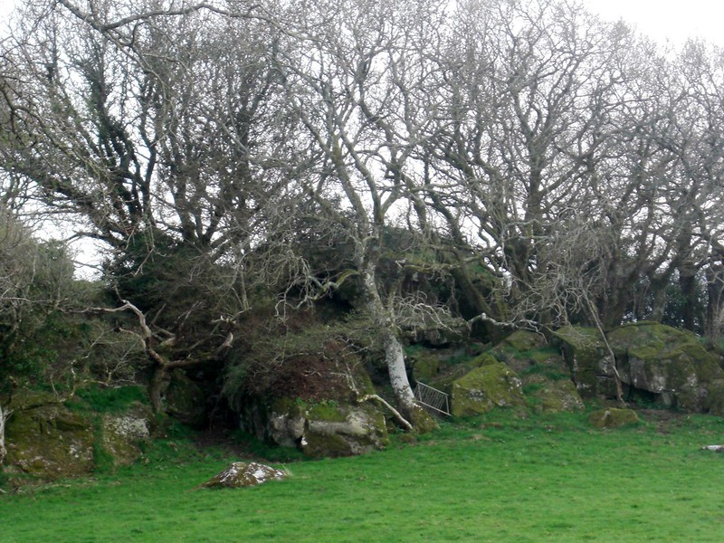 In another mysterious tale we learn from the Rev W.H. Thornton in 1907 that Bottor Rock is associated with the legend of John Cann he writes "There is up at Hennock near Bottor, among the rocks a cave which goes by the name of John Cann's Kitchen and around it is Little John's wood. Local tradition relates that John Cann was a Hennock loyalist...so these gentlemen (Cromwell's men) after the defeat of their opponents in the heath fields indulged in a hunt before they left the neighbourhood...having tracked poor John to his kitchen with bloodhounds they hanged him in the heath field below but, or so it is said, they did not discover some treasure he possessed, and this still remains where he hid it in the rocks." However, writing in 2013 Mary Tavy assures that she has it "on good authority that metal detectors have been used to try and find this elusive treasure but to no avail."
| ||||||||||||||||||||||||||||||