TORS OF DARTMOOR
a database of both lesser- & well-known rocks and outcrops
Branscombe's LoafBranscombe's Cheese, Brandscombe's Loaf, Brandscombe's Cheese, Bronescombe's Loaf, Bronescombe's Cheese 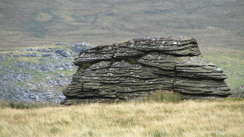 Perhaps best accessed from the direction of Prewley Moor a mile or so to the north, the so called 'Loaf' is not usually described as a tor but it nevertheless fulfils all the criteria sitting atop Corn Ridge high above the sprawling Shelstone Tor.  This supremely fissured outcrop with close horizontal joints in the granite is associated with an enduring legend of the moor first described it seems by Sylvia Sayer in 1951, where she writes: "Bishop Bronescombe often travelled to the Moor himself... tired and hungry he became, and how a stranger approached him with an offer of bread and cheese, if, in return, the Bishop would get off his horse, take his cap and call him "Master"; how the famished bishop almost did, but the chaplain spied the stranger's cloven hoof just in time - at which the Bishop cried out to God and made the sign of the cross, whereat the stranger vanished, leaving the bread and cheese turned to stone: it still can be seen on Corn Ridge... and is still called Branscombe's Loaf and Cheese!" These names continue to be used today for the main outcrop and the smaller one nearby. 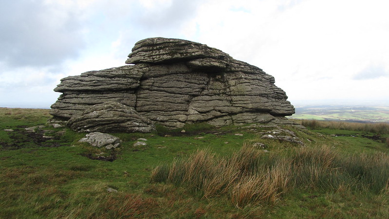 Eric Hemery (1983) describes it thus; "The tiny cohesive tor is itself surrounded by the outline of a circle, not unlike the bare remnant of a cairn once enclosing it, having a circumference of seventy-seven yards, and near it is a smaller outcrop of rock. Its odd name, or choice of names, stems from a legend concerning the medieval Bishop Walter Bronescombe of Exeter..."  Writing in 2022 for Dartmoor Magazine Tim Jenkinson named the Loaf as one of his favourite tors. He provides further information on the scene: "Legends aside, this is an exhilarating hilltop. The views to the north are magnificent, taking in the extent of Meldon Reservoir (opened 1972), a bright blue puddle in the far distance. Moving our attention to the right we see West Mill and Yes Tor with High Willhays and Fordsland Ledge on high and, lower down on the slope, Black Tor's three outcrops. Away to the south Great Links Tor dominates the scene. A visit is thoroughly recommended as the landscape shows Dartmoor at its best. For me this was the first great view of the moor in the late 1980s, and it has left a lasting impression. A revisit in 2022 reaffirmed its stunning appeal."
| ||||||||||||||||||||||||||||||