TORS OF DARTMOOR
a database of both lesser- & well-known rocks and outcrops
Brent Hill Summit TorBrent Beacon, South Brent Tor, Beara Common 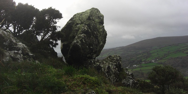 The summit of Brent Hill, also known as Chapel Hill as named on Tithe Maps, includes several impressive non-granite crags. Displaying the awesome nature of the non-granite rock seen all over this hillside, the crags dominate the onlooker from below. The hill was called 'Brent Beacon' by Benjamin Donn in his map of Devon 1765, but after this, it acquired the name of 'South Brent Tor' by John Lloyd Warden Page in 1895. To access, a bridleway begins the steep ascent from the hamlet of Lutton where the track continues on open moorland to reach the top; or alternatively, you can take a slightly more exhilarating path via the North-East Tor to reach the summit from the north side. 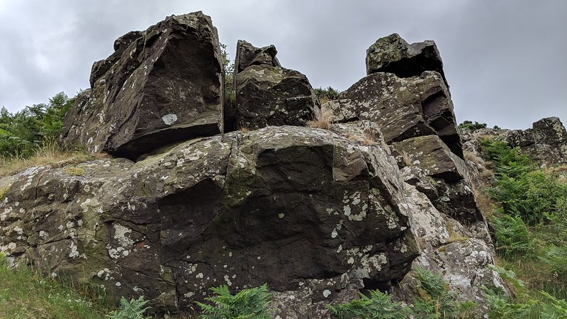 One interesting feature here is a curiously balanced boulder on the southernmost summit crag (SX 7026 6166), best seen from the north-east side, but the grandest outcrop here is nearest the trig point (SX 7030 6170), where there is a distinctive rock face looking towards South Brent, one of three major crags around the summit area. Above this at the trig point, an excellent vista is displayed with the likes of Hameldown, Bonehill Down, Rippon Tor and Haytor Rocks all visible to the north; south-westward, Ugborough Beacon Rocks impress and the hill is seen to its best advantage from there. It is a shame, however, that the ruined chapel and trig point number are now on private land and for the former, you must be content with viewing it from open access land nearby. Whilst the name of 'Brent Hill' is generally known for the whole hill, the outcrops have received little if any attention and have seemingly been overlooked in favour of the chapel and trig point. 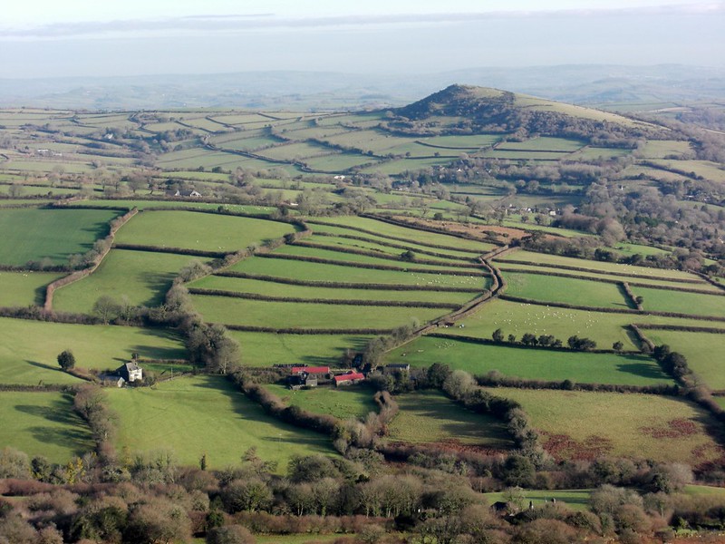 North of the trig point there is another crag (SX 7033 6174), reaching its conclusion at a small clitter below a fence. Thanks to The Book of South Brent, published in 2005, we have an added piece of information for Brent Hill; "Near the summit are the ruins of St Michael's Chapel. A custom of taking wooden crosses to the summit rocks of Brent Hill was started in 1972 by the then Reverend Michael Malsom. Every year since on Good Friday, excluding the foot and mouth epidemic of 2001, the pilgrimage has taken place. We assume that it still continues to this day." 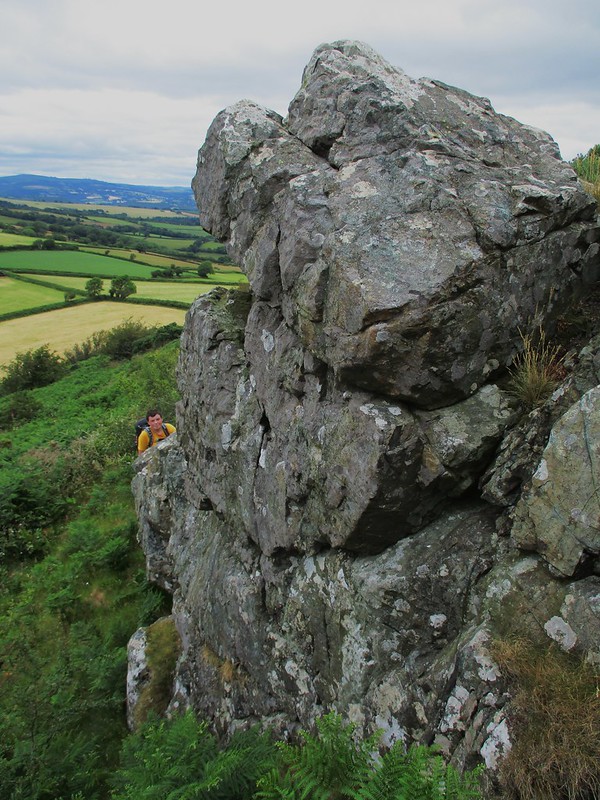
| ||||||||||||||||||||||||||||||