TORS OF DARTMOOR
a database of both lesser- & well-known rocks and outcrops
Brunel's Lookout
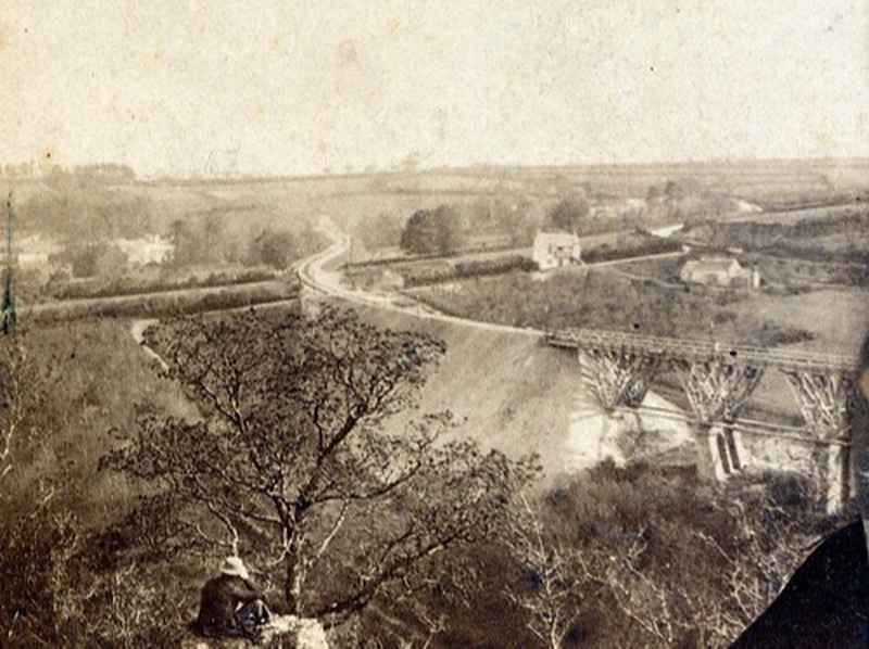 Above where Gem Bridge crosses the River Walkham, at the eastern end of Sticklepath Wood and directly above the old Walkham United tin mine a series of small, slate crags lie hidden in deep woodland. These wouldn't normally rate a mention, except that there is nothing else close by, and that there is a remarkable photo showing a man seated on one of the crags from around 1860. He is looking out over the valley and the then newly constructed I K Brunel viaduct that spanned the Walkham from 1859 until it was modernised in 1910. Although it is highly unlikely that the man in the picture is Brunel himself, especially as he's wearing a boater rather than Brunel's iconic top hat, the crag would have offered a magnificent view of the site while construction was in progress. 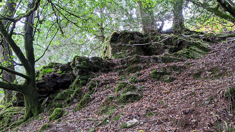 What was then a fairly open hillside is now dense woodland, but after a lot of wading through wet bracken and sliding about on steep, damp earth Peter Freeman managed to locate several outcrops. These lie around SX 494 705, and the most likely candidates for the rocks in the picture are at SX 49352 70510 and SX 49244 70532. Whereas the square profile of the rock suggests that the former of these two, as pictured above, is the most likely, when looking at the photograph and the OS map it actually looks like the bend in the A386 would be obscured by the lower building and therefore the latter (pictured below) is the best candidate. 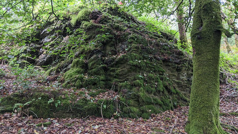 Close by are several shafts and adits belonging to the Walkham United Mine. Just below the foot of the first pile, there is a massive gash in the wooded hillside. This area was heavily mined for tin in the 19th Century and its remains today can only be described as spectacular, however, none of the open shafts are fenced off so you must tread with caution. 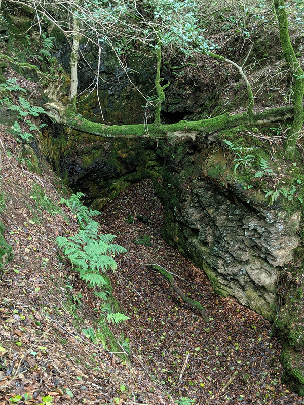
| ||||||||||||||||||||||||||||||