TORS OF DARTMOOR
a database of both lesser- & well-known rocks and outcrops
Burrator Waterfall
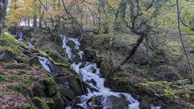 Any visitor to the Burrator area on Dartmoor will be rightly captivated by the reservoir lake and dam that was according to John Somers Cocks (1970) completed in 1898 at a cost of £150,000, with the reservoir flooding 117 acres. However, some 300 metres south of the dam and beyond the magnificent rocks of Burra Tor proper is a picturesque waterfall. 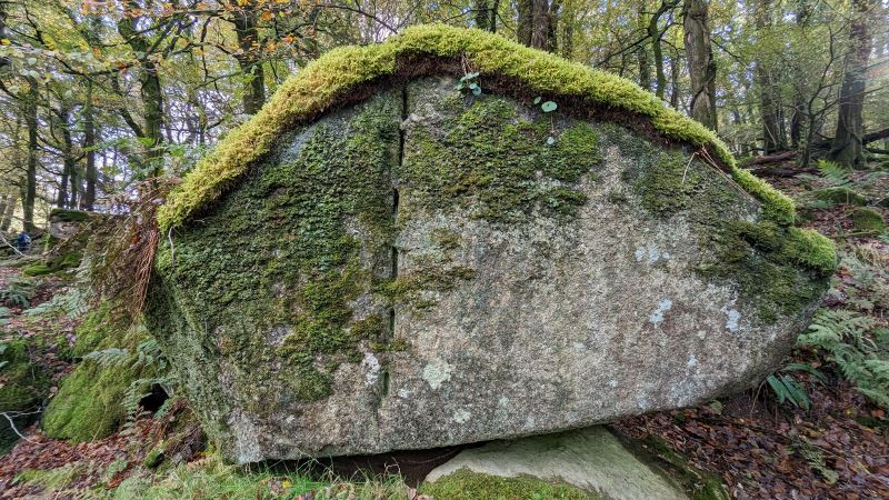 The impressive cascade of water is on Sheepstor Brook in Burrator Wood and whilst generally appreciated in the locality it surprisingly receives only scant mention in the literature despite being marked on OS maps. Johnie Stickland (2012) takes up the story in his Dartmoor blog: 'The Sheepstor Brook runs from under Sheepstor itself, through the village and cascades down a fabulous boulder strewn gully with mature trees littering the scene. At the bottom of the gully it joins the River Meavy at a point where the head weir of Meavy Mill leat sits. An old hydro-electric plant sits there, slowly decaying. A curious blend of stunning nature and man's attempt to harness nature's power.' 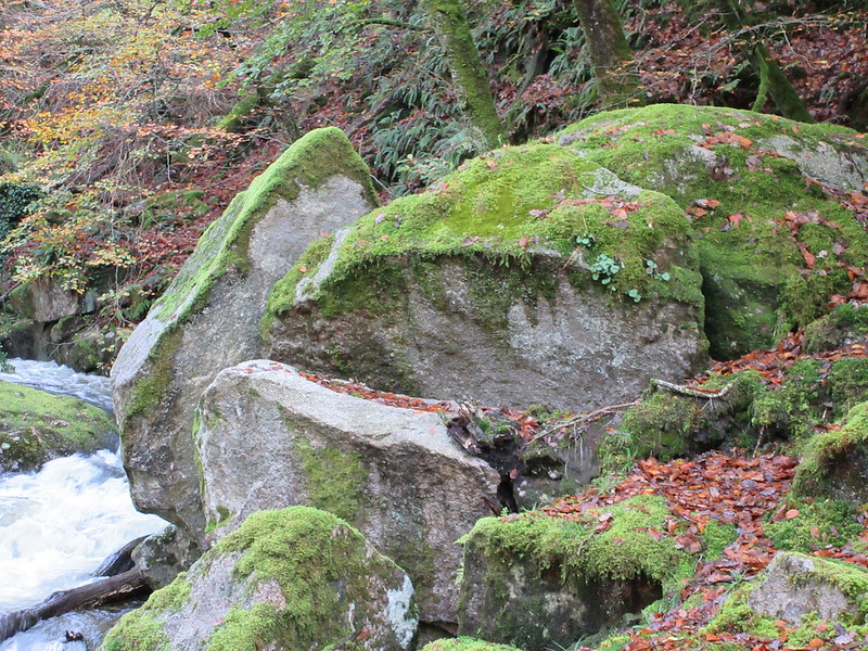 Indeed the foot of the brook is a delightful scene where on the riverbank several large rocks stand. Uphill from here the banks are covered in granite boulders where the water bursts, twists and skips over the rocky landscape. On the south side of the falls nearing the top more artefacts from the hydro-electric plant can be found including pipes and an old hut like building. Nearby there is a giant upright boulder bearing the scars of an attempt to split it. 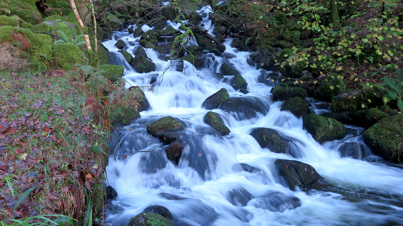 The ruggedness but also the beauty of this tranquil spot, if you discount the roar of the falls, is well worth a visit. Enter the wood at the west end of the dam on the south side of the road as for Burra Tor and after inspecting one of Dartmoor's finest lesser-known rockpiles continue walking south through the wood until reaching the mini chasm at SX 5521 6758. You will not be disappointed.
| ||||||||||||||||||||||||||||||