TORS OF DARTMOOR
a database of both lesser- & well-known rocks and outcrops
Buttern RocksButtern Hill, The Cuckoo Stone, Buttern Tor 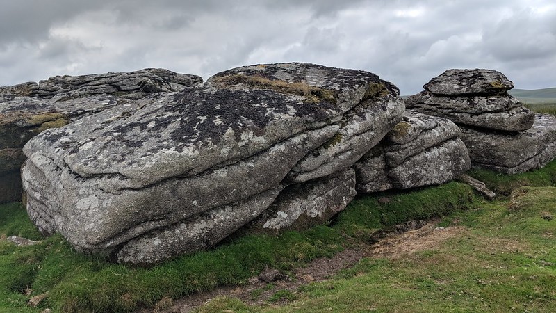 Buttern Rocks are a long band of short outcrops running along the top of Buttern Hill in a northerly direction towards Whitemoor Marsh, the highest point of which is at the southern end. Two small outlying outcrops also lie further to the north at SX 6522 8885 and there is evidence that some of the rock in this area has been plundered for building stone. William Crossing, when standing at South and North Creber (Creaber) to the south-west, gives an insight into other names for the rocks: "Our next point is the summit of Buttern Hill (R. 24, 38), on which is a small cluster of rocks sometimes referred to as Buttern Tor, and to which also the name of the Cuckoo Stone has been given, rather over 1/2 m. to the N.W." 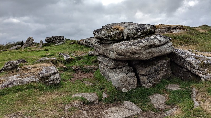 The tor itself gives the impression of a low wall when approached from the west and while none of the rocks reach an impressive height above the ground what they do possess is an abundance of artefacts: a tethering ring at SX 65279 88703, a few paces away a millstone resting on its side at SX 65276 88699 and two logan stones at SX 65287 88651 and SX 65278 88694, respectively. The ring is said by Eric Hemery to have been fixed by a former moorman of Buttern Farm. The surrounding slopes are given to several dilapidated antiquities, that are mostly ruinous and overgrown of which one a low stone and grass reave runs into and through the rocks of the tor in a west to east direction. In addition to this there is evidence of ruined cairns, settlement walls and on the lower western side the remains of a small stone circle that Worth (1953) estimates to have once measured about eighty-one feet in diameter. In his account of the Hill, Hemery also draws attention to what he describes as "curious pointed boulders" one of which some 100 yards south west of the tor is of bound stone proportions, standing at about four feet in height at close quarters it resembles a triangulation pillar. 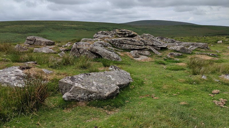 Good views are to be had from the modest rocks particularly of Meldon Hill and Kes Tor to the south east and in the same direction but much further away a long distant Haytor is visible on a clear day. Looking to the south west the crags of Wild and Watern Tors rise. The views are also extensive out towards Mid Devon and the wooded fringes of North-East Dartmoor. 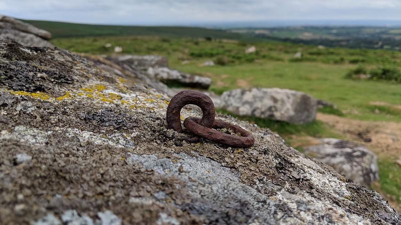
| ||||||||||||||||||||||||||||||