TORS OF DARTMOOR
a database of both lesser- & well-known rocks and outcrops
Chat TorLoaf, Clatter Tor, Chatter, Rattlebrook Hill 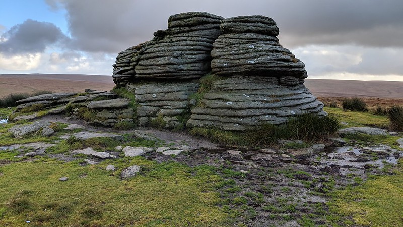 Despite its obvious appeal in an area otherwise devoid of granite on top of Rattlebrook Hill to the north-east of Lydford Sharp Tor, there is surprisingly very little commentary on Chat Tor in the literature. It appears on Donn's Map of Devon from 1765 onwards as 'Chatter' but this strangely translates into Ken Ringwood's 2013 book on Dartmoor Tors as 'Clatter Tor', repeating Terry Bound's earlier reference which is possibly a mistake especially as there is no clitter or 'clatter' nearby. Crossing (p15) describes that term as "the collection of boulders frequently seen covering a considerable area on the side of a hill", adding "these rock fields are really the ruins of tors." There is no such evidence of that here. 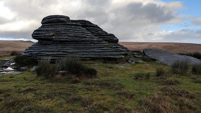 In recent times the tor has received a somewhat derisory 3/10 rating from Josephine Collingwood (2018) even though she shows an evocative black and white photo of the outcrop on page 53 having explained earlier that the score is 'purely subjective'. She then remarks "Since Chat Tor offers little of interest other than its view and shape I shall expand upon the blanket bog that surrounds it." Yet another blow delivered to the little tor, but anyone who takes the time to visit cannot fail to be impressed by its geology and compactness in such a lonely spot. 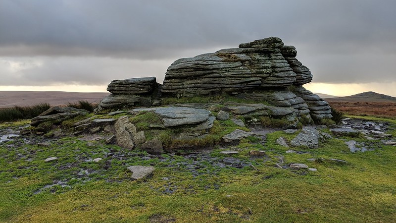 Hemery says of the area north-eastward: "Chat Tor provides a view of the turf-ties (pre-industrial) from which so much peat was formerly transported by packhorse along the old Lydford path, and from which the eighteenth-and nineteenth-century miners in the valley would have obtained their fuel."  Crossing explains that the tor is also marked on a Duchy Map as 'Loaf', which likely comes from the tor's characteristic appearance but is an ancient name not to be confused with the better known Branscombe's Loaf well away to north of here on Corn Ridge. Certainly, the tor has the resemblance of a small cob loaf to merit that association. Nowadays a military flagpole is set on the Hill near the tor as it resides within the Willsworthy Firing Range, so it is very important to check that access is permitted before visiting this part of the moorland landscape.
| ||||||||||||||||||||||||||||||