TORS OF DARTMOOR
a database of both lesser- & well-known rocks and outcrops
Chaw GullyChough Gully, Chow Gully, The Devil's Throat 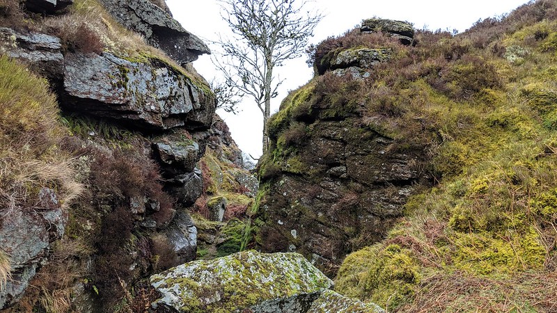 The deep tin mining excavations known as Chaw Gully are fantastic examples of tall granite cliffs that have been exposed by the tin mining industry of the 18th and 19th Century. The onlooker is intimidated by the sheer enormity of the cleft in the northern gully where chiselled rock faces jut from the steep sided slopes. In places the space between the rocks is so narrow and claustrophobic giving an eerie feel to the area especially on a misty day. In the book 'Half Brothers' Eden Phillpotts describes the gully as 'The Devil's Throat' and states that 'its greatest depth runs near fifty feet, and the sides of the shaggy and savage place are torn into many ledges carved grotesquely by winter torrents full of strange aerial nooks and crannies, where the hawk and jackdaw breed'. 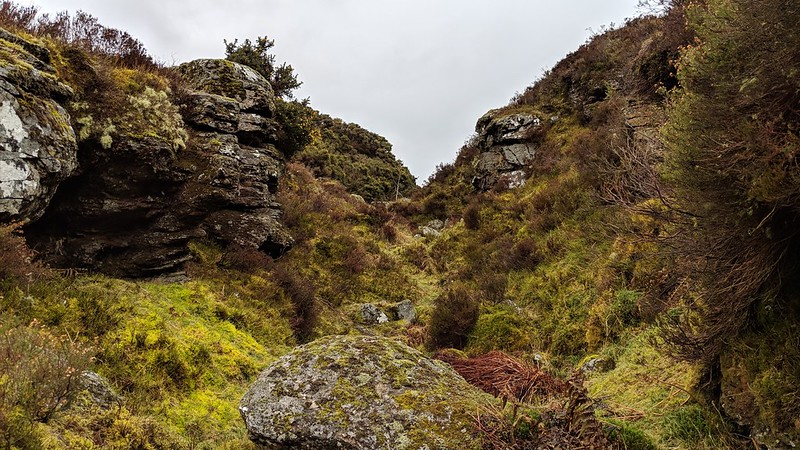 However, to the south amid another impressive gash in the hillside is where more gentle outcrops can be found including a pile that has what Hemery (page 598) describes as a logan rock atop (SX 68911 80887). Nearby there stands a most unusual artefact none other than a boundary stone (SX 68888 80883) bearing the inscription 'East Birch Tor' - the once name of a mine in the area that was first recorded in 1836 (Brewer 1986 p48). Whilst a path passes fairly close to the logan rock from the Challacombe stone row, the northern gullies are a little more challenging and care must be taken on the precipitous heather clad slopes above the cliffs. 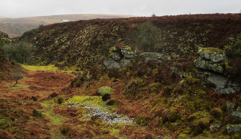 We learn from Crossing that the name of Chaw or Chow is a local corruption of Chough, a now relatively rare bird of the crow family with distinctive red legs originating from the cliffs of Cornwall. On a similar theme Hemery links the name to the Jackdaw. 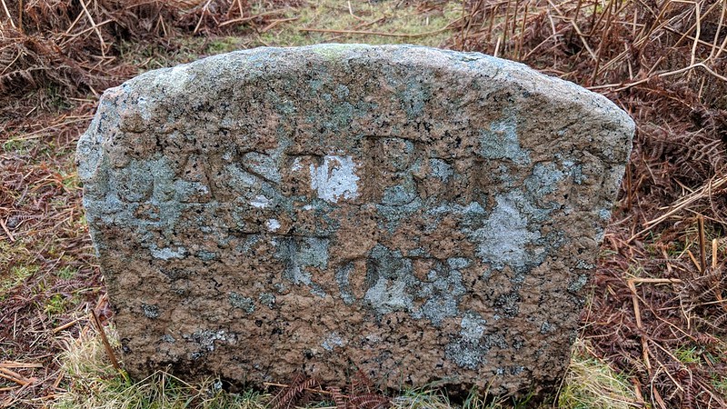
| ||||||||||||||||||||||||||||||