TORS OF DARTMOOR
a database of both lesser- & well-known rocks and outcrops
Chinkwell TorChinkywell, Clinkwell Tor, Clinkwell Rocks, Chinkwell Rock 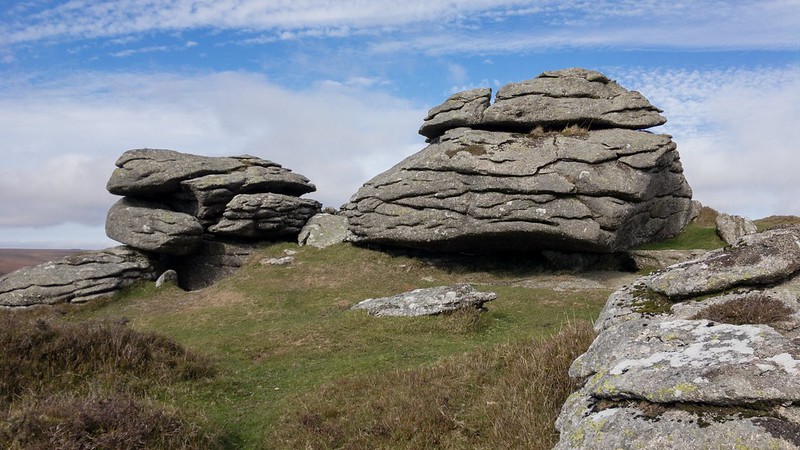 North of Bell Tor, a path runs through several granite outcrops, along the ridge known as Bonehill Down. The views from the summit cairns are stupendous with Hamel Down and Haytor Rocks most prominent. However, the more interesting outcrops lie just off the summit. 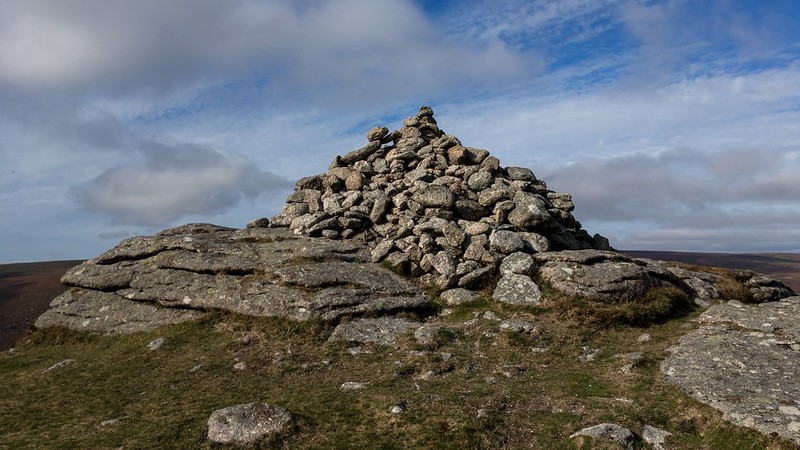 Hemery describes it; "The summit of the tor - known to the local moor people simply as 'Chinkywell' - is less impressive than that of Honeybags, but interesting features elsewhere include bold formations on the steep west slope, a court-like space below the summit on the east side and a 'gateway' formation on the west." 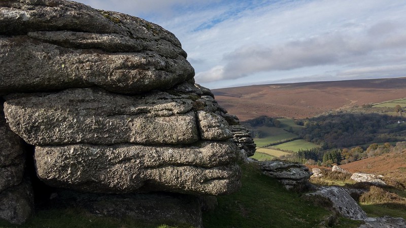 The southernmost outcrop at SX 72997 78030 possesses a very fine irregular rock basin, first noted by Tim Jenkinson, resembling a jigsaw puzzle and found beside the path that ascends the ridge. John Chudleigh (1892), in his book entitled 'An Exploration of Dartmoor Antiquities', gives us an alternative name, and on page 8 we read "Westward we descend another valley and make our way across some boggy ground in the neighbourhood of Hedge Barton, to the accompaniment of a smart hail storm (for the spring has hardly yet commenced) to Honeybag Tor, between which Tor and the neighbouring Clinkwell Rocks are some hut circles". 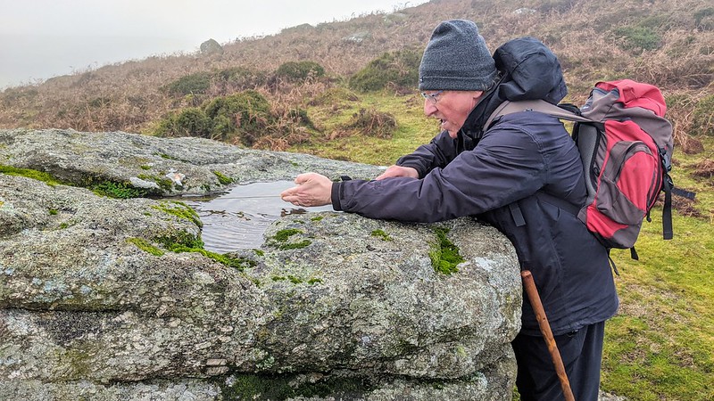 On page 37 he continues with details of another excursion "A short walk along the Widecombe Road and I take the Downs again. It is a steep and rugged climb over the clatters to the top of Clinkwell Rocks, but the view from this ridge is a very fine one." As with other tors in the area, it is best accessed from one of the three car parks below at Bonehill Rocks, with a short yomp up to the top.
| ||||||||||||||||||||||||||||||