TORS OF DARTMOOR
a database of both lesser- & well-known rocks and outcrops
Claig TorCleg Tor, Cleag Tor (Hemery), Click Tor (Hemery), Yannadon Crags, Yennadon Crags
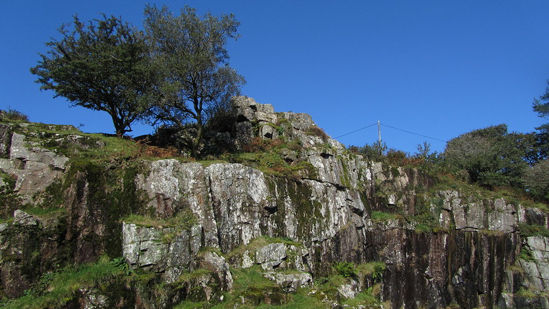 In 'Walking the Dartmoor Waterways', Eric Hemery (1991 p80), describes Claig Tor as being near Burrator Reservoir and includes the alternative names of 'Cleag' and 'Click' to refer to the same rocks, repeating his earlier assertion from High Dartmoor. However, the use of 'Click' is confusing as it is not the same tor as that which is mentioned by William Crossing as being some way to the east of here, and much nearer to Roughtor Plantation. What both authors do agree on though is the term Yennadon or Yannadon Crags to describe the tor here, which lies in two main portions above and below the road running from the village of Dousland to the dam at Burrator Reservoir. William Crossing, in his 'Guide to Dartmoor', marks the scene; "From Dousland the visitor will make his way to Yennadon and there branch L. into the road running along the side of the hill with Burrator Gorge R. On the hill above, L., are the Yennadon Crags, formerly known locally as Cleg Tor." It is worth noting that this reference to 'Cleg Tor' is only in the third edition of the book and the description he offers implies that the author did not notice the much more impressive lower crag. 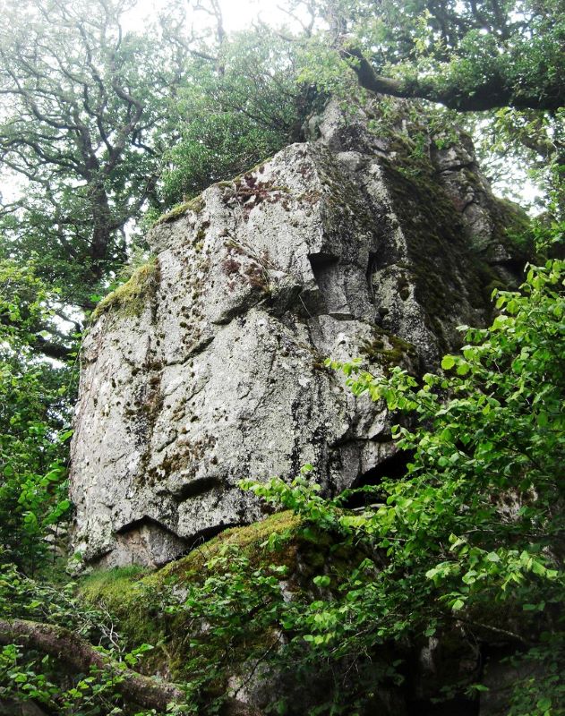 The upper rocks are perched above a large, quarried rock face at SX 5498 6773 and are approximately 300 yards to the south of the dam on the south eastern lip of Yennadon Down. Here we have a jumble of broken rocks, some of which still retain the rusting spikes that were used to split them. Worth (1953) explains that much of the granite and slate from Yennadon was used to heighten the dam between 1923 and 1928 and that is when the tor's appearance altered to what we see today. Away to the north of the rocks runs the old track bed of the disused Yelverton to Princetown railway line. Kingdom (1991) advises that the line was opened in 1823 and extended to Princetown two years later and that "granite and minerals formed the traffic down from the moor whilst coal, lime, timber and prison stores formed the upward traffic."  It appears that the line always struggled for its existence being in such a sparsely populated area and that once the granite quarries that it served closed in the 1920s, GWR tried to stimulate passenger traffic by opening halts at King Tor and Burrator with another at Ingra Tor in 1936. The plan was to attract moorland hikers and family picnic groups, but the increasing costs of operation and the isolation of the line that could get blocked by snow in winter coupled with the increasing popularity of the motor car meant that its closure came in March 1956. Since then, the route has become popular with walkers and cyclists alike. Little more than 200 yards from the top of the tor to the north are the fascinating remains of the Burrator and Sheepstor Halt where two kissing gates, a few steps and the concrete base of the waiting room shelter remain. Opened on the 4th February 1924, Kingdom explains that the halt "was situated on the high embankment above the dam and gave the traveller a fine view over the manmade lake." The place is well worth a visit as the upper rocks of Claig Tor also provide some exceptional views of the reservoir and the hulk of Sheepstor to the east and there is a marble memorial bench to 'Jack Trenerry' atop that is ideally placed to sit and enjoy what is on offer. 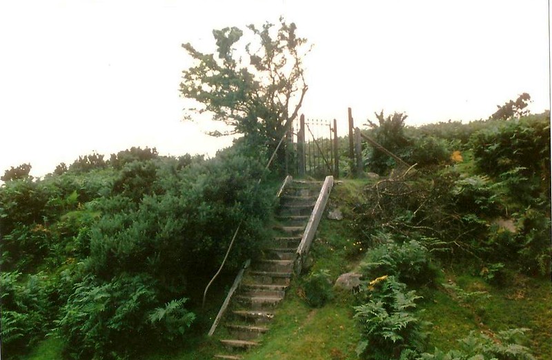 Across the road, and below it, the lower crag is well hidden even though its top edge lies little more than 50 yards from the tarmacadam. Situated at SX 5504 6772 the superbly fissured rock towers above and to the right of the track leading to Meavy village and a section of the now disused Plymouth (Drake's) Leat that once conveyed water from the River Mewy to the growing city of Plymouth. The leat was modernised in the 1860s but ceased to carry water around the time of the completion of the reservoir and the advent of piped supplies in 1898. Hemery advises that the current granite bedding of the leat dates from 1871 and it is probable that much of Claig Tor's lower crag was used to facilitate this. Seen at its best from below, the rock face is clad in moss and fern and rears up from the leat channel to height of some 20 feet or so. It has clearly endured much disruption but retains a unique defiant presence that is a lasting reminder of the former grandeur of the crags in the gorge.
| ||||||||||||||||||||||||||||