TORS OF DARTMOOR
a database of both lesser- & well-known rocks and outcrops
Clampitt Rocks South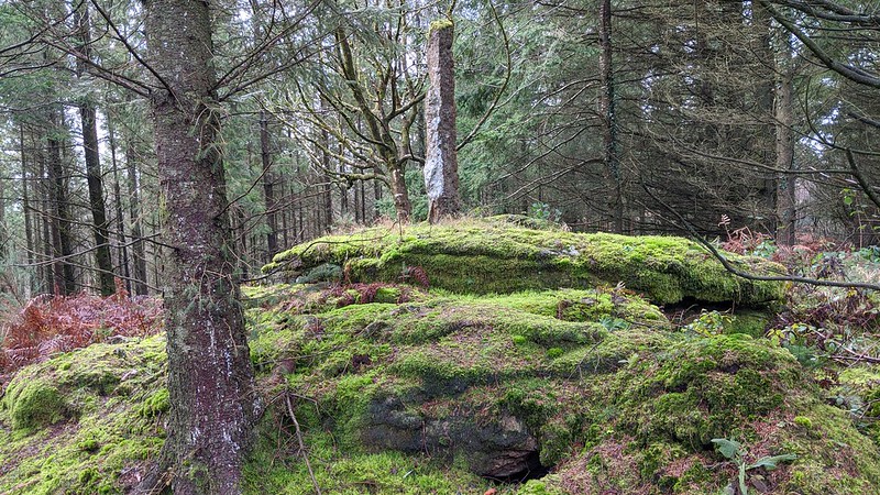 Hidden within Clampitt Plantation, there are two tumps with lowly granite outcrops to the north and south of Clampitt House. The southern outcrop at SX 8151 8438 is barely a metre in height. Its stature within the thickets of these dark woodlands, coupled with what appears above the brambles possessing a camouflage of moss, has meant it has long been overlooked, indeed it isn't noticeable from the nearest track some one hundred metres to the east. 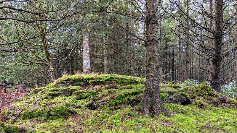 But it didn't escape the notice of a woodland archaeological survey of Kennick and Tottiford Woods in 1994, as the tiny tor is a natural plinth to an unusual artifact that sits atop. Referenced as a "Worked stone south of Clampitt House" it goes on to describe a "Standing granite post with feather and tare marks noted in 1994 woodland survey standing on the highest point of land in this sector, just north of the southern boundary wall." 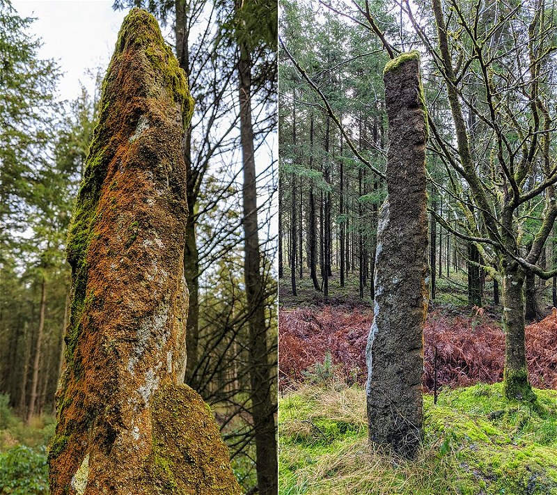 The stone, at an approximate height of two metres, is an oddity and its purpose is unclear although the 1841 Tithe map for the neighbouring parish of Bridford shows lines emanating from the Ordnance Survey trig point that once stood on Beacon Down, one of which would intersect the outcrop, therefore it is highly likely that it is simply there as a surveyor's aid to see the top (at 296m) of this part of the plantation (Clampitt Rocks North is higher at 302m) before the trees were planted. 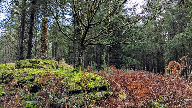 There are no inscriptions visible, but as the granite is coated in a thin layer of a rust coloured lichen on two sides we cannot rule any out. The records date the post to between 1750-1900, which isn't particularly helpful in the search for further information, but if it is related to surveyance, then this could date it to between 1809-1841. Special thanks go to Paul Rendell for alerting us to this outcrop. Clampitt Rocks North can be found here.
| ||||||||||||||||||||||||||||