TORS OF DARTMOOR
a database of both lesser- & well-known rocks and outcrops
Click TorCleag Tor, Outholme Rocks, Outhome Rocks, Outcombe Rocks
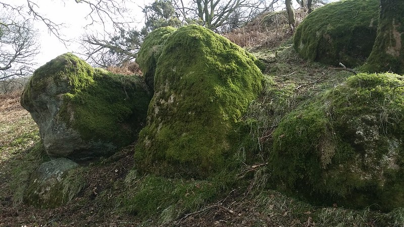 This is a very good example of how the names of some tors have been cited in the literature, yet their locations are unclear. The name of 'Click Tor' is first mentioned by William Crossing (1909) but his description of its whereabouts is impossibly vague. The author suggests that the tor is apparently "nearer the Plym" than Rough Tor (in Roughtor Plantation) and in the absence of any other rock piles in the vicinity Terry Bound (1991 and 1995) interprets this as meaning Outcombe Rocks at SX 5779 6844. The name 'Outcombe' though, does not appear on maps; the Tithe Map shows the name 'Outhome' for the tin working building, and modern Ordnance Survey Maps show the area as 'Outholme Woods'. 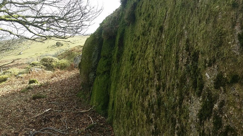 Alternatively, Hemery suggests that 'Click' is a corruption of Claig or Cleag Tor, a small pile elsewhere, one that is set above quarry remains at SX 549677 and is also known as Yennadon Crags, an assertion that is supported by Mike Brown (1995) in his Gazetteer of Dartmoor Names. Hemery describes Outcombe Rocks as a separate entity on pages 153-154 of High Dartmoor where he writes "Outcombe Farm has been derelict within the memory of even the oldest moor people I have met. Above it, precipitous and frowning surrounded by the gnarled oak and spindly elm and the outer wall of Outcombe Newtake are the core and clitter of Outcombe Rocks and at the foot of the clitter the garden of the old farm." At no point in this account does he link the two names. 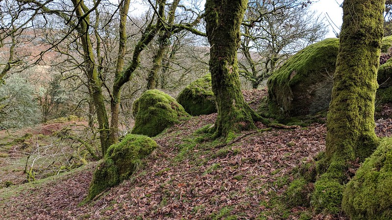 However, if Bound's assessment is correct then Outcombe Rocks or Click Tor, is a cluster of very large boulders set in an oak coppice (Outholme Woods) on the steep slope above the small ruin of the old Farm some 100 yards below. The tor is essentially a flattened pile of large rocks straddled by three oaks, giving rise to a moderate clitter of moss clad rounded boulders extending downhill. The main rock face is formed by one massive grass split boulder of about 20 feet in length that is 8 feet high on the north side. Above this point the tor levels out to a small grassy plateau beyond which an old enclosure wall, curls south westward. Lying in a peaceful shadowy aspect that overlooks the Narracombe beneath Down and Combeshead Tors it is a most pleasant place to visit but access in the past has been complicated by the erection of fences around the rocks, particularly on the eastern side. There is also uneven ground below, that has been disturbed by tin working so care on the approach is needed if coming that way. Views from the Rocks are concentrated to the north where the three tors of Snappers, Little Down and Down are seen in ascending order. 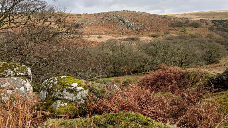 Famously, it was here on a spring day in 1993, whilst taking lunch at Outcombe Rocks that Tim Jenkinson had a chance encounter with a fellow walker, a Mr Derek Rendell an elderly man who had spent a good proportion of his life roaming the moor and soon the conversation turned to tor names and the view in front of them. Tim continues the story "He explained that the outcrop nearest to Middleworth Lane was, as one would expect Middleworth Tor, with the middle and most impressive pile being Snappers Tor, with Little Down Tor on high, beneath its dominating parent. However, I later discovered that this interpretation was somewhat at odds with Hemery's account of that arrangement on the hillside. As a result, I attempted to unravel the debate in an article in Dartmoor Magazine from Spring 1997". Reflecting on that occasion Tim concludes "To this day I am grateful for sharing the conversation that provided me with information regarding the tors' identities. Whenever I arrive at Outcombe Rocks I am reminded of that chance but fortunate meeting."
| ||||||||||||||||||||||||||||