TORS OF DARTMOOR
a database of both lesser- & well-known rocks and outcrops
Coombe Tor (Chagford)Coombe Torr, Combe Tor 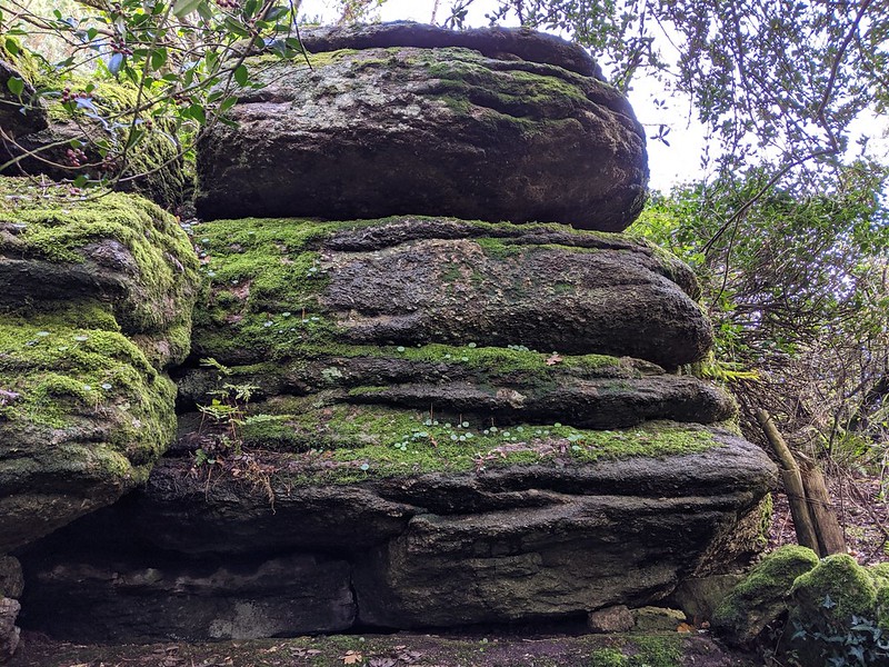 Coombe Tor resides on private land so please seek landowner permission before visiting. The owner is obliging when polite requests are made. The tor is set in woodland left for wildlife. It has a lower southern outcrop possessing a large arch feature but the top is relatively flat though possessing stunning views westward to Kestor Rock. 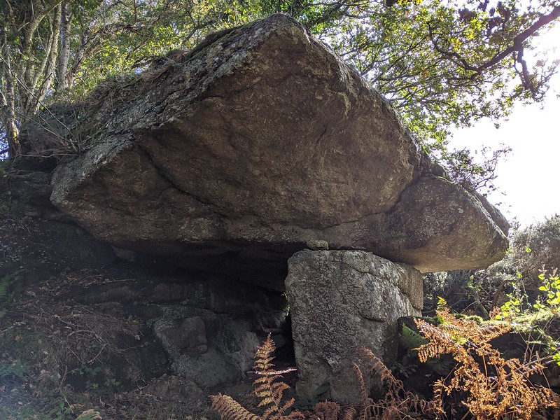 The tor's outcrops seem to span a long, exposed ridge of granite just below the summit of the hill where the southernmost pile is the most distinctive, presenting as a fine, rounded mass streaked with close horizontal joints that are tinged green with moss. Continuing northward, the land drops away steeply below the summit rocks where a little further down the hill a huge plaque can be found. This was set up in memory of Mary Ann Liggins Clampitt who was said to love it here and sit in quiet contemplation atop the tor admiring the distant views. Recently uncovered at SX 68580 87155, it reads; "IN LOVING MEMORY OF / MARY ANN LIGGINS CLAMPITT / OF COOMBE / DIED FEBRUARY 4TH 1908 /". 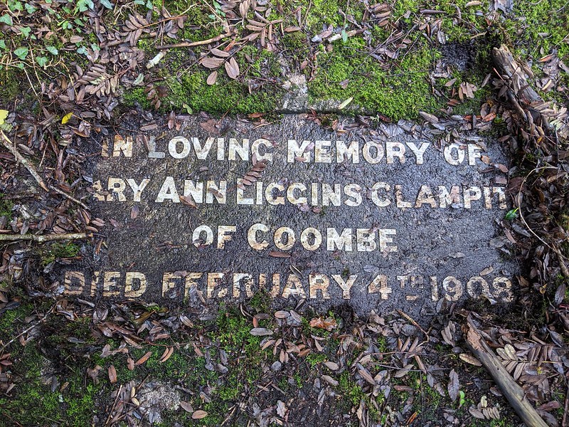 There is also a cross here, by the rock basin, with an inscription low on its base; 'M.A.L.C. 1908.' This is also in memory of Mary Ann Liggins Clampitt who, despite her Devon connections, as her husband owned the cottages below, was buried in London Road Cemetery, in Coventry. The headstone reads; "In loving memory of Mary Ann Liggins, the wife of Richard Vooght Clampitt of Coombe, Chagford... who departed this life February 4th 1908 Aged 70 Years. - Also of the above named Richard Vooght Clampitt of Coombe, Chagford, Devon who departed this life March 20th 1911 Aged 67 Years. United." 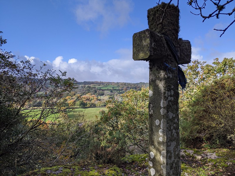
| ||||||||||||||||||||||||||||||