TORS OF DARTMOOR
a database of both lesser- & well-known rocks and outcrops
Corndon TorCorndon Down, Corn Down Tor, Cairn Down Tor, Cornetor, Curnen Tor, Quarnian Tor, Quarnell Tor, Belstone's Chair
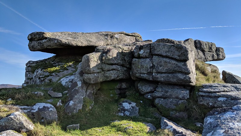 Corndon Tor is a deceptive tor, appearing to the casual person who visits the summit outcrop encircled by a cairn as rather a disappointing, unassuming tor, but look around and explore the nearby slopes where the more interesting granite outcrops reside. One of the best of these is to the east at SX 68709 74115 where there is a marvellous view of the Hameldown Ridge and an outcrop with striking close horizontal joints beside a fine rock shelter which displays the intersection of different types of granite. There is another interesting outcrop below the summit to the south-west at SX 68423 73910. Despite its close proximity to a footpath, it is quite difficult to reach as gorse surrounds and obscures it from most directions. One rock here resembles a logan stone poised as it is on the edge of the main outcrop here. 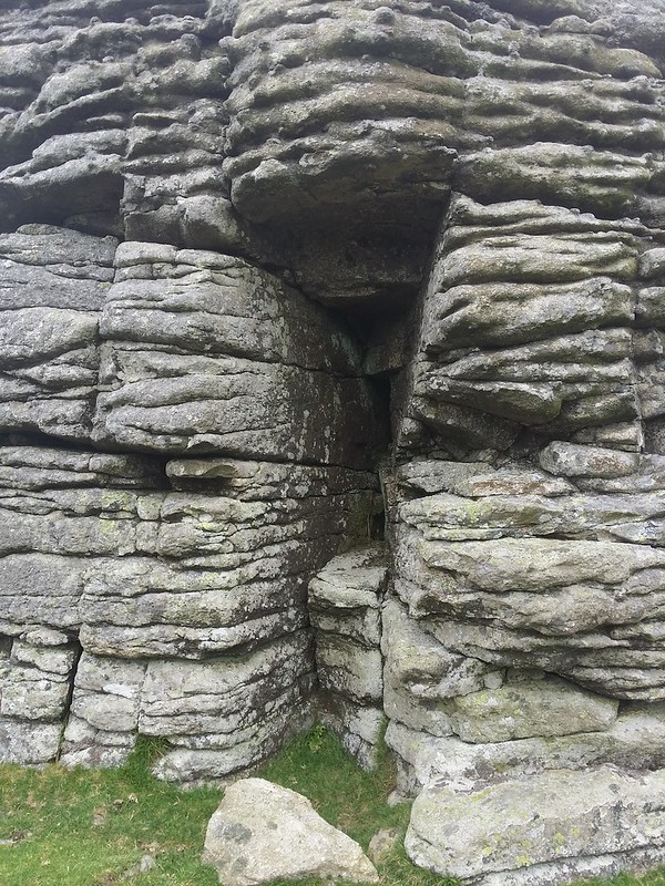 Eric Hemery (1983) says; "The main rock-piles on the down are three in number, the southernmost and largest being Corndon Tor (1,414 feet), which in itself consists of three distinct piles. In mounting the south slope of the ridge, the walker will notice that the cone of Sharp Tor (Double Dart) assumes from here its sharpest aspect, while Vag Hill's mound sinks into apparent insignificance; beyond, the heights of south Dartmoor rise like a grass-mountain range." The author also remarks that the southernmost outcrop of Corndon Tor is known locally as 'Belstone's Chair', but it is unknown which outcrop this name refers to and why it is named as such. 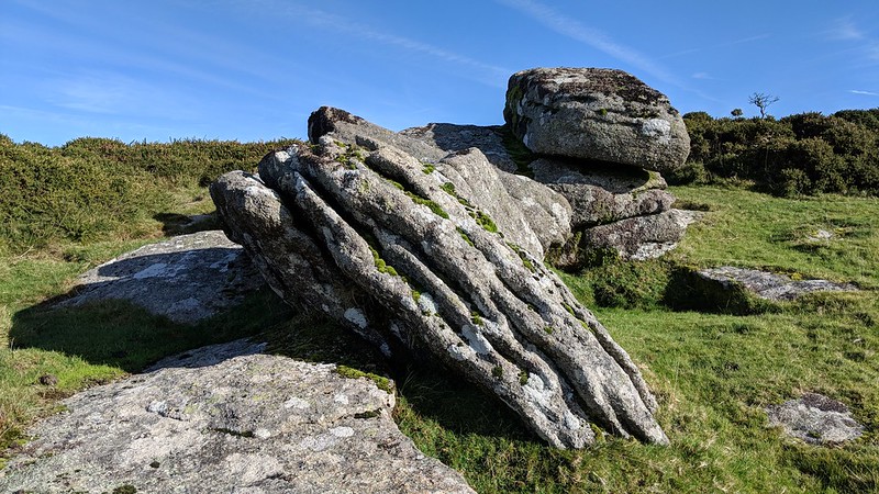 The area is perhaps most renowned for the Cave Penney Memorial Cross at SX 6832 7388 which sits atop a small outcrop known as the 'Belstone Bible'. It is located much closer to the road leading down to Sherwell and Babeny and is just a short walk uphill from there. The Memorial reads:
TO THE GLORY OF GOD
AND TO THE DEAR MEMORY OF EVELYN ANTHONY CAVE PENNEY LIEUT. Q.V.O. CORPS OF GUIDES. FELL IN PALESTINE WHILST GALLANTLY COMMANDING HIS MEN JUNE 8TH 1918 AGED 19 LOOK UP AND LIFT YOUR HEADS 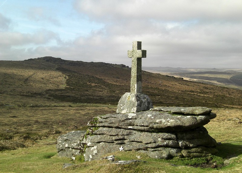
| ||||||||||||||||||||||||||||