TORS OF DARTMOOR
a database of both lesser- & well-known rocks and outcrops
Cossick TorCossick Rocks Tor
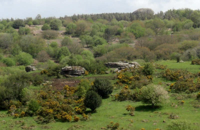 This is a small but nonetheless attractive tor set high on private ground above and about half a mile to the south of Cossick Farm. The rocks here are visible from the minor road that leads from Cossick Cross (passing Didworthy Cottages) to the magnificent Blackingstone Rock that towers menacingly above the tree line to the southeast (see above). 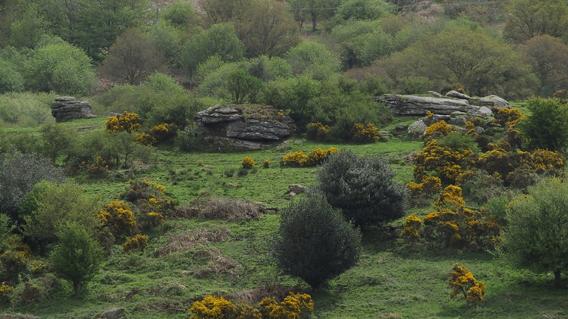 The tor seems to consist of three flattened but distinctively fissured outcrops and was at one time thought to be a possible site for the 'Druid's Altar', a curious feature first described by William Crossing as a "pile of rocks" and "not far" from Blackingstone. Since then, however, a much better site for the 'Altar' - also known as Shillyrock - has been located by Paul Buck in the neighbouring parish of Bridford at SX 7927 8512. 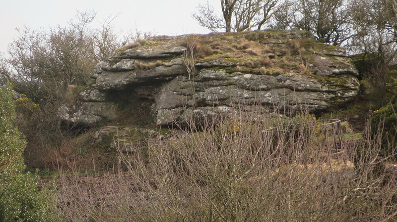 It seems that Dr. Peter Sanders and Alan Watson may have been one of the first to document the rocks above Cossick. In an entry dated to November 15th 1996 they remark: "Although un-named, Cossick Rocks "Tor" is an obvious group on top of the hill between Cossick Farm and Didworthy Cottages. The summit rocks have fine views over Mardon Down." Visiting much later in May 2014 and viewing from the road Tim Jenkinson introduces the name of Cossick Tor, noting at the time that: "It looks to have three main outcrops but we cannot see what is off the hillside. Maybe a bigger tor hidden beneath." A further account on the stature of the rocks appears in Max Piper's book East Dartmoor Lesser-Known Tors and Rocks from 2022 where on page 75 he concludes: "It is certainly worthy of 'tor status' as it is without doubt larger than many well-known tors on the high moor."  The two-storey Cossick Farmhouse is Grade II listed and has its own Historic Environment Record that is first dated to 1987 with extra information supplied in 2018. It is part described as "17th century modernised in 19th century. Rendered granite rubble walls, exposed to adjoining shippon which has some large granite blocks in its lower gable end. Slate roof with gable ends. Projecting stone gable stack to higher end with brick shaft, axial stack has stone base with dripmoulds and brick shaft." Please be advised that the tor here is clearly on private land and therefore access is prohibited without prior permission to visit from the occupant of the farm.
| ||||||||||||||||||||||||||||