TORS OF DARTMOOR
a database of both lesser- & well-known rocks and outcrops
Curtery ClittersCurtory Clitters 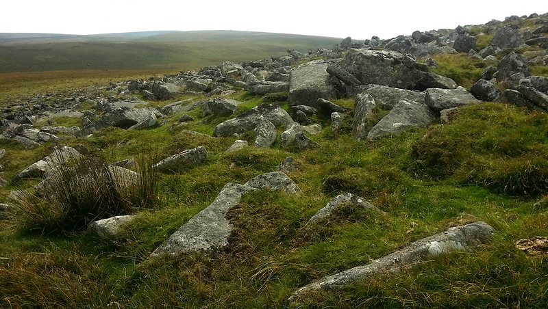 North Dartmoor boasts many impressive tors that punctuate the skyline but so little regard is given to this clitter field above the Black-a-ven Brook. This in part might be due to the name of 'Curtery Clitters', up until September 2024, being indicated as a water feature on OS Maps, and still incorrectly marked some 100 metres or so to the north-east by New Bridge. It is this error that causes some confusion. Richard Horsham (2019) in his article about clitter explains that "The earliest use of 'clitter', so far found, is from an 1872 paper by Spencer Bate who says it is a local term used by the moormen; 'clitter' is more used on the South Moor, and 'clatter' more on the North. He suggests that it means 'a confused heap of stones'. In north Devon the vernacular for a lump of earth is 'clat', so perhaps 'clatter' meaning lumps of rock is not too speculative. It is most probably not of Cornish (Brythonic language) origin, even though some argue that 'clitter is a rather evocative Cornish term'. William Crossing, writing in 1912, considered that 'clitter' was the result of the softening of the first vowel of 'clatter'." 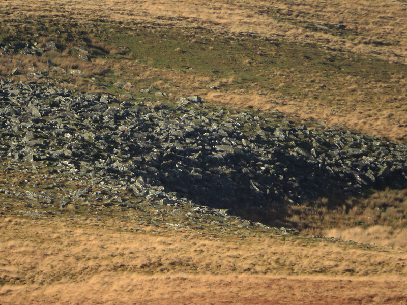 Crossing mentions this particular clitter in his 'Guide to Dartmoor', calling it 'Curtory Clitters'. The clitter itself is large and best seen from the military road that passes below East Mill Tor en route to Okement Hill. Its crescent shape above the flat bowl beside the brook is evidence perhaps of a glacial deposit; indeed, the nearest existing tor that could have produced this clitter is Yes Tor, over half a mile away to the west-north-west. So, it seems more probable that Curtery Clitters are remnants of a totally disintegrated rockpile whose core has completely eroded away that would have once stood on the hillside here. 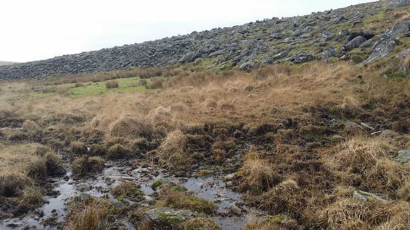 The military, who have been training on the North Moor for centuries, have also had an effect in the vicinity, as an observation post (OP) that is blocked up can be found above the rocks at SX 59091 89717. Close by, to the south at SX 59054 89631, there are two boundstones denoting Okehampton Parish Bounds and Curtery Clitters fall on the alignment of the modern parish boundary. Undoubtedly a fascinating place, for there are few places on Dartmoor where a sprawl of rocks presents so clearly as we see here, Curtery Clitters are worth a look when walking along the military road above, by taking a short detour to the OP which is obvious from here. 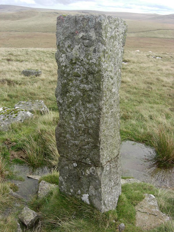
| ||||||||||||||||||||||||||||||