TORS OF DARTMOOR
a database of both lesser- & well-known rocks and outcrops
Erme Pits Rocks
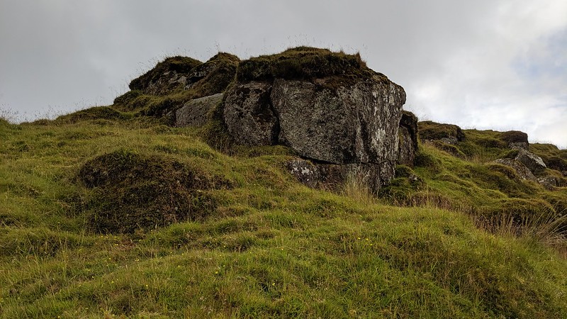 Nestled near the head of the River Erme (formerly 'Arme') in the middle of Dartmoor's South Moor can be found a wonderful area that has been heavily worked by tinners: several deep gullies scar the landscape, many of which have resulted in a fair amount of granite becoming exposed resembling crumbling outcrops. The main gully is to the south and west of the infant Erme at SX 624 668 but another to the east at SX 62606 66821 is of equal interest, presenting as a narrow crevice on the south side of Erme Pits (or Wollake) Hill. 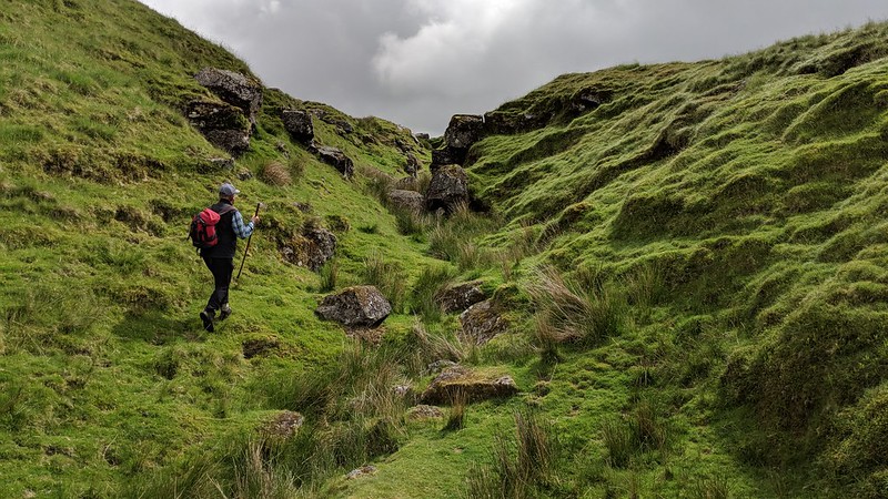 The scene is described by William Crossing; "As we have already seen, the mining remains in this locality are extensive, and afford examples of streaming and also of open workings. Of the latter Erme Pits, by which name the excavations on the Cornwood side of the stream are generally distinguished from those on Erme Pits Hill, are the largest and deepest. These probably represent the Armed Pit mentioned in 1672 as yielding a particular kind of ore called zill tin. The remains of two little buildings of the usual mining type may be seen in these pits." 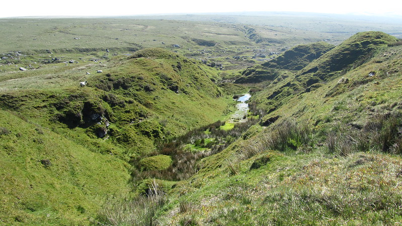 The author also mentions a rock called the 'Table Stone', a name introduced in his 'Guide to Dartmoor' (1912 p405); "Passing down through the stream work, where we shall notice a great slab of granite called the Table Stone..." and then this is repeated by Hemery (1983 p277) for a rock that is somewhere in the lower reaches of Erme Pits. A favoured site among various Dartmoor Guides is at SX 62625 66757 where a large triangular slab lies on the eastern bank of the old tin workings. Whilst accepting that it is indeed a good-sized rock it is hard to see why it would be likened to a table in any shape or form, so it remains a rather dubious site. Our thanks go to Paul Rendell for affording this area the name of 'Erme Pits Rocks', a name that's apparently been in use since the 1990s though there is no known documentation of this. 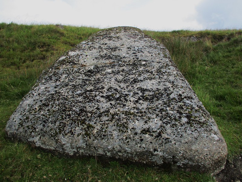
| ||||||||||||||||||||||||||||||