TORS OF DARTMOOR
a database of both lesser- & well-known rocks and outcrops
Fitches' Holt
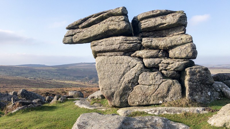 Until Eric Hemery's account of the area in 1983 nobody had any documentary evidence of the huge sprawl of granite outcrops on the slopes to the north of Saddle Tor that he names Emsworthy Rocks. The Ordnance Survey (OS) representation of that portion of the moor is virtually non existent and remains so to this day, a point that is recognised by Tim Jenkinson (2011). Hemery (p735) gives an account of a particular outcrop in the impressive group that he describes as a 'smaller detached pile below the main summit is locally known as Fitches' Holt an interesting pointer to the former breeding holt of the polecat.' A part problem with this description is the location of the summit, where is it exactly? 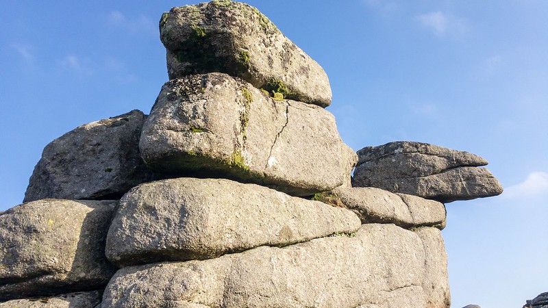 Hemery goes on 'Near Fitches' Holt is an abandoned attempt at trough cutting, with nothing further accomplished than the incising of a shallow trapezium on the surface of the boulder; this lies between the south corner of Emsworthy enclosures and a large poised boulder north of the corner.' Hemery's refusal to use National Grid References (NGRs) that were easily at his disposal has led to ongoing confusion about the true location of the Holt and a neighbouring pile he labels as 'Whortleberry Rock'. The frustration generated from the author's vague descriptions in an area that is hardly represented by the OS has occasioned subsequent commentators to opt for what is a much better and quite distinctive outcrop albeit at the eastern end of the rocky ridge of Emsworthy. 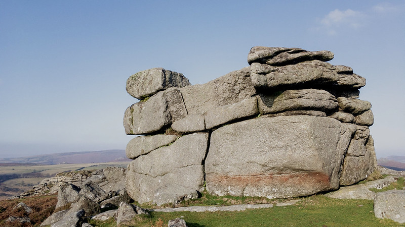 First to step forward is Mike Brown (1995) who offers the tentative NGR of 751767. In 2011 Tim Jenkinson not only photographs the outcrop but gives a more precise NGR of SX 7518 7683. Later Ken Ringwood (2013) who is now recognised as an authority on the subject of tors, repeats the assertion that this is indeed the outcrop in question. Interestingly, a photo (below) of the preferred site for Fitches' Holt originally featured in 'A Book of Dartmoor' by Sabine Barine-Gould (1900) and although not named is correctly identified as 'rocks near Heytor' and later in Gems in a Granite Setting from 1905 William Crossing shows a photograph that might be the same rock, although he subsequently fails to describe anything between Saddle Tor and Holwell Tor in his Guide to Dartmoor published some four years later. As a result the true location of Fitches' Holt has become a bit of a conundrum largely created by Eric Hemery. In the absence of any views to the contrary and given the various historical photographs of what is the fine upstanding rock pile on the far eastern side of Emsworthy Rocks from 1900 onwards it shall for now be known by the name of Fitches' Holt. 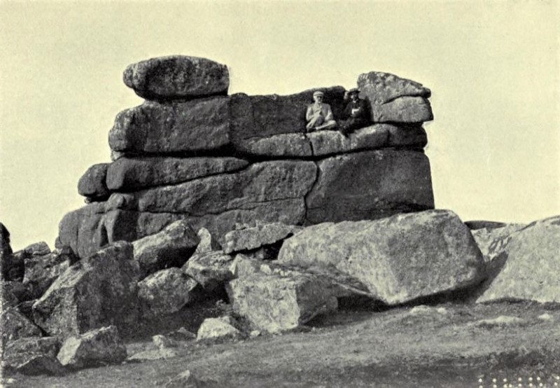
| ||||||||||||||||||||||||||||||