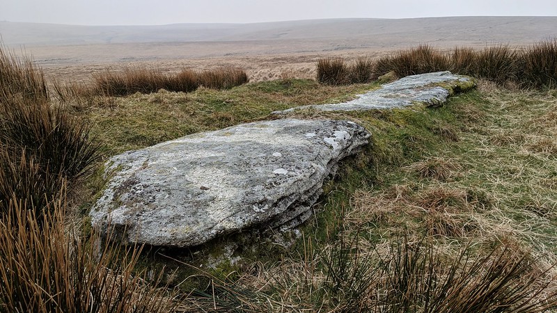
A very remote, aptly named flat exposed area of granite, easily found by following the military posts north from Rough Tor. Whilst the outcrop is disappointing there is an interesting dispute about the location of Flat Tor.
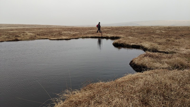
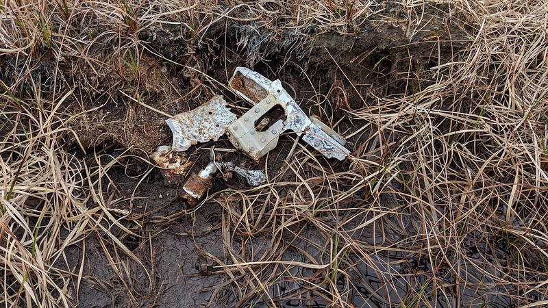
The position of Flat Tor was misplaced for many years by the OS who had it at SX 603 807. This point is mentioned by Terry Bound in A to Z of Dartmoor Tors who also, courtesy of Helen Harris, supplies a correct grid reference. To the south-east of the tor there is a water filled pit the scene of an air crash.
We learn from Mr C Lloyd of Bristol (Dartmoor Magazine 15 Summer 1989 Letters to the Editor) that the crash involved a naval aircraft - a Sea Vixen - in May 1965. Both airmen escaped unhurt. Debris at the crash site can still be found.
Flat Tor
The map above is not a navigation tool and we recommend that the grid reference shown below is used in conjunction with an Ordnance Survey map and that training in its use with a compass is advised.
Grid Ref:
SX 6089 8153
Height:
542m
Parish:
Dartmoor Forest
Tor Classification:
Emergent
Access:
Public
Rock Type:
Granite
Credit:
Ordnance Survey
Reference / Further Reading:
Ordnance Survey Maps
Please Support Us
We are proud to see the names of lesser-known tors are now being used more commonly on other websites and whilst this is to be encouraged we do request that, should you wish to use the information on this page, you provide a backlink to the website as reference, by copying the relevant address:
Please also consider a small donation to the upkeep of the site; any contribution goes toward the fees to keep the database online and any costs incurred when undertaking research such as subscriptions to online archives.