William Crossing, when describing the scene upstream of the Tavy from the Power Station; "Between this clam and Horndon Bridge are some fine crags. One of these we may see as we look up the stream. This is High Tor, the others being Fox Tor and Brimhill Tor." With time passing, the trees have dwarfed the crags and the only way to see them is to enter the woods. Herein lies a problem; there is no public access, they are on private land.
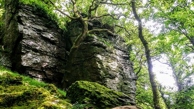
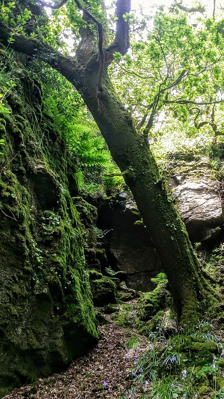
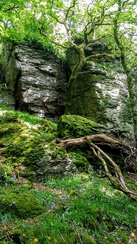
Fox Tor is the best of the collection we call the "Tavy Four". Parts of its imposing vertical walls are clear of vegetation and it possesses some interesting nooks and crannies.
Fox Tor (Mary Tavy)
The map above is not a navigation tool and we recommend that the grid reference shown below is used in conjunction with an Ordnance Survey map and that training in its use with a compass is advised.
Grid Ref:
SX 51380 78844
Height:
207m
Parish:
Mary Tavy
Tor Classification:
Valley Side
Access:
Private (seek permission)
Rock Type:
Metamorphic
Credit:
Ordnance Survey
Reference / Further Reading:
Ordnance Survey Maps William Crossing: Guide to Dartmoor
Please Support Us
We are proud to see the names of lesser-known tors are now being used more commonly on other websites and whilst this is to be encouraged we do request that, should you wish to use the information on this page, you provide a backlink to the website as reference, by copying the relevant address:
Please also consider a small donation to the upkeep of the site; any contribution goes toward the fees to keep the database online and any costs incurred when undertaking research such as subscriptions to online archives.